dendrite
-
Posts
66,889 -
Joined
Content Type
Profiles
Blogs
Forums
American Weather
Media Demo
Store
Gallery
Everything posted by dendrite
-
This is what I’m thinking

-
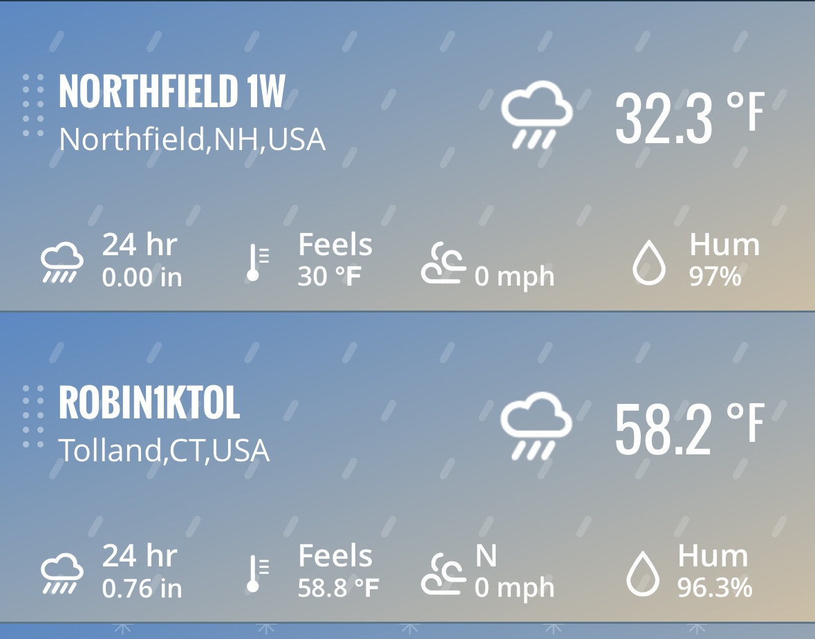
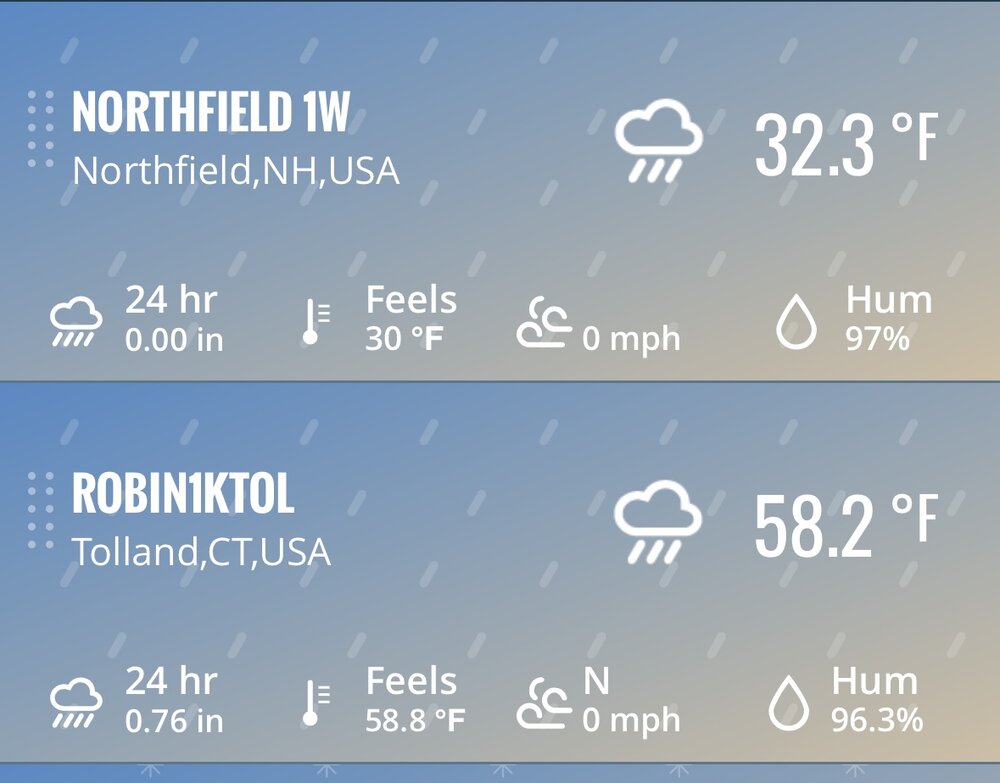
32.5°
-
WWLT
-

December 2024 - Best look to an early December pattern in many a year!
dendrite replied to FXWX's topic in New England
You were never losing it -
Yeah I’m resigned to my wedged fate. CON may flirt with not warm sectoring either although an hour or two of 50+ is more likely.
-
31.9° -RA No real accretion although the coop stairs were a little slick
-
I think your shot is in that 21-00z window. So near sunset until about 7-8pm.
-
Wagons east
-
December 2024 - Best look to an early December pattern in many a year!
dendrite replied to FXWX's topic in New England
31.9° with R/ZR I don’t think it’s glazing that much though. -
December 2024 - Best look to an early December pattern in many a year!
dendrite replied to FXWX's topic in New England
It initializes with this…
-
December 2024 - Best look to an early December pattern in many a year!
dendrite replied to FXWX's topic in New England
31.1° -ZR Here comes the glaze. -
-
December 2024 - Best look to an early December pattern in many a year!
dendrite replied to FXWX's topic in New England
Change the °F to °C and it might be correct. -
You’ve made everyone rabid.
-
December 2024 - Best look to an early December pattern in many a year!
dendrite replied to FXWX's topic in New England
Tuck in full force. 28.7° at home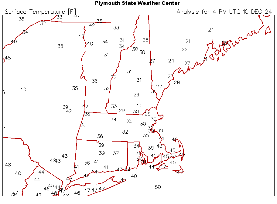
-
142 days until May 1st
-
I’m not expecting to lose much so I’m clearing the whole driveway this evening. A few hours of warm sectoring may clear up the driveway if I do that.
-
Will be a screamer either way.
-
December 2024 - Best look to an early December pattern in many a year!
dendrite replied to FXWX's topic in New England
Hopefully the pattern changes soon because all of these snow events are killing my back. -
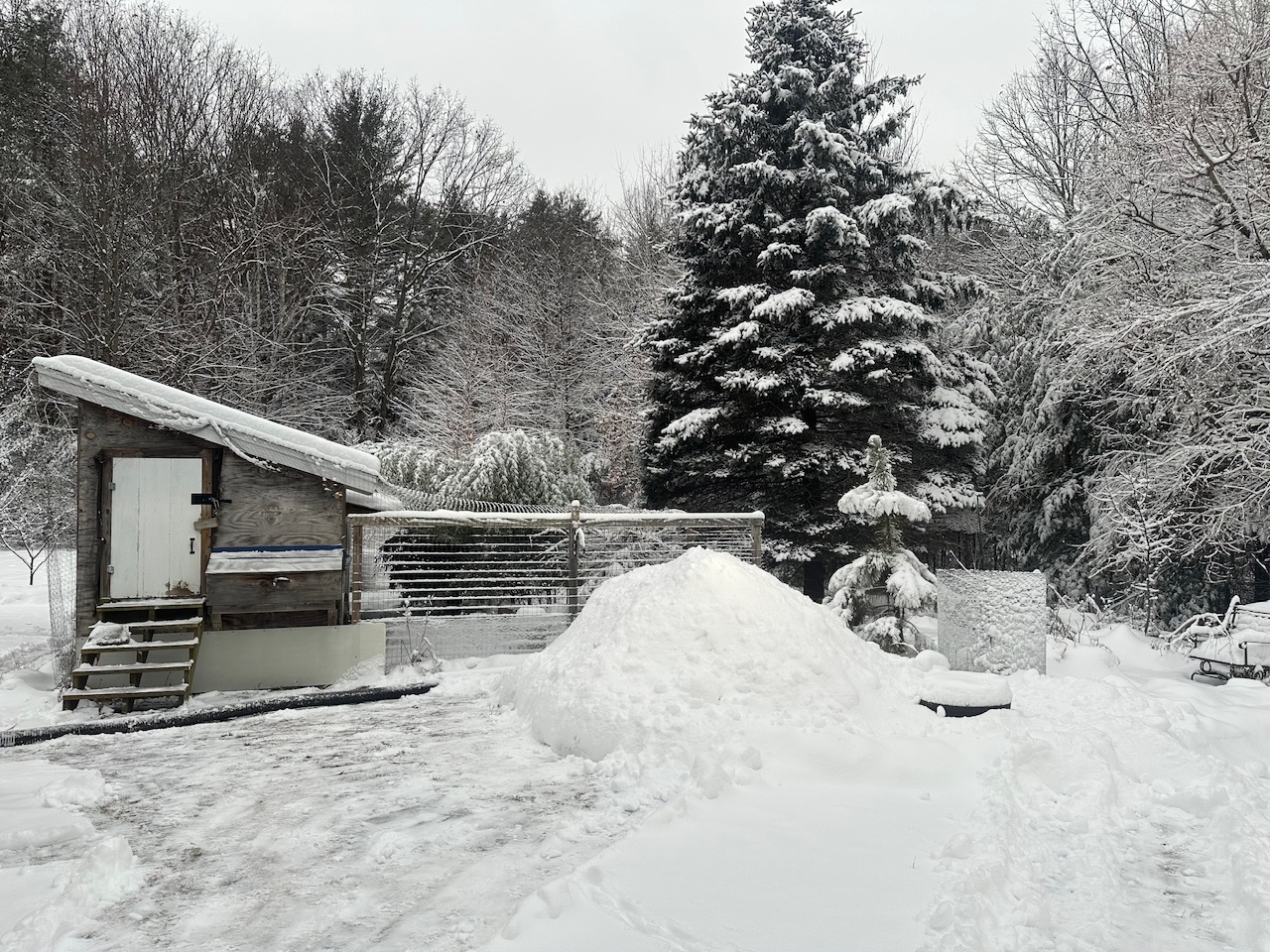
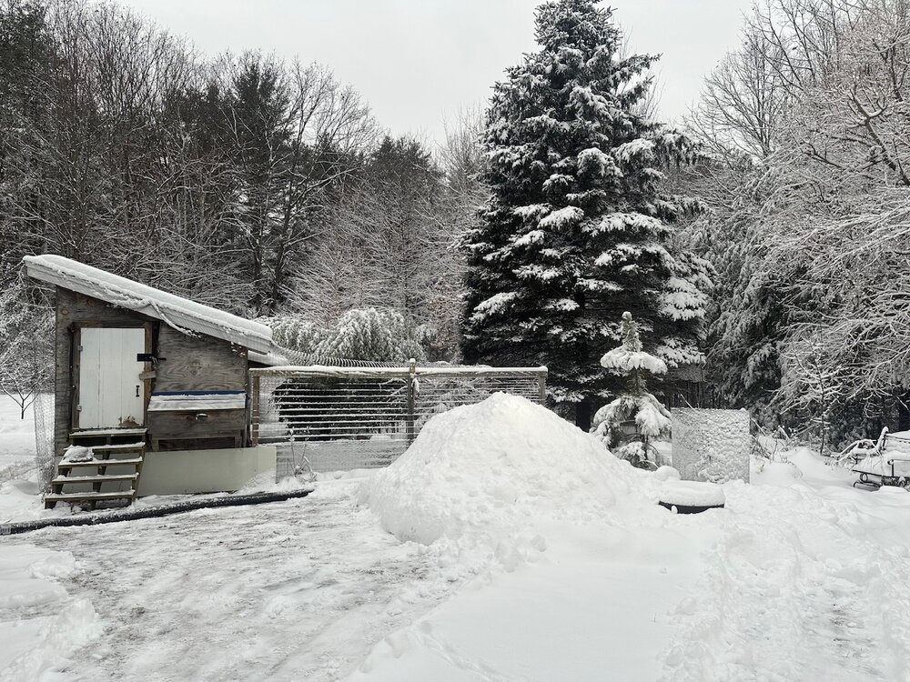
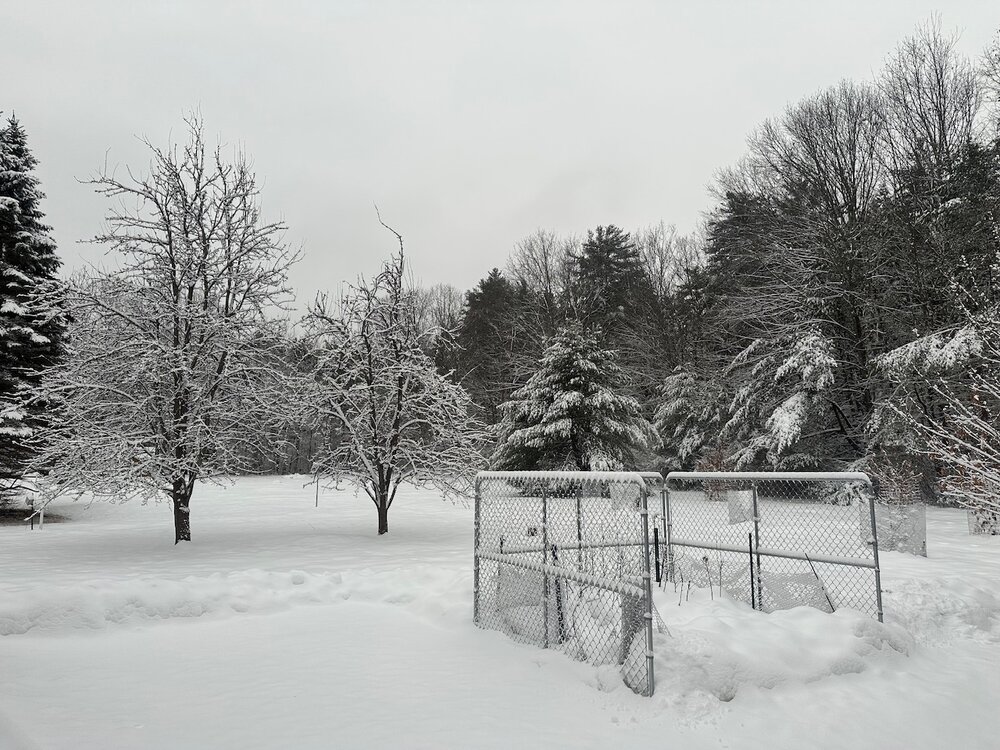
Deep winter. Pack is into the double digits.
- 753 replies
-
- 10
-

-
December 2024 - Best look to an early December pattern in many a year!
dendrite replied to FXWX's topic in New England
25.7° Finished with 3.3” -
December 2024 - Best look to an early December pattern in many a year!
dendrite replied to FXWX's topic in New England
Any word from CH on new snow and pack tonight? -
December 2024 - Best look to an early December pattern in many a year!
dendrite replied to FXWX's topic in New England
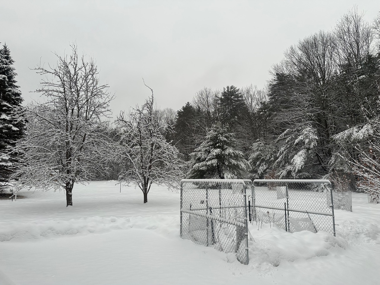
30.2° -SN 2.9” -
Get that axis back over VT.
-
December 2024 - Best look to an early December pattern in many a year!
dendrite replied to FXWX's topic in New England
Similar here. 31.6° 1.9” Got over 1” in the half hour we were out getting coffee and some groceries.