dendrite
-
Posts
66,943 -
Joined
Content Type
Profiles
Blogs
Forums
American Weather
Media Demo
Store
Gallery
Everything posted by dendrite
-
In 20 years I'll be getting a name change request from ineedsnow to ineedvitaminD
-
On computing power
-
42 this year. And yeah, I’m too old for cold now too. It better be record breaking if it’s going to get below zero.
-
-
-
-
Another shift south like that and it starts getting close here.
-
Nice hit for NNE.
-
Meh luck in a meh pattern. Like Scoot has said, we're cutter prone. We're just not getting away with it right now.
-
and another one gone and another one gone another one bites the dust
-
Most of Hartford county is up to 43-45. 41° here with vrb cloudiness. Nice day.
-
Negative confirmation bias. Everyone remembers the many ways a storm can fail, but we easily forget the ones that trend in our favor.
-

Winter 2020 New England Banter and General Obs
dendrite replied to CapturedNature's topic in New England
ORH is 53° on 2/6. -
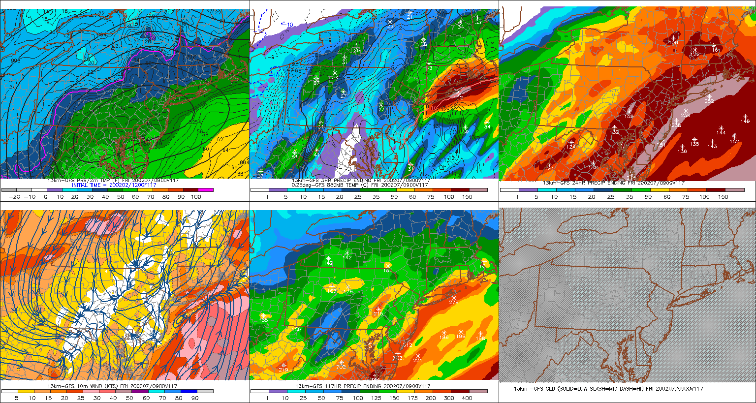
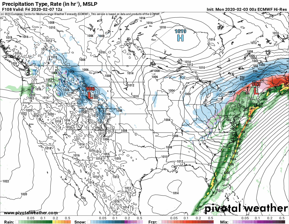
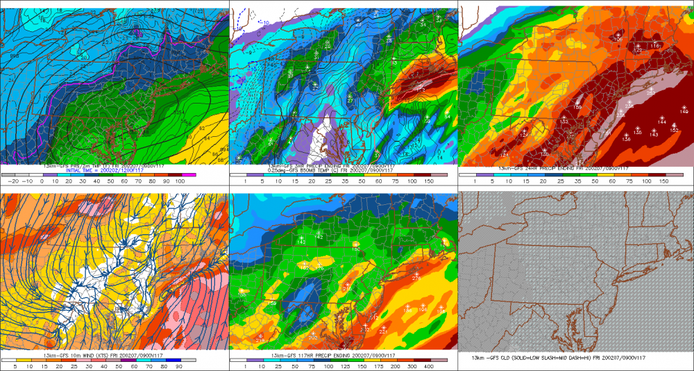
Pretty good low level NE flow with a lot of QPF, but I don't like how that high got so easily tossed to the curb.
-
All intensive purposes
-
Winter 2020 New England Banter and General Obs
dendrite replied to CapturedNature's topic in New England
29.5°. Another 30°+ min. -
lol. The euro has like 5” up here and then wedges for awhile. It never truly warm sectors up here before the cold fropa. That would be a net gain verbatim. I wish it was no snow at all at this point.
-
Winter 2020 New England Banter and General Obs
dendrite replied to CapturedNature's topic in New England
Is there any online weather data from the summit? -
Winter 2020 New England Banter and General Obs
dendrite replied to CapturedNature's topic in New England
Pretty sure that's Tolland from IJD. -
idk...you can make a case there’s a weak wave tuesday, one on wednesday that pushes the BZ south of us, then the wintry one thursday/friday.
-

-
They saw this thread repinned.
-
Yeah, torching cutters seem to become more rare as we get deeper into winter. Most of the record high mins at CON for Feb are U30s or L40s. The first half of Jan has some U40s and 50s as we're still dealing with the seasonal lag from the warm season.
-
Winter 2020 New England Banter and General Obs
dendrite replied to CapturedNature's topic in New England
Low of 29.9F. The 30F+ mins keep on mounting. -
Not many have a base to start with this Feb though.