dendrite
-
Posts
75,090 -
Joined
Content Type
Profiles
Blogs
Forums
American Weather
Media Demo
Store
Gallery
Everything posted by dendrite
-
Getting a few gusts now. Up to 25.2°
-
Lots of winning out there
-
Mom said it’s mixing with rain in Hooksett. Guesstimated 4”
-
Up to 35° at MHT now
-
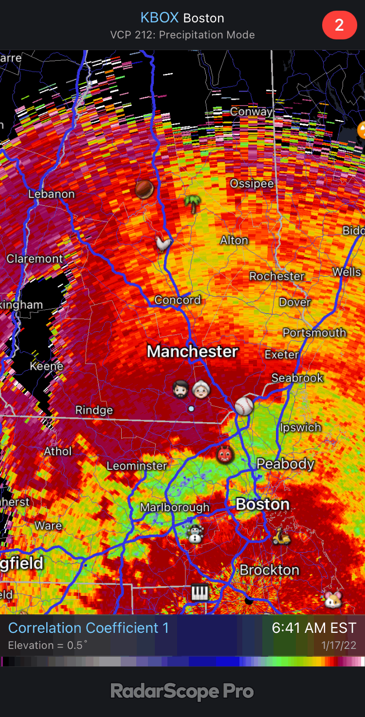
BOX CC may be our best idea at the mixing line even though we’re pretty far from the beam.
-
Seems like many sites are transitioning to 34° snow and/or mixing so I guess there’s some ambiguity there with “end”. MHT is still mod snow and 34° so I’m not sure how much is accumulating at this point versus melting. They’re probably still seeing a net gain with the rates.
-
Not much wind here, but you’re 29° and CON is 30° so you must be out of the wedge now and able to mix some of that wind down. I didn’t think it’d be that windy before the changeover so that’s pretty cool.
-
I assume crystal growth is subpar, but there’s an immense amount of flakeage out there. This is how you pull off 0.25”/hr liquid via snow. We’re not there yet though 23.7°
-
23.7° +SN
-
To be fair you’re like 56 miles from the beam.
-
21° -SN
-
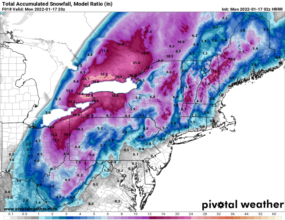
HRRR modeled snowfall…calculated by the model itself. Posting it for comparison purposes when it’s over.
-

Monitoring a potential important TV to East Coastal storm: Jan 17
dendrite replied to Typhoon Tip's topic in New England
Maybe Mitch has a spare bed in his basement? -
The bodies may be buried until May.
-
Looks a little slower with pushing the LLJ northward so WNE/Berks benefit. Juicy.
-
I think I’d rather have the Pats lose the way they did…less agony.
-
Bouncing around 14-15F as the overcast thickens and lowers. A little bit of fake cold for now.
-
Monitoring a potential important TV to East Coastal storm: Jan 17
dendrite replied to Typhoon Tip's topic in New England
They upgraded to warnings but admitted they may not meet the threshold, but went with them anyway because of the intensity of snow rates in the morning. We'll see. I mean I had 5-8" for us IIRC. -
Monitoring a potential important TV to East Coastal storm: Jan 17
dendrite replied to Typhoon Tip's topic in New England
-
Monitoring a potential important TV to East Coastal storm: Jan 17
dendrite replied to Typhoon Tip's topic in New England
idk...reading the AFD now and it aligns with my thoughts. -
Monitoring a potential important TV to East Coastal storm: Jan 17
dendrite replied to Typhoon Tip's topic in New England
So you're forecasting 40mph gusts with +SN here under the wedge? Noted. -
Monitoring a potential important TV to East Coastal storm: Jan 17
dendrite replied to Typhoon Tip's topic in New England
Trust me I've already made a point to check the 00z highs -
Monitoring a potential important TV to East Coastal storm: Jan 17
dendrite replied to Typhoon Tip's topic in New England
What I should say we may get some gusts late morning once we erode that cold wedge and warm sector a bit. We’ll be ripping in that LLJ late morning. -
Monitoring a potential important TV to East Coastal storm: Jan 17
dendrite replied to Typhoon Tip's topic in New England
We’ll be inverted during the snow so don’t worry about the wind. Maybe some gusts later in the day. We’ll flip to rain before the slot…guarantee it. Not trying to burst your bubble here. -
Monitoring a potential important TV to East Coastal storm: Jan 17
dendrite replied to Typhoon Tip's topic in New England
2m looked warmer on there to me as well.