

dendrite
-
Posts
75,081 -
Joined
Content Type
Profiles
Blogs
Forums
American Weather
Media Demo
Store
Gallery
Everything posted by dendrite
-
MWN was +3° while Alex was -30°.
-
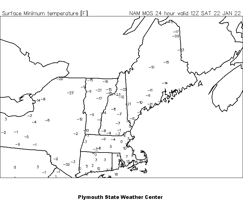
Clayton Lake -36° Island Pond -35° Pittsburg -32°
-
-13.0° Still droppin
-
CAR isn’t normally an efficient radiator.
-
-12° Clayton Lake -36°
-
Still dealing with wind here. 4.6°
-
weather.gov...NOWdata. Calendar day summaries.
-
12z MET MOS mins for tonight...couldn't get the 18z MAV to load on Plym.
-
George is a poor boy, no one loves the Navy He's just a poor boy that's a big weenie Spare him his life from meteorology
-
Is this the real life? Is this just fantasy?
-
Deformation out in W MA and VT. Either gotta get that E or the CCB NW.
-
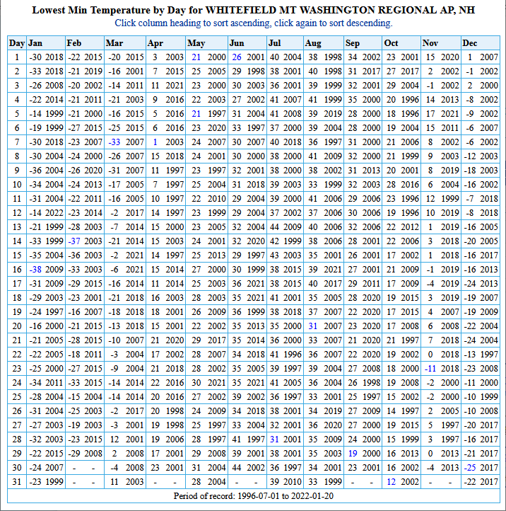
Yeah probably. Here's the HIE daily records since the ASOS began in 7/96.
-
-20 to -30 isn’t that big of a deal in the Coos pits. They used to pull that every winter.
-
Coldest I saw was -34° at Estcourt Station…METAR site was 40B with -33°. SLK was at least -31°. Quite a few -30s in ME.
-
Down to -4.7°
-
-3° BML -22°
-
I’m well aware. When have we ever had a 30 day period with -17F departures?
-
IPAs keeping you up late tonight?
-
-17F for the cruiser parking lot. Sounds reasonable.
-
That was rain up here so I'm all for it. lol
-
It's felt like deep winter up here with about a foot on the ground. The bottom 2" of pack is from the first event in mid December. The pack is fairly deep, the snow banks are high, the driveway is a slab of ice, and there's been some high end cold shots. We haven't gotten any of the warmups in CAD land either. My high for the month so far is 37F.
-
Lots of weenies in here today. I'd love to end winter early more than anyone, but we know it's not going to happen. It's like canceling dews on 7/20.
-
So cold I can’t even make a hand print on my hypercolor shirt.
-
I haven't seen my grass in over a month.


