dendrite
-
Posts
66,900 -
Joined
Content Type
Profiles
Blogs
Forums
American Weather
Media Demo
Store
Gallery
Everything posted by dendrite
-
I really need one more tick south to get into the 1-3” here. There’s that initial finger of fronto that pushes through and then the lower level dry slot for SNE and most of CNE before the fropa approaches. Best accums will be north of that dry nose moving W to E
-

December 2024 - Best look to an early December pattern in many a year!
dendrite replied to FXWX's topic in New England
Ginx already mentioned WU. This is a good one too. https://www.wrh.noaa.gov/map/?obs=true&wfo=sto -
December 2024 - Best look to an early December pattern in many a year!
dendrite replied to FXWX's topic in New England
https://mesowest.utah.edu/cgi-bin/droman/mesomap.cgi?state=MA&rawsflag=3 Here’s the Davis one. You may need to change it from AQ to temp. https://www.weatherlink.com/map -
December 2024 - Best look to an early December pattern in many a year!
dendrite replied to FXWX's topic in New England
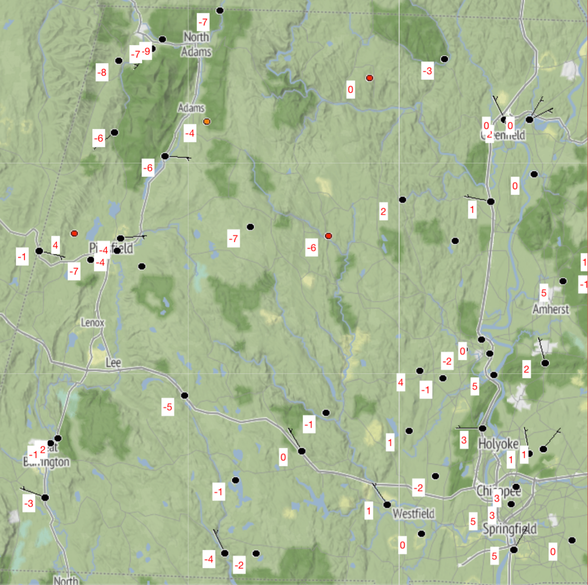
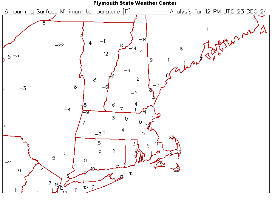
I don’t see one low of -10° or colder in MA.
-
December 2024 - Best look to an early December pattern in many a year!
dendrite replied to FXWX's topic in New England
- Actually thought you’d be colder than that in the valley. -2° used to be a warm morning out there. -
December 2024 - Best look to an early December pattern in many a year!
dendrite replied to FXWX's topic in New England
Still dropping. -1.6° -
December 2024 - Best look to an early December pattern in many a year!
dendrite replied to FXWX's topic in New England
$$$$$
-
December 2024 - Best look to an early December pattern in many a year!
dendrite replied to FXWX's topic in New England
-1.2° -
Nah I’ll stay right here and continue bitching about it.
-
December 2024 - Best look to an early December pattern in many a year!
dendrite replied to FXWX's topic in New England
High 10.8°. Colder than my lowest of 13° last year…probably have to go back to the 7° on 2/4/23. -
December 2024 - Best look to an early December pattern in many a year!
dendrite replied to FXWX's topic in New England
9.5° At least we gain 3s of daylight today -
AWT
-
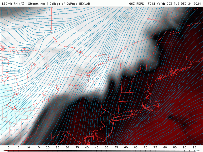
You guys in SNE are basically relying on some snow with the cold fropa and it starts drying up once it gets past the western hills. Low to mid levels are bone dry before then so any stray echoes are likely virga. Even up here it’s probably < 1”.
-
Best forcing has always been near the canadian border with this. There’s a reason why you want them sliding south of you. Congrats Sherbrooke.
-
Some of that was me. You get a week of 850s above 0C and you figure torched mins and at least a couple of days where you go westerly and push 50-60 across the region. I think I posted a few days ago that it wouldn’t necessarily be tulips and skip-its at the sfc, but we may actually be able to radiate the first half of this stretch and keep some teens and 20s overnight to really keep it iced up before the step up climb in mins sets in toward NYE.
-
I personally don’t think the week after Christmas changed that much. Mid levels are torched relative to the season, but it’s a little fake with the dry airmass. We’ll probably have a lot of poor mixing days even if we have some sun.
-
Yeah it’s all pretty marginal. 850s are warm, but dry so there’s room to wetbulb down near 0C up there. It looks a bit like early spring in the mid levels. Turn the flow westerly and we would torch…bring in precip or turn it E-NE and it’s a bit raw.
-
December 2024 - Best look to an early December pattern in many a year!
dendrite replied to FXWX's topic in New England
Today should be CON’s first day with a colder daily departure than -10 since 11/21/23…over a year. Since that day there has been 56 days with a daily departure greater than +10. -
December 2024 - Best look to an early December pattern in many a year!
dendrite replied to FXWX's topic in New England
Mitch is down to -4.7°. The bodies may not thaw out even with a cutter. -
December 2024 - Best look to an early December pattern in many a year!
dendrite replied to FXWX's topic in New England
Congrats everyone on higher heating costs And DAW has been consistently 5F too warm all night. @OceanStWx can we just unplug the ASOS so Pope can’t use it?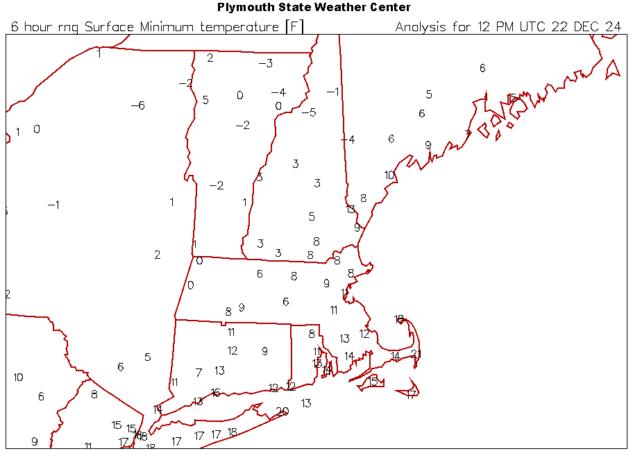
-
December 2024 - Best look to an early December pattern in many a year!
dendrite replied to FXWX's topic in New England
2.8° Coldest since 22-23 for me. -
December 2024 - Best look to an early December pattern in many a year!
dendrite replied to FXWX's topic in New England
7.5° Terrible and useless -
December 2024 - Best look to an early December pattern in many a year!
dendrite replied to FXWX's topic in New England
Toss the DAW ASOS into the GOM. It’s actually colder at IOSN3 right now.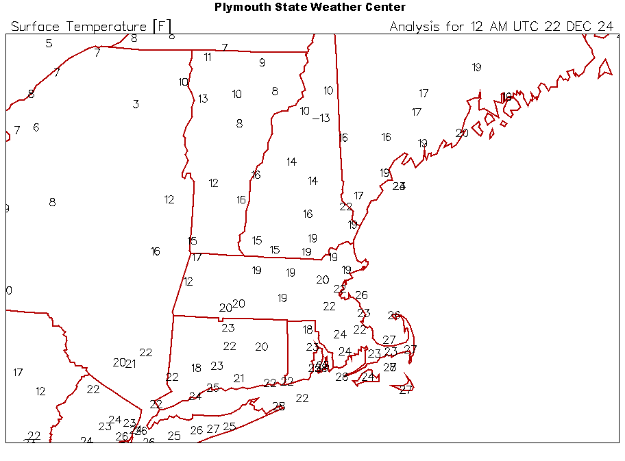
-
December 2024 - Best look to an early December pattern in many a year!
dendrite replied to FXWX's topic in New England
CON would be +3.6F through yesterday if this was the 90s. I’d probably call that “siggy AN” too given the larger winter std deviations, but it’s pushing it. Of course we’ll knock a couple off the departure the next few days. Tomorrow will be a deep winter day…may push a sub 10F mean here. -
December 2024 - Best look to an early December pattern in many a year!
dendrite replied to FXWX's topic in New England
That’s not my point though. We’ve been so warm for so long that we treat normal temps as cold now. This would be considered a torch month at some sites 25 years ago. I’d have to dig for the SNE Dec normals to see how much they changed though. The rad pits probably have the biggest change over the last 30 years. Anyway, down to 19/7 here with flurries.