dendrite
-
Posts
66,871 -
Joined
Content Type
Profiles
Blogs
Forums
American Weather
Media Demo
Store
Gallery
Everything posted by dendrite
-
Warned now
-
Yeah GFS is meh on heat the rest of the work week...especially for ENE. Over the top shot of heat first into NNE on Saturday and then days and days of torch for all. Of course it's pushed back to d7+ again though.
-
Just had a nasty +CG nearby.
-
And yeah the GFS and EC aren't as cool...we'll see if they trend cooler at 12z or if the nam is just its usual synoptically challenged self.
-
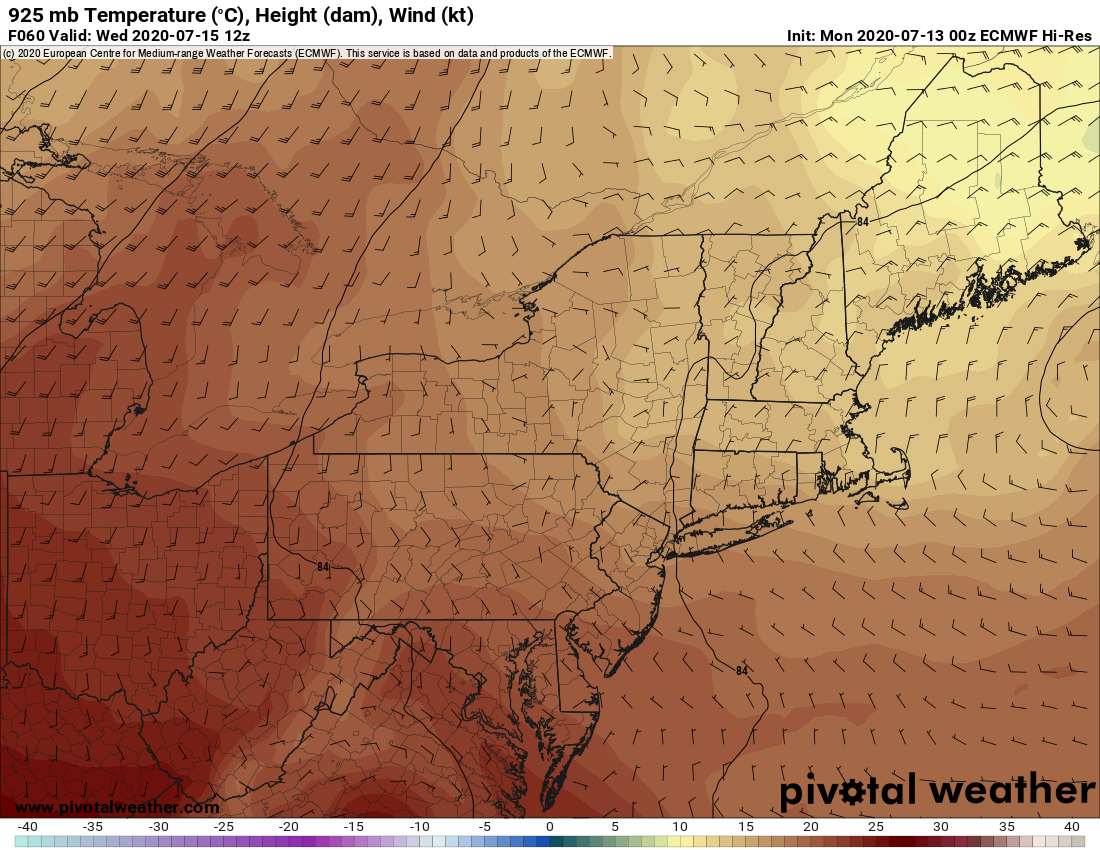
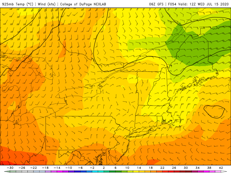
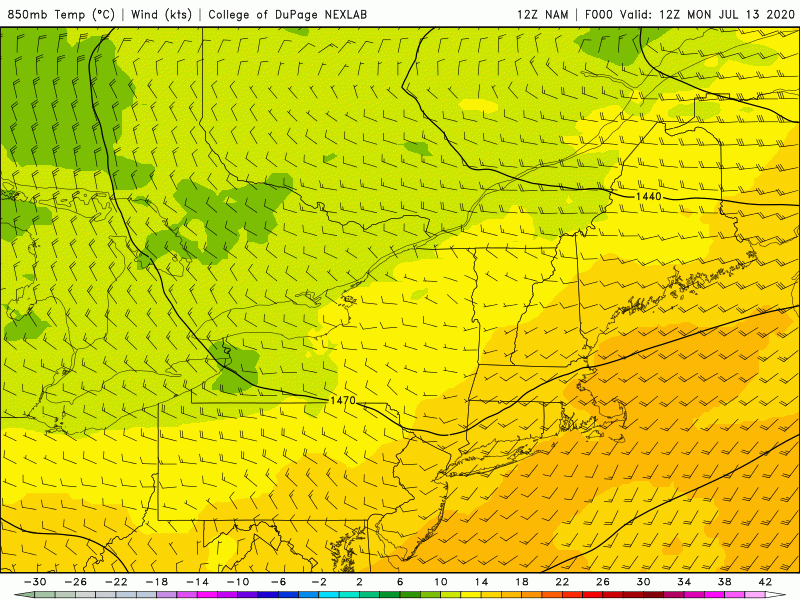
Euro/GFS at 925 and the 12z NAM loop of 850s. Notice the source region and the winds backing and advecting those cooler temps in from osumetstud.

-
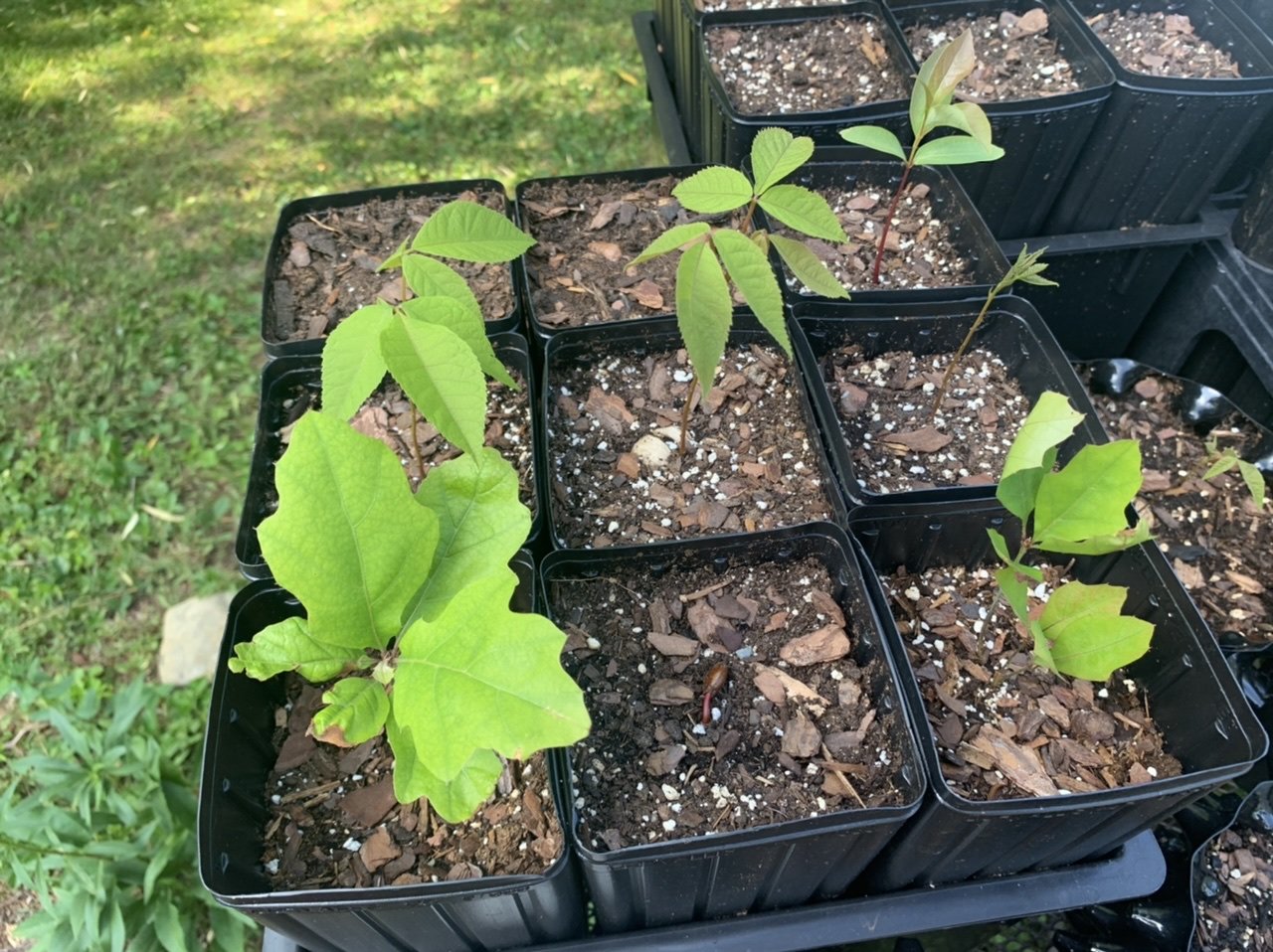
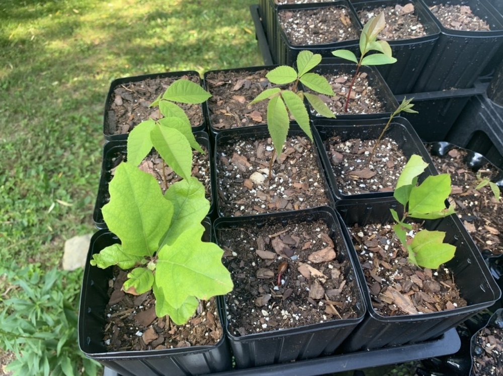
Tuesday. The ones with multiple leaflets are hickories. the others are persimmon and pin oak.

-
How is that not a door? And I'd be surprised if the STEM doesn't have a day below the 80s.
-
No it isn't. NE
-
NAM gone wild with that door. 850s under 10C for a couple days.
-
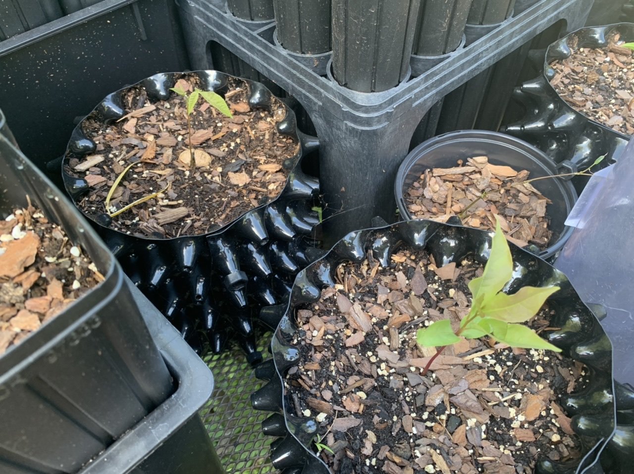
I have about 10 germinating. I'll have to find or take some pics. I would use one with an attachment, but I have a lot of those invasive buckthorn trees and some of them are 2-4" wide. I could probably rent one for the day and save a lot of money, but I like my own toys.
-
Nice. I got an autumn blaze from Lowes a few years ago on clearance. It was actually pruned aesthetically really well. The trunk has a slight hook that I've been trying to work out by tying the tree back to my chicken run, but other than that it's a great looking tree.
-

TS Fay - Drought ending Rains and Severe Convection
dendrite replied to weatherwiz's topic in New England
Tree topper! -
He could try one of those tree watering bags or rings like the tree gator. I’ve never used one myself since we have plenty of soil moisture.
-
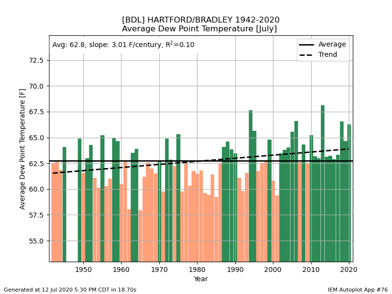
We will judge based on hours of 70+ dews. I don’t like the avg ones for this because periods of COC decades ago brought down the means. A month of dews in the 60s ranks very high, but isn’t necessarily too impressive because of no COC.
-
I picture Scoot with a big rack on his head laying limp on the ground and you taking a selfie with him.
-
I don’t think the manned observer reported dewpoint. I’d have to look back at old obs, but based on everything being near 32F I assume most obs came in with a missing dew and the plotter is seeing it as 0C aka 32F.
-
There’s bad data in there. Plus that’s avg dewpoint. Toss anything between 81 and 02 there. BDL is 5th right now, but will probably move up to 3rd after today behind 94 and 13.
-
What’s up with that HVN 80s/90s data?
-
Fantasy land NAM is a little backdoorish up here midweek.
-
Yeah. I start drawing the line with 72F+ dews and mins of 70+...just can't cool the house down with window fans with those temps.
-
Maybe. But it’s always at d7-10+.
-
lol

-
Keep me updated on how it looks when it arrives. Did you try looking at Blueview Nursery near you? http://blueviewnurseries.com/Deciduous_trees_EM.html I usually get the common tree species around here at nurseries, but I have checked out Fast Growing, Arbor Day, and Wilson/Stark Brothers as well. If I want something native that is hard to find I go through Go Native. Trees with a deep tap root I’ve been trying to grow directly from seed...like hickories, pawpaws, persimmons, and chestnuts. I try to get those seeds through Sheffields.itks kinda fun to stratify them on your own, watch them germinate, and then plant them in the spring. It eliminates all of the transplant shock and circling roots too.
-
Summer 2020 Banter and random observations
dendrite replied to Baroclinic Zone's topic in New England
You’re setting up my garden next year...lol