dendrite
-
Posts
67,071 -
Joined
Content Type
Profiles
Blogs
Forums
American Weather
Media Demo
Store
Gallery
Everything posted by dendrite
-

Summer 2020 Banter and random observations
dendrite replied to Baroclinic Zone's topic in New England
IADOT 91mph -
Summer 2020 Banter and random observations
dendrite replied to Baroclinic Zone's topic in New England
Tostitos Bear necessities right there -
Summer 2020 Banter and random observations
dendrite replied to Baroclinic Zone's topic in New England
Screen doors slammed shut? -
-
Epstein Salt?
-
This will be the year we pull off a cold early fall and close the windows in Sep with COVID lurking around.
-
Those have really nice bark at maturity.
-
81/67. Nice day after a min of 65°
-
Yup...entirely different tree. The nuts aren’t edible either. Gene has one and it’s a nice ornamental, but he does have problems with sapsuckers. His tree service has done a lot of work to seal it up to keep it alive. I’m not familiar with the different cultivars though.
-
I’d rather lose power in summer as well. Our water pipes all run in the interior of the basement and up to the first floor so they’re well away from walls. Even when we didn’t heat it down there (when we used the pellet stove upstairs) it never went below 45°.
-
Dunstans are a hybrid with good resistance. Any chinese tree will have resistance too. I know our Agway tried selling a few purely chinese trees last year, but they were still there in the fall. You can find 100% American trees online grown from seeds from parents with good blight tolerance, but there’s no guarantee on what those seedlings will produce. I have about 10 american trees in my yard right now because I’m on the early list for those transgenic american trees from SUNY ESF. I need to have some pure american trees with it to create genetic diversity. Half of the nuts from the transgenic tree with carry the blight resistant gene and the other half won’t. I believe the transgenic ones are expected to be available to the public in a few years if they get the OK from the govt.
-
Summer 2020 Banter and random observations
dendrite replied to Baroclinic Zone's topic in New England
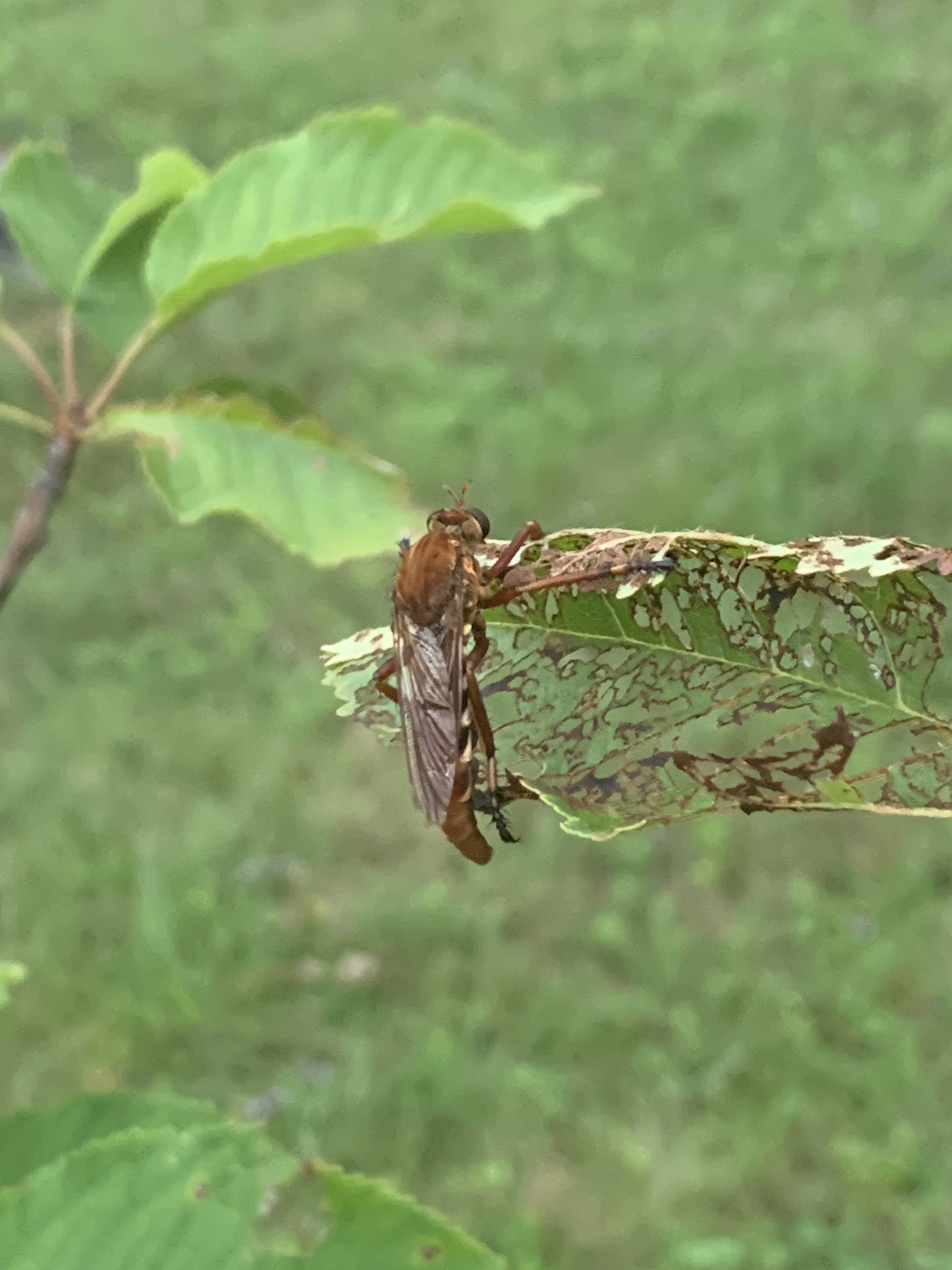
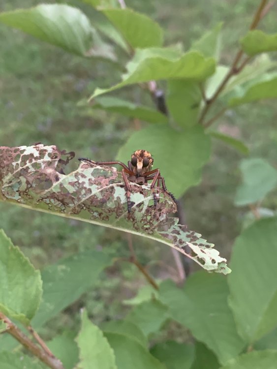
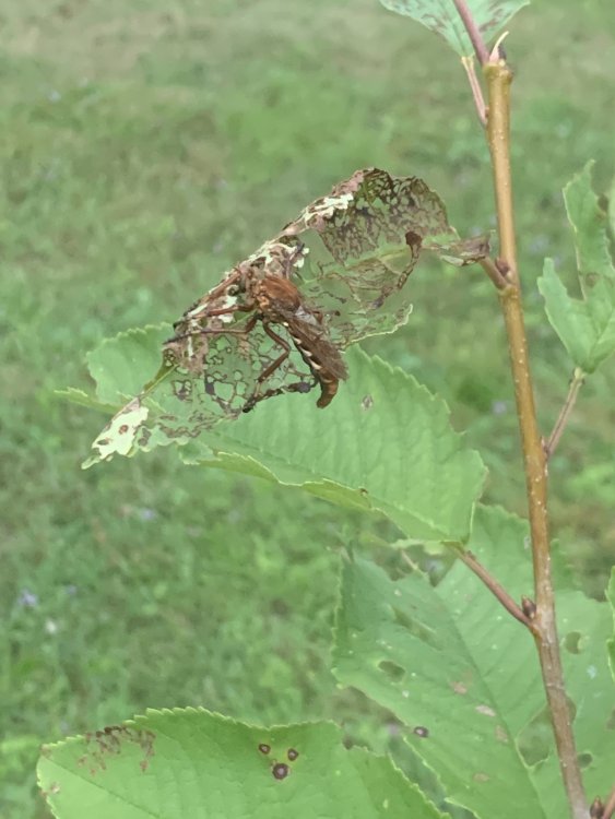
Think I found it...robber fly. -
I'm just hoping for a cold front this winter. 2 would be gravy.
-
Lots of nice weather, but about the most boring summer I can remember. COVID restrictions haven't help.
-
Summer 2020 Banter and random observations
dendrite replied to Baroclinic Zone's topic in New England
Anyone know what this is?
-
I live north of you. It’s already dark here by 5pm. In another month it’s full darkness.
-
MAV with 95° at CON for Tue...probably do it again on Wed.
-
Dog days. I could already feel yesterday at midday how much bite the sun had lost. The darker mornings suck.
-
Don't recall that one, but I remember this one well. https://www.weather.gov/okx/HistoricFlooding_081314
-
Yeah that's rare but doable. You're basically doing 0.15"-0.20"/min. I've done that in a min before on the Davis, but can't imagine it for a half hour. But even as insane as that is, the 1.23" in 1 minute is like 6x heavier. I just can't believe it's possible. That record was from July 4, 1956 and I guess the equipment calibrated out correctly. I figured everything was manual gauges back then though? If it was manual, who in their right mind is going out there to check the rain during the heaviest rainfall in world history?
-
A 1 in 1000 year event. They should toss that 1” in 1 minute from Unionville out of the record books. https://www.delawareonline.com/story/news/2020/08/07/friday-storm-delaware-isaias-delmarva-power-flooding-rain/3324504001/ https://amp.usatoday.com/amp/87914944
-
0.19” BUT it soaked in slowly. More better?
-
73.5/64 SCT
-
And I’m in that green/yellow in northern Merrimack. We’ve been relatively screwed as well.
-
64° -RA 0.19” but a slow soaking