dendrite
-
Posts
67,071 -
Joined
Content Type
Profiles
Blogs
Forums
American Weather
Media Demo
Store
Gallery
Everything posted by dendrite
-
Min 69.9F Should get more comfortable as the day goes on as the drier air starts working in with the weak CAA.
-

Summer 2020 Banter and random observations
dendrite replied to Baroclinic Zone's topic in New England
Lots of grasshoppers and locusts. I'm surprised I still see fireflies. -
Looks like the BDL ASOS
-
81/68 at 930pm. I would like some outflow please.
-
Max 91.1F Tied for hottest of the year with 7/27.
-
90.3 Made it even with MPM 90.0 criteria
-
Hit 89.3F but clouds have knocked it back to 85.7F.
-
Brief sprinkle. Back up to 88/70.
-
It's a 5 day ens mean. No one said pull out the hoodies.
-
The ridge retrogrades westward.
-
Summer 2020 Banter and random observations
dendrite replied to Baroclinic Zone's topic in New England
My tents caterpillars went bye bye after Itchyassy. -
Similar here. 84.7/70
-
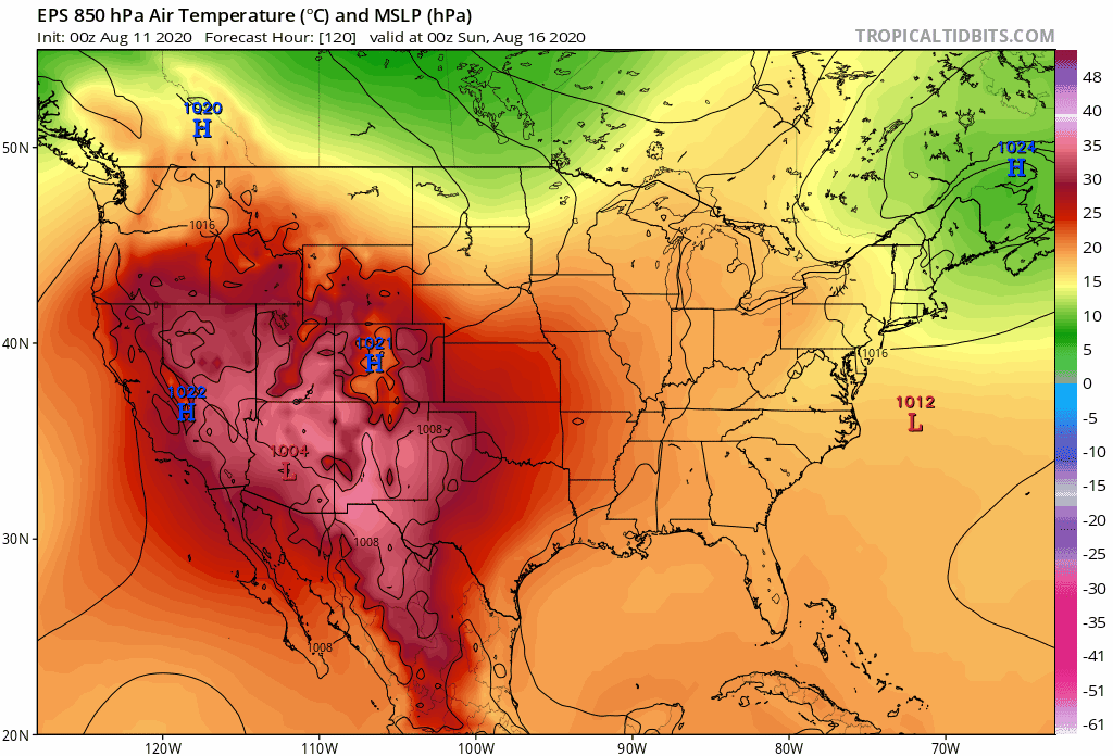
Euro op had it too at 12z. I see 00z was a little more mundane and kept most of the cold in the GLs or north of us. Anyway, point is there’s been multiple runs from models for some sort of fropa during that time. I don’t expect much more than some COC, but we’re getting to that point in the season where the cP airmasses will try to start nosing their way into our latitude with more frequency. The ridge retrogrades a bit to out west which may open the door for some troughs to actually dig in. There’s some persistent relatively lower heights in the SE in the 6-10d as well. Of course BDL will probably have a heat wave during that period since that’s what we do now.
-
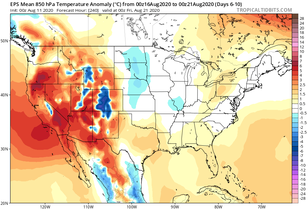
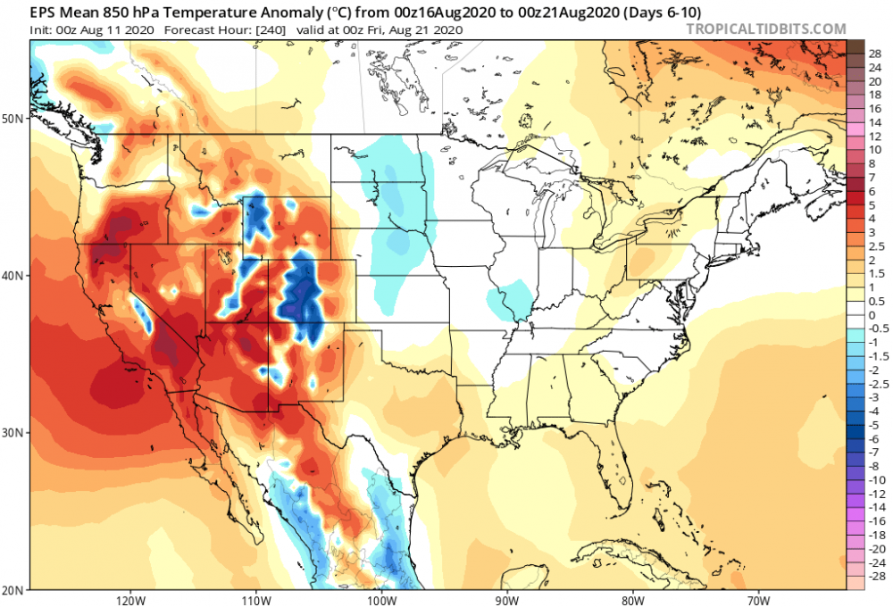
Charts lol
-
"Substantial" may have been a poor choice of words. It's not like I'm saying it will be chilly. Getting 850s even a hair below normal from the NW will probably feel substantial. In the end it's probably more of a mild down than this weekend. Of course if the SE ridge decides to really flex that could hang the front up a bit to our NW and it just clears us as a diffuse POS.
-
Was using the euro
-
Similar here too...I only had a couple. But the swampazz was off the charts that year. We'll have to compare the house of 70+ dews charts when the month comes to a close.
-
Min 65F...going for our 3rd 90F of the year. It hasn't been too hot up here. Just a monotonous amount of 80s. Dews have been way more tolerable than 2018 as well.
-
Special one
-
Looking like a mild down this weekend and then ridging getting pinched off ahead of a more substantial cold front next week.
-
Great where?
-
Already 75°. Pretty nice out. Was going to turn on the AC, but going with the window fans for now.
-
97mph at a home station in Marion https://mesowest.utah.edu/cgi-bin/droman/meso_base_dyn.cgi?stn=F3880&time=GMT
-
87/66. Warm one. May even hit 90° here tomorrow.