dendrite
-
Posts
75,066 -
Joined
Content Type
Profiles
Blogs
Forums
American Weather
Media Demo
Store
Gallery
Everything posted by dendrite
-
And AK has been cold, but the really extreme departures have been radiational cooling. Fairbanks hasn’t been threatening low max records.
-
It’s not UHI
-
Picking up again, but it’s still refrozen flakes with a sleet-like sound. Radar looks abysmal.
-
Trying to stay safe

-
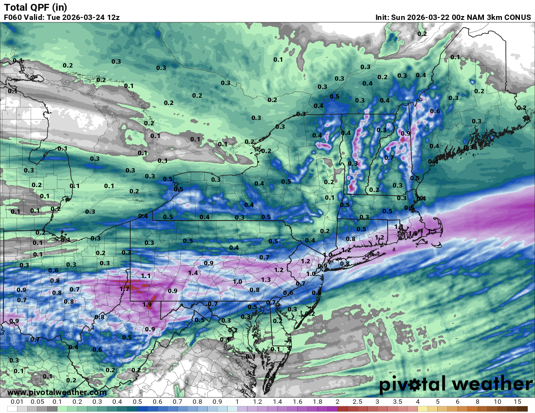
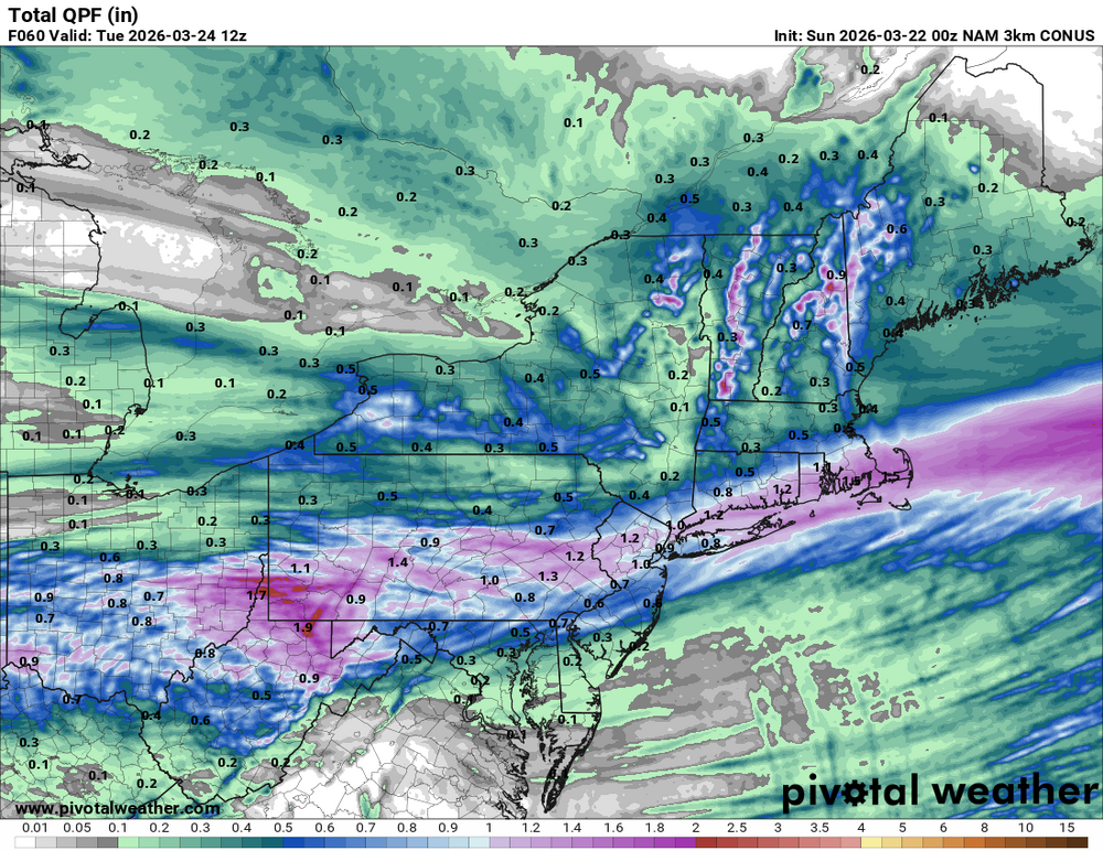
Most models are flipping the rain in C/E MA over to snow tomorrow and then swing an inverted trough through during the evening bringing a N-S oriented band of snow.
-
Barely. 31.0° -SN Just a dusting so far. It almost looks mixy at times…hard to tell in the early light. The flakes are heavily rimed though.
-
Screwed 6 ways from Sunday
-
NAM is little snow too. Not complaining.
-
Haha HRRR is almost no snow here…mix to rain.
-
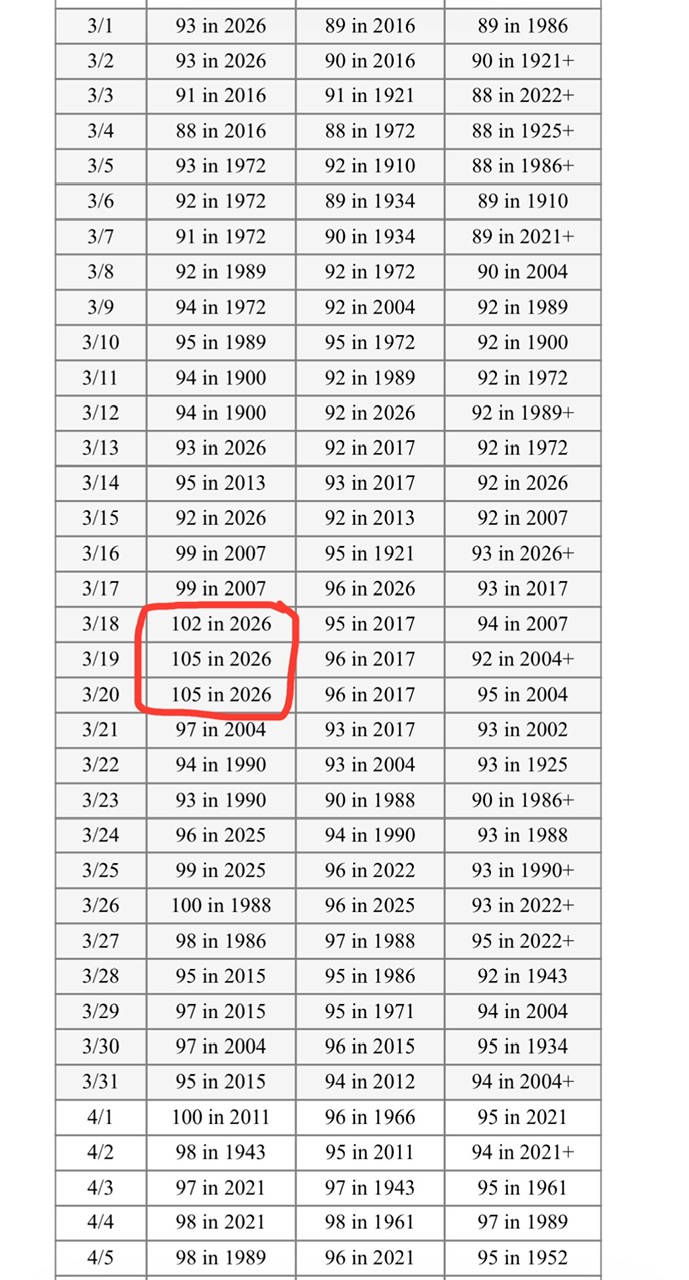
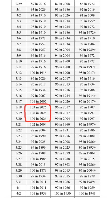
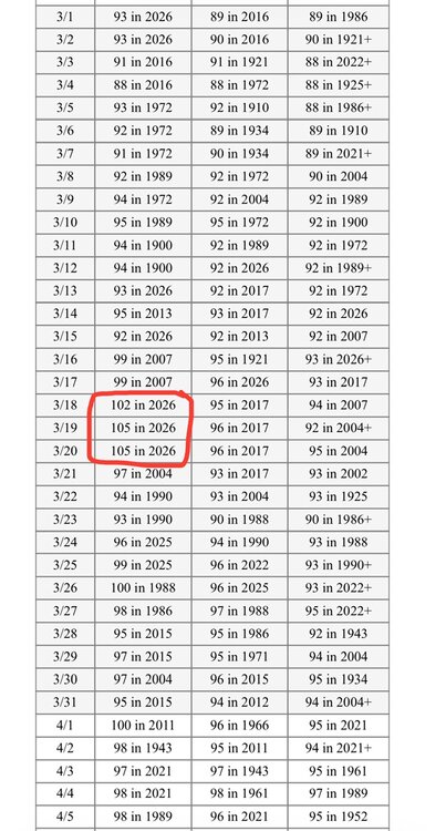
“Only” 107° for Yuma today. 6 100°+ readings for March there on record coming into this year (max 102°) and their last 4 days have been 103-106-109-107.
-
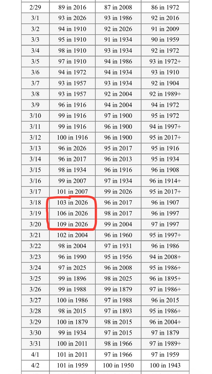
3rd straight 105° at PHX today. They had one (1) 100° reading ever in March going back to 1895 and they’ve pulled 102-105-105-105 the last 4 days.
-
Everyone is blowing away their records equally as impressive though. I don’t think the UHI has much to do with this…especially on daytime highs.
-
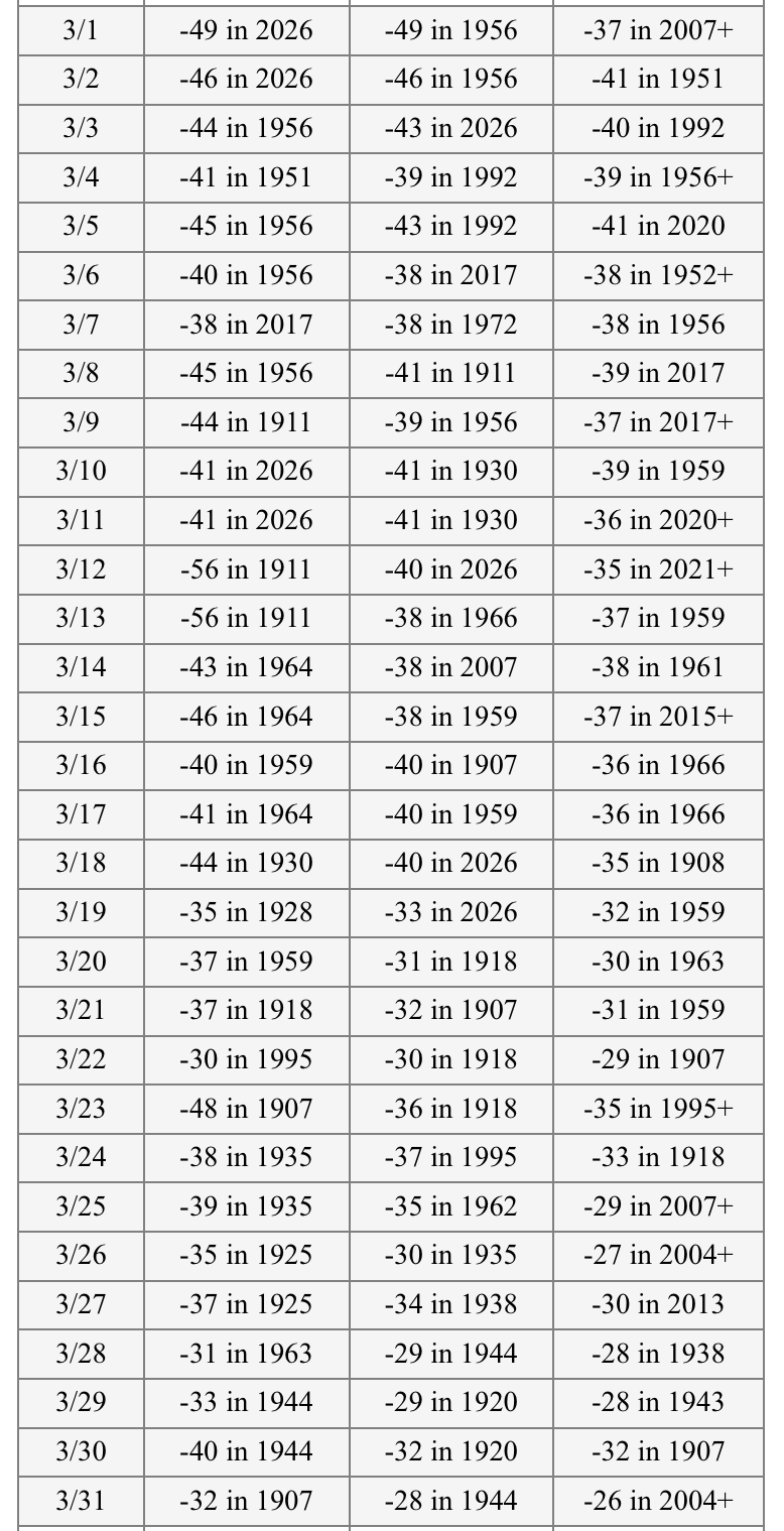
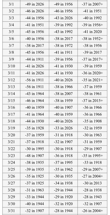
Those 1911 readings look legit…brutal cold on the original COOP forms for multiple sites. -68 at Allakaket is nuts for March. Alaskan yore.
-
It’s been impressive. Not sure about the validity of the 1911 stretch, but if you toss that then Fairbanks tied the next coldest reading of -49. 4 record mins this month and lots of runner ups.
-
Got the April map? I mentioned AK the other day.
-
Bad news in Tamworth at Chocorua Preserve. Hopefully no one killed, but it doesn’t sound good. edit…hopefully just broken bones
-
Complain enough and good things happen
-
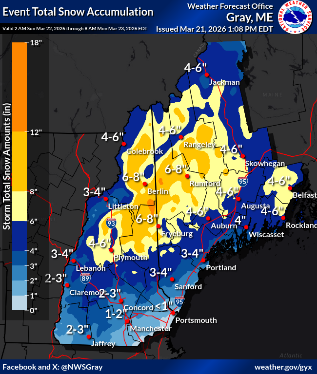
3-4” here on the social media map. Sounds about right.
-
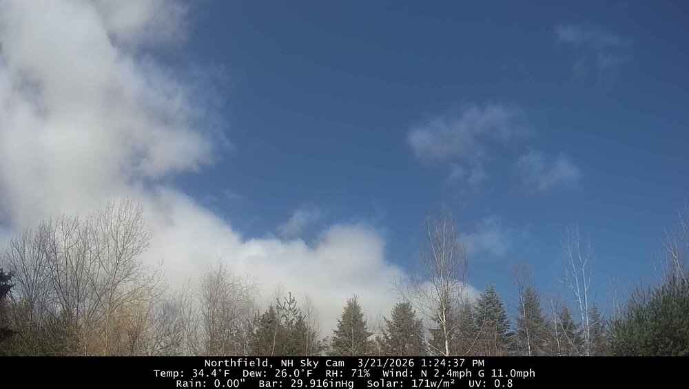
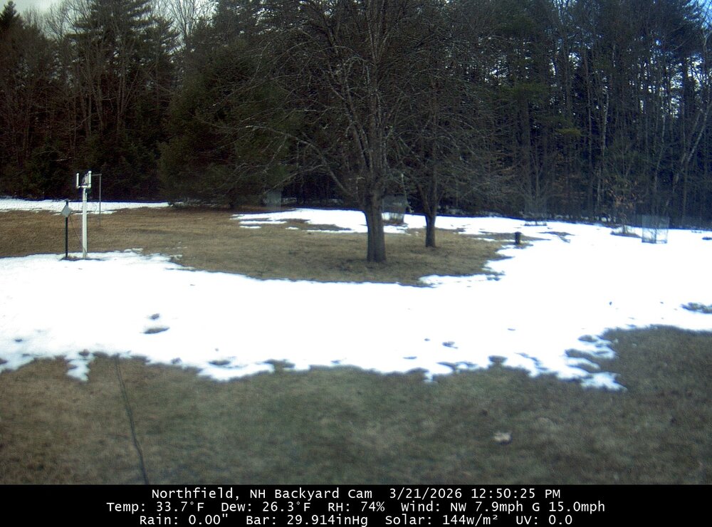
I’m almost always in the wrong spot in relation to cloud streets. I see blue occasionally to the north and east, but it’s just been a raw deep overcast here. 33.7° now
-
Absolute shit day. Overcast and haven't had a peek of sun yet. 34.7F
-
Tomorrow into Monday…then maybe watch Thu too. Probably advisories.
-
Looks like a snowy week up here on most modeling. Just when my shoulder was starting to heal.
-
I just find this so wild
-
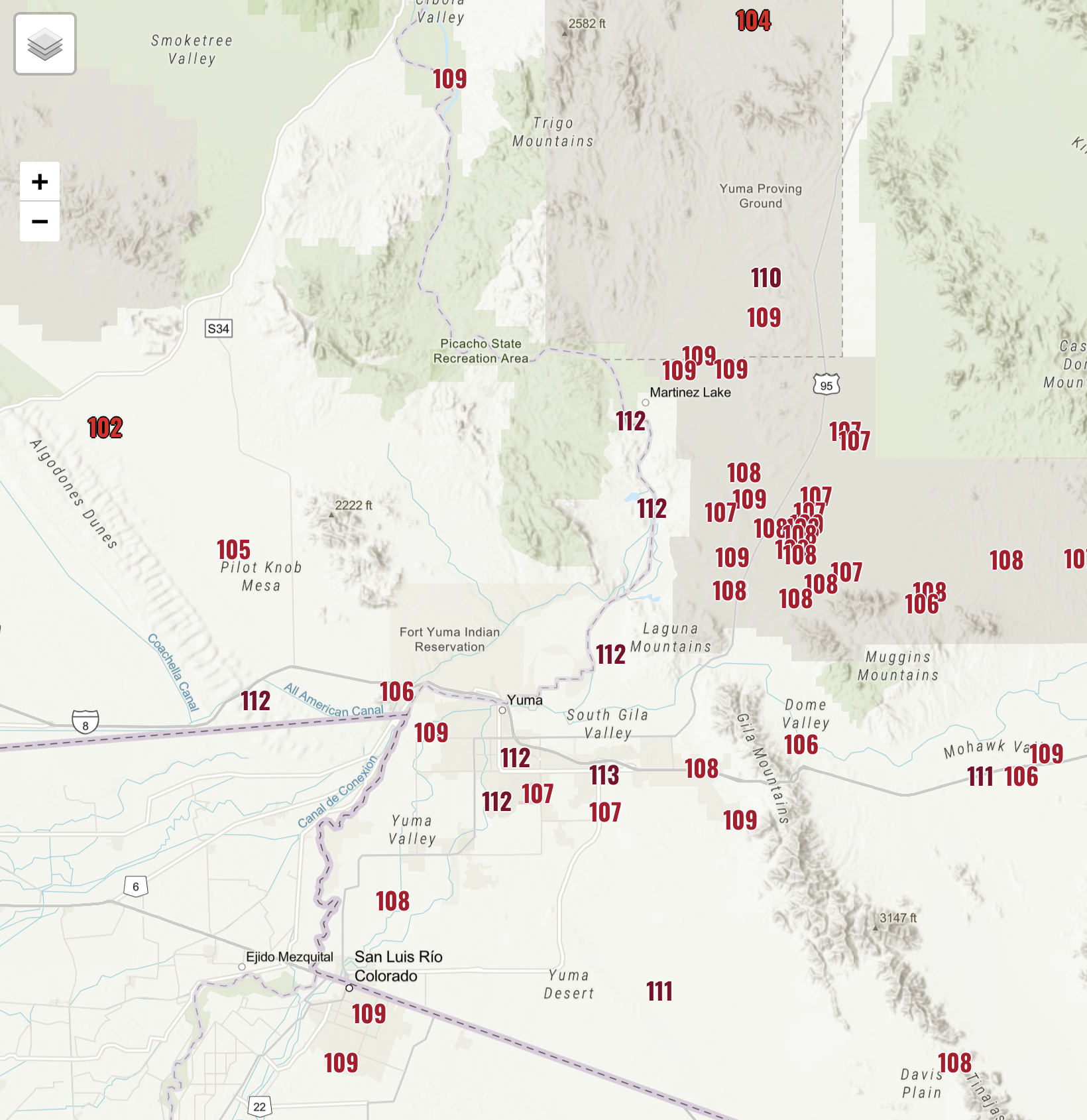
There was a 113° in there. Those are all RAWS stations though so they will have to have their instrumentation and siting verified.