dendrite
-
Posts
76,042 -
Joined
Content Type
Profiles
Blogs
Forums
American Weather
Media Demo
Store
Gallery
Everything posted by dendrite
-
They’re augmenting the obs now. Human observers ftw KMHT 061053Z 32008KT 10SM CLR M14/M18 A2998 RMK AO2 SLP173 T11391178 $= KMHT 061053Z COR 32008KT 10SM CLR 07/00 A2998 RMK AO2 SLP173 T11391178 $= KMHT 061153Z 33007G13KT 10SM CLR M14/M18 A3000 RMK AO2 SLP179 T11391178 53014 $= KMHT 061153Z COR 33007G13KT 10SM CLR 07/00 A3000 RMK AO2 SLP179 T11391178 53014 $=
-
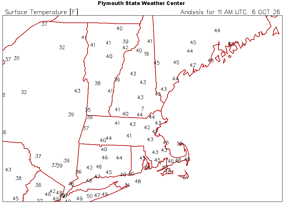
Looks like the MHT sensor shit the bed
-
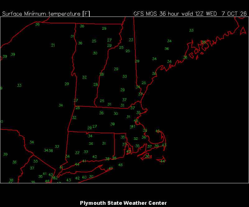
00z mav mins for tomorrow
-
Yup wind has been cranking for a couple of hours. 61.8/38
-
I think the boundary just went through. Was overcast most of the morning and just had a thin line of showers go through. Mostly clear now. 51.4°
-
Lawn thread And that burr looks a bit hybrid
-
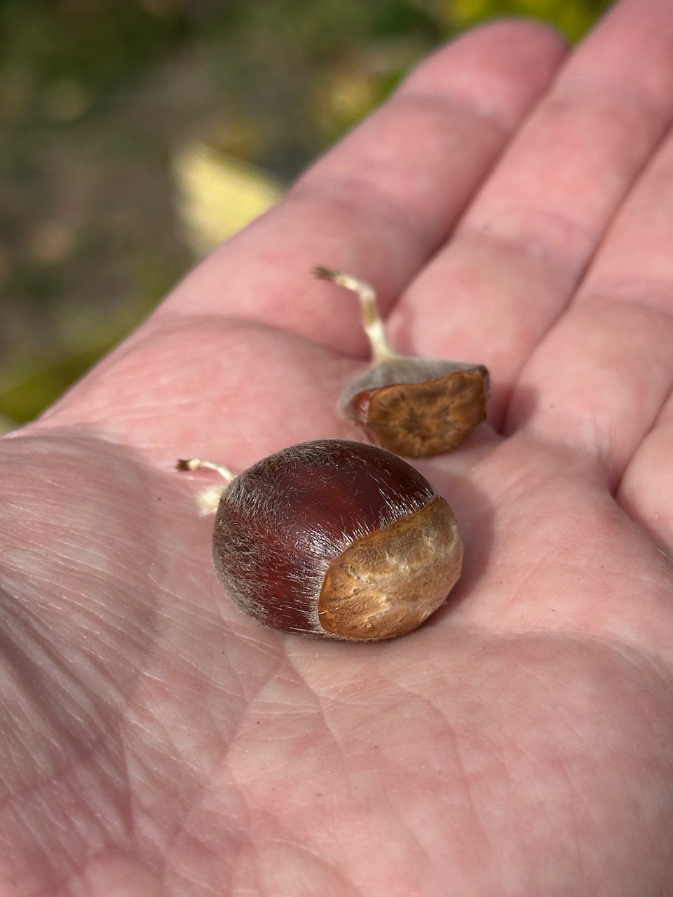
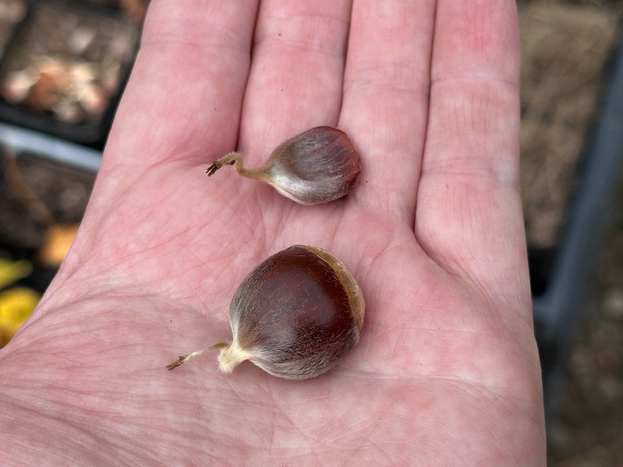
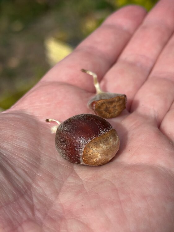
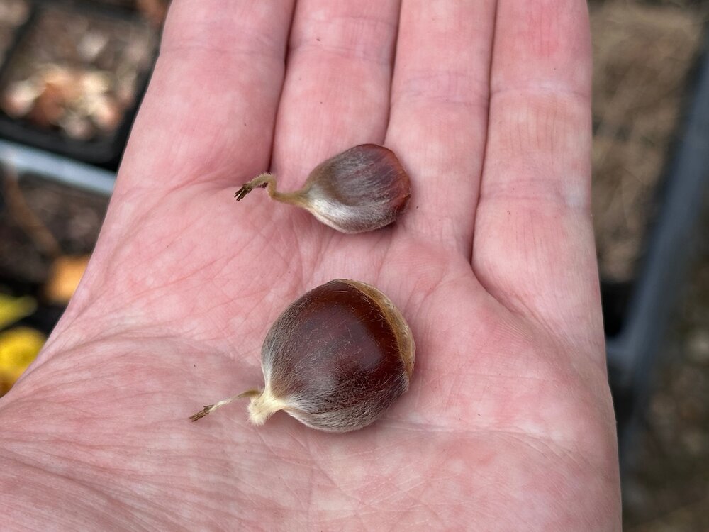
We got one. I climbed up the tree and cut the last burr off and found a fertilized chestnut. You can see the difference between the two. @wxeyeNH Any fertilized nuts up there yet?
-
Miller Ass Miller BS Just give me a bunch of nice safe SWFEs where I don’t have to worry about deform bands, screw zones, downsloping, etc.
-
It’s actually quite frosty in the back field despite 39°
-
Min 39.0° Lots of 20s up north. HIE 27, HUL 28 Coldest I saw was 23° at Estcourt.
-
One of the historically fun obs out of SCH KSCH 041300Z 30016G26KT 5/16SM TSSN FG OVC005 00/M A2978 RMK LTG HIT TREE AE SLPNO T0000////
-
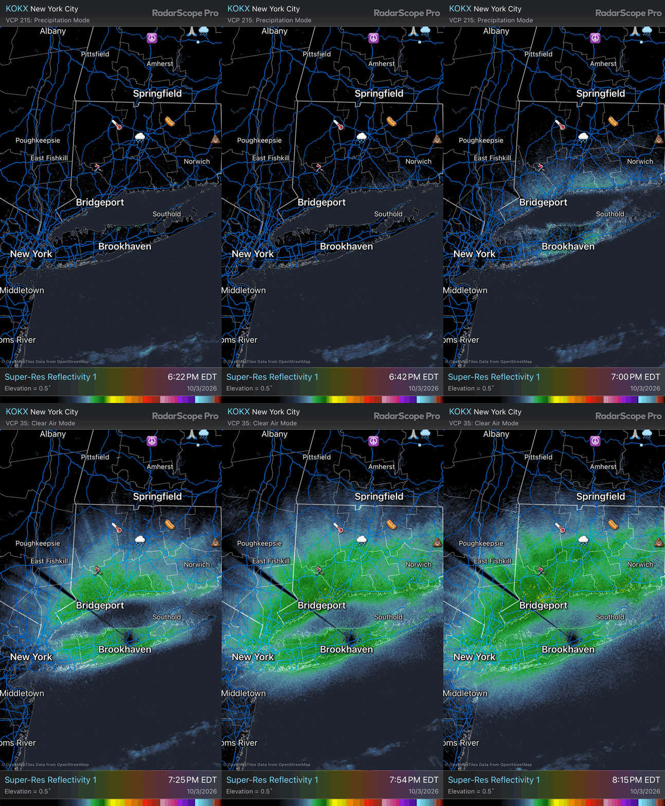
Sure. It can hit anything. There’s some filtering algorithms. On social media tonight there’s some vids from Cedar Point in OH where there’s huge swarms of insects coming off of Lake Erie. Here’s an example of the beam being ducted back to the surface and picking up traffic on I40 east of KLIT https://www.kark.com/weather/weather-headlines/ast-blog-radar-beams-towards-i-40/
-
Well they’re hitting the surface. Moisture/dew on objects, insect swarms, dust, etc. Although I didn’t see any flying insects tonight. https://8245forecast.wordpress.com/2013/09/05/anomalous-propagation-part-1-ground-clutter/
-
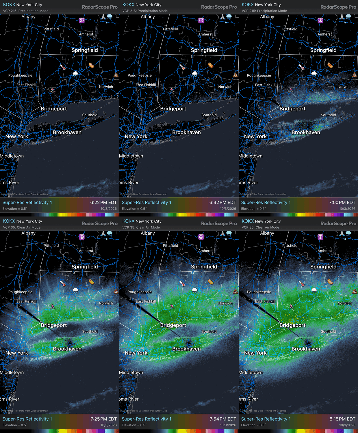
You can see the reflectivities start over land surfaces.
-
The radars are in precip mode instead of clear air The temp inversions develop at sunset from radiational cooling and the beam gets refracted back to the surface.
-
Ground clutter in precip mode. Already 40s here Although the social media weenies will claim that it’s migrating birds. lol
-
It will be an interesting winter with DirtySnowchez posts
-
A+ day apple picking despite the doughnut line 59.9/39 off of a max of 63.6F
-
We call it Indewgenous Peoples’ day now
-
Min 48.8° MEX has 29° for CON next Wed morning…33° at LCI. Hopefully we avoid a freeze a little longer. BML/HIE 22°…should be the first real hard freeze there.
-
We’re ending the NAM about as fast as the Iran war.
-
Feels like it just started
-
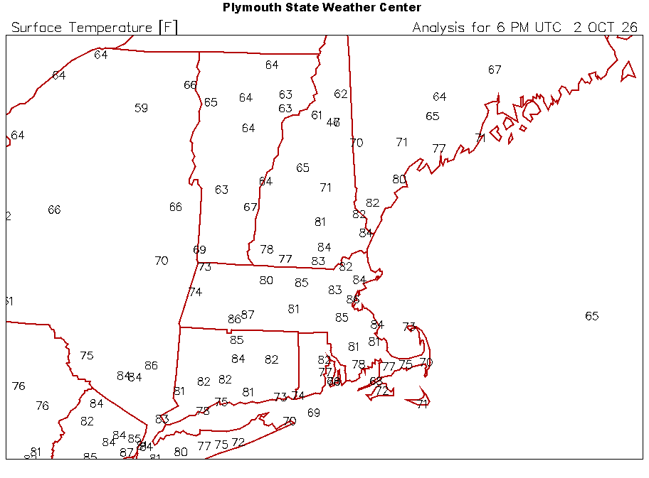
Goodbye summer
-
Temp is nosediving behind the front. Windy, overcast, and 67/62
-
79.2F before the clouds