dendrite
-
Posts
75,078 -
Joined
Content Type
Profiles
Blogs
Forums
American Weather
Media Demo
Store
Gallery
Everything posted by dendrite
-
Clear out just in time to radiate tonight ahead of the backdoor tomorrow morning.
-
F you all
-
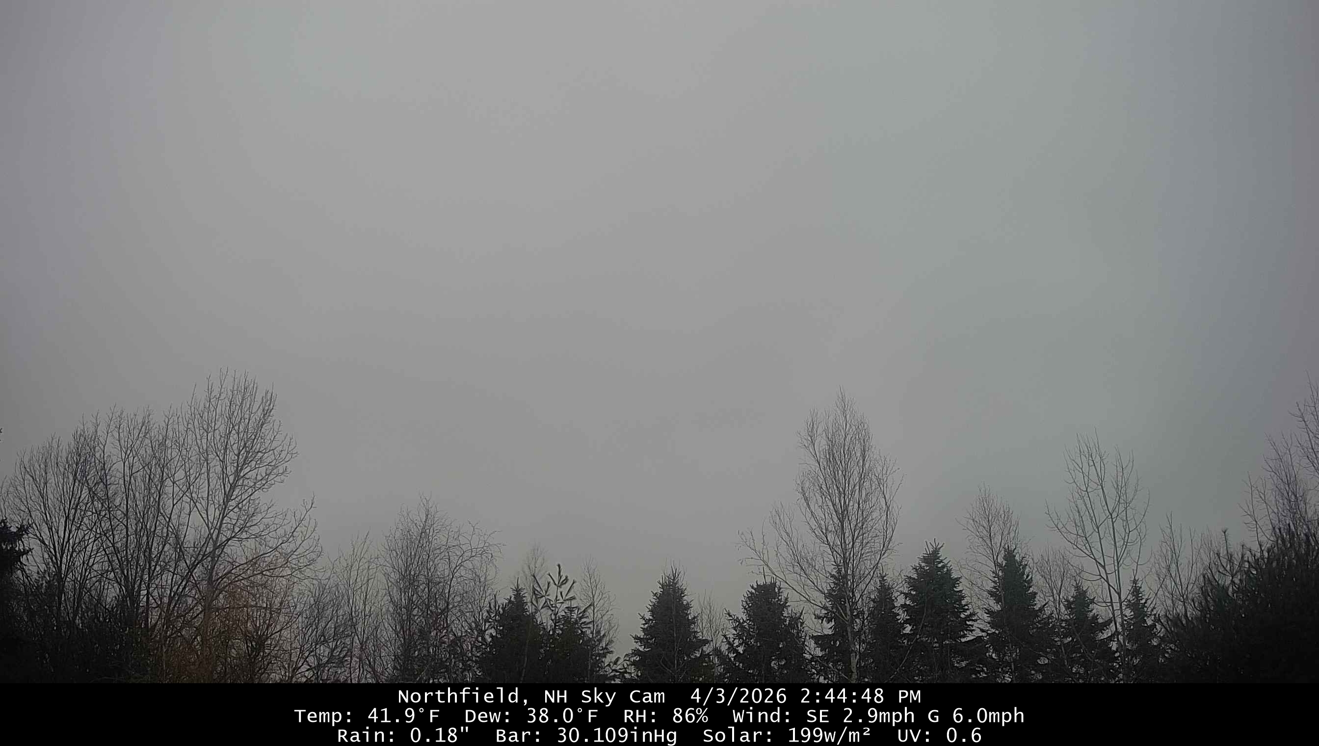
41.9° and shat but I’m numb to it by now
-
Mostly sunny south or rt 2 now. We wait up here. Still dark overcast.
-
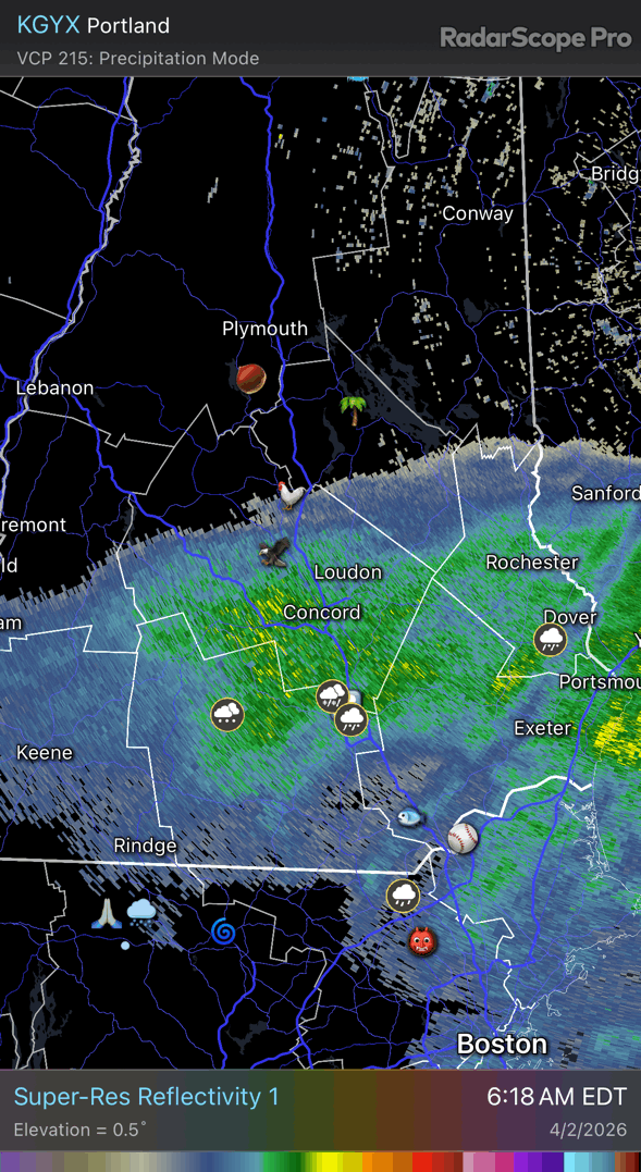
I mean yeah…it’s going to clear west to east. Seems to being working out as progged. There’s still low level crud CRV-east that needs to be eroded below the mid level clearing.
-
It’s still low 40s in CT
-
36.4° +SHRA (RW+ for vortex)
-
That’s SW downslope off the Catskills. But yeah it will slowly improve SW to NE. But I think we’re skunked most of the day. Maybe SW flow off the Monads will work in our favor.
-
Had a little SHSN here before sunset too yesterday. Then just 32.1° and -RADZ the rest of the night.
-
Wetbulbs verified a lot cooler than that in the H7-85 layer. Add in some extra cooling with convective lift and I guess it was enough to overcome.
-
The warmest weather here will be overnight tonight.
-
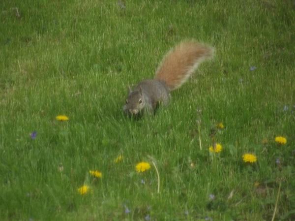
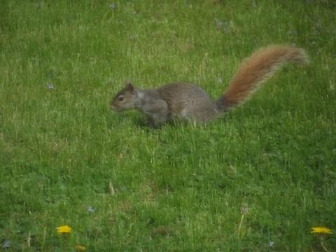
The more I dig I guess they’re just grey squirrels with a red tail variation.
-
Sat still has the chance to be mostly ass for many. CT may hold it off for most of the day.
-
We had one in 2016
-
We could get the CO2 to 1k ppm and this region would still find a way to rot near climo in the spring.
-
Can’t wait for my 4pm warm sector on Friday that slams shut sunrise Saturday. Sat looks like definite toast now. NAM has screen doors slamming shut in CT midday.
-
He moves in mysterious ways.

-
Not a drop here…riding the line. 34.2°
-
Haha NAM wedges up here Fri and Sat now. Shitshow.
-
Bro calm down. They’ll have more boston cream tomorrow.

-
3 airmasses in place right now. The wedge in the east, warm sector in SNE/CRV, and then the CAA moving south through upstate NY and VT.

-
Still snow piles here
-
Not looking good for the growers the middle of next week
-
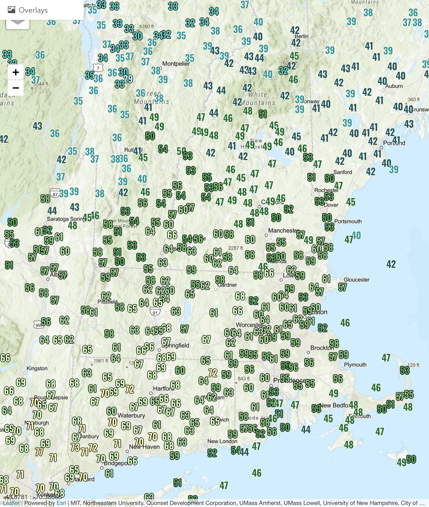
39° with some clearing 1.19”
-
40° +RA 0.93”