

dendrite
-
Posts
75,069 -
Joined
Content Type
Profiles
Blogs
Forums
American Weather
Media Demo
Store
Gallery
Everything posted by dendrite
-
 Coworker in Barnstead has a large tree that took out powerlines across his driveway and road. Can’t even get his car out until the tree is removed.
 -
Today's the 25th anny of the 12/23/97 quick morning thumper for NE MA into S NH.
-
Looks like the CON anny is out
-
Yeah small hail
-
Doing something frozen
-
Mom is out of power. Just flickered here
-
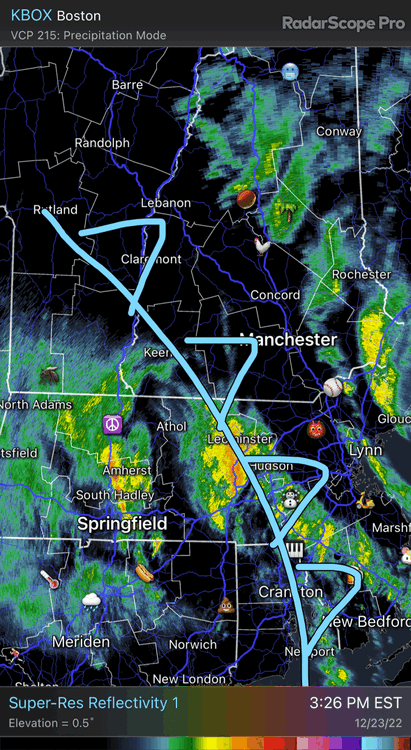
A little TS around Claremont
-
I’m outside with the birds but I think it’s along this line
-
We rainbow
-
That rain that just went through was pretty intense for 20 minutes. The chicken run was breached, but I was able to seal it off before it totally flooded in. Up to 2.53” and most of the glacier has melted as well.
-
BUF down to 11° with 60kt and S+
-
I want that car frozen in place tonight
-
This threat should start looking really good by New Year’s
-
West side til we die?
-
Mt Mansfield 130mph. Picnic tables flying into NY.
-
MWN 151mph with +FZRA
-
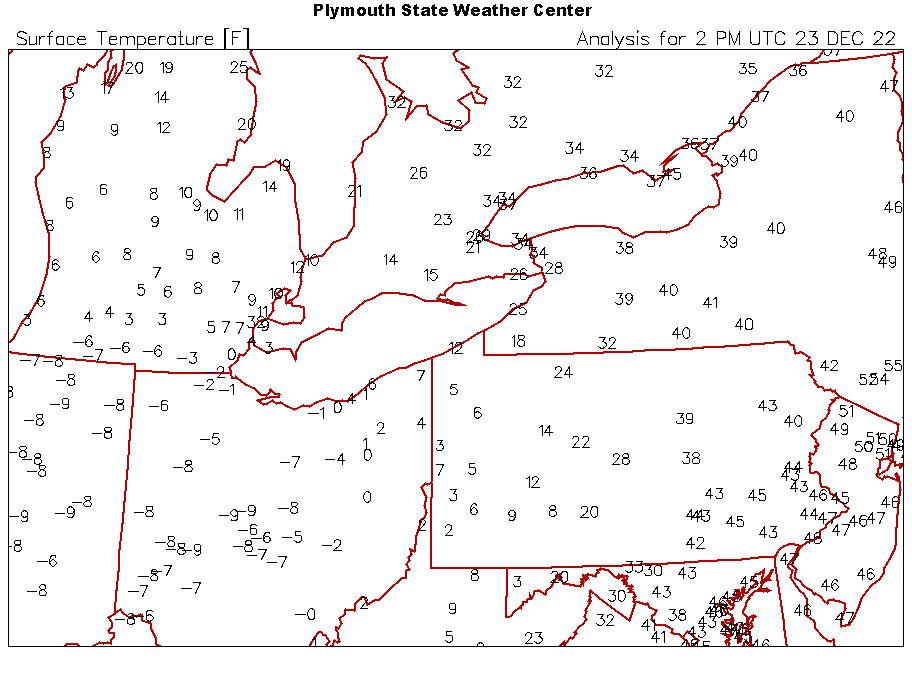
Pretty wild temp plot
-
BUF gusting to 59kt with +SN
-
45mph on my davis so far. Probably translates to 50kt with no tall oaks just to my east.
-
Really ramping up here. Actually picking up wet snow and lifting it into the air
-
In the hot tub with the scanner
-
MWN +SN and gusting to 147mph. They don’t actually report a lot of “official” +SN obs up there for whatever reason.
-
Goodbye western VT soon
-
I obliterated 3ft. Lol
-
The Chris Davis of weather


