dendrite
-
Posts
66,943 -
Joined
Content Type
Profiles
Blogs
Forums
American Weather
Media Demo
Store
Gallery
Everything posted by dendrite
-
Yeah...the observer went a little weenieish there. Like you said, SQ has a specific definition. I’ve seen it reported automated in New England, but it’s rare...a lot more common to our west with severe weather.
-
How's the kuchie? With iffy 2m temps and insolation it may be more representative for the lower els.
-

-
64.4" More than half in 1 storm.
-
Methuen jack!
-
Crime, strip clubs, downsloping on NE winds... Why does anyone live in Tolland again?
-
There’s something else going on down there. It’s been mostly sunny in CT and SE NH most of the day with a stripe of clouds from SW NH toward BOS. Maybe a bit more convergence in that region? Haven’t really looked at anything besides vis.
-
It’s far, far away.
-
Out in the woods in the poo pile.
-
Or borrow Ginxy’s dogs and let the doo absorb all of that radiation and melt holes right through the pack. It must look like Swiss cheese this time of year.
-
If I hear one more person blame the southern Plains cold and snow on global warming I’m going to set my bamboo on fire.
-
Southerly flow...definitely favors the high terrain in SNE/CNE.
-
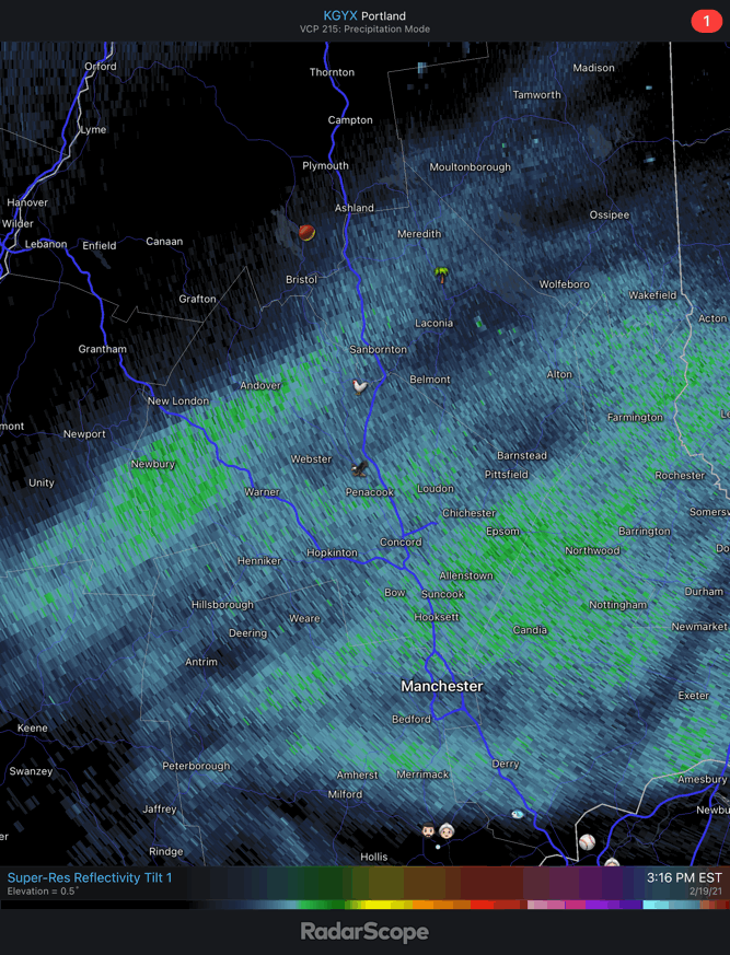
Another 0.3”/T overnight. Was spitting flakes around sunrise, but SCT skies now. 4.8”/0.17” final
-
Still snowing lightly. 23.3F 4.5" new snow via only 0.17" The 3 samples were pure fluff... 630am 1.8"/0.09" 130pm 1.4"/0.03" 10pm 1.3"/0.05"
-
Up to 4.0”. Still a steady -SN.
-
I thought growth looked pretty good up here despite the lack of liquid. Most of the weak omega from the bands was in the DGZ. The WAA snows in SNE looked more below the DGZ.
-
Huge growth on this back edge.
-
Who are you?
-

-
Getting a little happy ending.

-
Deep winter's back is broken. I haven't hit 40F here since 1/16 and it looks like those chances will creep up this week. Then maybe some warmer days to start March. Yeah...it'll snow again. Yeah, it'll get cold again. But the coldest of the cold looks to be behind us. It's like when you get that 1st cold front in late August that breaks the string of 3 weeks of lows in the 60s to near 70F and the outlook shows multiple fronts and sfc highs going into Sep.
-
Well 26:1 total.
-
The last hurrah is approaching here, but it may weenie out for 30 mins before essentially ending.
-
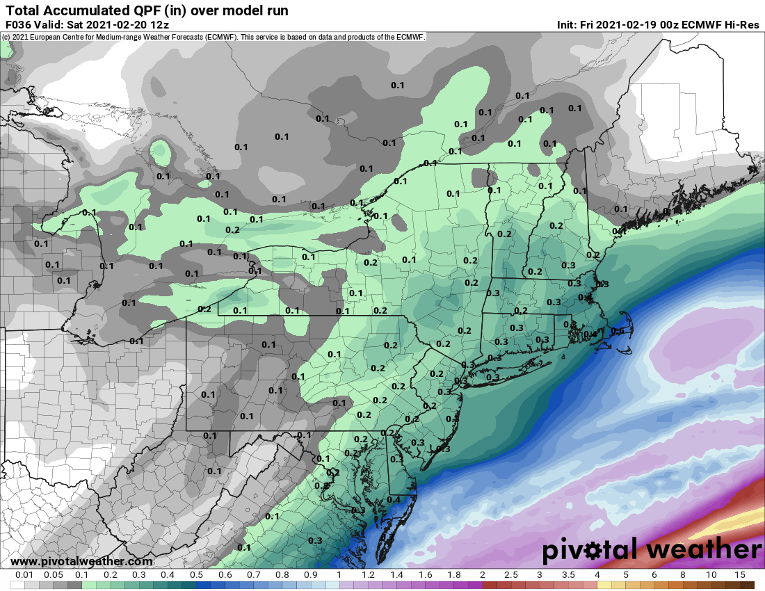
Heh...1.4"/0.03" in this last sample. A jspin special. So that's 3.2"/0.12" so far. Model QPF on the money, but we're overperforming with ratios.
-
25° -SN Had 3.2” a half hour ago. Still accumulating lightly. Maybe we can pull 4”. That would be a win.