dendrite
-
Posts
75,081 -
Joined
Content Type
Profiles
Blogs
Forums
American Weather
Media Demo
Store
Gallery
Everything posted by dendrite
-
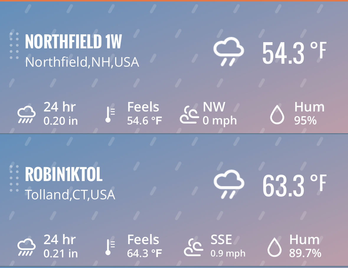
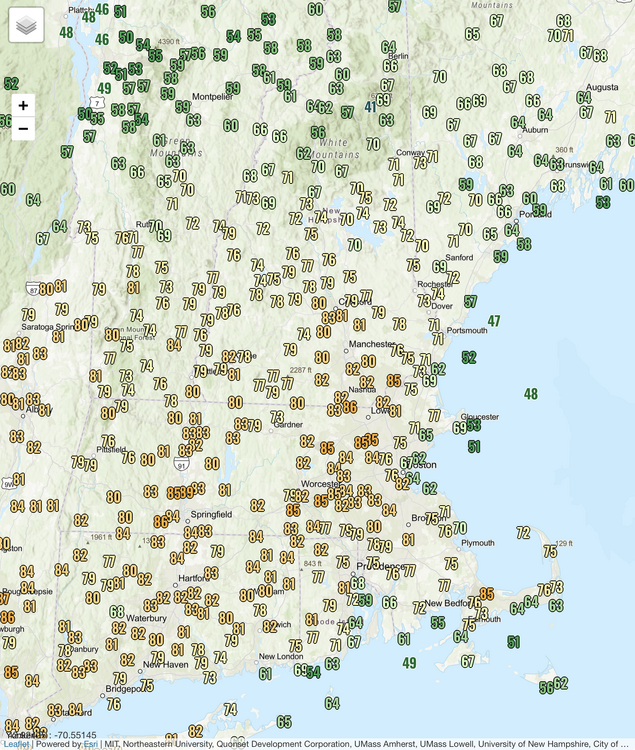
Stratus is backing in there from Maine too. It’s been sun and clouds here and it’s finally nearing 60°. But it just has a feel with the E breeze that it isn’t getting much higher than mid 60s.
-
Beer?
-
50.6F Euro is on the warmer side here this week...hope it's right. The mesos at best keep the airmass tainted with easterly modification. Staying cooler may be better for the fruit trees if we are going to freeze again next week.
-
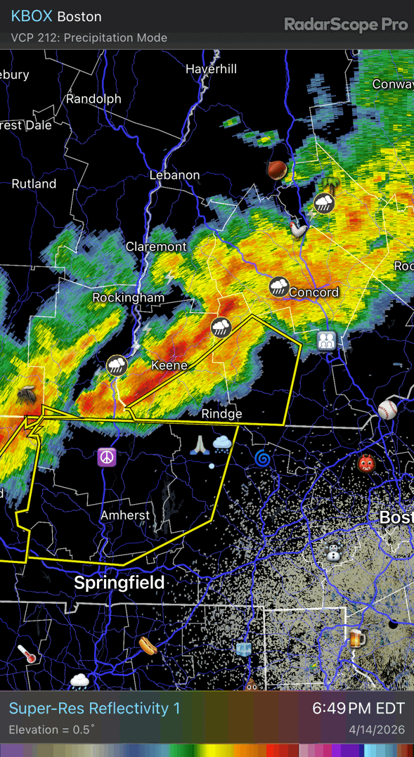
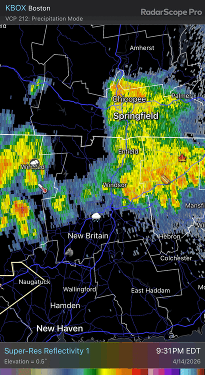
Passed me on rain with more to go…congrats.
-
It comin
-
A boring 0.19” here, but we embrace rain rates, thunder, and petrichor.
-
Heat is completely gone here for the next week now. lol
-
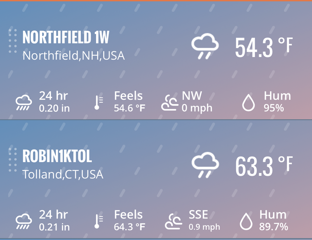
Brief downpour…more coming. 67.7/58
-
A lot of the 12z runs were meh for heat N and E of ORH this week outside of Fri. Gross.
-
Didn’t realize I was so close to breaking things
-
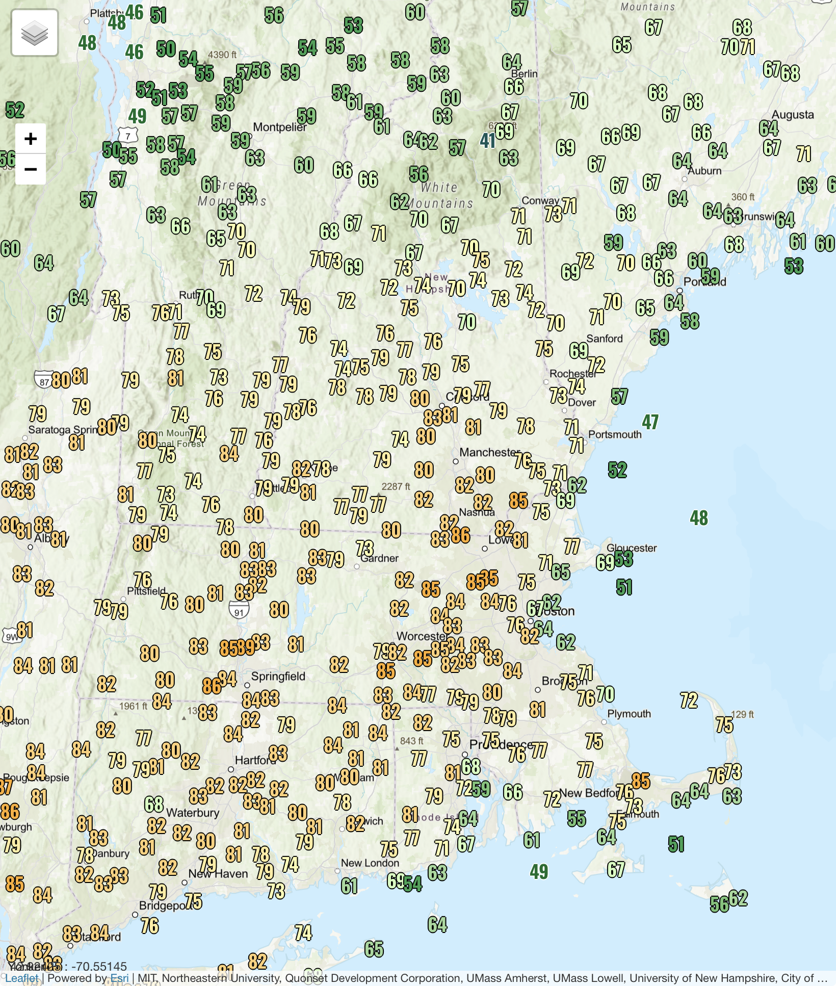
77.8° may do it.
-
Yeah just like winter
-
Sun contaminated in Jan but not Apr?
-
Fast growing…outcompete natives. They wake up earlier and get a headstart shading out others. They spread their seed more than Ray.
-
They’re giant weeds that threaten the native diversity. Kill’em with fire.
-
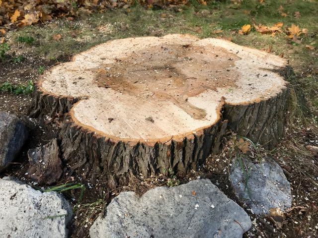
It’s pruning season. This is where you properly trim them.
-
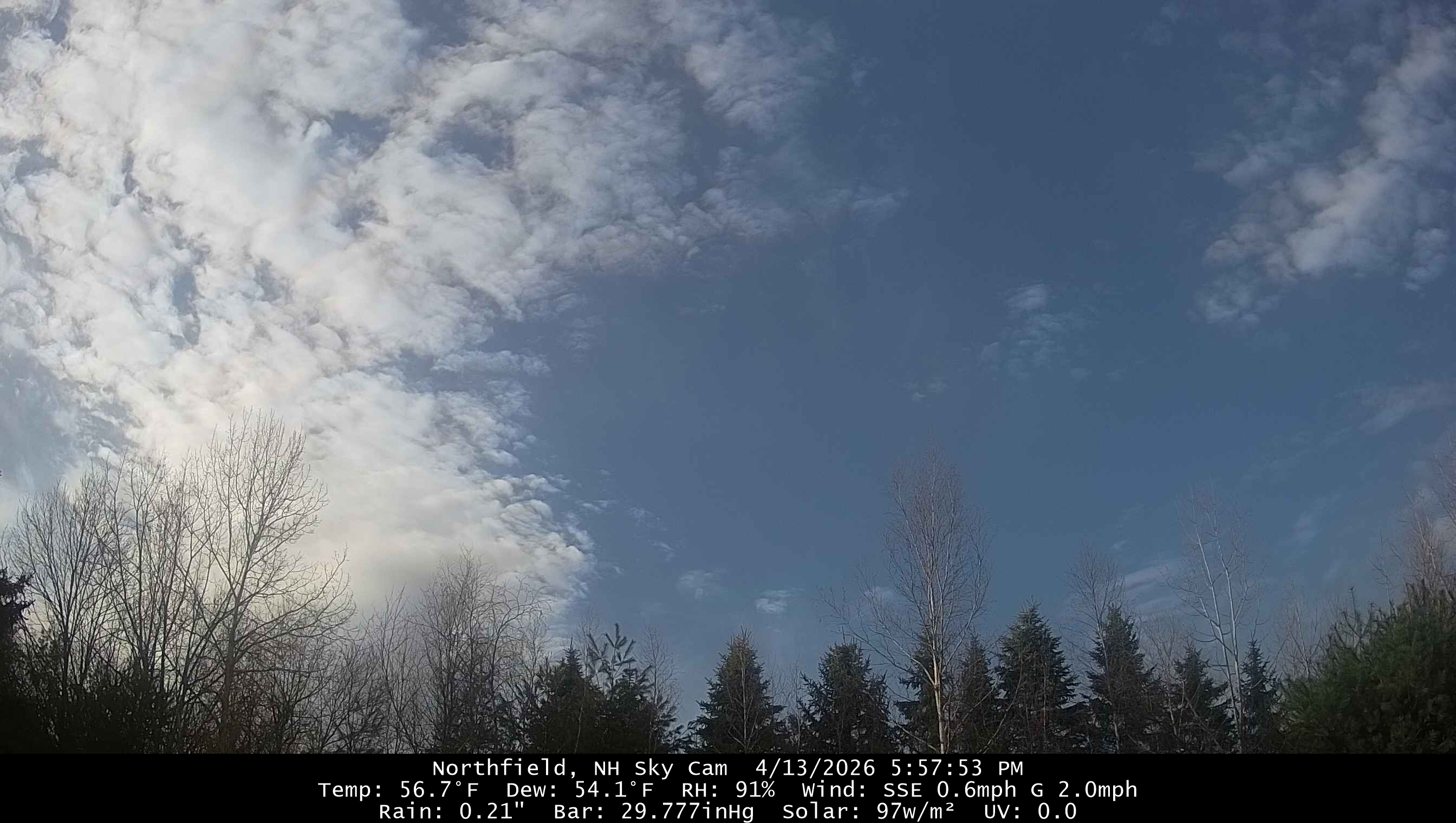
Today is a slog so far again. 58.9° and BKN skies
-
49.6° Hooefully we 70s even up here
-
Weak. ALB had 2.2”
-
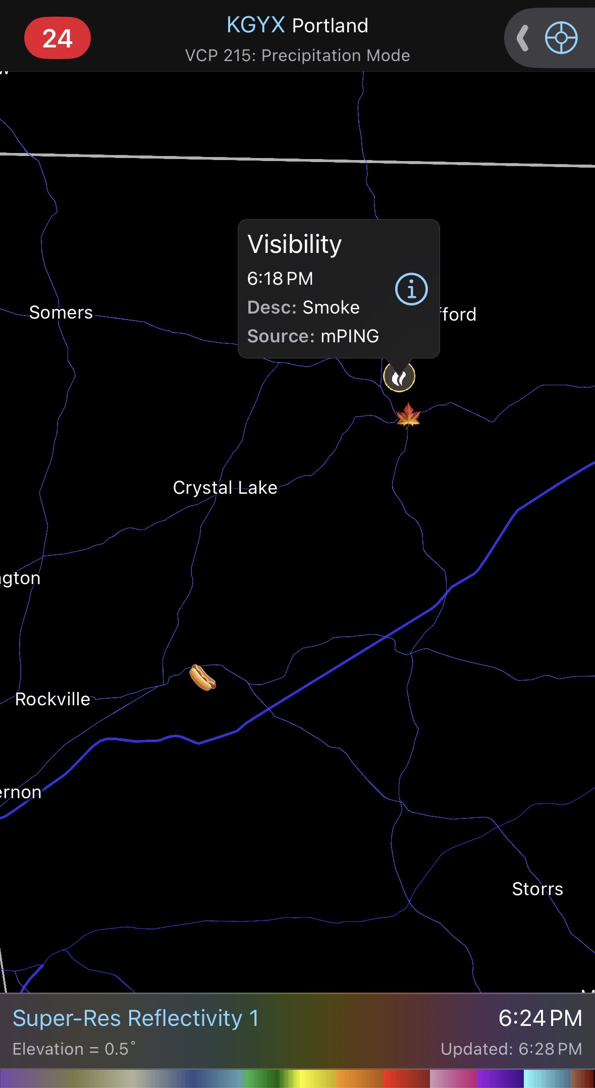
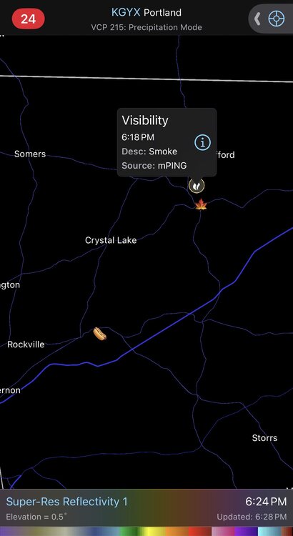
MetHerb’s maple trees on fire?
-
Clearing at 6pm right on cue. Maybe we can warm a bit this evening with a little WAA and mixing.

-
Wow…look at that 8mph wind for Shabbs
-
57.3