dendrite
-
Posts
75,057 -
Joined
Content Type
Profiles
Blogs
Forums
American Weather
Media Demo
Store
Gallery
Everything posted by dendrite
-
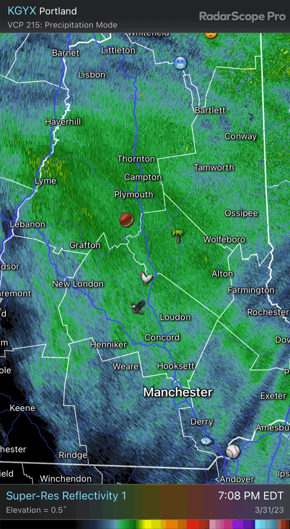
3k is pretty icy tomorrow afternoon up here.
-

The 2023 Lawn, Garden, Landscape Party Discussion
dendrite replied to Damage In Tolland's topic in New England
Looks like a good spot to grow a willow tree. -
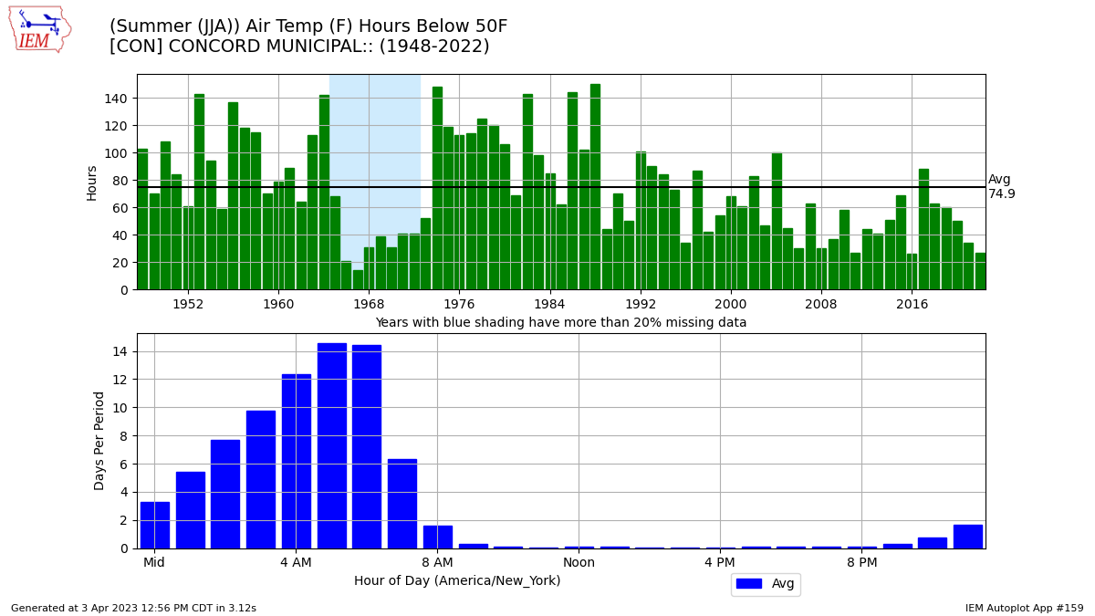
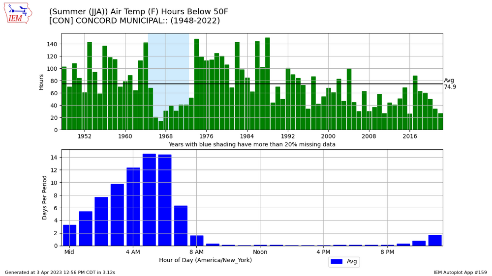
I'm just referring to CON which is obviously a rad pit. It's been difficult to get ideal rad cooling conditions with a 45 dp airmass the last couple of decades.
-
Pre-1990 we used to average about twice as many hours in the 40s at CON in met summer than we do now. But I don't think those times are walking through that door anytime soon.
-
Due? That's pretty much all we get now. lol
-
The Californian cordillera cryosphere is burgeoning.
-
Way better than what we had. 30s and rain all day.
-
Maybe a bit of a regime change starting this weekend with less frequent potent cold fronts? We’ve been on a steady diet of fronts every few days which equates to CAA, wedge, fropa, rinse/repeat up here.
-
41.8° at 230am once it mixed out.
-
Don’t be sorry. Rub it in.
-
34° and windy with an occasional flake, but it’s still better than yesterday’s atrocity.
-
The 2023 Lawn, Garden, Landscape Party Discussion
dendrite replied to Damage In Tolland's topic in New England
I don't think so. Check out some of them on findaspring.com. -
We need a temp probe on there so we can do some soundings.
-
38.7° TSRA lol
-
lol…what?
-
40° with thick fog.

-
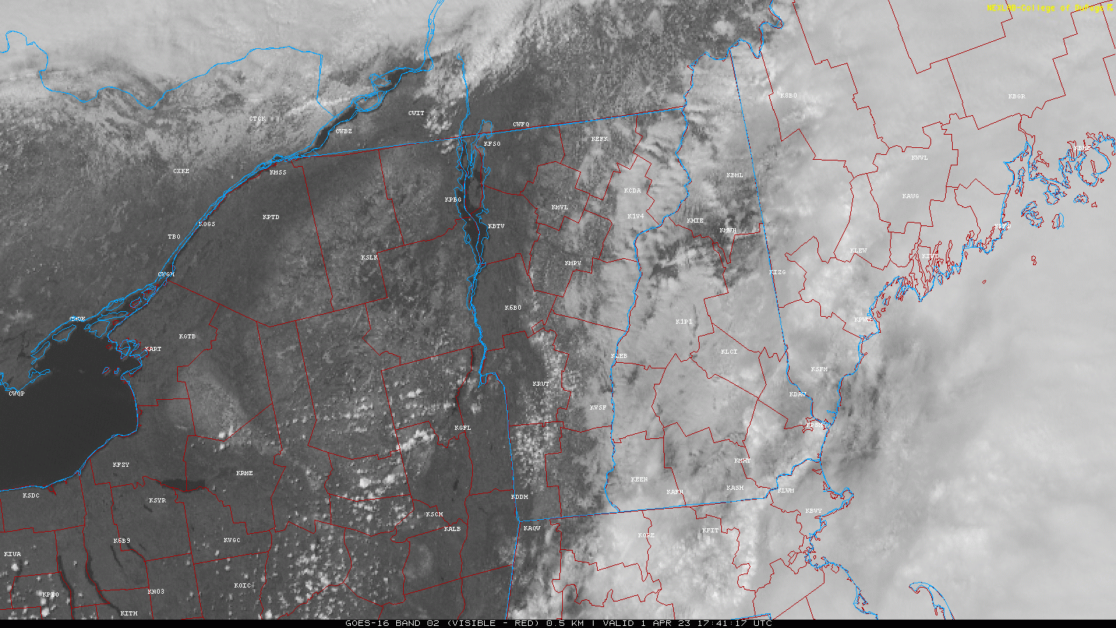
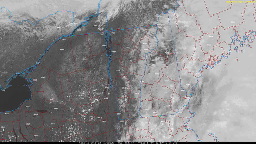
Vis tells the story in C NH
-
Compare it to this. lol
-
39.9° and gloom The shitshow continues
-
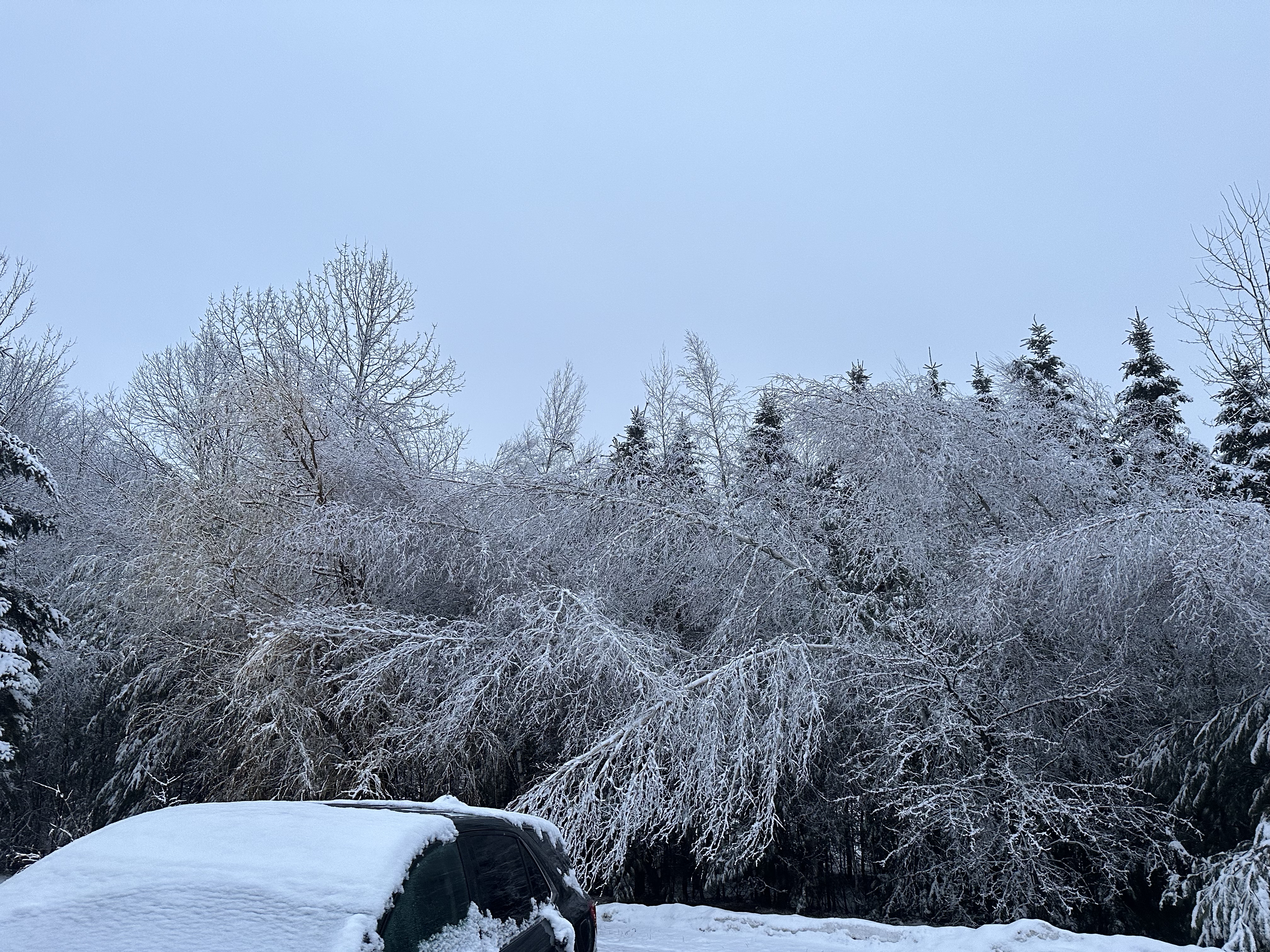
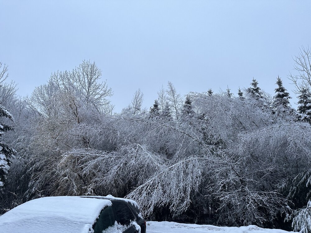
32.2° -RA The birches are bent again.
-
Looks like 1.9” will do it.
-
I’m more than done with winter, but always before winter is done with me.
-
It’s pounding. That’s always fun. I’ll be even more excited if it’s gone by morning and we hit 60°