dendrite
-
Posts
75,066 -
Joined
Content Type
Profiles
Blogs
Forums
American Weather
Media Demo
Store
Gallery
Everything posted by dendrite
-
 It wasn’t done at 84hr on the models, but I don’t like the system getting shunted southward as it gets toward this longitude either. Rain will pinwheel around and pivot in, but we’re flirting with mid level dry air in some of these runs. The 18z euro suite is pretty wet up into NNE.
 -
Canada should tariff us or make us the 11th province
-
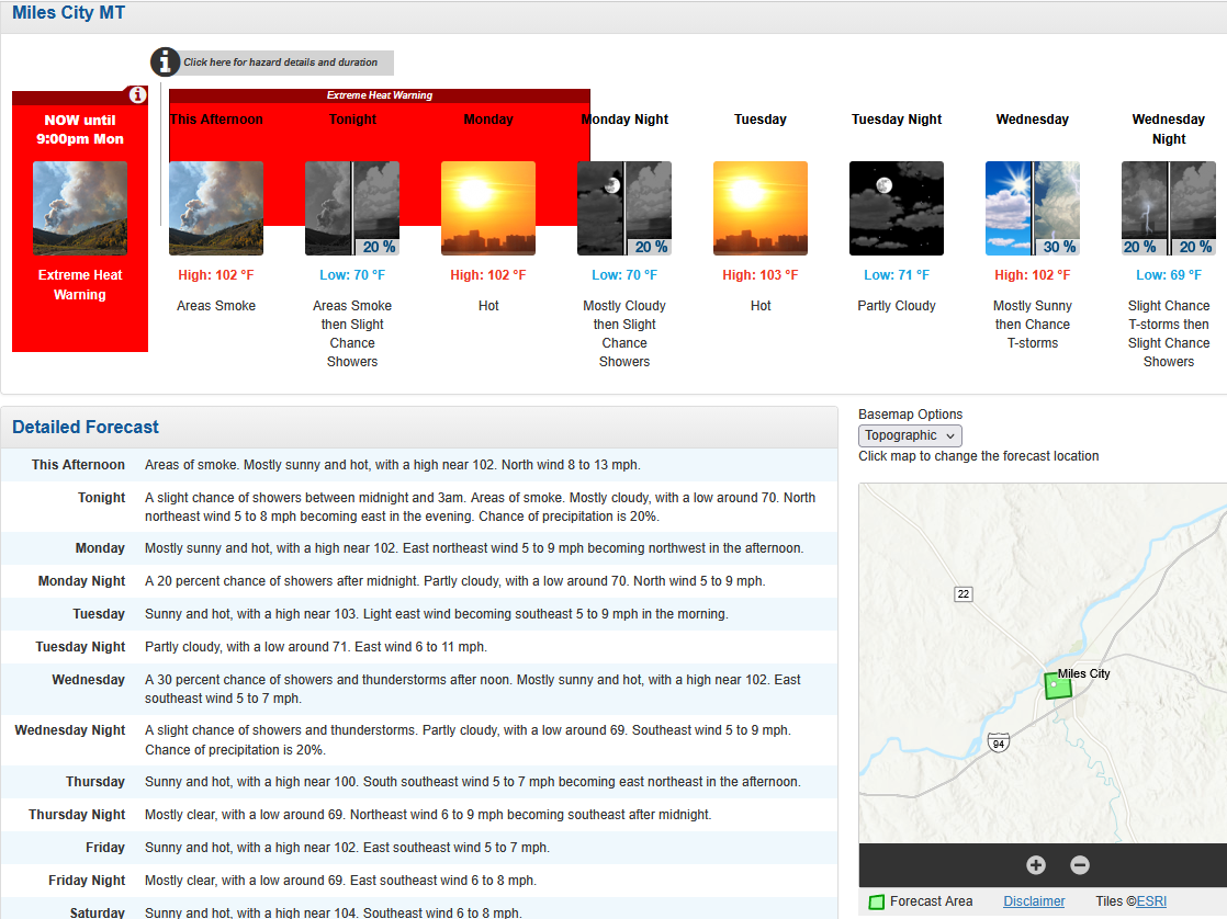
Oh trust me, I know. That area can torch right into the western Dakotas. But they did another record yesterday with 107F. They were +6.9F MTD before today and they put up another 100+ today. The 9th 100+ of the month.
-
Some of these maps have my blood pressure rising. Trying to remain calm.

-
Imagine moving to MT and thinking you're getting away from the heat

-
Gettin' there
.png.d02931190474f901a4e0b63b05f521b2.png)
-
TKGW 49° in Durham in July is NBD.
-
58° Just not a cold place
-
Maybe even ever
-
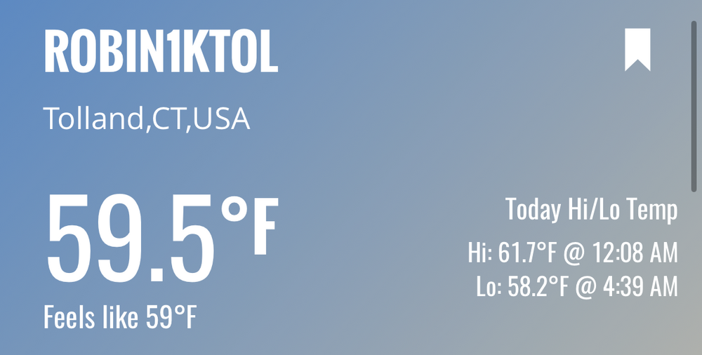
51.5° Chilly morning. A lot of upper 40s in EMATT.
-
I would put SNE underwater with a foot of rain in a second if it meant I could get 1" up here.
-
Get that max north. I want divorces In Newfound
-
Imagine if it snowed in a hurricane eyewall
-
Looks like all rain
-
The smoke was fun, but it’d be nice if we could get some volcanic ash from a massive eruption.
-
There’s only a couple of deniers here and he isn’t one of them.
-
Hopefully the euro/icon have the right idea for midweek. Otherwise we’re facing a July with under 1” of rain. 0.89” so far. 00z AI GFS was really wet too, but it backed way off at 6z.
-
Lol…C MN…puff puff pass
-
A little overmixed in fantasy land
-
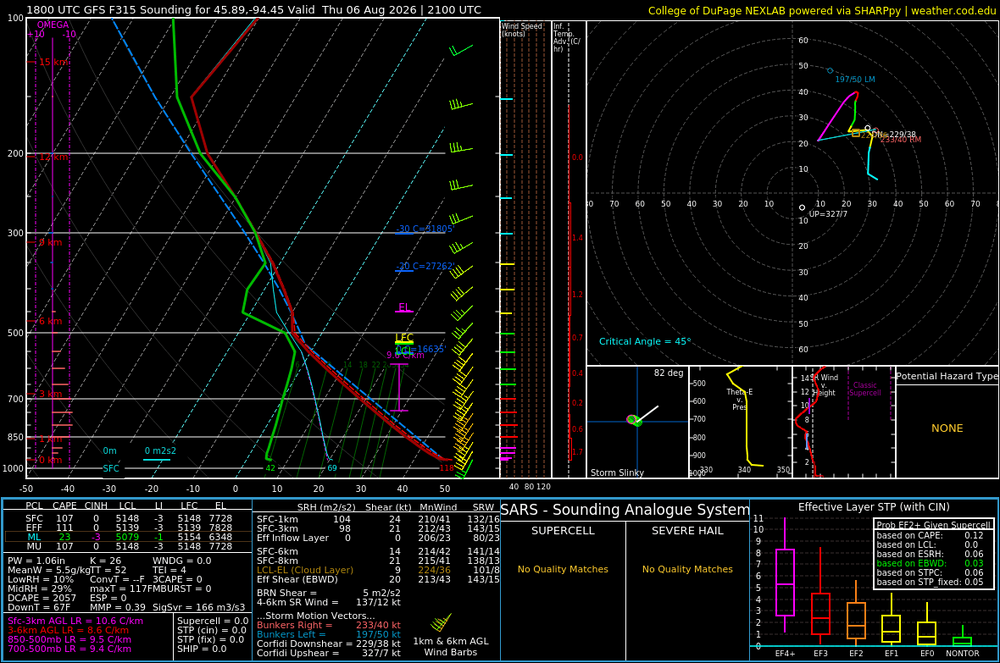
EPS retrogrades the western ridge a bit, but it still looks a bit troughy in the OH valley. AIFS gets the trough and WAR more west. Regardless, it’s mostly chamber weather for the next 7-10 days.
-
Ok ok ok The ratio of weather:political posts is taking a nosedive. Let’s at least sorta get back on track. 79.7/50.6 on the day here. Yore New England summer day.
-
A nice plate of liver to fill you up before you head home too. Can you imagine winter in here with everyone having high T? Not sure I want to be here for that.
-
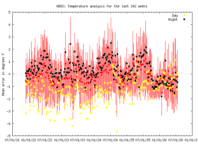
The thing to do would be compare the BOS max and min departures with the other sites going back to spring 2025 and seeing if they start deviating last fall.
-
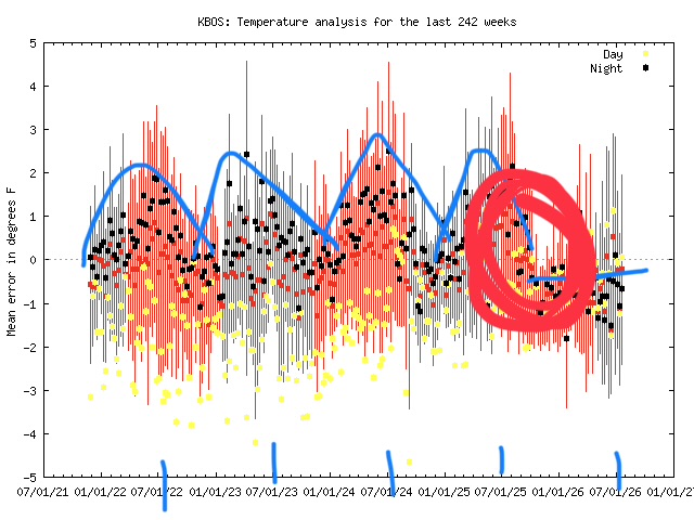
With the MADIS charts you look for step changes or changes in trends. There’s a step change in there around the beginning of October last year. Positive error means the station is running cooler than expected; negative error means it’s running warmer than expected. Traditionally BOS has run positive error (cooler than MADIS “expects”) during the warm season. I marked in blue curves above the nighttime temps centered over the 7/1 plots. This warm season you don’t see that…it’s flatlined in the negative error (warmer than expected). The funny thing is that the max temps are running cooler than expected. The net is a little warmer in the means. I’m not sure what’s going on, but it’s almost like when you mount your sensor on the north side of your house…you’re keeping it in permanent shade during the day, but you’re getting radiative heat from the house at night.
-
Definitely running warm again. Looks like maybe a step change last fall, but it’s a lot more noticeable this summer.