dendrite
-
Posts
75,086 -
Joined
Content Type
Profiles
Blogs
Forums
American Weather
Media Demo
Store
Gallery
Everything posted by dendrite
-

July has arrived ... the Meteorologically defined mid summer month
dendrite replied to Typhoon Tip's topic in New England

-
July has arrived ... the Meteorologically defined mid summer month
dendrite replied to Typhoon Tip's topic in New England
66.9° Nice morning with BKN skies. -
July has arrived ... the Meteorologically defined mid summer month
dendrite replied to Typhoon Tip's topic in New England
160 soundings at CAR since 2000 have had pwats >= to that. So not that rare. 2.00”+ is more rare…9 since 2000. 2.17” is the record. -
July has arrived ... the Meteorologically defined mid summer month
dendrite replied to Typhoon Tip's topic in New England
How many ASOS's are at 1000ft out here? Home sensors run high. And I just posted a map...IJD 66, FIT 64, EEN 62. But of course ORH must be 70. -
July has arrived ... the Meteorologically defined mid summer month
dendrite replied to Typhoon Tip's topic in New England
lol -
July has arrived ... the Meteorologically defined mid summer month
dendrite replied to Typhoon Tip's topic in New England
It's hot, but typical summer stuff. -
July has arrived ... the Meteorologically defined mid summer month
dendrite replied to Typhoon Tip's topic in New England
87.5/69 Dews have been mixing out a little bit. Mostly m/u 60s away from the coast.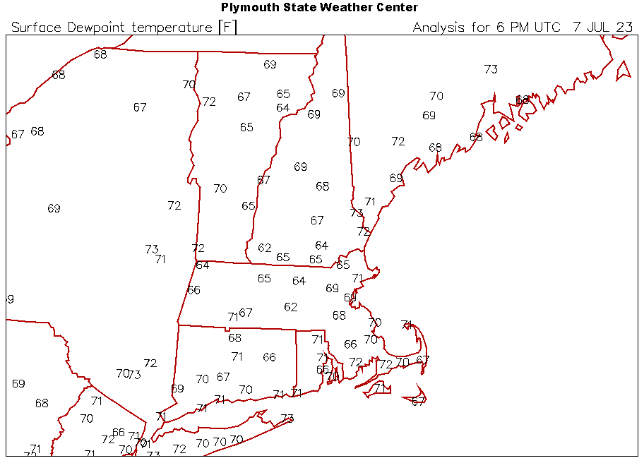
-
July has arrived ... the Meteorologically defined mid summer month
dendrite replied to Typhoon Tip's topic in New England
83.4/71 -
July has arrived ... the Meteorologically defined mid summer month
dendrite replied to Typhoon Tip's topic in New England
Min 67.9° Comfy in the house with the fans. -
July has arrived ... the Meteorologically defined mid summer month
dendrite replied to Typhoon Tip's topic in New England
76/71 now after a brief shower passed through. Swampy. -
When will (did) you install/ turn on the AC this year?
dendrite replied to Cold Miser's topic in New England
Not installed yet! -
July has arrived ... the Meteorologically defined mid summer month
dendrite replied to Typhoon Tip's topic in New England
88.6° may do it here -
July has arrived ... the Meteorologically defined mid summer month
dendrite replied to Typhoon Tip's topic in New England
77/68 Plants are loving it. -
The 2023 Lawn, Garden, Landscape Party Discussion
dendrite replied to Damage In Tolland's topic in New England
Someone in my pawpaw group had good results with 3 tbsp watered in around the plants every 3 weeks. The ones that look the worst were trees that were already very green from a guy in VT. So maybe he used some kind of soil with fert already in it? The really stressed one looks a little better after a couple of gallons of water through it. The curled leaves opened back up. Lesson learned. -
July has arrived ... the Meteorologically defined mid summer month
dendrite replied to Typhoon Tip's topic in New England
Low 65°. Only down to 73° at TOL. GWDLT -
July has arrived ... the Meteorologically defined mid summer month
dendrite replied to Typhoon Tip's topic in New England
Thanks for bringing me nice weather to start the week. -
July has arrived ... the Meteorologically defined mid summer month
dendrite replied to Typhoon Tip's topic in New England
Made it up to 86°. Nice day that finally feels like deep summer. I feel alive. -
When will (did) you install/ turn on the AC this year?
dendrite replied to Cold Miser's topic in New England
The wife is pushing me to install. -
The 2023 Lawn, Garden, Landscape Party Discussion
dendrite replied to Damage In Tolland's topic in New England
Well it’s probably a good thing I had excess water flowing through the yard because the couple of trees I had on the slope, above the water table, had nitrogen damage to their newer leaves today. I ran a few gallons of water through the root zone to try to dilute it some more. Apparently 4tbsp of 46-0-0 in a half gallon of water is too concentrated for 1 tree. I think I’ll cut back to about 1tbsp and just apply more frequently. They’re voracious N eaters, but apparently I overstuffed them. -
The 2023 Lawn, Garden, Landscape Party Discussion
dendrite replied to Damage In Tolland's topic in New England
Yeah I bought a 50lb bag of 46-0-0 urea to fertilize my pawpaws. I was dissolving it in multiple 1 gal water jugs at a time using collected rainwater and was spreading it around the trees with the watering can yesterday morning. I got about 3/4 of the way through when I saw the dark clouds coming. Over an inch of rain later, I think all of the urea is flowing down the Merrimack right now. I'll do it again sometime this week when the yard isn't ponded and the ground isn't sloshing when I walk through it. -
July has arrived ... the Meteorologically defined mid summer month
dendrite replied to Typhoon Tip's topic in New England
59.9 A little chilly this morning with the window fans running. -
July has arrived ... the Meteorologically defined mid summer month
dendrite replied to Typhoon Tip's topic in New England
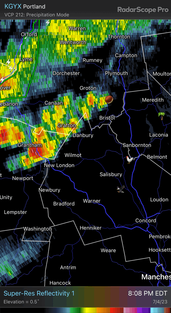
Just missing some peas here to the west. Decent light show. -
July has arrived ... the Meteorologically defined mid summer month
dendrite replied to Typhoon Tip's topic in New England
Watch out for the one eyed trouser snakes. -
July has arrived ... the Meteorologically defined mid summer month
dendrite replied to Typhoon Tip's topic in New England
Let’s tack on the extra point
-
July has arrived ... the Meteorologically defined mid summer month
dendrite replied to Typhoon Tip's topic in New England
Phil doing some work this week