dendrite
-
Posts
75,087 -
Joined
Content Type
Profiles
Blogs
Forums
American Weather
Media Demo
Store
Gallery
Everything posted by dendrite
-
High temps the last 4 days 44.8° 44.5° 47.8° 45.1° Living the dream
-
The problem is they’re usually front loaded…not back.
-
35° and sunny Where’s my precip?
-
Please tell me you aren’t calling that leaf out.
-
Ha…that was the old WCI formula.
-
Up to 47.7° with full sun, but man…these dews near 10° make the airmass feel more brutal.
-
Well peaches can set wayyyyy too many fruit. People usually have to thin them a lot to get larger peaches and to prevent branches from breaking. So having 50%+ blooms get fried saves growers from that hassle. Re:coolwx…I have obs from all over the place. Some from Auburn through 2001. Lyndonville obs while at school in the late 90s. North Branch MN for a year. Manchester and Goffstown obs for a bit. Then finally up here starting in 2006.
-
Maybe this will be the year we don’t make it?
-
I think they’re hardier than peach (people are growing some in MN). But you’d almost never get ripe fruit there with your short growing season. There are some cultivars out there that ripen early though.
-
Northern Catalpa are traditionally only native to parts of the MS river valley, but they grow like weeds everywhere. Blue ash isn’t native here either, but it has shown a little more EAB resistance than green and white. Of course it could just be a preference thing and once the green and white are gone they’ll move onto the blue. Can’t help you with the beech though. Hickories and black walnut are nice shade trees, but hickories take a long time to grow. Butternut is faster, but those are diseased and dying too. The NH state forestry nursery has butternut hybrids that they sell for cheap in bulk. We need more people growing pawpaws too.
-
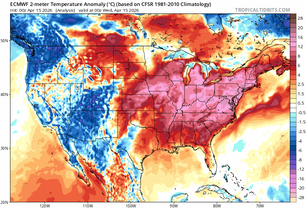
There was widespread 10s in the northern plains. My point though is that everyone got a piece of this. Maybe we linger some slightly BN temps into the weekend with chilly mins, but we’ll still have some napey 60° afternoons.
-
To be fair this airmass affected most of the rest of the country too.
-
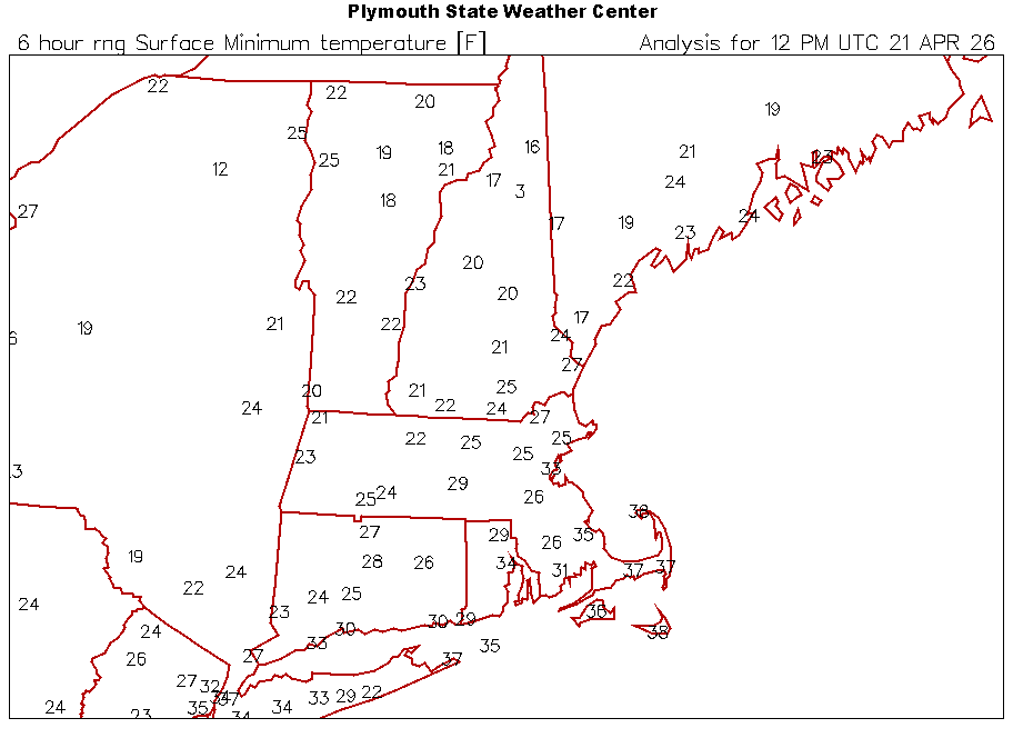
I thought the BOS record of 21° for today was a joke until I saw 16° at CON. What the hell was that airmass in 1875.
-
Congrats everyone
-
Even 28° for Ditty. Hopefully all of his leaves froze off.
-
3° at Estcourt Station. Hopefully everyone is out enjoying it this morning.
-
22.7° what a morning
-
What area are you staying?
-
2m is meh is my point
-
Yeah a coating at best at the higher els. Toss the 10:1 with meh 2m temps this time of year
-
Still a lot of ash, beech, and elm here. I dug up an elm out of my tiger lilies by the corner of the house a couple of weeks ago. I have a couple of ash by the house that have to come out too. The older trees have taken a bit of a hit…especially south of here.
-
He lives in one of the warmest spots in interior CT. I believe him.
-
You can really feel the extra push of CAA up here right now. Dews are dropping into the 10s.
-
35° SHSN Getting some heavier bursts in this plume.
-
36.1° -SN flurries Happy 420