dendrite
-
Posts
66,943 -
Joined
Content Type
Profiles
Blogs
Forums
American Weather
Media Demo
Store
Gallery
Everything posted by dendrite
-
July 50s for highs CON - 55 -- 7/1/1882, 57 -- 7/19/1873, 57 -- 7/2/1914, 58 -- 7/6/1956, 59 -- 7/18/1873, 59 -- 7/4/1932, 59 -- 7/4/1992 ORH - 55 -- 7/4/1978, 56 -- 7/6/1956, 58 -- 7/13/1986, 58 -- 7/4/1992, 59 -- 7/8/2005 Not sure how much yore is in that 1873 stretch in CON, but yikes. 7/17 64F 7/18 59F 7/19 57F
-
Not going to lie...I enjoyed today. As for tomorrow...not too sure. If Sunday is like this I may start popping vitamin D pills.
-
Yeah I agree. I think the overall theme is simple and easy on the eyes.
-
56.1F Has rained over 24hrs straight...no break. The lulls are sheet drizzle. Up to 1.74".
-
Give us a little time. Long story short...it wasn't exactly planned. lol
-
Pretty sure these won't stick long term. I think all he did was a quick upgrade. I had no idea it was being done...lol.
-
Finally getting upgraded. We’ve been bugged about it for 2 years whenever we log into admin cp.
-
Get the FFWs up for CT.
-
Stratus is overflowing the inner tube so we’re over 1” since yesterday despite the tipper having 0.83”…probably robin poop plugging up the hole.
-
He thought it was Christmas eve with this wx.
-
This is what my 12/17 deform looked like except the orange pixels were snow. lol

-
God hates America
-
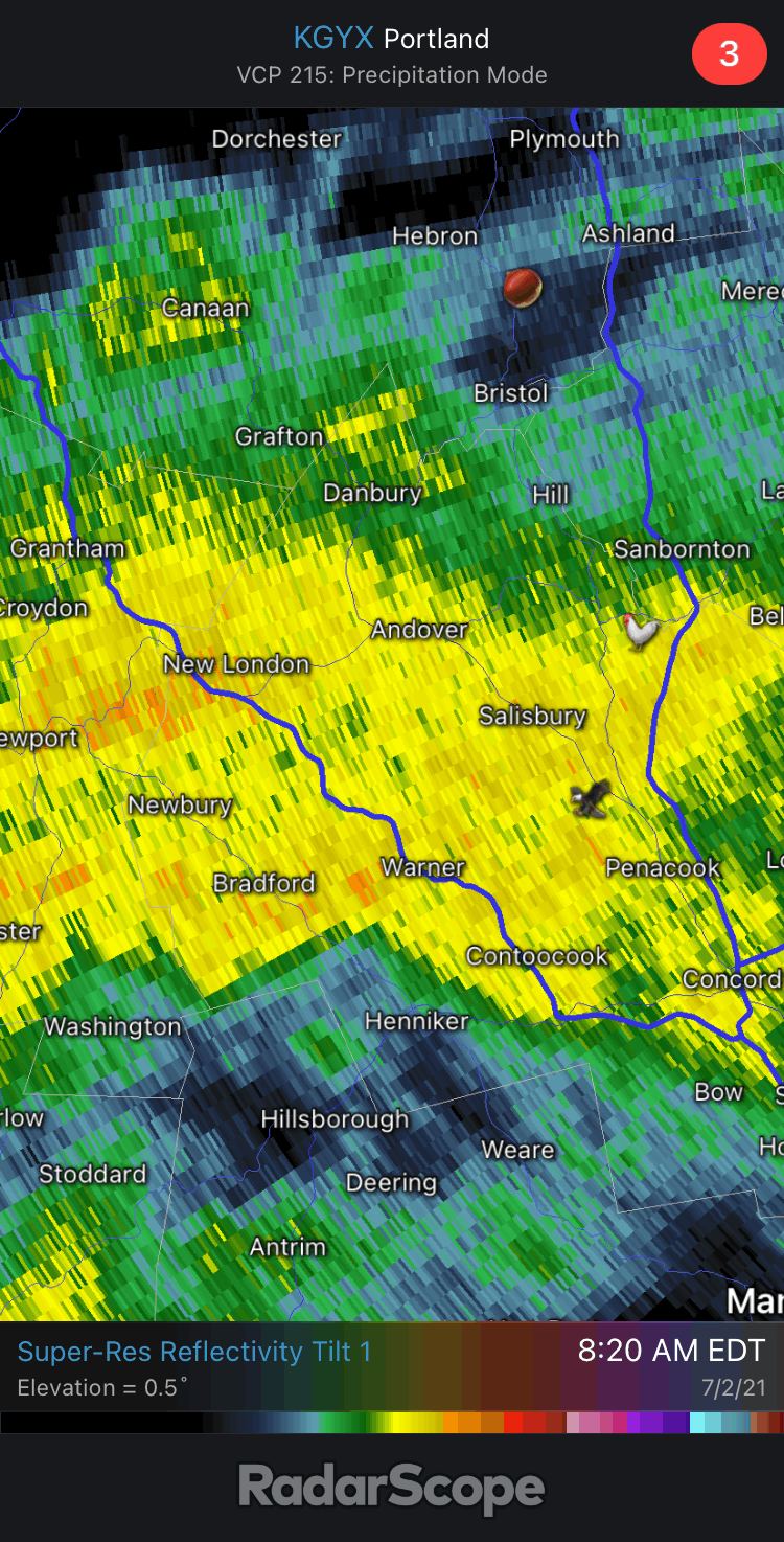
59° and pouring. This is like a synoptic small droplet drenching even though on radar it’s yellow and orange pixels. Love it.
-
Looks like most of the rabbit sightings are near the eastern Mass border.

-
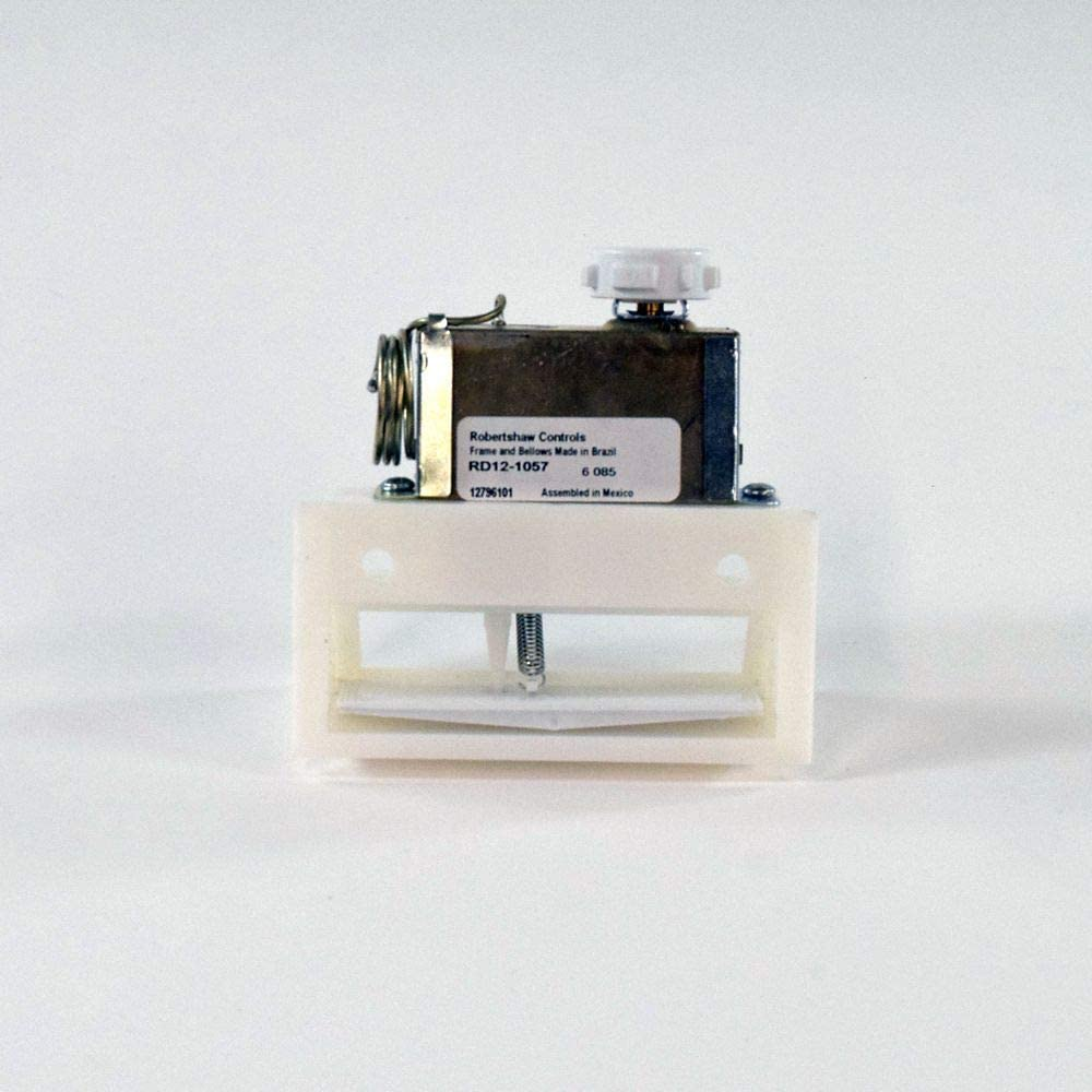
So a question about my refrigerator... I noticed the other day the fresh food portion was freezing all of my food (freezer is on bottom). I noticed the fridge is permanently running. I cleaned it out underneath and made sure the coils weren't frozen...check. I made sure the fan was running and pulling heat away from the compressor...check. However the damper in the fridge was permanently open. I took it apart tonight and it's a simple mechanical damper with thermistor. So I'm assuming this part failed. Either the damper physically broke or something failed with the thermistor. My question is, would this possibly cause the compressor to keep running and cold air to keep blowing? With the damper permanently open I would think it would still get cold enough to stop kicking the compressor on and blowing cold air. But if the thermistor is fried it may be thinking it's continuously too warm in there and the damper stays open and compressor keeps running? I just figured the compressor ran based on a thermistor in the freezer portion and not the fridge part, but I'm not exactly an expert with these things. I thought maybe someone here has an idea and could help. It's an older Maytag, but it's a Whirlpool part too. edit...just turned up the setting on the freezer and the compressor and blower kicked off. So maybe that's running normal and there's just too much cold air escaping into the fridge part forcing it to keep running?
-
It's weird because when I lived in the countryside in Auburn I never saw one there either.
-
A little slow on these training gushers the past 24hrs
-
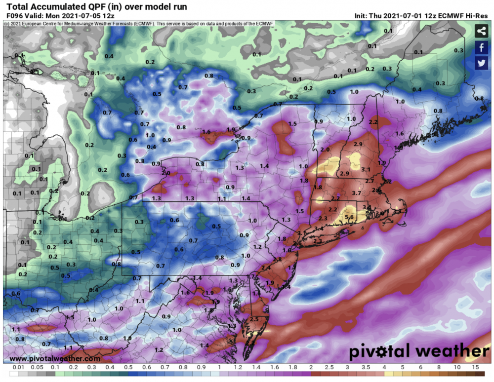
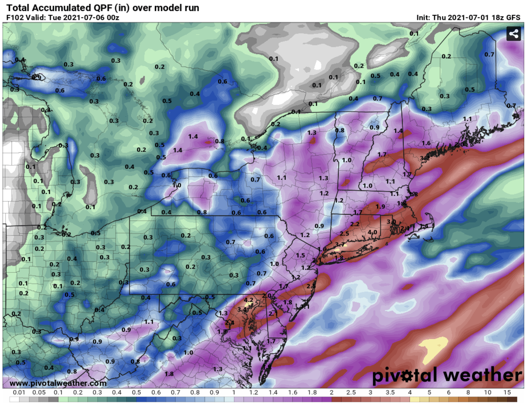
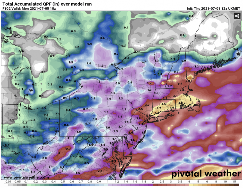
18z goofus. Maybe an inch less across the board.

-
I’ve never seen a wild one in NH. Saw a couple down south though.
-
Sox are en fuego.
-
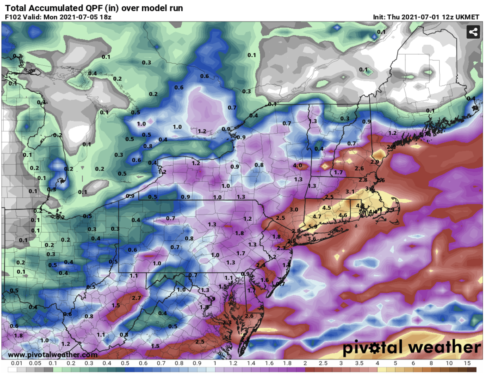
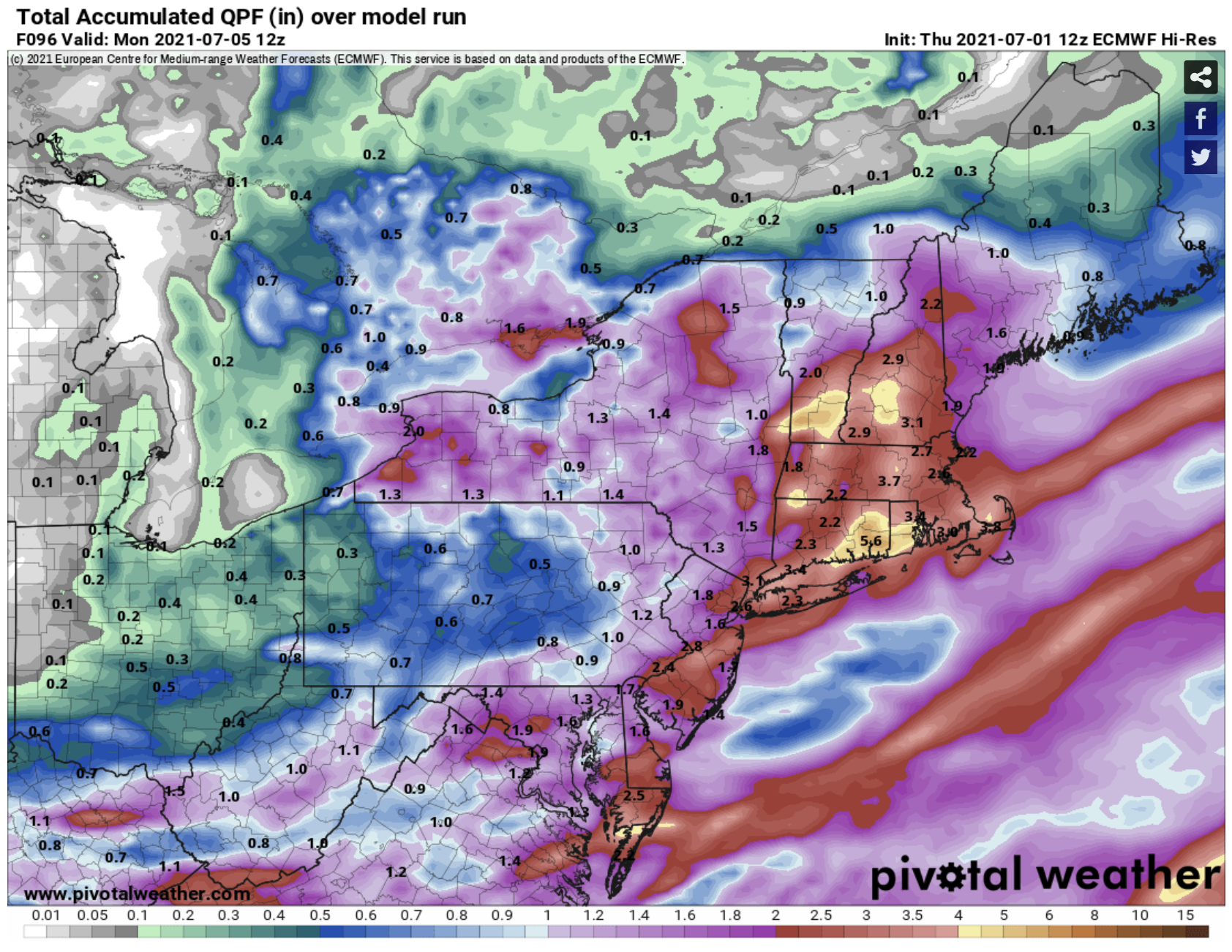
I mean those 12z euro and ukie distributions are eerily close.
-
Ukie?
-
Euro is a solid 1-2” up your way. We shall see.