dendrite
-
Posts
66,906 -
Joined
Content Type
Profiles
Blogs
Forums
American Weather
Media Demo
Store
Gallery
Everything posted by dendrite
-
 This is the time of year where the torchin twins’ friendship gets dicey. Please hold each other now.
 -
Yeah that has a good 15:1 event total look to it verbatim. I wouldn’t go forecasting that, but someone will get into that zone.
-
Do they still make NoDoz? We used to wash them down with some Jolt.
-
HRRR has a nice banding signal here with the 0.85ish QPF. Bigly.
-
You need to ask @ineedsnow
-
You’re supposed to start with the srefs
-
Even the rgem flashes to paste at PSM after maybe a few hours of 34/35 rasn.
-
I just want as much qpf as possible. It’s going to settle and blow around Monday anyway. 0.50”+ of all snow will be great for the fruit trees with the cold coming in.
-
How many straight all-nighters?
-
He makes me want it to completely cave
-
RGEM looking flatter
-
3k has that ukie/ec look. I think we start seeing CMC cave.
-
Ecmwf.int uses ms paint
-
Been there and seen it cave in that situation. Ask NYC about that.
-
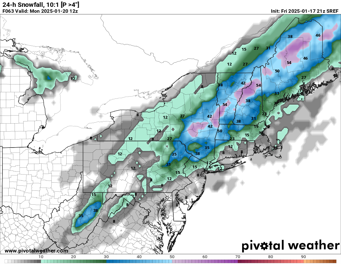
Wow I beat ineedsnow to a srefs image
-
Congrats Alex and Freak

-
West side til I die
-
I just want to know how many were in the RGEM/GFS territory 12z vs 18z.
-
Yeah looks like only 1, maybe 2, there.
-
Are we sure on that?
-
Well at least we can label one of the euros as trash.