dendrite
-
Posts
67,071 -
Joined
Content Type
Profiles
Blogs
Forums
American Weather
Media Demo
Store
Gallery
Everything posted by dendrite
-

August Disco 2021. Do record dews continue?
dendrite replied to Damage In Tolland's topic in New England

-
August Disco 2021. Do record dews continue?
dendrite replied to Damage In Tolland's topic in New England
2022 -
August Disco 2021. Do record dews continue?
dendrite replied to Damage In Tolland's topic in New England
0.03” Enough to cool it off. Getting some breaks now and I assume this is the beginning of the CAA. -
August Disco 2021. Do record dews continue?
dendrite replied to Damage In Tolland's topic in New England
Looks on track to me? -
August Disco 2021. Do record dews continue?
dendrite replied to Damage In Tolland's topic in New England
Yeah…of polio. Not a temp of 92°. -
Yeah…pushing through VT and eastern NY now. Will be through here mid afternoon.
-
August Disco 2021. Do record dews continue?
dendrite replied to Damage In Tolland's topic in New England
75/69 here…not too bad out right now with overcast skies. I’ve only been 90+ 1 or 2x this year. People lived without AC for thousands of years. We can get by too. -
Which hires is that?
-
August Disco 2021. Do record dews continue?
dendrite replied to Damage In Tolland's topic in New England
His climate is a little different from yours…especially with NW flow. Once mine are in, they’re in, but to each their own. -
August Disco 2021. Do record dews continue?
dendrite replied to Damage In Tolland's topic in New England
Maybe…goes hand in hand with dews though. Except it’s a deeper humid airmass versus the shallow pooling types that mix out a bit in the afternoon and then muggy back up in the evening. -
August Disco 2021. Do record dews continue?
dendrite replied to Damage In Tolland's topic in New England
Relief is in sight.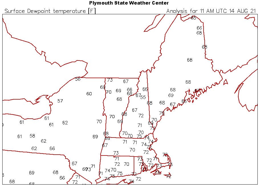
-
Read this as crazy stupid dave at first…lol
-
August Disco 2021. Do record dews continue?
dendrite replied to Damage In Tolland's topic in New England
Yeah they're actually mixed out. Looks like a bit of an inversion mid mountain though? 77F at 4300ft, 72F at 3300ft, and 74F at 2300ft. Unless there's shadows being cast on the lower els of the autoroad. -
August Disco 2021. Do record dews continue?
dendrite replied to Damage In Tolland's topic in New England
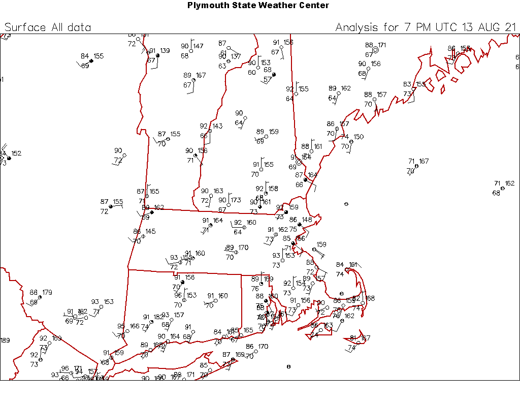
Not as bad up here today. U80s to L90s and dews falling into the 60s into C NH. Pretty swampy in SE SNE and warm at HFD though…BDL shot up to 95° after this map time as well.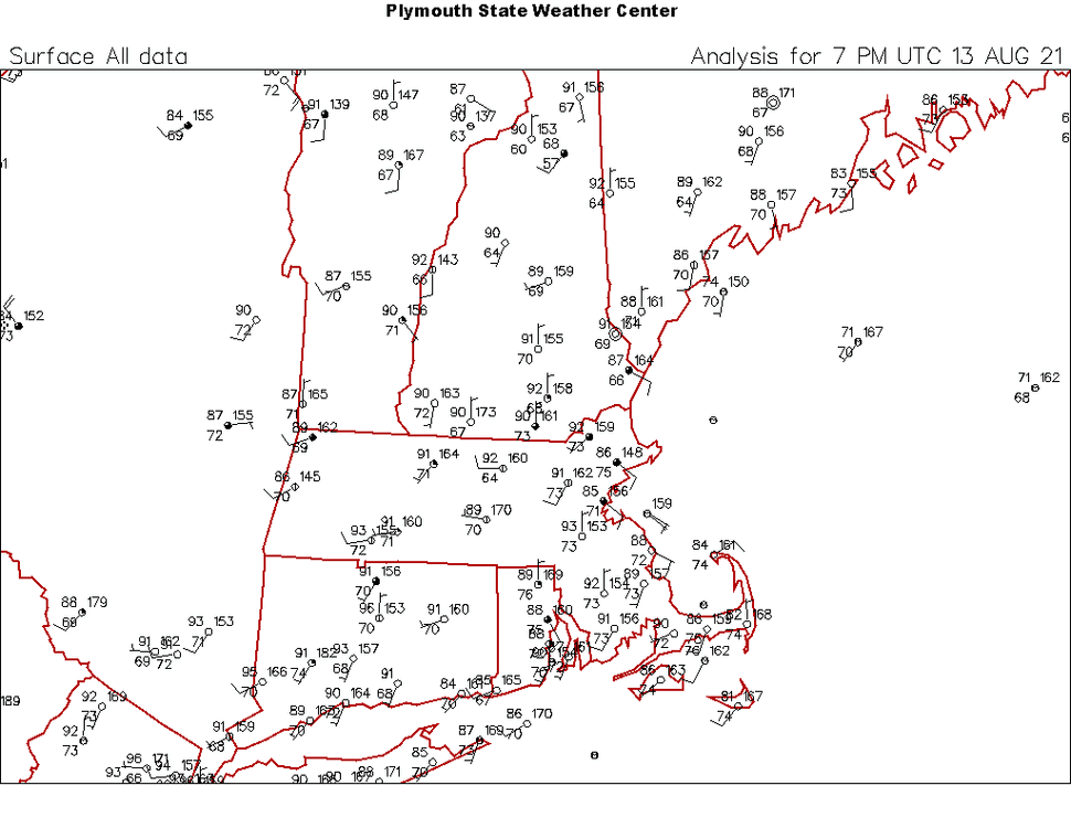
-
August Disco 2021. Do record dews continue?
dendrite replied to Damage In Tolland's topic in New England
lol…warm blooded is for handling cold weather. -
August Disco 2021. Do record dews continue?
dendrite replied to Damage In Tolland's topic in New England
Opposite here. Lots of debris and haze yesterday…today bermuda blues. -
August Disco 2021. Do record dews continue?
dendrite replied to Damage In Tolland's topic in New England
85/72…def hot in the sun, but feels like another underperformer. -
August Disco 2021. Do record dews continue?
dendrite replied to Damage In Tolland's topic in New England
I guess it’s nice on the beach with a breeze but get 2 miles inland and it sucks. It”s not like we want it cold…I’m all set with crisp highs of 70F until October. -
Skeeters and black flies are back here…unbearable to be outside in the evening. Heat and dews after 5 weeks of rain will do that I guess.
-
August Disco 2021. Do record dews continue?
dendrite replied to Damage In Tolland's topic in New England
Boring dog day heat and humidity. -
August Disco 2021. Do record dews continue?
dendrite replied to Damage In Tolland's topic in New England
Cooler this morning…68.8°. -
August Disco 2021. Do record dews continue?
dendrite replied to Damage In Tolland's topic in New England
Do we need 92/74? What’s wrong with 85/63? -
It's warm, but we're mixed a bit and have some clouds. Last night was worse here at this time. 80F at 11pm vs 74F now.
-
August Disco 2021. Do record dews continue?
dendrite replied to Damage In Tolland's topic in New England
89/71 today…kinda meh. 74/70 now. Not impressed.
-
Everyone chill and move on. Nobody died. lol