dendrite
-
Posts
66,905 -
Joined
Content Type
Profiles
Blogs
Forums
American Weather
Media Demo
Store
Gallery
Everything posted by dendrite
-
 Yeah I’m trying to understand what’s going on
 -
This may end up being your best thunderstorm of the year.
-
Welcome to the forum
-
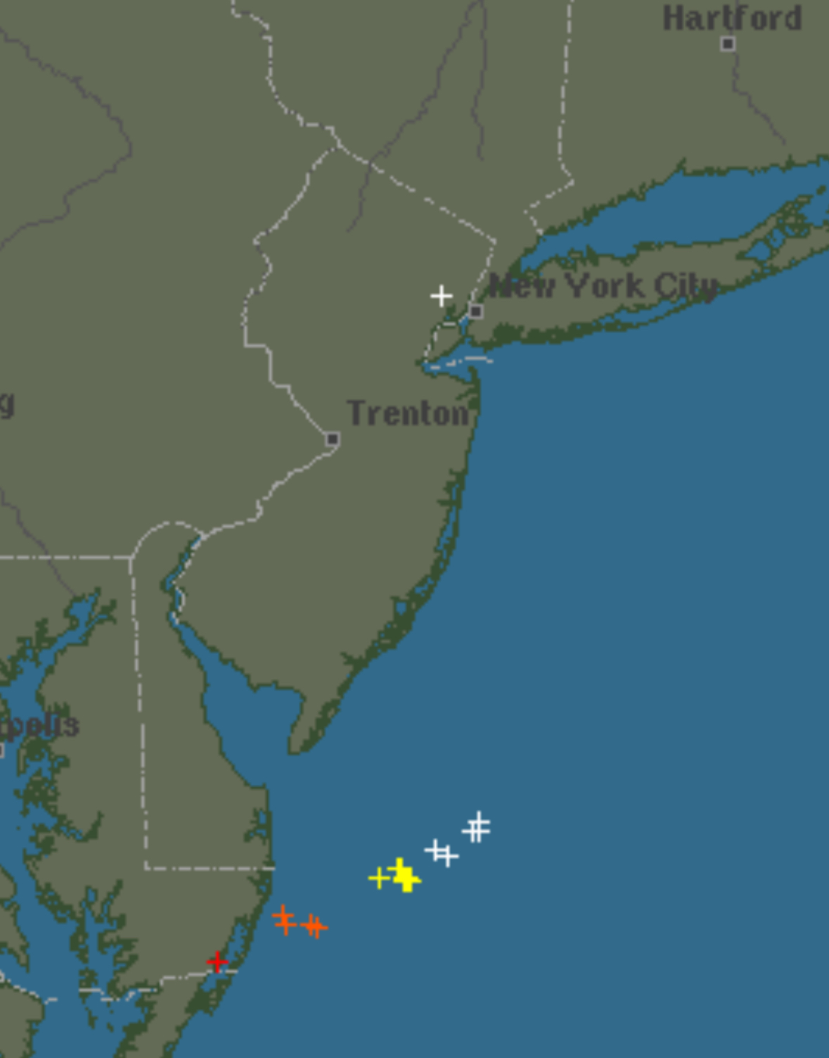
Yeah my guess is it’s one strike being reported by many in the area.
-
Seems sus. What are they using for data?
-
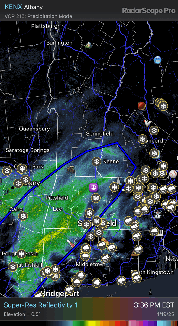
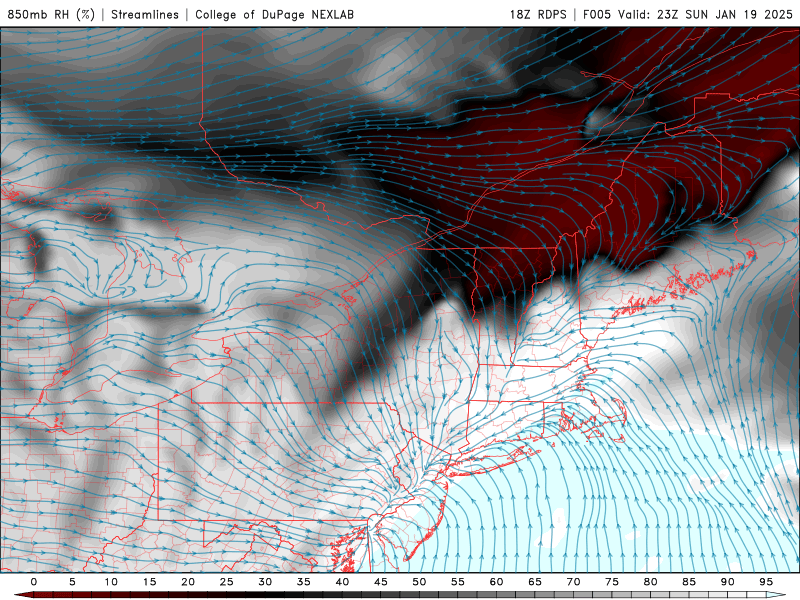
It’s all tight frontogenesis…ie a strengthening midlevel front. The wave progressing through along it is slowing it down. E-SE flow and weak WAA ahead of it and N-NW flow west of it with CAA. Check the convergent flow at H85 near where the band is now.
-
Should be fun for a few hours tonight.

-
30.4/20 Primed and ready to go
-
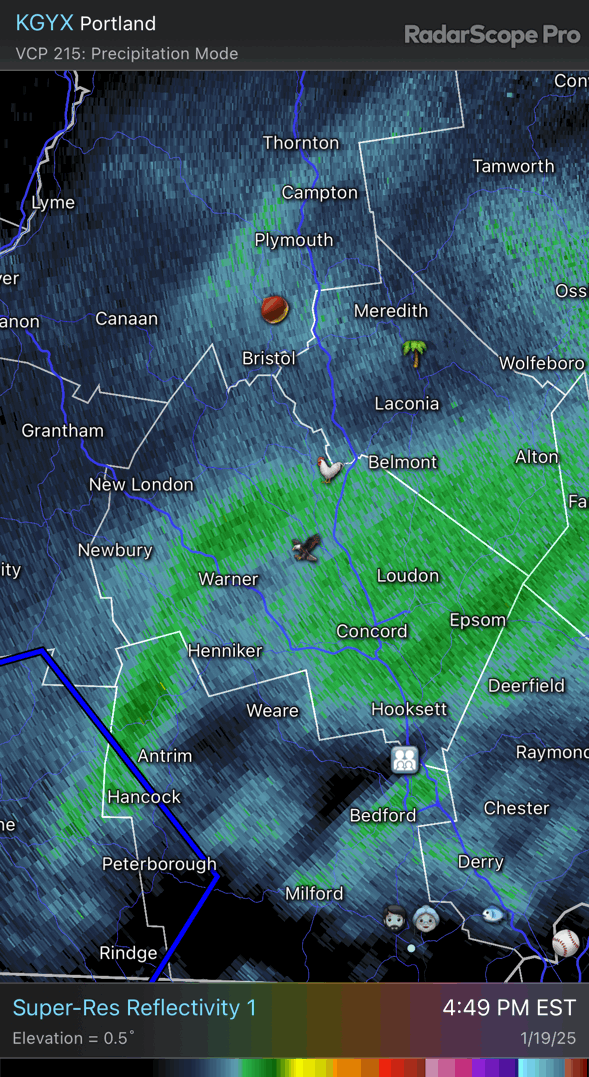
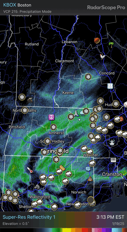
Banding looks good for up here later
-
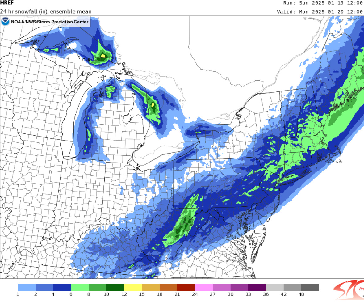
EC looks decent up here with the banding. 3-6/4-7 still on track.
-
Yeah, but there was radiational cooling overnight as skies cleared…common black ice recipe. I’m talking FZRA on the driveway despite a 2m temp decently above 32°. That’s how deeply cold the ground surface was.
-
It’s 1030. I think you’re fine now.
-
My hunch is that it’s probably funky
-
I had glazing in my driveway yesterday despite 36° RASN.
-
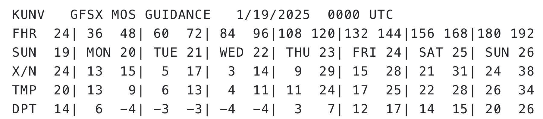
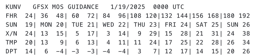
Does State College even see one day with a high of 12°? It’s definitely not happening tomorrow because of an early high so toss that 3 day streak.
-
DIT’s on the back up Weenies free, so put the clowns up
-
Some of that leading edge may not be reaching the ground too.
-
It’ll be cold this week, but models backed off a bit on the intensity the past few days. The heart of it dumps into the MW and then slightly moderates our way. It won’t be the coldest stretch of our lives. lol