dendrite
-
Posts
75,053 -
Joined
Content Type
Profiles
Blogs
Forums
American Weather
Media Demo
Store
Gallery
Everything posted by dendrite
-
Claremont is on the VT border…big longitude advantage there with this system. Can’t you use LCI?
-
I’ll take the under on ZR here and the over on IP
-
Keep it coming
-
Goofus is all snow here through 15z Sat. Then we start losing H85. But we’re at warning criteria by the changeover. The RGEM is one good tick south away from being wild here.
-
43.9N? I’m at 43.43
-
NAMs were so warm that it’s just a colder shat.
-
The chickens loved the snow today. They prefer that over their regular water. Let’s get this all frozen. I want lower QPF overall.
-
Maybe your wind is funneling between all the weed?
-

14th Lawn and Garden Thread P Allen Smith 2024
dendrite replied to Damage In Tolland's topic in New England
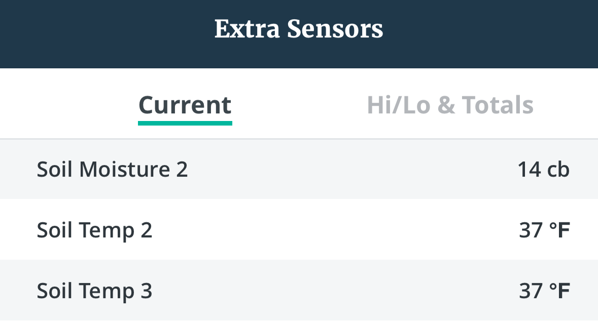
4” and 8” soils are down to 37°. Let’s keep those trees dormant.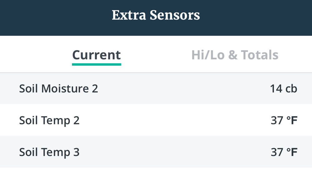
-
Made it to 32.4° here. Snow is mostly gone where the sun hit it for more than 10 minutes. The sun felt nice, but that wind was ripping at times. Nice day to slow down the tree progress.
-
GYX RAOBs had -4C last night and -13C this morning. Not even close to records.
-
A foot here would put me within range of getting near average if we have a decent April
-
Warm. 22° and splitting flakes here with widespread BLSN.
-
Yup. Sfc front modeled right where they usually end up. Looks like a shitshow Saturday here.
-
Let’s get this more south. I’d rather clear 15” all snow rather than 8” with R/ZR on top.
-
GFS is like 5” here and then a period of ZR midday Sat. It probably won’t equate to much glazing given the time of day and year. What’s 2m look like on Sat? Goofus has a period of ZR here after 5”.
-
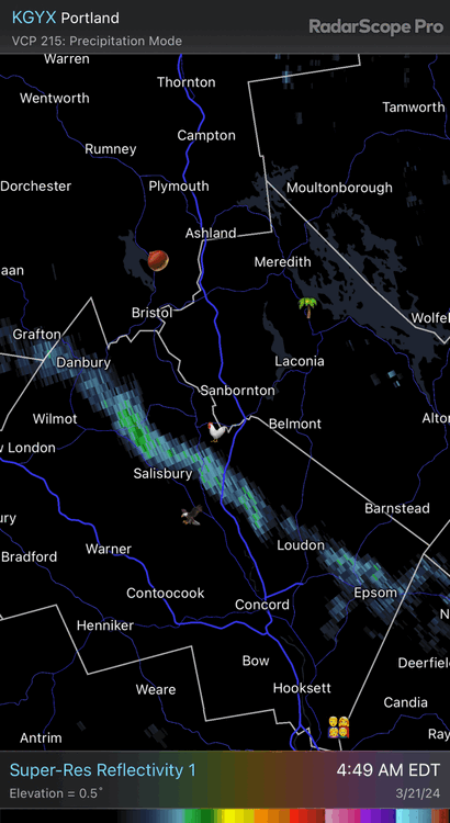
Nothing showing on radar but it’s doing this The cheesewagons have been going by so I assume they had a delay. IMG_6687.mov
-
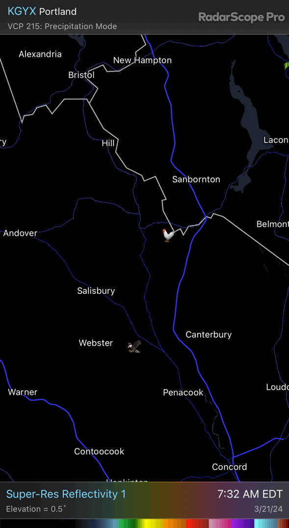
Got down to 19.0° here. Feels like deep winter even though we’re not too far below climo. lol Here’s vis from a few mins ago. Looks like it traces back to Hartford/Bethel VT and toward Middlebury Snowbowl
-
Getting another lighter “burst” with large dendritic growth even though radar is fairly putrid. Maybe there’s some geographically favorable wind trajectory to squeeze them through here.

-
3.4” wtf 2.3” of that is from the streamer this morning.
-
Euro with like 2.5” QPF. Hopefully the goofus is right with half that.
-
Pounding snow under a streamer right now. 21.6°
-
2012 just fighting its way back out of the ground and through the pack