dendrite
-
Posts
75,073 -
Joined
Content Type
Profiles
Blogs
Forums
American Weather
Media Demo
Store
Gallery
Everything posted by dendrite
-
Just measured 9.0”/0.97” in the core from the board. I missed some rain and melted sleet in there. There’s another can out there that caught it all from the beginning, but there’s probably undercatch with the snow. I’ll take the higher of the two totals when it’s over.
-
I have some dippin dots mixed in. Mod/hvy here. Not huge growth, but a lot of flakes.
-

-
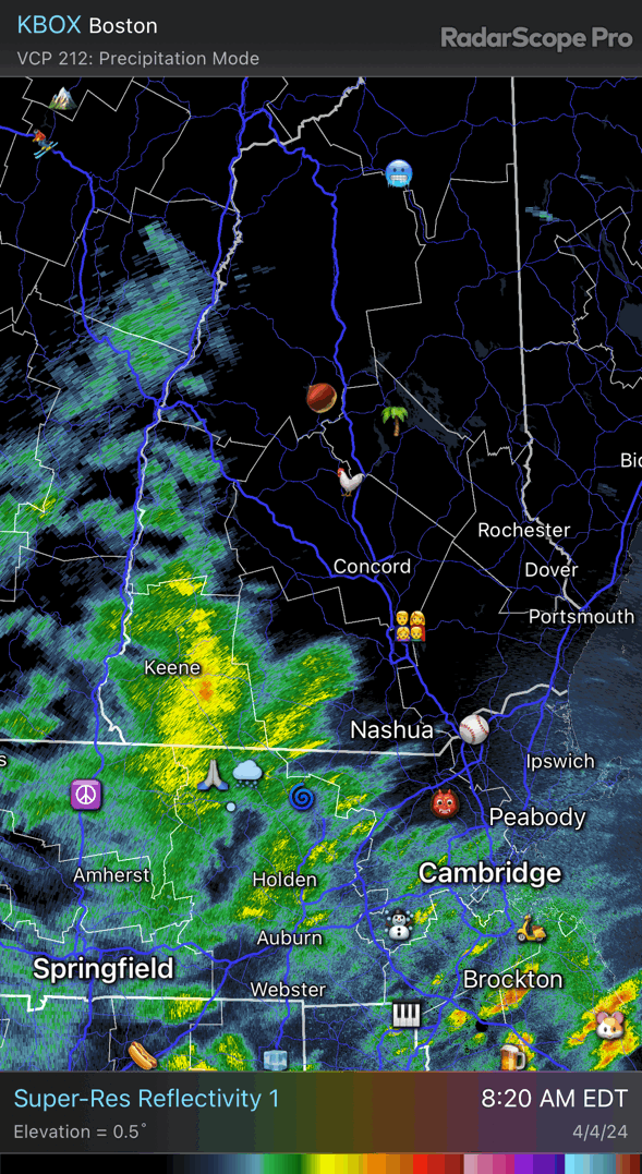
Starting to pick back up. Had to get the echoes NE of me with the drift below the beam. Let’s get the 12+. We’ve had a more wintry astronomical spring than winter. lol
-
Did you check any of the cobb data yesterday?
-
Maybe my new fave CON ob ever KCON 040822Z AUTO 06018G28KT 1/4SM +TSSN FG VV005 00/M01 A2960 RMK AO2 PK WND 06033/0752 TSB19 P0007 T00001006
-
RGEM yesterday was really humping that N-S forcing over the Monads and into the MRV.
-
They’re clowns for a reason. If you’re mixing sn/pl the whole time with 33-34 temps kuchie and 10:1 are never happening. Especially in April with warm soil temps and coming off a high well into the 40s
-
31.2° -SN About to ramp up

-
Maybe the best there, but overall garbage. They’re always going to be closest on the sloppy edges.
-
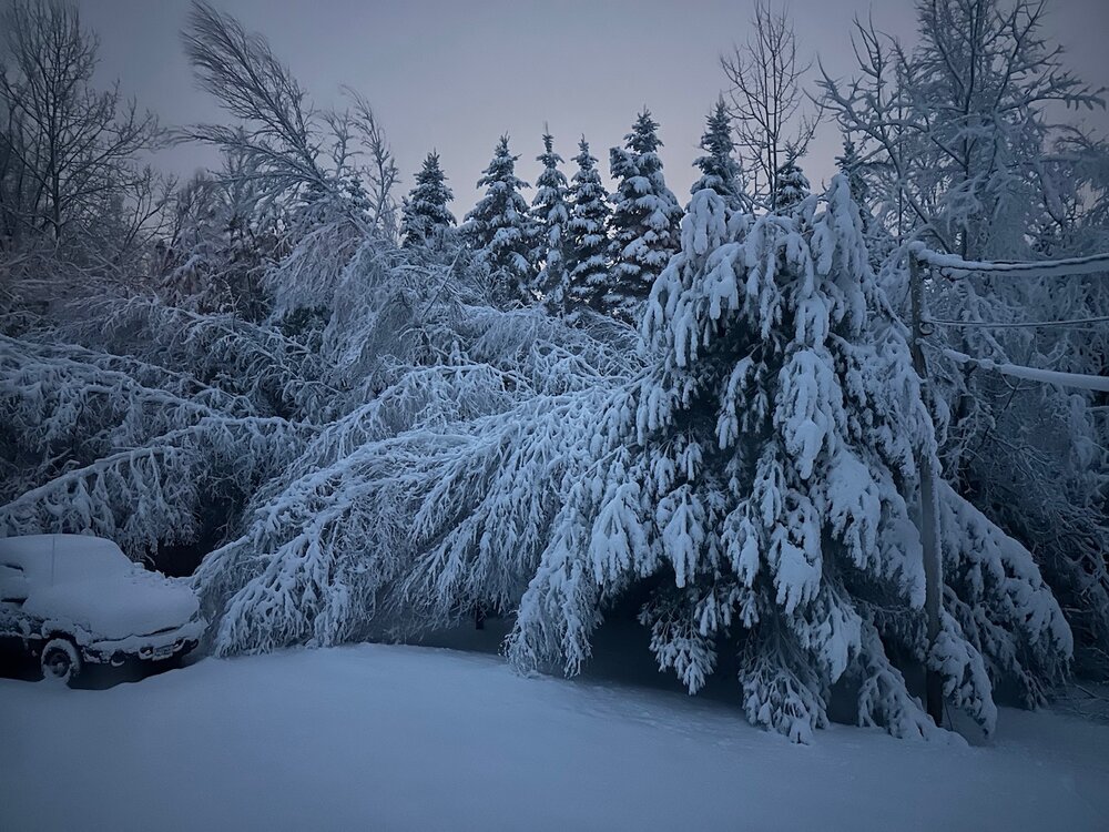
Wind is picking up here. Thankfully it’s blowing it out of the trees and off the wires so far.
-
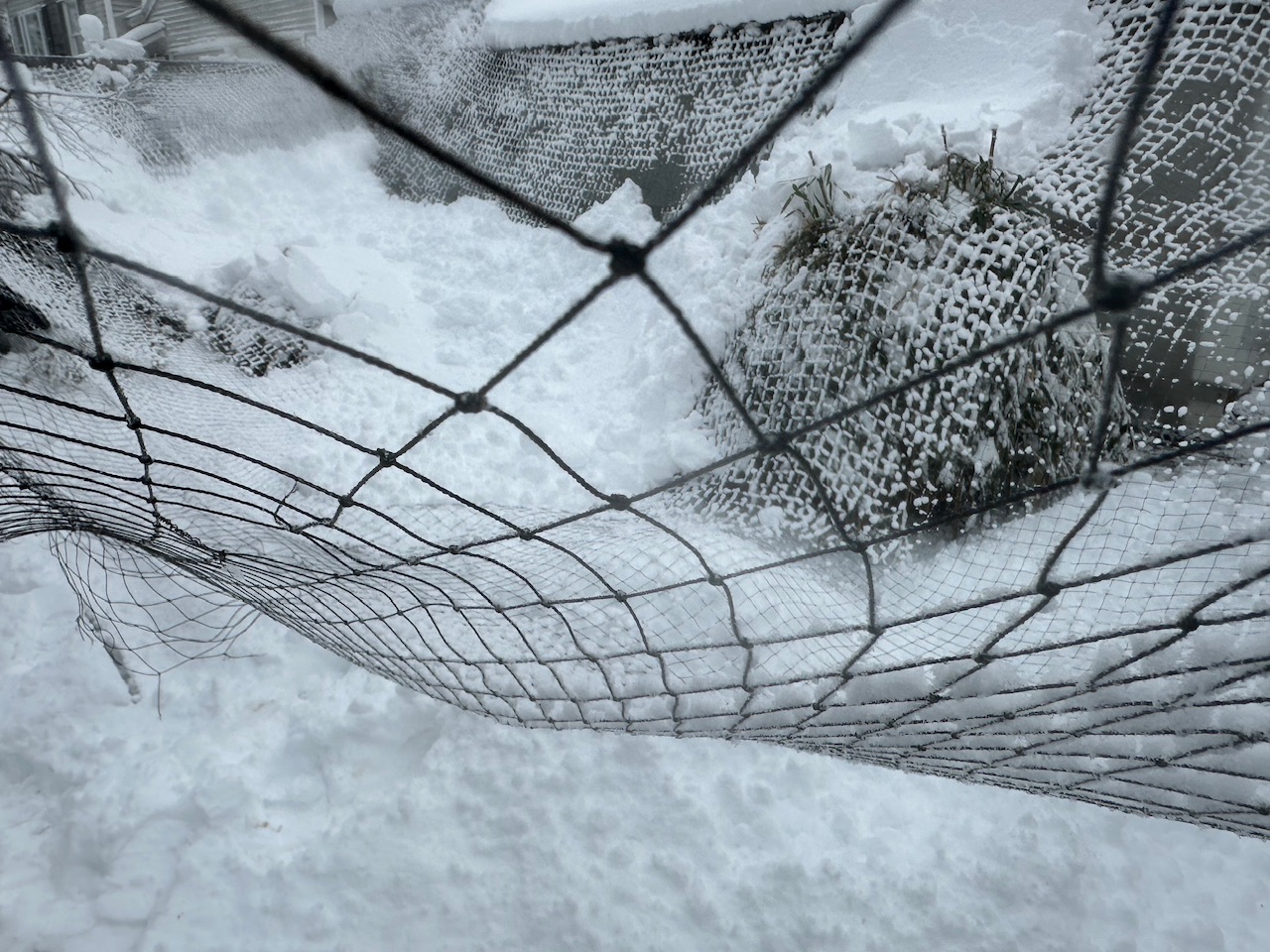
Hawk nettting in the run tore and collapsed under the weight in multiple places. The chooks will be under the metal roofed area for awhile.

-
8”
-
Going down like a stripper at club studio sex.
-
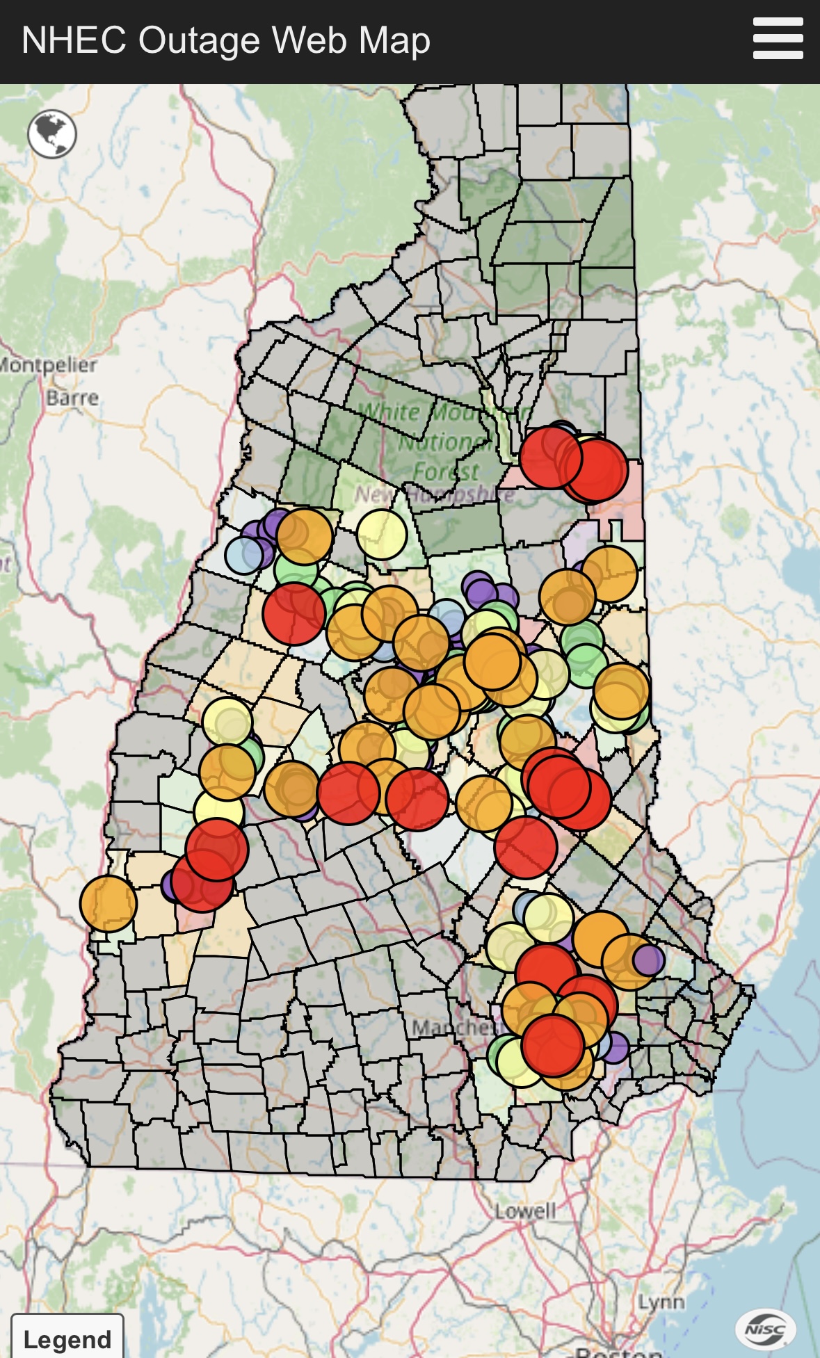
NHEC coverage area hit hard. Not sure how we’re still up here.

-
lol. We went outside during class in HS in the 1994 eclipse and looked at it.
-
I’m ready for some insolation to get the snow off these wires. All of my lines are caked and bouncing. High exposure pic…
-
Latest HRRR has another 0.50” QPF after 10z here. Will need all of it to get near a foot.
-
Still a decent -SN out there despite meh echoes. 31.0° Over 72” on the season now. lol
-
DGZ slot is here. Gonna have to hit a foot with the lower level forcing with weaker snow growth.
-
Power flickering. F***
-
Pushing 7”. Every birch is kissing the ground. Pray for the fruit trees and power.
-
31.2° +SN It is caked out there. Gah.
-
+TSSN CON
-
SN line is down near the MA border now.