dendrite
-
Posts
66,900 -
Joined
Content Type
Profiles
Blogs
Forums
American Weather
Media Demo
Store
Gallery
Everything posted by dendrite
-
+1 for ditty already
-
-
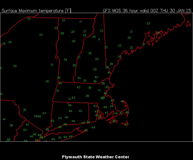
QPF max axis basically followed the northern MA border with the local max near the CT River. 20-25:1 in there.
-
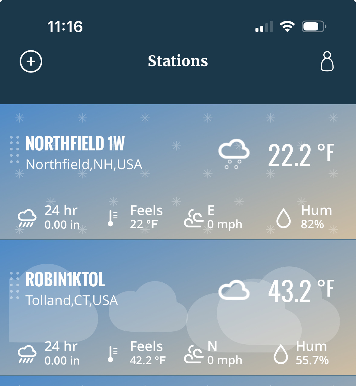
1.8” overnight. Still some -SN with decent growth. Had 0.2” in the squall yesterday so an even 2.0” in the last 24hrs. 17.6° -SN
-
Let’s see how fast we can get rid of it all today
-
Man everyone ignored putting obs in Bob’s thread
-
It may be. It may not be. We just don’t know for sure yet.
-
Will someone do 48° tomorrow?
-

What the hell, January 28-29 2025 FLURRIES
dendrite replied to Baroclinic Zone's topic in New England
Temp dropping. Wind roaring.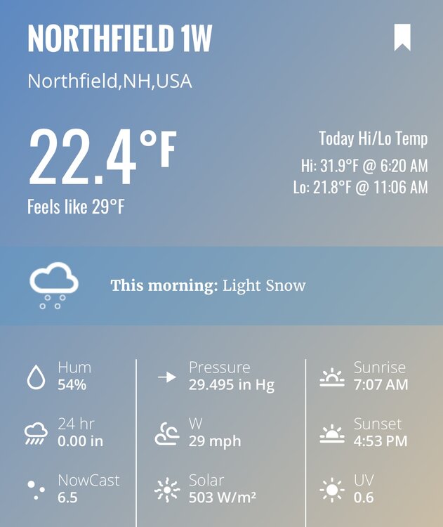
-
What the hell, January 28-29 2025 FLURRIES
dendrite replied to Baroclinic Zone's topic in New England
Bob wasting his thread juju on this pos. -
Usually they don’t even meet squall wind criteria…it’s just mod/hvy snow showers with some breezy conditions.
-
Defo looks better along the Pike than modeling showed. Maybe someone gets a quick 1/2”.
-
Yeah like 5-10 mins here. Quick coating.
-
Held together nicely in SW ME.
-
Ditty is sensy this morn. SHSN right now.
-
A few -SHSN this morning. Maybe a brief heavier one soon, but the line should start dissipating.
-
Cope better.
-
Maybe a few SHSN or flurries, but they should mostly dissipate on this side of the high terrain.
-
Looks like we even lose the cold tuck up here tomorrow. Nice.
-
What the hell, January 28-29 2025 FLURRIES
dendrite replied to Baroclinic Zone's topic in New England
Warm midday. Embrace it. -
What a way to start the week.
-
Dropping faster than an rgem clown map
-
-
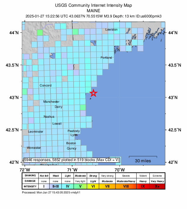
3.9 now. Take’em down
-
Yup