dendrite
-
Posts
66,943 -
Joined
Content Type
Profiles
Blogs
Forums
American Weather
Media Demo
Store
Gallery
Everything posted by dendrite
-
Glad that fake cold mixed out quickly.
-

March 2022 Obs/Disc: In Like a Lamb, Out Like a Butterfly
dendrite replied to 40/70 Benchmark's topic in New England
It shows a cold next 45 days…not exactly April. -
I got adventurous and decided to shovel the whole driveway and run so it could melt down to the ground. After 6hrs I think I’m going to have a major sunburn on my face. I was down to a tshirt despite temps in the low 20s. That sun gets potent between the combo of direct radiation and reflected from the high albedo. Looks good when it’s done. And oh yeah, love the pics of your little ones in the snow.
-
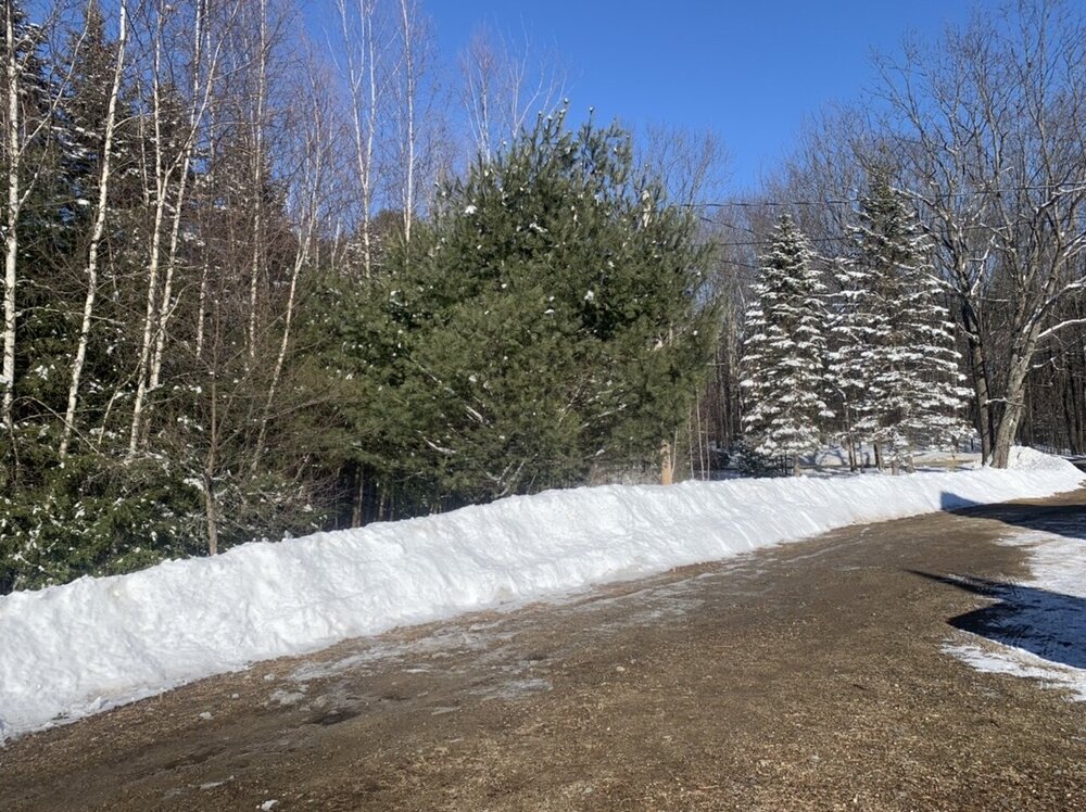
8.4”/0.61” final here
-
3.2”/0.09” in the core beginning at 330pm. So roughly 35:1.
-
I'll take my next core after dinner, but it'll probably be in that 30:1 ballpark.
-
8.4” -SN Pure VT champagne in this top 4”.
-
Still dropping fatties. 15.5°
-
Popé Le Pew?
-
Does this slow-mo work for everyone or is it only rendering on my IOS?
-
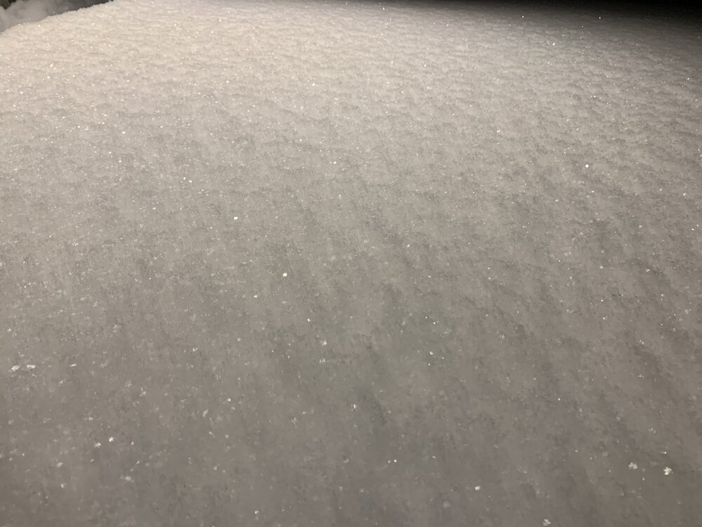
Big dendritic aggregates Fatty Flakes.mov
-
Some of it may be below the beam so it appears to redevelop as it moves in. There’s still some action on CXX so I think we have a few more hours of light snow with good growth.
-
Looks like the back edge is approaching. I haven’t had a chance to look at much though.
-
I thought it looked like less in CON than here…at the least similar.
-
5.2”/0.52” Dumping large spatial dendritic aggregates right now though so sample two should have some fluff.
-
It sounds like my wife when I ask her. "About how much?" "idk"
-
Midlevel goodies looking good out in NY
-
-SN at the CON ASOS, but it's decent growth.
-
Brightbanding from wet flakes above the beam dropping into it?
-
1” already
-
Looks like the sleet line is wasning out a bit in the northern half of the state.

-
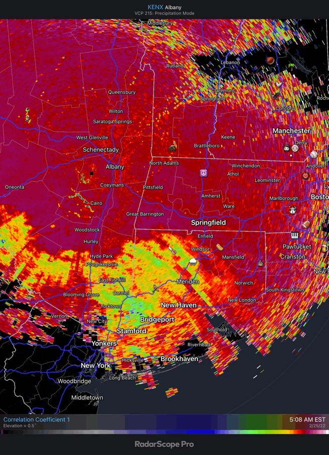
Winter storm for the 25th of February is imminent.
dendrite replied to Typhoon Tip's topic in New England
I think that busted in CT before it even came out. -
Only 2 Ukrainian airports are still reporting obs. https://mesonet.agron.iastate.edu/ASOS/current.phtml?sortcol=ts&network=UA__ASOS&metar=yes&sorder=desc&format=html
-
Winter storm for the 25th of February is imminent.
dendrite replied to Typhoon Tip's topic in New England
Now I understand his optimism. He’s only in it to get a day off. -
I posted in the storm thread that the gfs was way warmer down there for today than the nam…like 10° warmer at 2m.