dendrite
-
Posts
75,080 -
Joined
Content Type
Profiles
Blogs
Forums
American Weather
Media Demo
Store
Gallery
Everything posted by dendrite
-
May need the heat here on Sunday. I’ll take the rain. Goofus is basically a goose egg after this weekend.
-
You can do it put your into it
-
Sad
-
RIP Woodstock
-
We want dews and rain. Pants stay on.
-
Boundary is through here. Skies are mostly clear, wind has picked up, and dews are dropping.
-
Fish doing my dirty work. Although someone has to tell him the 5 min obs are averaged…not instantaneous.
-
Is he living off the grid yet?
-
MAV has 23° at SLK Fri morning. Terrible.
-
He’s baaaaack
-
Those are the warmest 7am May temps at BML and IZG ASOS since they were commissioned
-
Happy 7am!
-
Extended looks overall. Hopefully the weekend rain comes north.
-
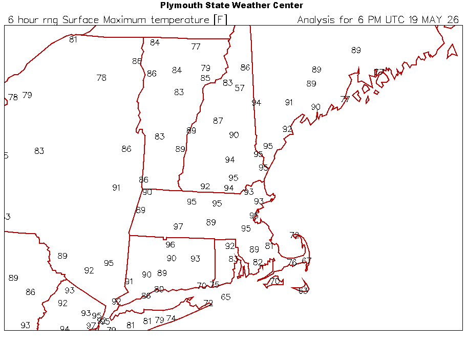
92 in 62. CON is 97 in 62.
-
MHT 97R CON 96 BOS 96R BDL 96R PVD 93R PWM 92R ORH 90 BTV 90
-
Just had a heavy trace. Briefly cooled it to 77F 80/68 now
-
Pope doing wet wheelies on the way home?
-
BDL and MHT have records too
-
BOS may have tied the all time May record high of 97°
-
Yeah rounding
-
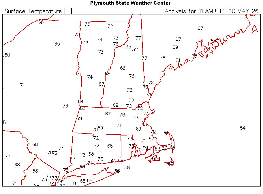
Highs through 2p
-
88.8° but we cloudy now
-
Going to the desk to read his A grade winter forecast one more time

-
MHT 95°