dendrite
-
Posts
75,090 -
Joined
Content Type
Profiles
Blogs
Forums
American Weather
Media Demo
Store
Gallery
Everything posted by dendrite
-
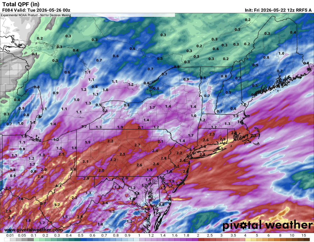
Nice steady light rain or sheet drizzle all day here and it's only 0.36"
-
It’s still out for a couple of months. But I’ve been trying to follow rufus more since we have no choice soon.
-
Retired. Rufus all the time now. RATT
-
They get the crap day tomorrow. NYC-south had it Friday.
-
Yeah he’s excited to bump troll if we get a 70° high in practically June.
-
It will be 53° and 0.25” of rain so that no one wins
-
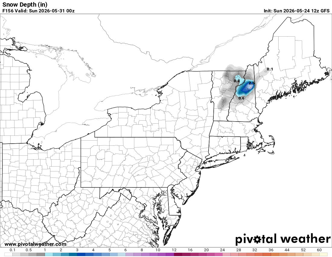
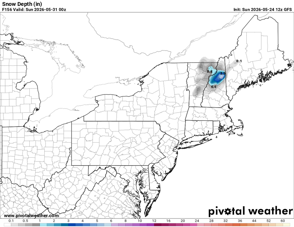
There’s even modeled snow depth. Awesome.
-
BeerFS
-
He already has too many spouses for me
-
There’s like another 24hrs of rain periods to go.
-
CoastalWx’s great-great-great-great-great grandfather must’ve loved June 11, 1842.
-
They’re mucking up much of tomorrow now. Still looks like 0.50”+ up here. We take although I wish it was 68 instead of 48.
-
48° -RA The day is going into the dumpster so hopefully it’s at least a good soaker.
-
I can’t understand cheering on 52° and drizzle on Memorial Day weekend, but we do have a mental health crisis in this nation.
-
Need to rotisserize so I don’t burn the
-
I already expect to have the oven on a couple times to take the edge off.
-
Decent morning with filtered sun through thin cirrus. 63.3°
-
I’m trying to figure out what he’s blehing. We get some rain and then some heat.
-
https://www.loveagain.app/find-a-wife.html
-
Rufus is wet