dendrite
-
Posts
65,583 -
Joined
Content Type
Profiles
Blogs
Forums
American Weather
Media Demo
Store
Gallery
Everything posted by dendrite
-
Mark. We’re screwed.

-
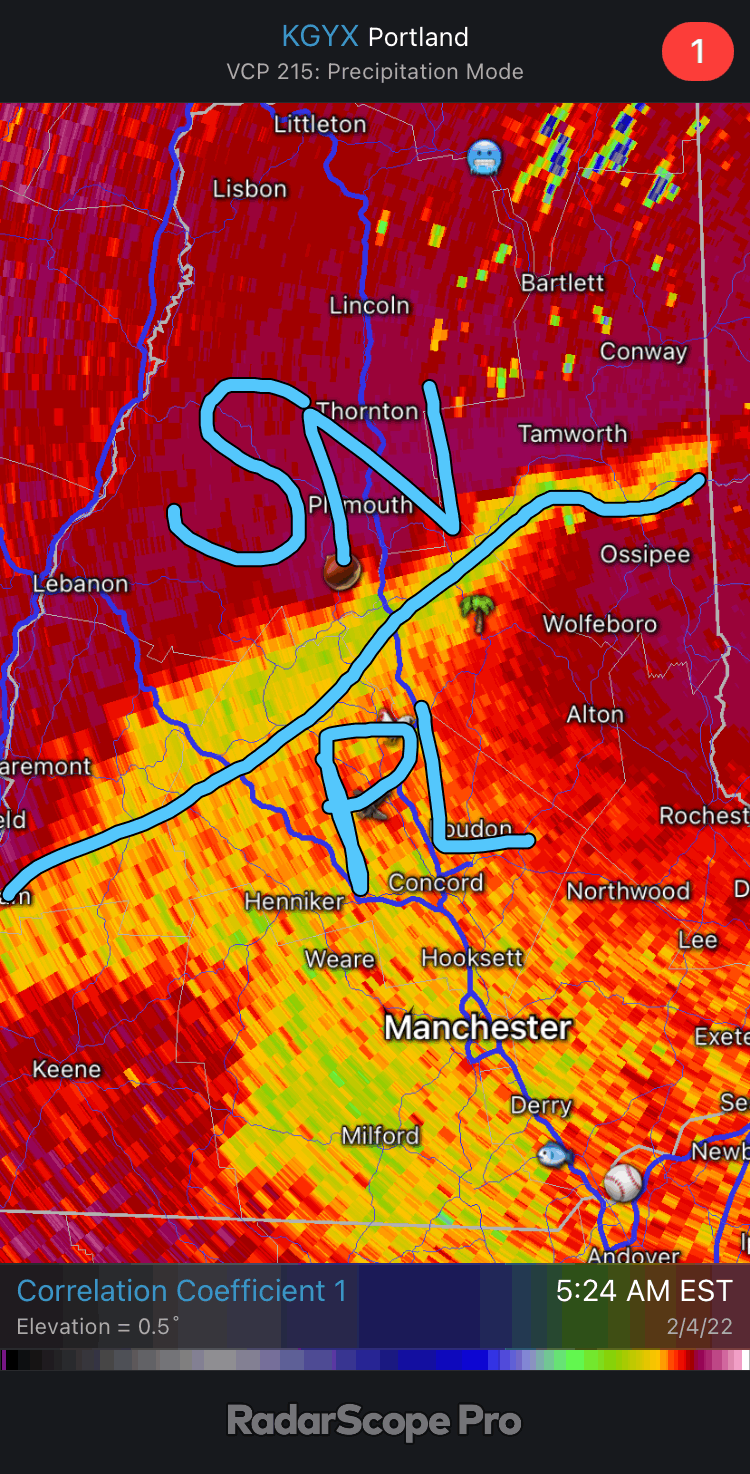
Correlation coefficient. Those lower cc values indicate the melting/mixing layer.
-
You'll probably get a little glaze or frozen.
-
I just find the physics there fascinating.
-
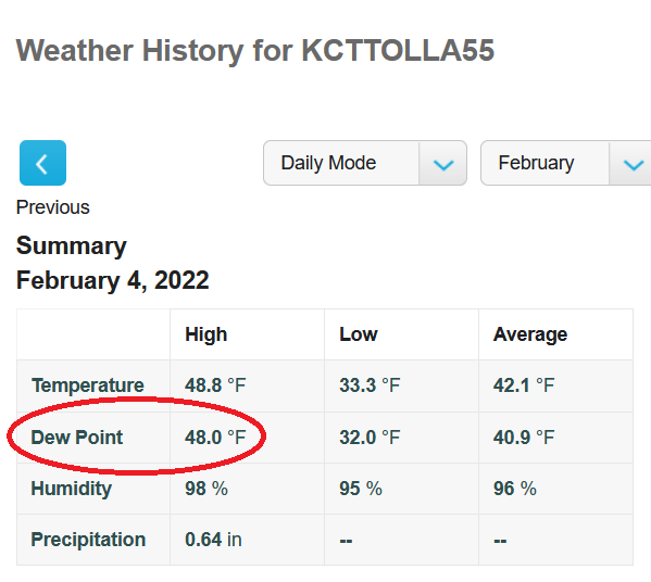
32.6F? https://www.wunderground.com/dashboard/pws/KCTTOLLA55
-
Thankfully the noon sun will limit the accretion.
-
Warm layer so probably some occasional wet aggregates aloft.
-
40-48, lollies to 60
-
Mahk from philly
-
Alternating sleet and snow, but expect mostly sleet for awhile.

-
Nailed the gulf stream
-
The sleet isn’t done yet
-
FV stands for "**** verification"
-
I should've been more clear...I didn't expect U40s dews to hold all night for you, but I didn't expect the actual sfc boundary to come through until about 8a. Basically a slow drop out of the 40s and then the quicker drop post fropa.
-
Sorry dude, but
-
Over 1" of rain in the stratus. The chicken run was flooded with 6" of water. Was snowing like a biatch when I left home. 93 was a mess. Ugh. 25.7F
-
Starting to mix with snow. 27.5°
-
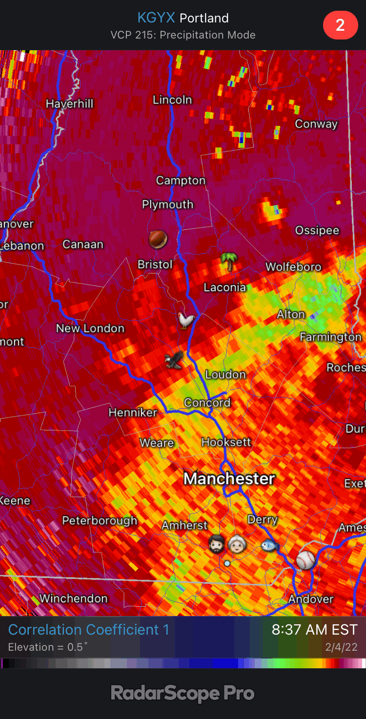
The snow line is approaching.

-
Pounding sleet. 29.1
-
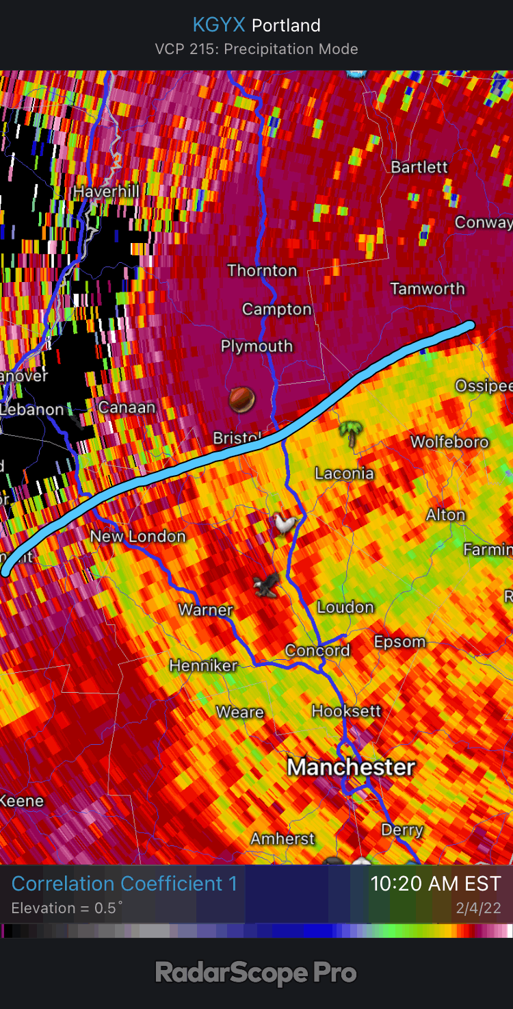
Mix line is pushing thornton now.
-
The Tolland triforce?

-
-
It should be a nice peltfest for you overnight.
-
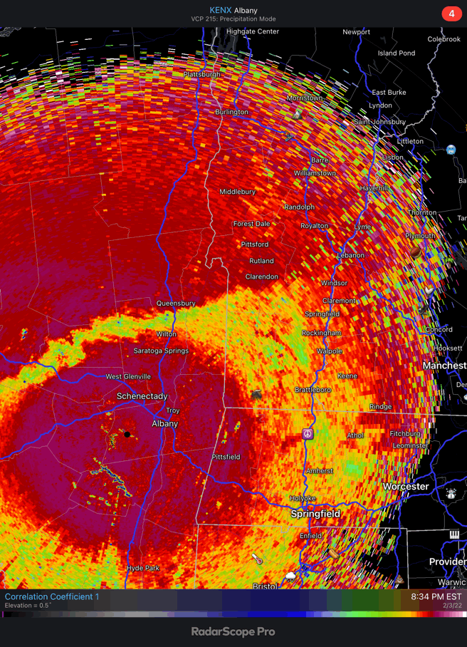
Looks like it gets worse for the borderline areas before it gets better based on rad out of ENX. The mix line is approaching RUT now.

-
I did notice it kicking the midlevel cold in much quicker around 12z. That would be a few inches post changeover.