

dendrite
-
Posts
66,943 -
Joined
Content Type
Profiles
Blogs
Forums
American Weather
Media Demo
Store
Gallery
Everything posted by dendrite
-
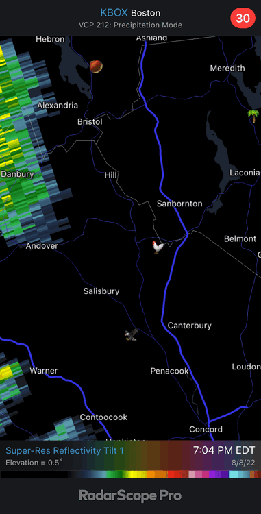
BOX radar always looks zonked out compared to neighboring sites.
-
Another line coming through. Looks like some heavy showers for Gene.
-
0.48” in the stratus. 0.46” in the tipper but the rates were probably too high for it.
-
Not one rumble of thunder either. Hit a peak rate of 8.35”/hr. And as I type this a rumble rolls in the distance to the E.
-
Not getting a lot at a time like you, but these small chunks add up nicely and keep it moist.
-
Damn girl. Gusty swirling winds
-
Could be a good brief soaker
-
Doin' the dew up here with moist ground. Can cut the air with a knife. 80/76
-
Yup BOS 98R PVD 95 TR BDL 94 ORH 92
-
BD is through Conway now. It’ll probably be a remnant sea lion fart by the time it gets here.
-
CON 96R MHT 99R PWM 95TR
-
Looks like it’s “catching up” now…maybe coming in a little faster a hair aloft?
-
MHT pushing 100
-
Just about through lavarock now.
-
Aug 1944 had 7 straight of 97+ Don. (although maybe that's what you mean by tied for 2nd place)
-
PWM 95 to 77 in 25 minutes.
-
There's some, but not much, CAA with this Tue front for SNE. Thu PM is the stronger front. We're talking 850s of 19C tomorrow versus about 16C Wed. So still warm to hot, but not record breaking.
-
BOS is about 20 mins ahead on yesterday with 95F. Back to BKN skies though.
-
91/71 Exact same as 11a yesterday
-
BOS 91F at 11a...same as yesterday. Should be another 97-98F.
-
Looks like it's getting into a sun filled zone now and although it's popping some Cu inland it's losing that diabatic assist from the rain over C ME. It'll probably start to peter out near the NH border unless we can get some convection firing and moving over the BD.
-
3k gets the shallow BD through here this evening, but it mixes out easily tomorrow. The front door front comes through in the afternoon. Probably a lot of thermal gradients around to spark some convection over the next 24hrs...more rain please.
-
56° and +RA in MLT. Let’s see how much momentum that BD can get.
-
Eggs are white. Those are a type of aphid.


