dendrite
-
Posts
75,073 -
Joined
Content Type
Profiles
Blogs
Forums
American Weather
Media Demo
Store
Gallery
Everything posted by dendrite
-
I do. I don’t even care if it’s all rain. Pull it more inland and Nov 1950 me.
-
If we can’t fix DAW we’ll tear it down
-
Weenies will complain about the wet solution, but I’d rather see that at this range than 492dm over Montreal.
-
Dropping the pv in over the midwest is always fun
-
Under
-
A little less confluence…going back the last 5 cycles the off hour runs have had less confluence than 00/12z. Maybe it’s just coincidence. In the end it doesn’t move the needle for us. We need a lot more work to get it up here.
-
Not sure what you’re getting at here. Height anomalies are higher, but that doesn’t necessarily mean more ridging. Just think of it as having December H5 climo during January.
-

New England Winter 2024-25 Bantering, Whining, and Sobbing Thread
dendrite replied to klw's topic in New England
I drove by and got a pic of him working on it.
-
New England Winter 2024-25 Bantering, Whining, and Sobbing Thread
dendrite replied to klw's topic in New England
Are they there yet? Not looking great at noon.
-
ICON has another s/w diving in right behind it. Let’s phase that piece in more.
-
Yeah this definitely has that big northern edge fronto band look with that deformation assist from the PV lobe.
-
New England Winter 2024-25 Bantering, Whining, and Sobbing Thread
dendrite replied to klw's topic in New England
-
Euro, GGEM, and ICON all have that one last little PV lobe piece swinging through the region which is just enough to send the system wide right like a Scott Norwood kick. I think we can work with the GFS evolution more up here, but it’s probably wrong.
-
I’m just trying to talk to your level based on the music vids you post. Did you have that football phone too?
-
Other than your Kathy Ireland Sports Illustrated.
-
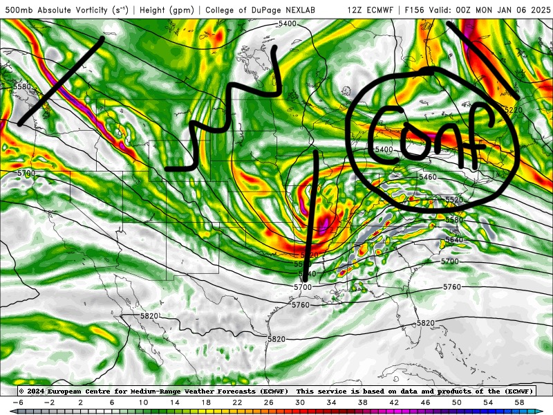
We’re going to need to start seeing some larger scale changes to get snow up here for 1/6. I know the ens have some hits, but that vort lobe is practically sitting over the coop on approach. Trend that up toward Labrador.
-
She faking
-
People up here were doing that in December lol. The public has forgotten what climo feels like.
-
You’re probably right in theory. The first one does some dirty work trying to pump the downstream ridging before getting dampened and the trailing wave tries to pick up the pieces. But yeah, moot point at this range. lol
-
That’s why I don’t worry about epic patterns up here when it comes to snow. Even being a little AN in DJF can net us snowy months. Just keep it cold enough to snow and throw shortwaves our way and we will snow out of most of them. When NYC-RIC are weenieing out over the indices and the H5 look we can start playing with fire in NNE.
-
Euro was more consolidated and potent with that s/w, but the confluence beneath the block just shears it apart. It’s just too much of a squeeze play. Relax the confluence and maybe we can get it up here before weakening much. At this range it’s all shits and giggles still though.
-
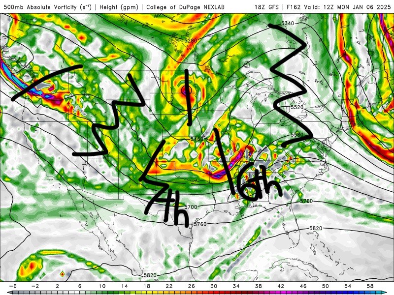
Lots of turds in the punchbowl. I kinda wish the s/w on the 6th was gone because it looks like the block relaxes just enough to get something up here. But there’s not enough wave spacing for the trailing s/w to amplify until it gets near our longitude. There’s still a lot of time though and these players will trend in different ways toward valid time. Some may disappear…some may suddenly be “seen” by the model.
-
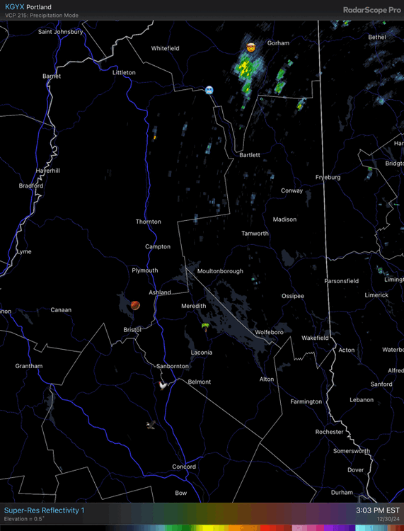
December 2024 - Best look to an early December pattern in many a year!
dendrite replied to FXWX's topic in New England
Convection!