dendrite
-
Posts
66,943 -
Joined
Content Type
Profiles
Blogs
Forums
American Weather
Media Demo
Store
Gallery
Everything posted by dendrite
-
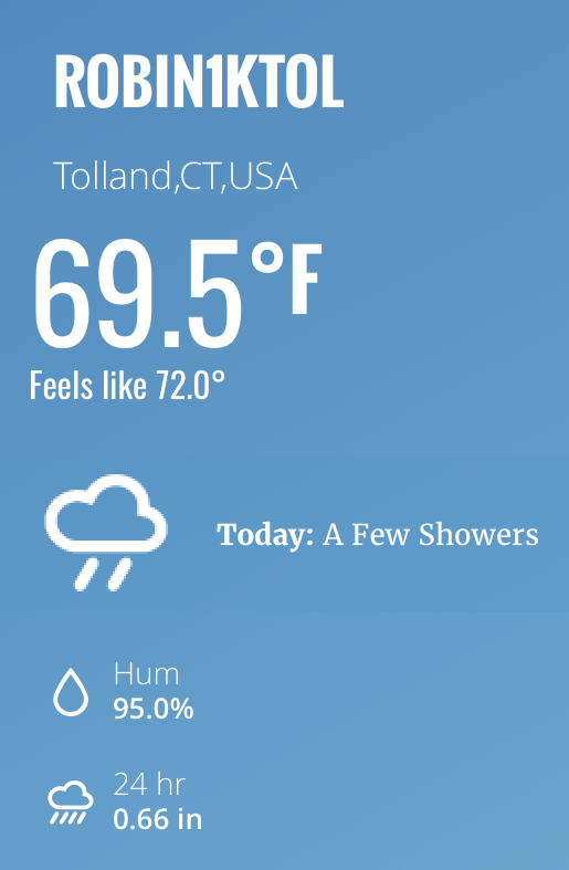
Up to 76F with quite a bit of sun so far this morning thanks to the NE flow behind that mesolow. It looks like the low level flow is piling up into SW NH and NE MA on vis...we'll see how that plays with convection later on.
-
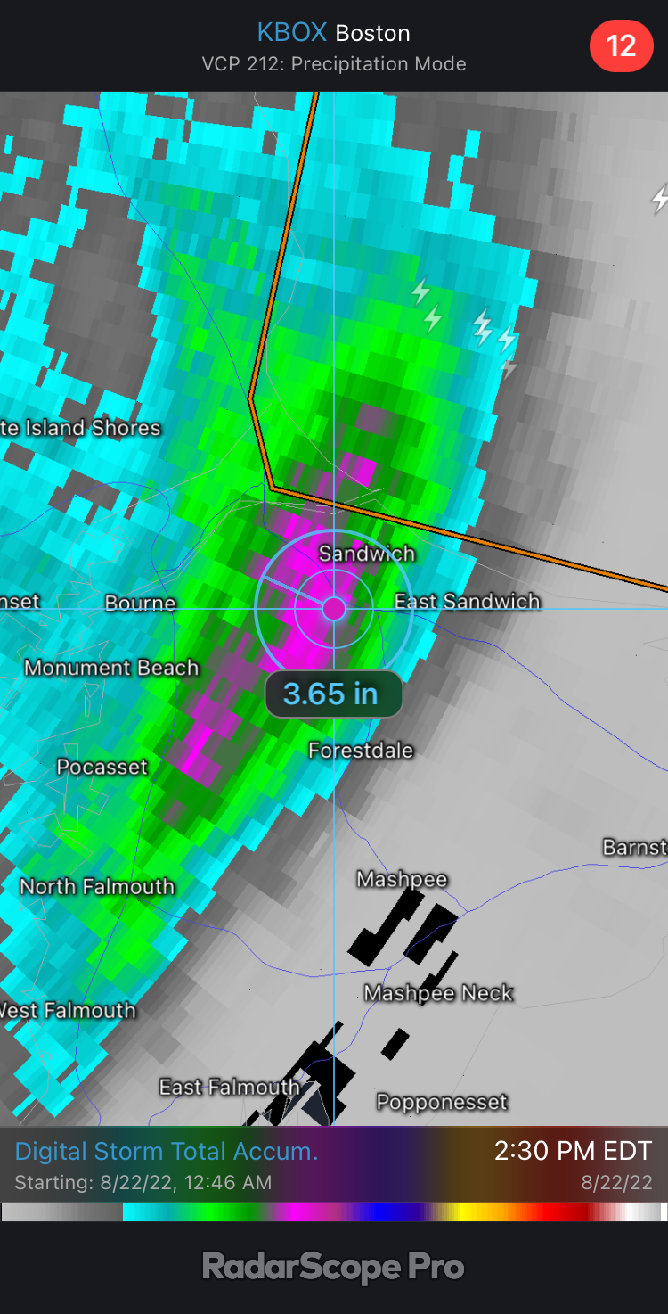
It’s mostly dual pol estimated precip. That localized area from Waterboro to Biddeford.
-
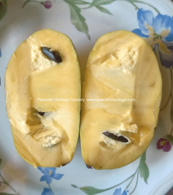
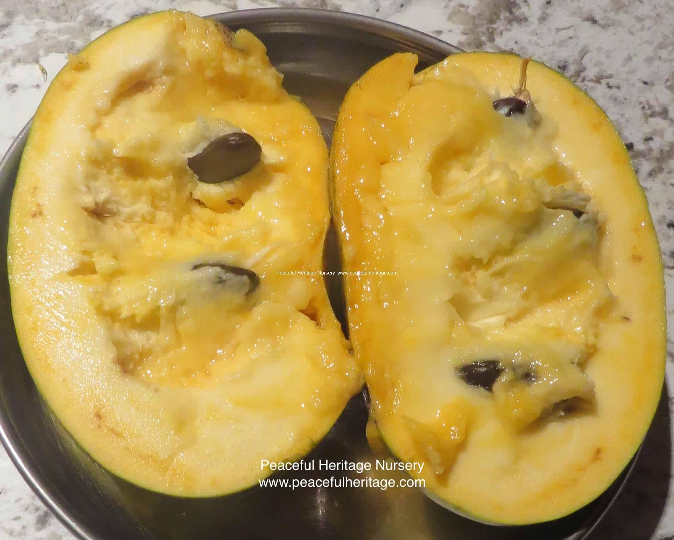
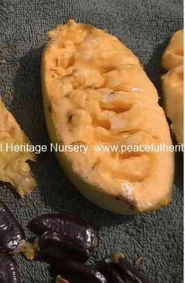
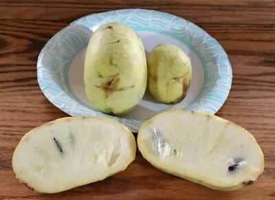
It depends on the variety, but most of the good cultivars have a variation of a banana-mango-melon taste. Some have other hints of flavors. You need to eat them when very ripe though or else they can taste pretty bad...unripe ones have been compared to kerosene lol. Texture is custard like for most. Flesh color ranges from orange to light yellow/almost white. Darker flesh tends to have more "pawpaw" flavor whereas lighter orange to yellow is more mild.


-
Probably legit. Big gap in that zone on the mesowest coverage, but the surrounding values line up. Never looked too heavy on radar…probably that dense, small droplet rain.
-
They're a cool fruit with tropical ancestry that evolved to colder climates. They attract almost no pests (only had a few japanese beetles on them this year) and are pretty disease free. The only insect that really goes for them is the zebra swallowtail and they're not up here since pawpaw is not native and they only eat the leaves of pawpaws. You definitely want grafted trees to get superior fruit. You can grow seedlings, but they'll take longer to fruit and you need to be sure they're seeds from superior parentage. We have a short growing season so you definitely want the vigorous varieties with early ripening. You need 2 different varieties for pollination and they are only pollinated by flies and some beetles...no bees. Hand pollination is a better way to make sure you get a good harvest. This guy is in Marlborough, MA and has a bunch. Here's a vid of some early varieties he recommends. I have a few of these. Nyomi's Delicious is one of my most vigorous growing trees so far.
-
-RA 0.19" so far. I asked for a 1/4" and may get just that. lol
-
That would be great, but not happening. 0.10” so far
-
It’s all showers…how is that lucky? You just said you were a screw zone compared to Vernon. Lol
-
0.73” congrats
-
We'll get used to it soon with winter coming.
-
Dave Dinger approved
-
Looks like it hasn’t wrapped up yet.
-
Looks like you're about to get dumped on
-
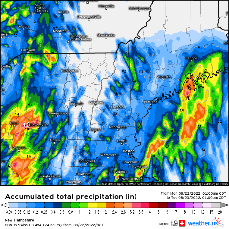
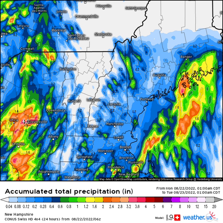
6z Swiss nailed that PYM area
-
HRRR is all over the place. It’ll catch on when it’s over. But yeah, there’s a chance of that convection with the mesolow in SE MA stealing our rain
-
wrapping up?
-
Mesos starting to look better for NH
-
Looks like the difference is about 7 hours.
-
I'm not asking for a lot. A 1/4" will suffice.
-
Looks like Stein is working real hard up here today. Scooter and TBlizz stealing mah rain on the HRRR with their reverse psychology
-
Plover lives matter
-
HRRR and the NAMs trending toward ORH-BOS corridor while here to WNE are the have nots.