dendrite
-
Posts
75,080 -
Joined
Content Type
Profiles
Blogs
Forums
American Weather
Media Demo
Store
Gallery
Everything posted by dendrite
-
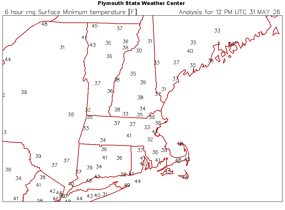
Yup. Obs thread…
-
52° with RW+ at 230pm. What a way to run the last weekend in May.
-
That was a pretty good 5 minute deluge
-
CT is the slightly further south version of the western 2/3 of MA. I think forecasters can easily handle it.
-
Pretty good wind with this line of showers/downpours
-
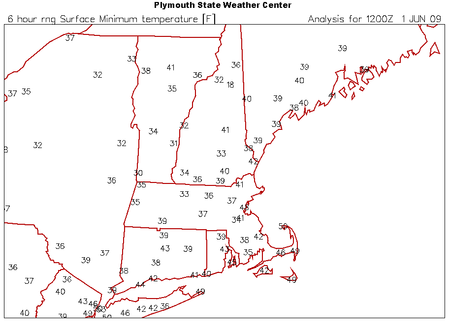
6/1/09 we had legit frost here. FIT was 1F cooler than this morn. So maybe then?
-
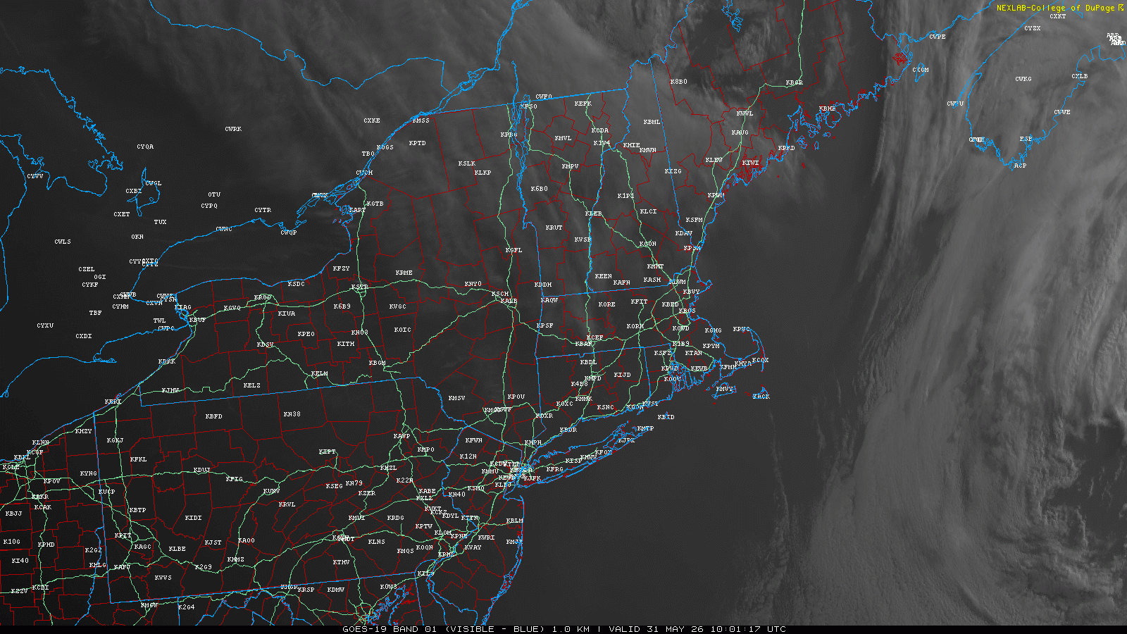
Yeah the vis loop this morning has me triggered. Hopefully we can bring down the rest of SNE with us.
-
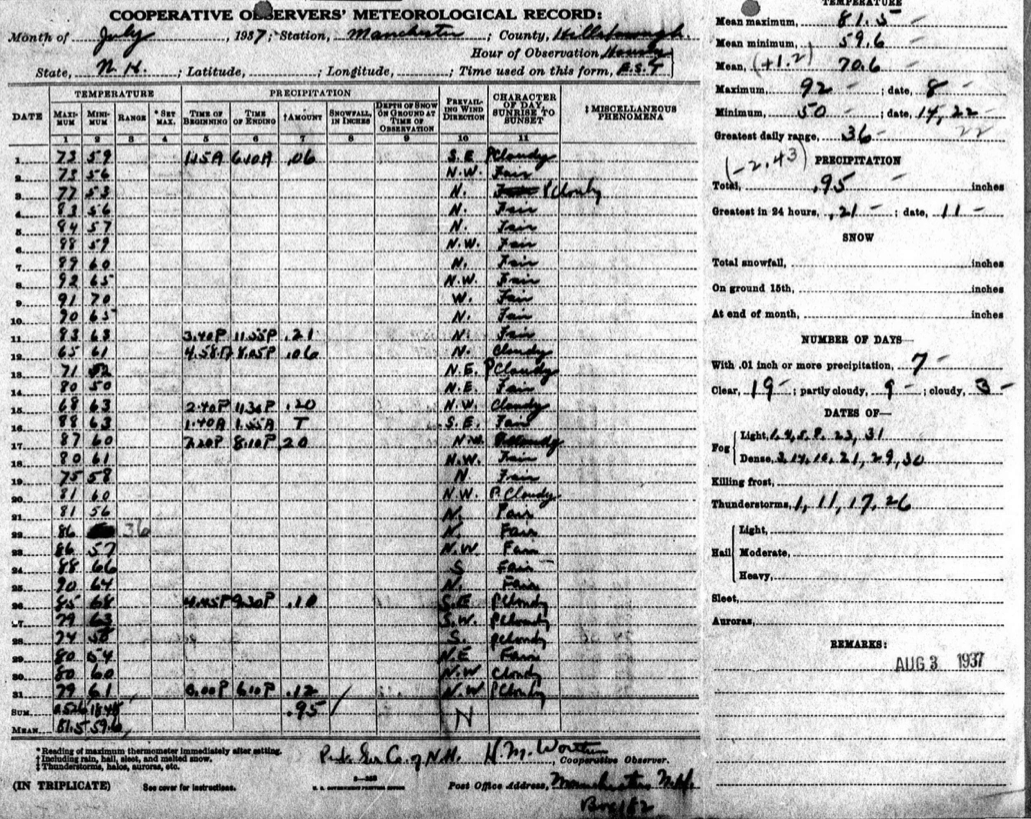
@OceanStWx Found an error in the MHT climo and record history. 36° is listed as the min for 7/22/1937. It should be 50°. I went and found the original form and the min for the date was crossed out and 36 was put in the range column alongside the 86 max. But the min for the month clearly has 50° listed on the 14th and 22nd. So that 36° is obviously the range and not meant to be the min.

-
That 34° at MHT will go down as a record and tied for the coldest for so late in the season. Their threaded climate history is a bit of a disjointed mess though.
-
What a way to end May
-
Of course we used to have a mile deep ice cap too.
-
Sure. It has snowed in June before. Boston had flakes in 1842. Then there was a decent storm in June over the interior in the infamous 1816 summer.
-
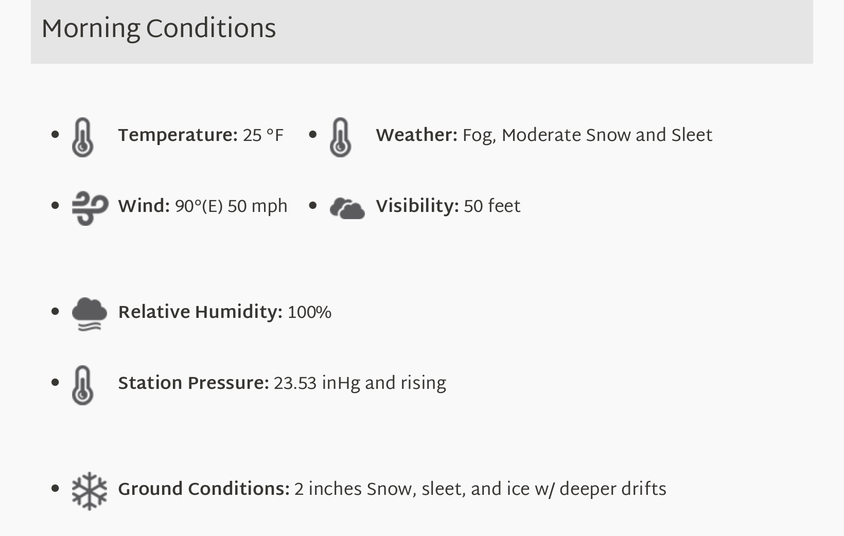
Props for getting out and going out after it, but please don’t tell me this is what you’re calling 60mph and +SN.
-
Wow that’s pretty bad asteroid damage.
-
It’s hard to read social media. The american education system is scarily bad.
-
I agree, but the 6am observer report has it in the obs and ground conditions too. So idk…

-
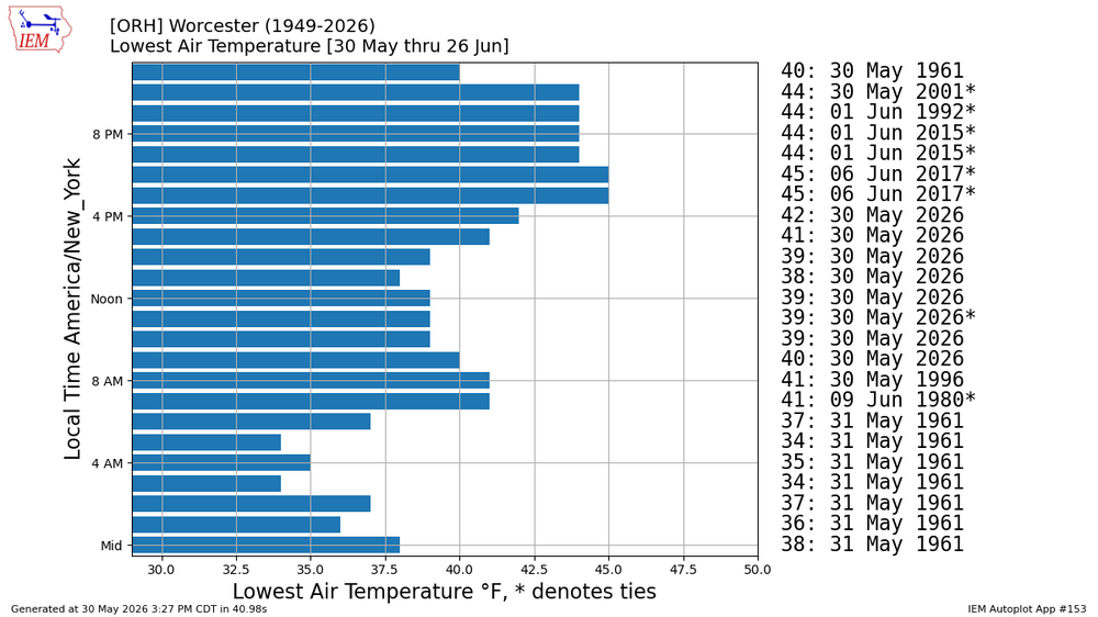
#1 worst day at ORH for so late in the season?
-
Yeah it seems strange. Rookie observer counting some bouncey, heavily rimed flakes as IP? CC still looked a little mixed aloft up north through sunrise I suppose…then it crashed SE as the precip started moving south of Coos.
-
His chocolate is overrated too
-
Different version of the same GLM (geostationary lighting mapper) product everyone is posting
-
Boom goes the dynamite
-
The sound of ACs being pushed out of windows?
-
People in NYC saying they saw it
-
Nothing on USGS yet. Meteor?