dendrite
-
Posts
75,088 -
Joined
Content Type
Profiles
Blogs
Forums
American Weather
Media Demo
Store
Gallery
Everything posted by dendrite
-
33/32
-
When do we change the name of NM?
-
Yeah the 4” record is in trouble.
-
Sounds like a typical winter week up here. lol
-
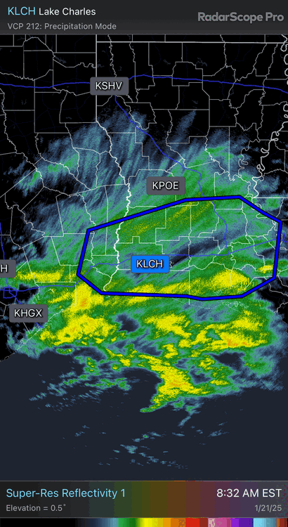
LCH 1/4 S+. Big numbers incoming.
-
They’re going to do some legit ratios.
-
Unreal
-
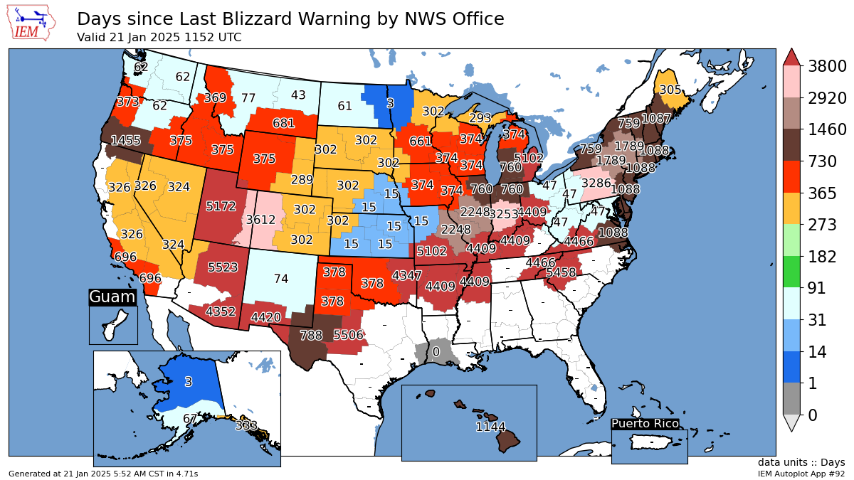
Never had a blizzard warning along the gulf of Mexico, but it only takes one day to get one in the gulf of America.
-
You live in VT. Not everything is a bust.
-
You need to get used to living in New England. lol
-
Here’s how rare blizz warnings are down south. lol

-
Any diamond dust up there this morning?
-
Congrats everyone on the energy usage
-
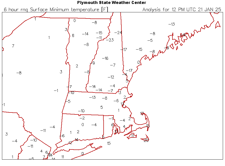
It’s been bouncing around here. The rad cold sloshes up and down the hills here along the river valleys. Was back up to -7°, but back down to -9.7° (officially -10°) I guess. Alex will stroll in with -20s this morn (edit… -21.8° )
-
Depends on the cultivar. Mine rarely flowers and -10ish is the threshold for it. It was here before I moved here so I have no idea what it is. More peach talk for Ray to wake up to.
-
All of my fruit trees will laugh at that except for the peach. -9F is getting borderline for the flower buds on that tree of mine.
-
First Lake got down to -27
-
-9.3°
-
Down to -2.4° Coldest in almost 2 years
-
A little, but still only -0.4F in the highs.
-
Yup. CON is +1.7F for Jan coming into today and that’s with 1991-2020 norms. This week will quickly chomp into that, but it hasn’t been very cold so far.
-
They have?
-
 The wind was due north…perfect trajectory for Champlain LES.
 -
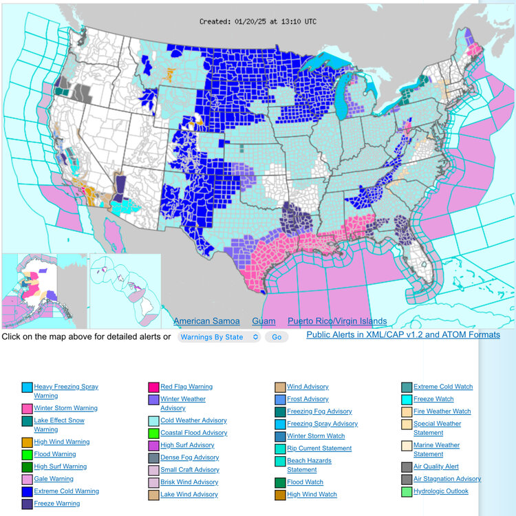
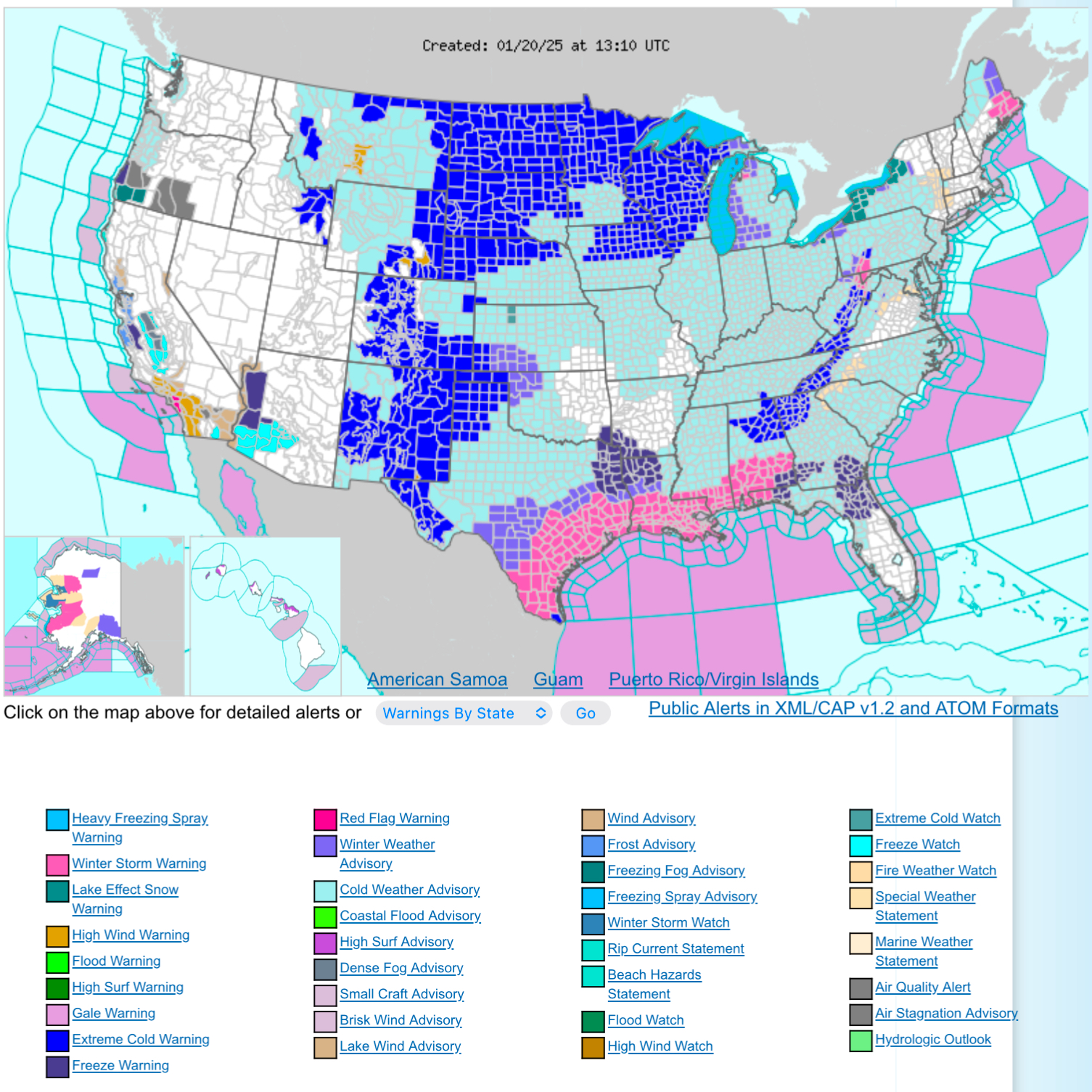
This is quite the headline map. Gotta love a WSW along 2/3 of the gulf coast.