dendrite
-
Posts
75,073 -
Joined
Content Type
Profiles
Blogs
Forums
American Weather
Media Demo
Store
Gallery
Everything posted by dendrite
-
 Well we’ll obviously keep getting some below normal months if we move the goalposts every 10 yrs. It would be BN if we used Jurassic period norms.
 -
They’d be +1.5F with the old normals
-
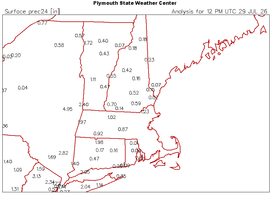
Not my station, but 0.01” here too. Just a hundredth feels like a deluge. I’m 4…not 154.
-
Hopefully the McDonalds wizzy eats his filet o’fish at in Troy is underwater.
-
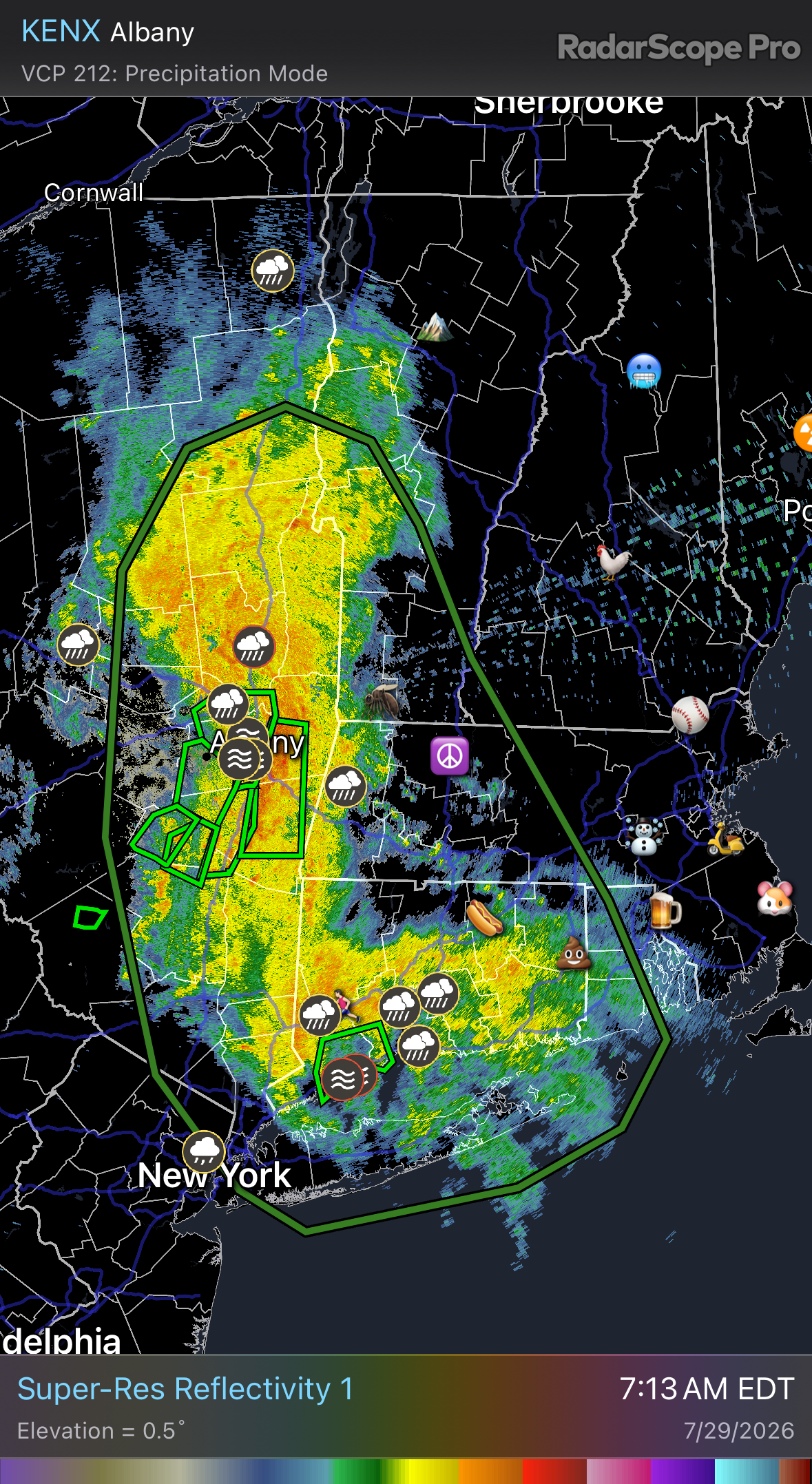
I have a virga storm in July. I feel like I live in Littleton.
-
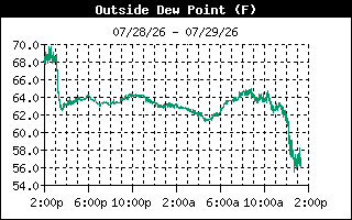
Probably not a good sign. Just noticed dews plummeted.
-
Actually it isn’t. Virga.
-
Last year sucked but it was a larger scale drought. We were mostly all in it together. This July has been a personalized Stein boning from here to Winni while I get to watch daily flood pics and record wettest month charts daily.
-
Untrue. Tblizz, ditty, and scoot have historically been rewarded
-
lol euro. Orographic f job
-
10” in a day and I can’t even get 1” in 4 weeks
-
Oops…thanks. Just spot reading posts in reverse chronological order. lol
-
What do they base these on? A specific gridpoint?
-
67.8° A few drops
-
I melted quite a bit yesterday, but we were strategically missed multiple times.
-
I’m not down with other people’s precip
-
You’ve been complaining about Stein for months and you’ve had a May-Jun-Jul of 13” and counting so you can just

-
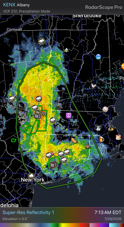
My only guess is the relatively recent change of the 0.3° beam angle. With a cool season like storm and “flatter” beam they’re returning a lot of area in the mixed-phase layer.
-
5.61” I also had 10” in 2009. Point?
-
Glue factory
-
5.46” vs 0.95” MTD
-
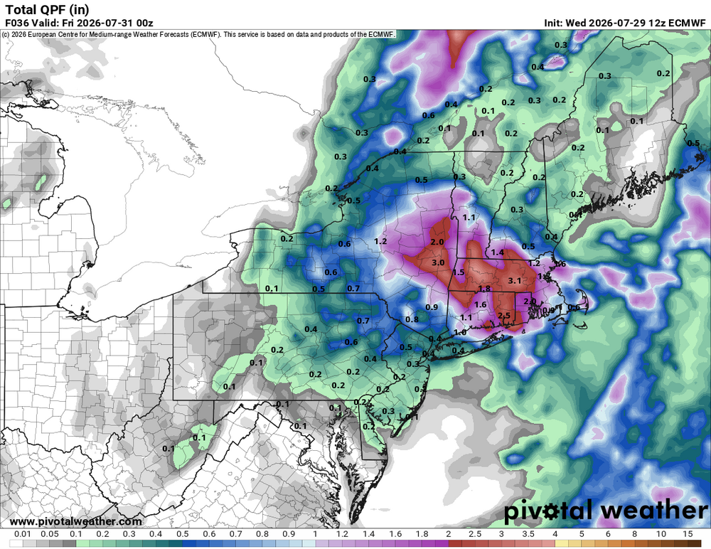
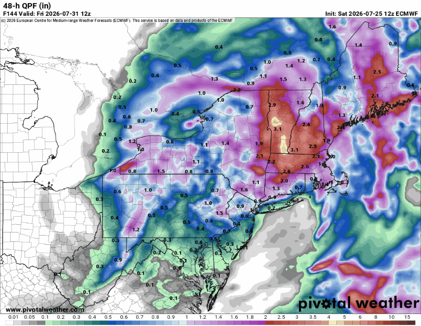
6z HRRR is like 0.25” here. Euro isn’t much better. Holy hell.
-
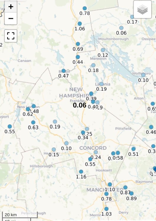
0.06” Getting the big L so far
-
They’ve been like that for years