dendrite
-
Posts
66,943 -
Joined
Content Type
Profiles
Blogs
Forums
American Weather
Media Demo
Store
Gallery
Everything posted by dendrite
-
It wasn't that cold there. He uses an unsheltered sensor there in his "valley".
-
15F lol
-
 33F -RA at the casa...not much melting so far. There was barely any snow at CON this morning when I got in. The usual big drop off around exit 17/18.
-
Moderate sleet now. 32.3°
-
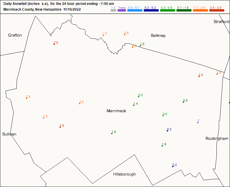
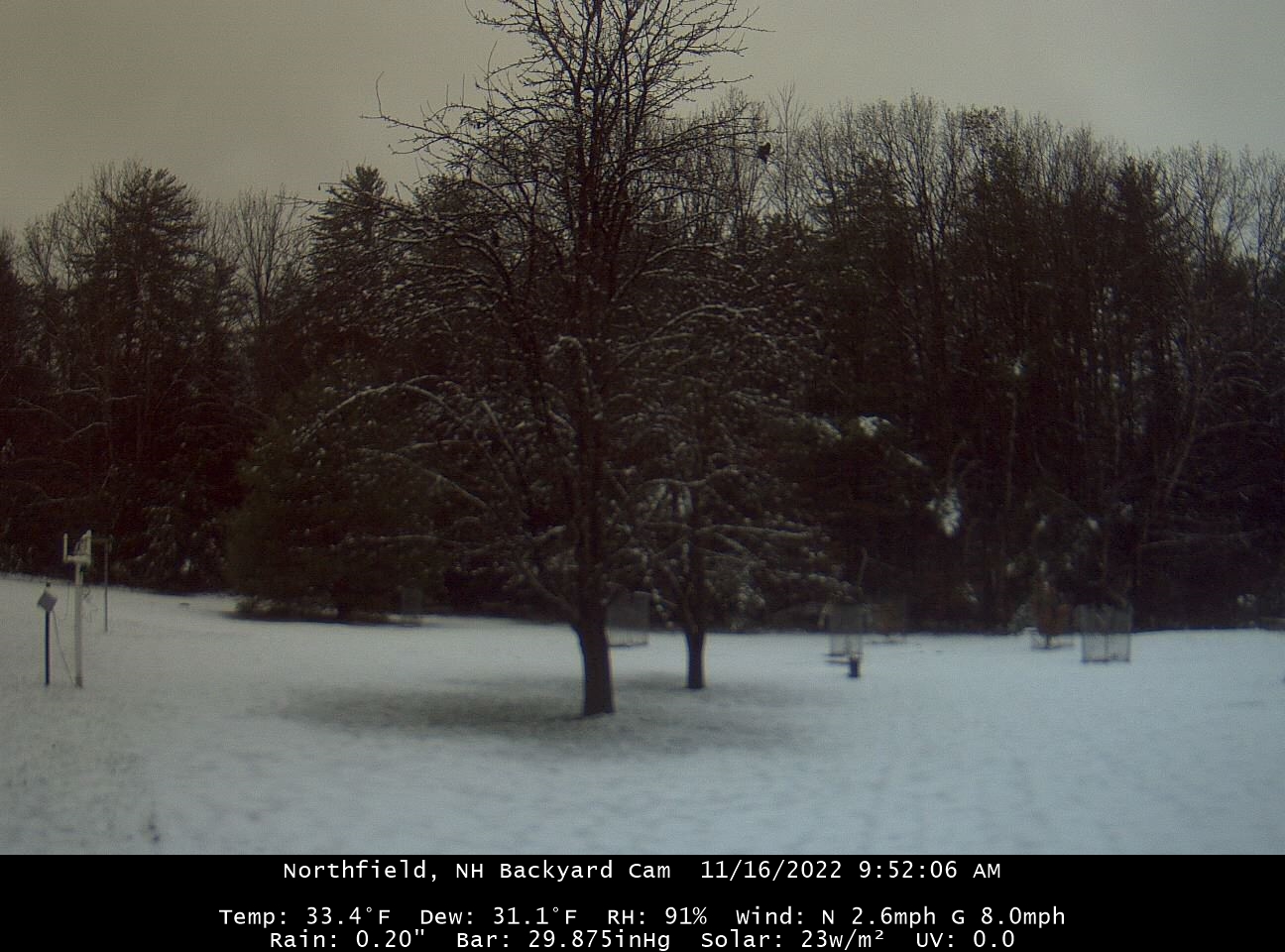
Rain and pingers now. 32.3° 2.2” new
-
31.8° -SN
-
That’s young for you
-
Been busting my rear since sunrise getting my birds winterized. Definitely a nice one. I thought the cold would bother me more than it is.
-
First flakes of the season. 30.8° with flurries
-
Not ready for that yet. Thx tho
-
It’s a good map. Just need to get the circle in New England next time.
-
63.8° overcast and dropping. It was fun.
-
OWD 77F
-
Up to 69F. CON 73F...1 away from tying the daily record.
-
I mean I think it’ll be warm with steady or slightly climbing temps as it dries out, but probably a lot of 68-72 in E sections and mid 60s at 995ft.
-
Rocket? We’re like a month from the solstice. You’re already 5° off your high from this morning.
-
CAA bro
-
Almost a tied all-time November temp record at MWN. They’ve hit 52° twice in Novie. 6hr max earlier was 51.4°.
-
-30F at Peter Sinks this morning
-
Mowed the backyard really short yesterday and bagged the pear leaves to help prevent fungal diseases. Anyway, it left the lawn looking yellow since I cut so much back. One night of warm rain and dews and it’s greening right back up.
-
7/10’d on the line, but that’s fine. We’ve had enough rain. 67° -RA
-
CON tied their 3rd highest temp for the date already with 68°
-
Up to 67°. Enjoying the last hurrah. Hopefully our thaws this winter are like this.