dendrite
-
Posts
75,073 -
Joined
Content Type
Profiles
Blogs
Forums
American Weather
Media Demo
Store
Gallery
Everything posted by dendrite
-
I can’t wait for the HHH. All of the bad guys can finally come out of hiding from the cold and hit the streets of Brooklyn.
-
Try Ginxy or dryslot for that. Only clover here.
-
Barely a drop this afternoon…even had some sun. I have tomorrow off so I will be tanning the nape.
-
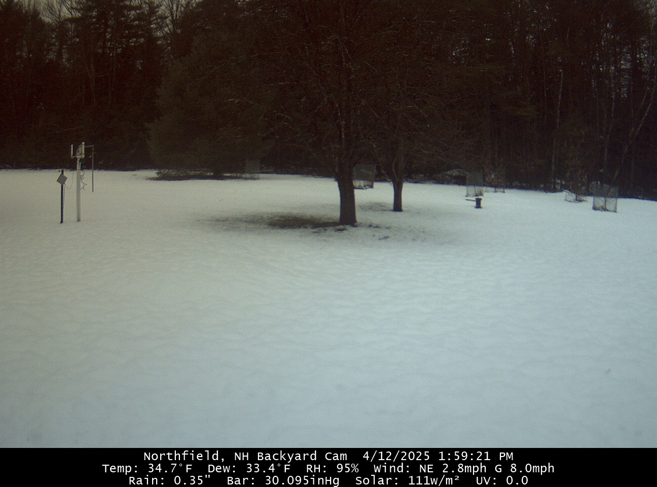
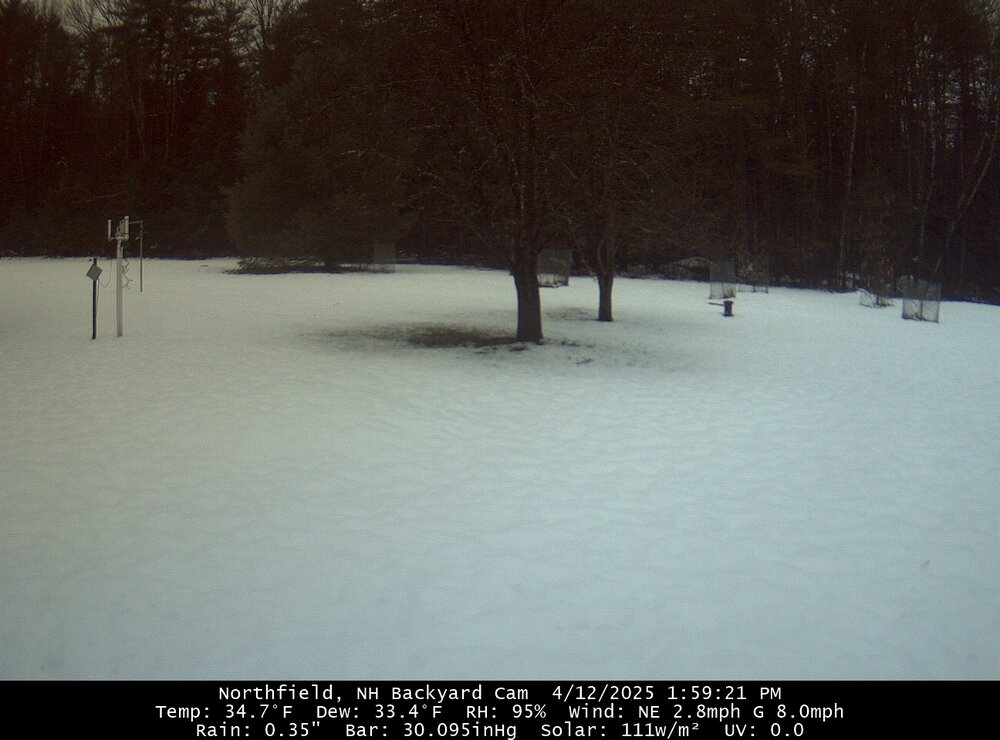
The snow took a beating overnight despite mostly holding at 34-35°. Those warmer soils just start to eat away at it bottom up this time of year. We’re pretty much down to C-1” now depending on how much insolation the spot receives. Hopefully the rain stays east of here today…models are generally a tenth or so this afternoon. Looks like a miserable day for ENE.
-
Yeah that’s awful. At least it was fun here for a few hours. Hopefully we can start flipping the script after Easter.
-
Did you get any snow accum?
-
Yup. Have had plenty of those over the years. I just always think of Tip when I see it in print.
-
35° with a sleet shower. High was 36.6° at midnight. A true winter day.
-
Yeah I’m inclined to toss the liquid. Lakeport had 2.96” w.e. I believe and Plymouth had 26.5” snow. I wonder if it was a Dec 2020 type event given how quickly it fell.
-
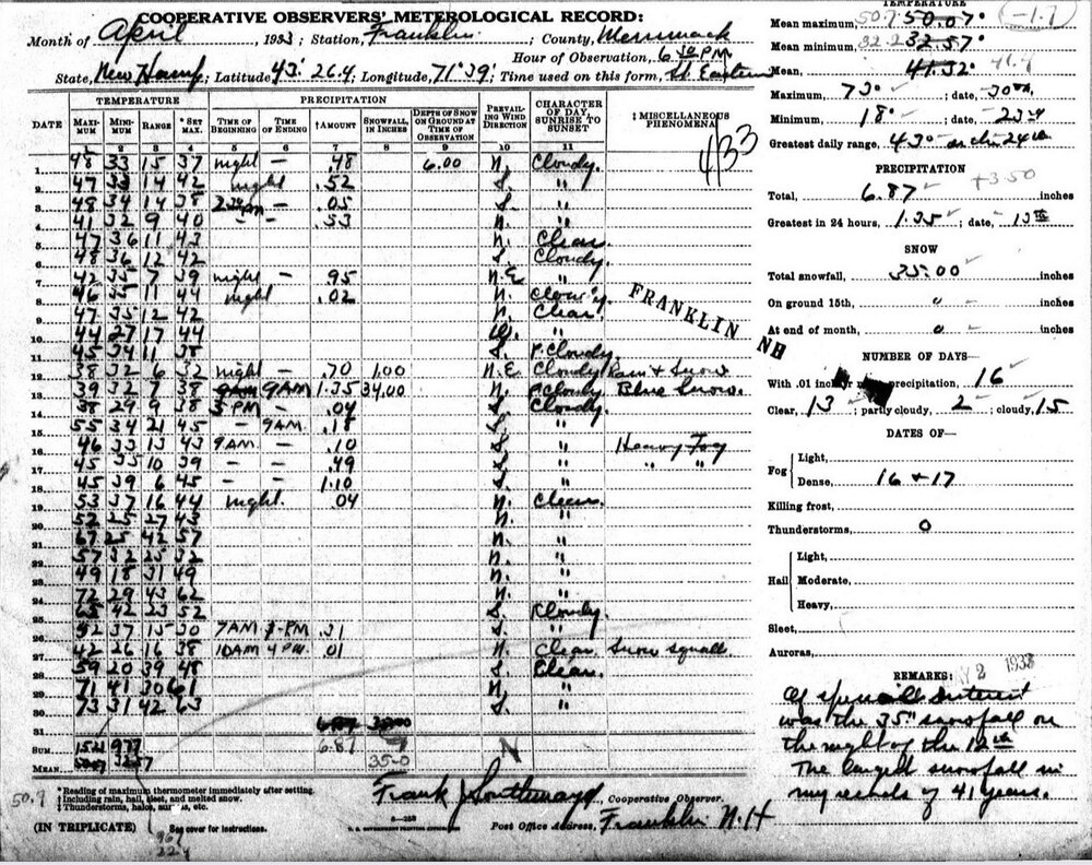
It’s the 92nd anniversary of a major paster up here. CON had over 18” and the COOP here in Franklin had 35”. I went back and looked at the form earlier today and noticed the observer put “blue snow” in the comments.
-
No free ranging today. What a way to run a weekend.
-
lol…most of the offices up here don’t even have staffing to do balloon launches anymore and you’re grilling them over a couple inch discrepancy in some hill towns.
-
That was great. Now let’s melt it all by sunset.
-
4.1” and down to -SN. It’s already starting to fall off the trees on clumps. 32.2°
-
Big fatties IMG_2492.mov
-
Getting blitzkrieged right now.
-
Congrats DAW! KDAW 121151Z AUTO 02004KT 1/4SM +SN FG OVC003 01/00 A3013 RMK AO2 SLP203 P0010 60023 70023 T00060000 10033 20006 53002
-
It’s 32.0° here and only 12z. So it’s plenty cold to avoid the wet aggregates right now. That’ll change in a couple hours when we start creeping to 32.5-33.
-
I’m getting into some of the New England heirloom varieties. I have Roxbury Russet, Northfield (VT) Beauty, and Black Oxford to graft too.
-
32.1° and moderate now. Getting pasty.
-
Apples? @HoarfrostHubb I’m grafting this one this year. https://www.cumminsnursery.com/buy-trees/product-detail.php?type=scion&id=8211
-
Not sure they will believe him after all of the clown maps he clung to this season.
-
Nice day today. Wind coming from New Brunswick.
-
It’s still brightbanding though. Big wet aggregates aloft.