dendrite
-
Posts
67,071 -
Joined
Content Type
Profiles
Blogs
Forums
American Weather
Media Demo
Store
Gallery
Everything posted by dendrite
-
Haven’t looked at a lot yet, but some models really pork your area. 3k is toward noon and HRRR is very late afternoon. That remnant low from the inv trough just kinda sits over you.
-
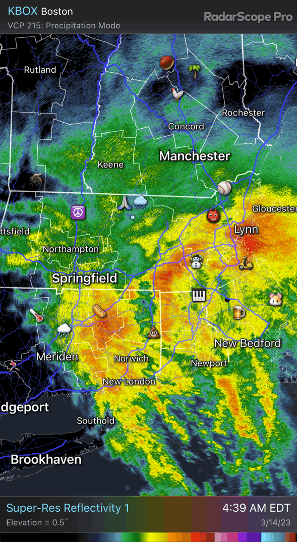
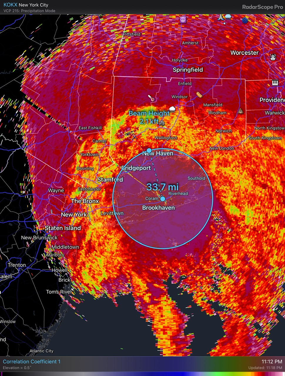
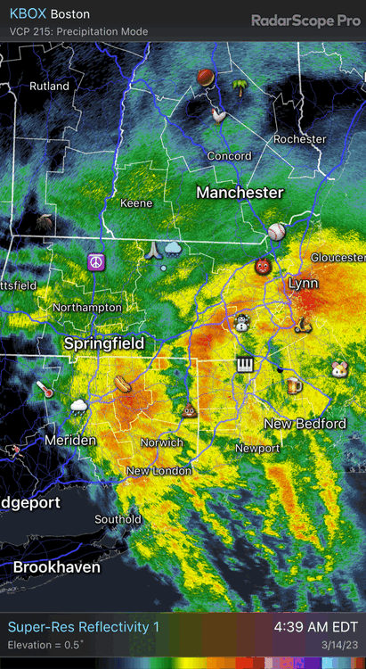
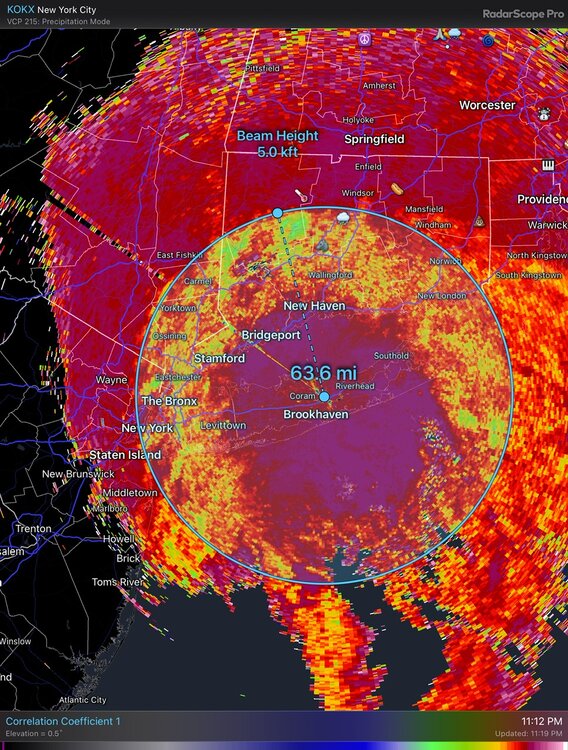
It’s still brightbanding aloft. The radar hits your area well above your head.
-
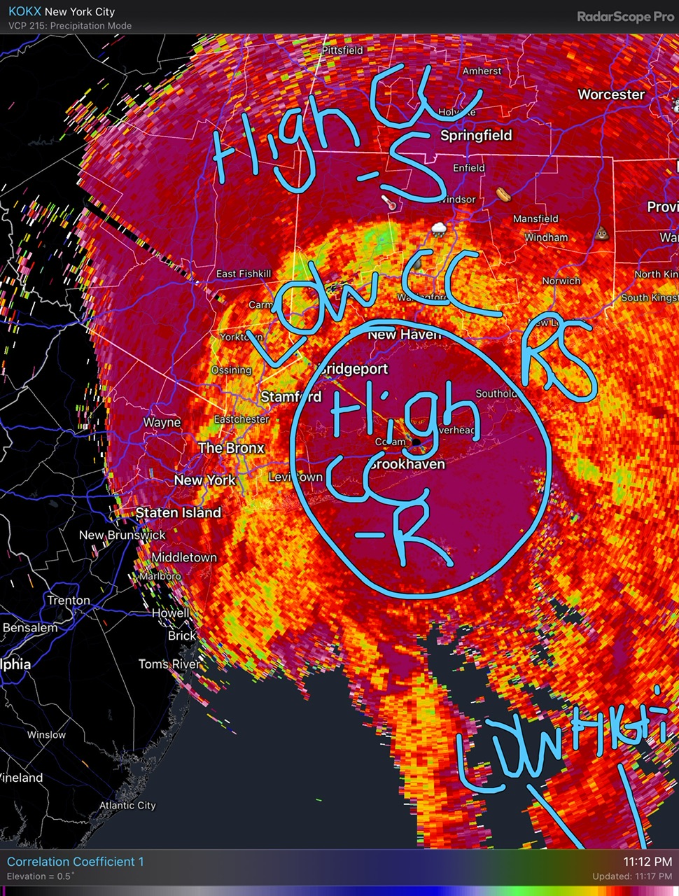
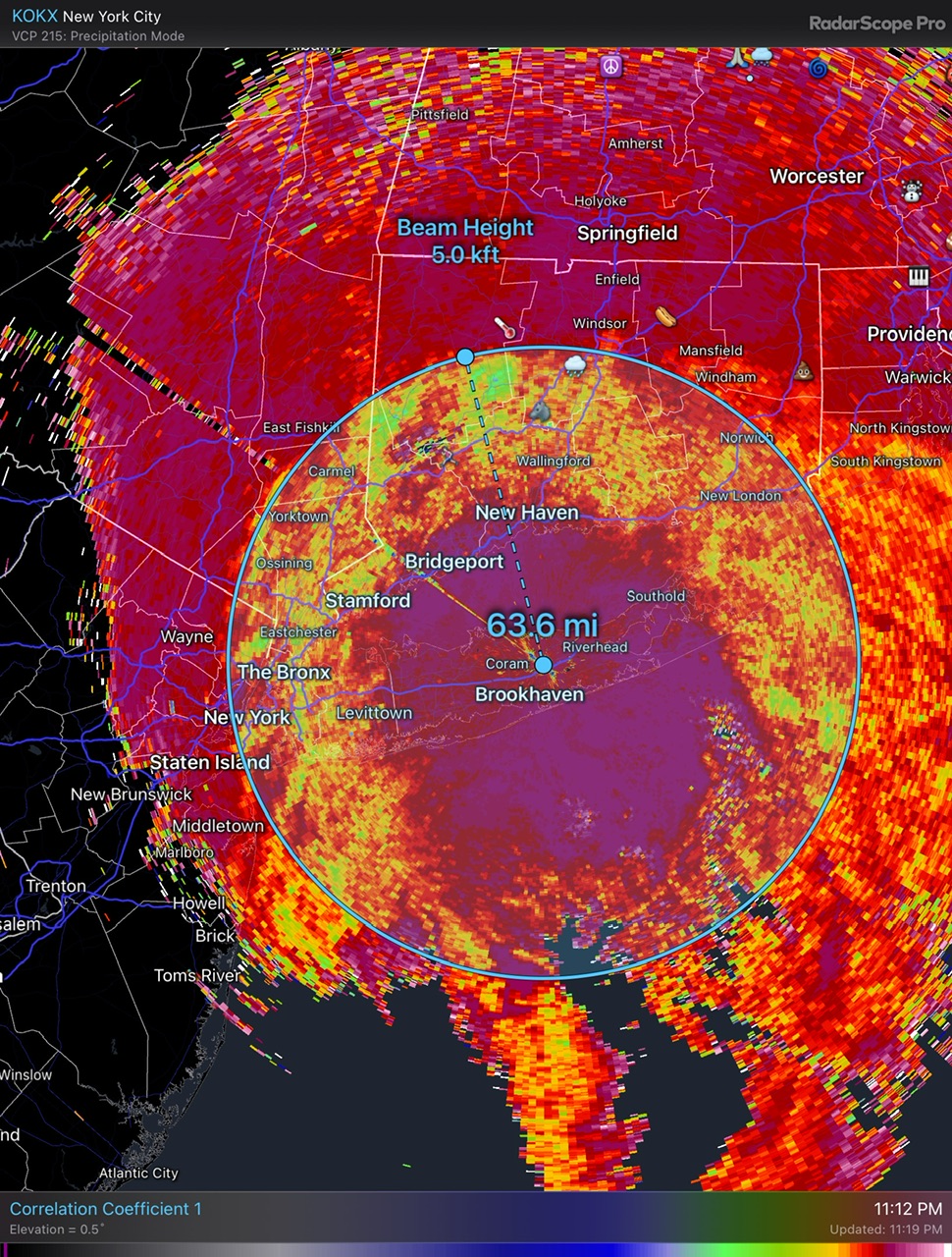
So the bottom of the snow (mixing) level is collapsing toward BOX on the NW side, but it’s still around 800ft up toward ORH. The top of the mixing layer is around 2kft near ORH, 3kft by Ray, and 5kft by Tolland.
-
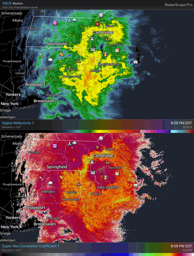
Brightbanding gone wild
-
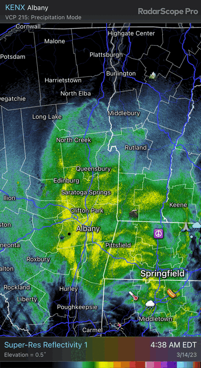
They are getting wrecked just west of Saratoga Springs with QS banding.
-
Looks like 3” or so on the railing? 32.1°
-
Sorry man. Just saw your temp in the app.
-

The last hurrah? Putting all the eggs in the Tuesday 3/14 basket
dendrite replied to Ginx snewx's topic in New England
Caved warmer in the morning, but goes to town midday like the other models now. -
The last hurrah? Putting all the eggs in the Tuesday 3/14 basket
dendrite replied to Ginx snewx's topic in New England
GFS just delivered a big FU to Tolland. Stein laughing in his sleep.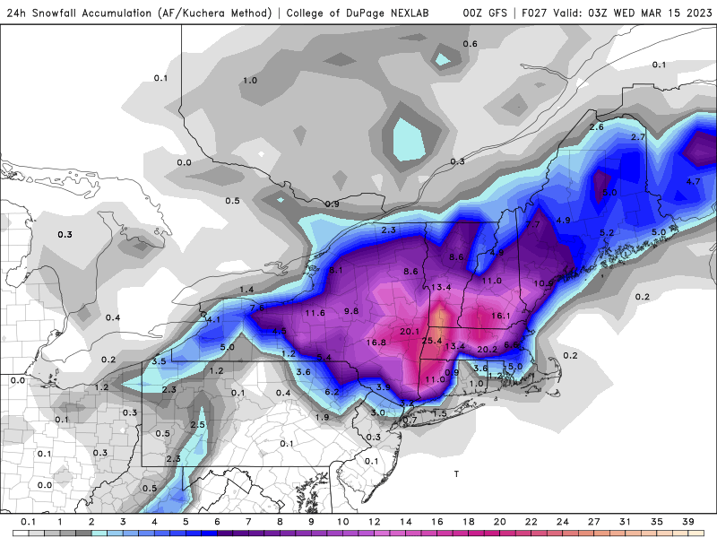
-
32.3° -SN Pushing 3/4”
-
I start tracking warmth after this storm.
-
The last hurrah? Putting all the eggs in the Tuesday 3/14 basket
dendrite replied to Ginx snewx's topic in New England
But of course the beam increases with height. So in this 0.5° angle, in S CT the snow is mixing in down to about 2kft and in N CT the warm layer is up to about 5kft.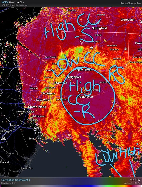

-
The last hurrah? Putting all the eggs in the Tuesday 3/14 basket
dendrite replied to Ginx snewx's topic in New England
-
The last hurrah? Putting all the eggs in the Tuesday 3/14 basket
dendrite replied to Ginx snewx's topic in New England
Actually lower CC is your melting layer. Mixed precip has hydrometeors of different shapes/sizes so there is less “correlation”. -
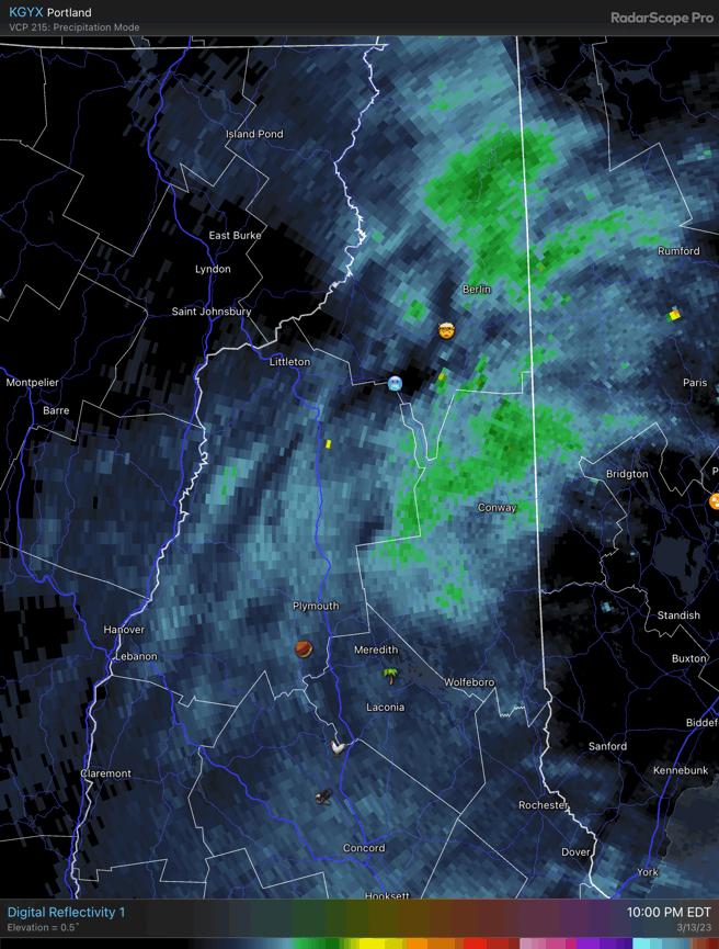
Starting to see the terrain effects in N NH.

-

-
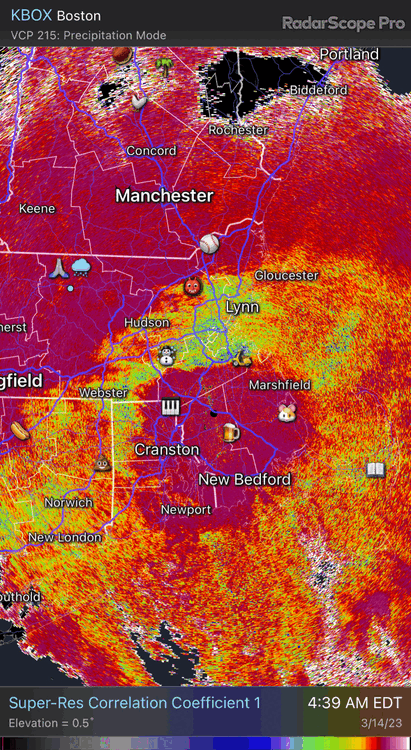
I’ll add that some of the ptype/reflectivity products from the models account for that. Where it expects wet snow it will simulate much higher reflectivities.
-
Bright banding
-
32.4° -SN Truck/driveway covered.
-
34.0° -SN
-
The last hurrah? Putting all the eggs in the Tuesday 3/14 basket
dendrite replied to Ginx snewx's topic in New England
That’s the run I was waiting for. -
The last hurrah? Putting all the eggs in the Tuesday 3/14 basket
dendrite replied to Ginx snewx's topic in New England
Snow almost to MVY at 15z. That’s be a fun 3hr period from 8a-11a. -
The last hurrah? Putting all the eggs in the Tuesday 3/14 basket
dendrite replied to Ginx snewx's topic in New England
NAM is wasting quite a bit of QPF for the deep interior early tomorrow morning -
The last hurrah? Putting all the eggs in the Tuesday 3/14 basket
dendrite replied to Ginx snewx's topic in New England
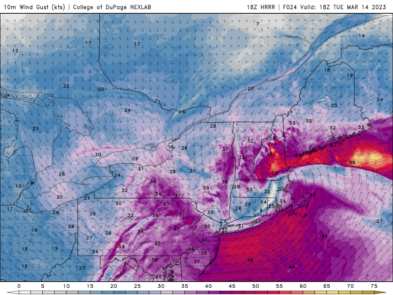
All you need is this.
-
The last hurrah? Putting all the eggs in the Tuesday 3/14 basket
dendrite replied to Ginx snewx's topic in New England
Chickens blown onto bodies