dendrite
-
Posts
75,066 -
Joined
Content Type
Profiles
Blogs
Forums
American Weather
Media Demo
Store
Gallery
Everything posted by dendrite
-

2025 Lawns & Gardens Thread. Making Lawns Great Again
dendrite replied to Damage In Tolland's topic in New England
I can’t wait for brush cutter June. -
If this was a winter storm the snow would be lingering into late tomorrow night.
-
46.7° What a day to be alive
-
46° -RADZ Feels like January out there
-
So is the 65-70 for the azalea beds or are you heading to NYC?
-
Are we forecasting your Davis or ASOS sites?
-
-
Congrats @jbenedet !! 1st American pope! I will change your name to Leo soon.
-
“I could see 1-2” but none of this 4” nonsense some are saying”
-
67.2° SCT/BKN Nice day but more rain approaching
-
It was nice to see the sun this morning albeit for 10 minutes.
-
My yard is under water, but
-
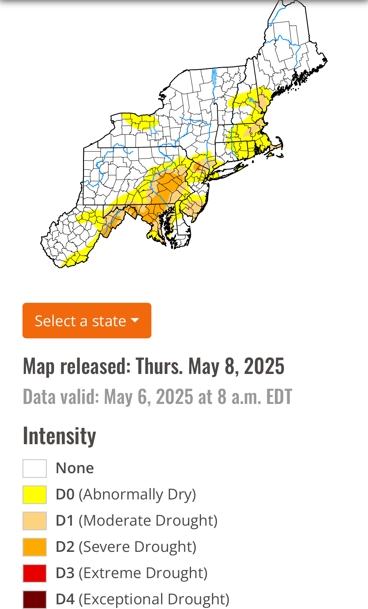
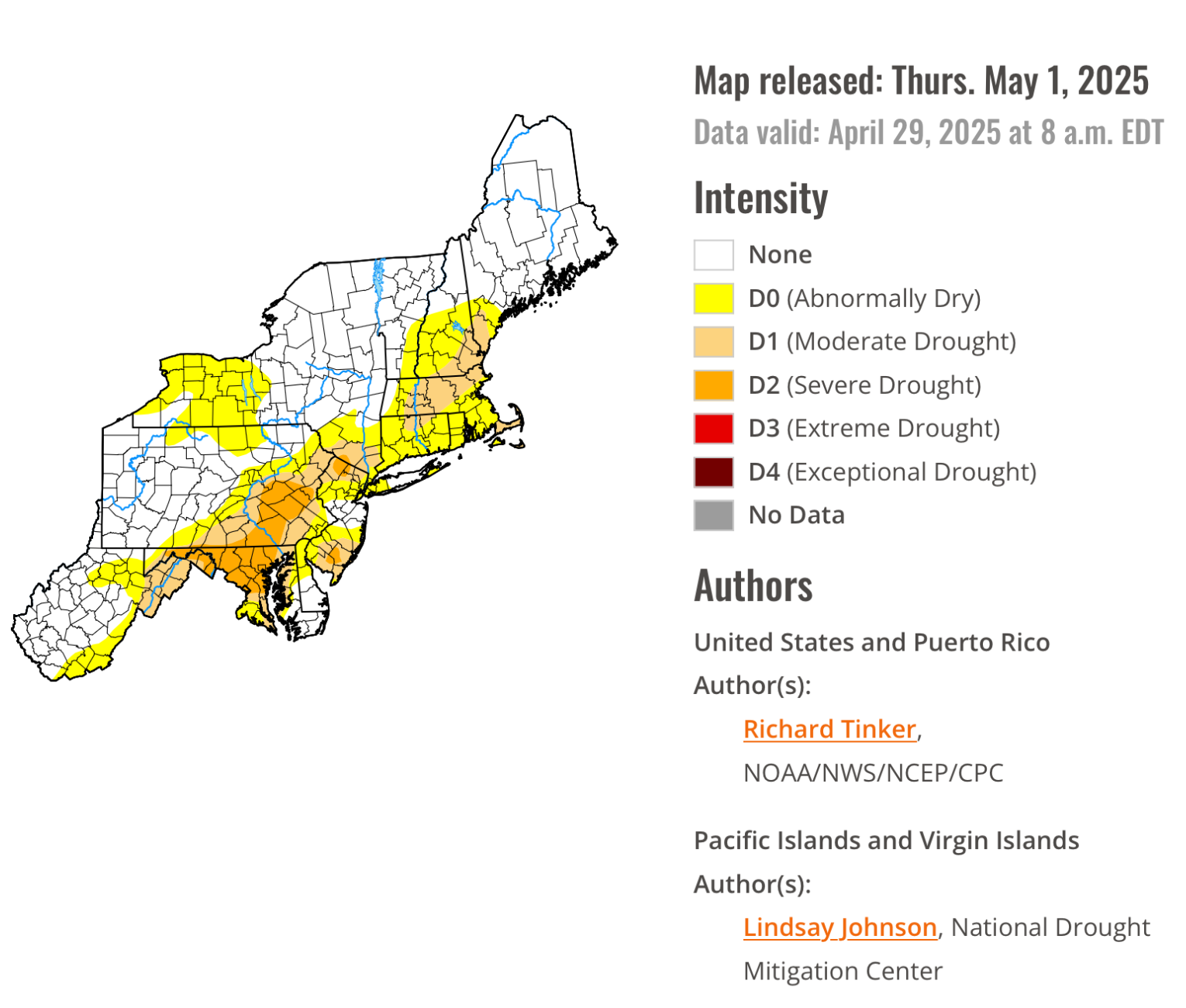
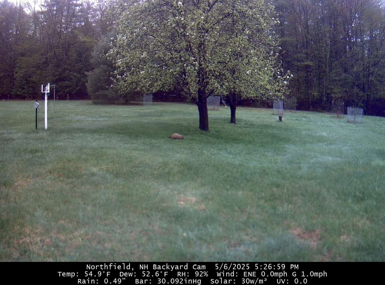
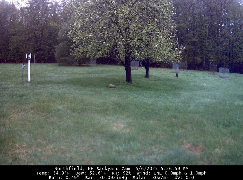
We’re in the lime green stage too. Hopefully the fruit trees get a little sun before they’re done blooming. At least the whistlepig is having fun in the rain.
-
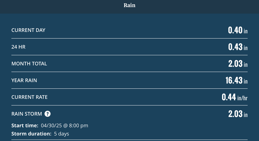
It’s been raining so frequently that my Davis thinks this is the same storm going back to April.
-
He’s had 1.01” on the day and 2.26” for the month. He wet.
-
54° +RA
-
LFG
-
Good thing the W is far from the M on the keyboard
-
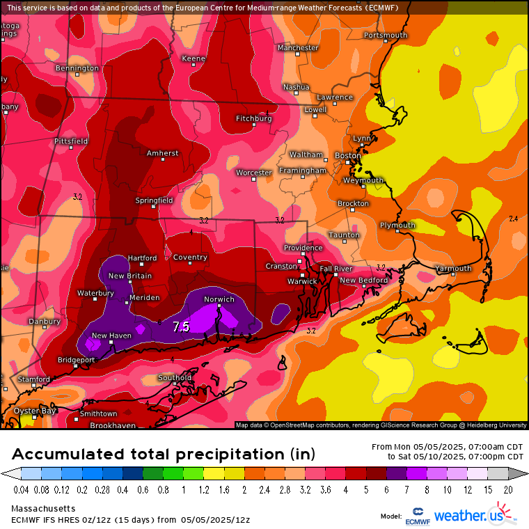
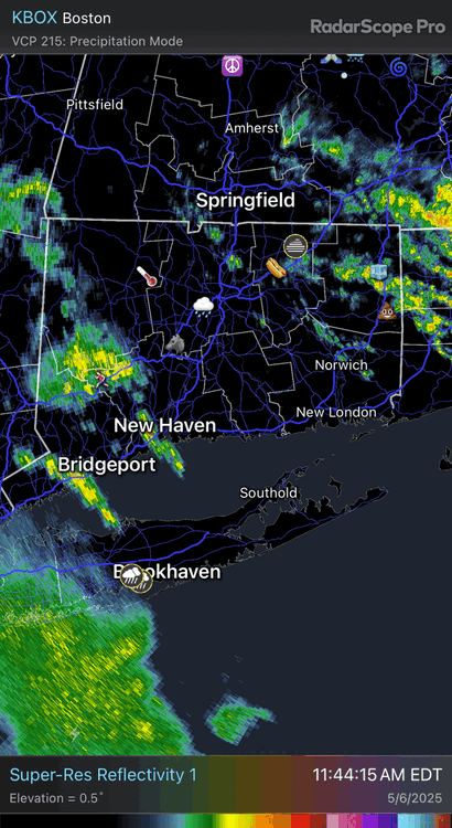
After a lull…more convection firing in SE CT. Let’s get ditty more rain. I want that giant oak complex getting swallowed by a sinkhole.
-
Perfect track Fri/Sat for SNE. I don’t want to hear any bitching come winter now.
-
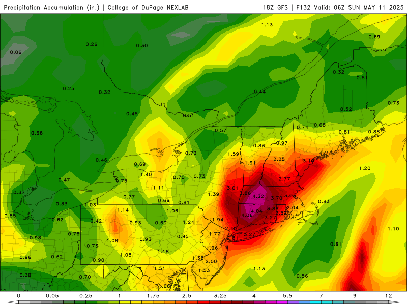
Hopefully this juices up more over the next few runs

-
Ever?

-
Reflection from the winter blue balls of AEMATT
-
Gonna need to analyze the lake Winni sediment core data to find the last decent weekend up here
-
50.2° RA Stinko de Mayo