dendrite
-
Posts
66,900 -
Joined
Content Type
Profiles
Blogs
Forums
American Weather
Media Demo
Store
Gallery
Everything posted by dendrite
-
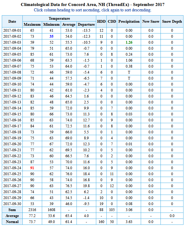
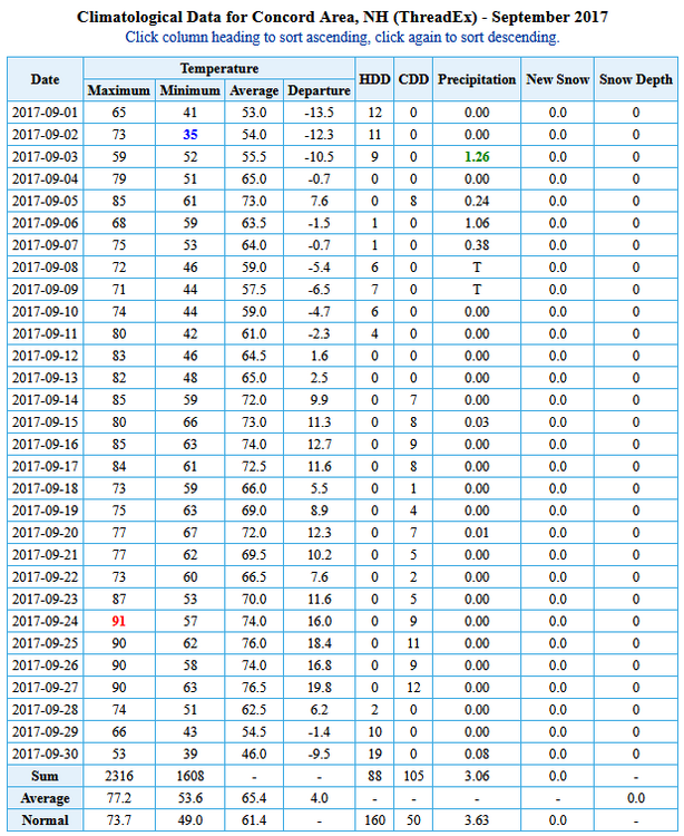
This is #3 for CON. Looks doable to me. 5 of the top 9 warmest Septembers have been since 2011.
-
There's not a lot of cold air in the extended. Climatologically I should be seeing a lot of 40s over the next 1-2 weeks and 30s by mid month. I'm just getting some July vibes with much AN mins and some torchy max temps sprinkled in.
-
Yeah...you know what CNN is insinuating with their headlines. This is just a statistical anomaly plus geometry challenged region.
-
I could see it. I was looking at the top Seps in CON and how the monthlies looked and it looks easily doable. Most of the top ones have been in the last 5-10 years too.
-
I think there’s a higher than normal chance for that…sure. Especially with torchy mins.
-
Let me guess. Neverending summer for another 2 months with no breaks. Got it.
-
Looks pretty warm overall in the extended, but there will be mild downs. We’ll sneak some late fronts in around that ridge centered way to our SW.
-
Have only needed AC a few days and they were all July. I don't quite understand the problem some have with sheets sticking to the body, but that should get checked.
-
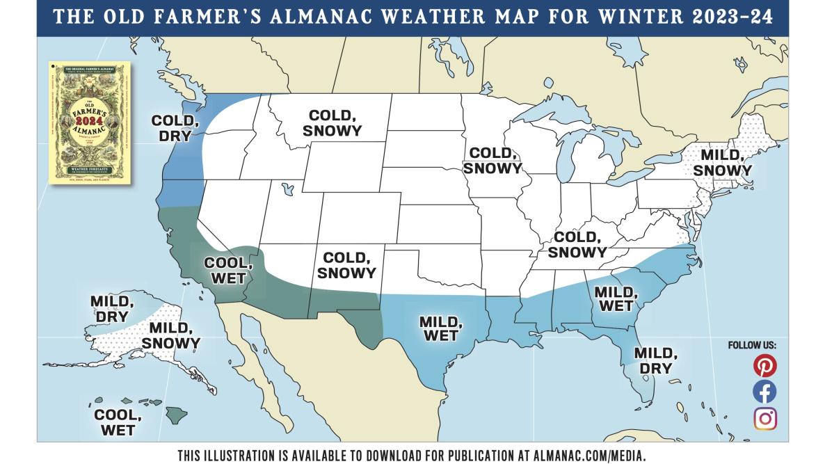
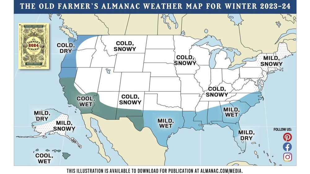
OFA winter forecast is out. lol https://www.almanac.com/winter-extended-forecast-farmers-almanac
-
Yup. It seems to struggle with that BL moisture pooling in the corn belt. It’s like it has dust bowl physics built in to the geography and all moisture just evaporates to the moon.
-
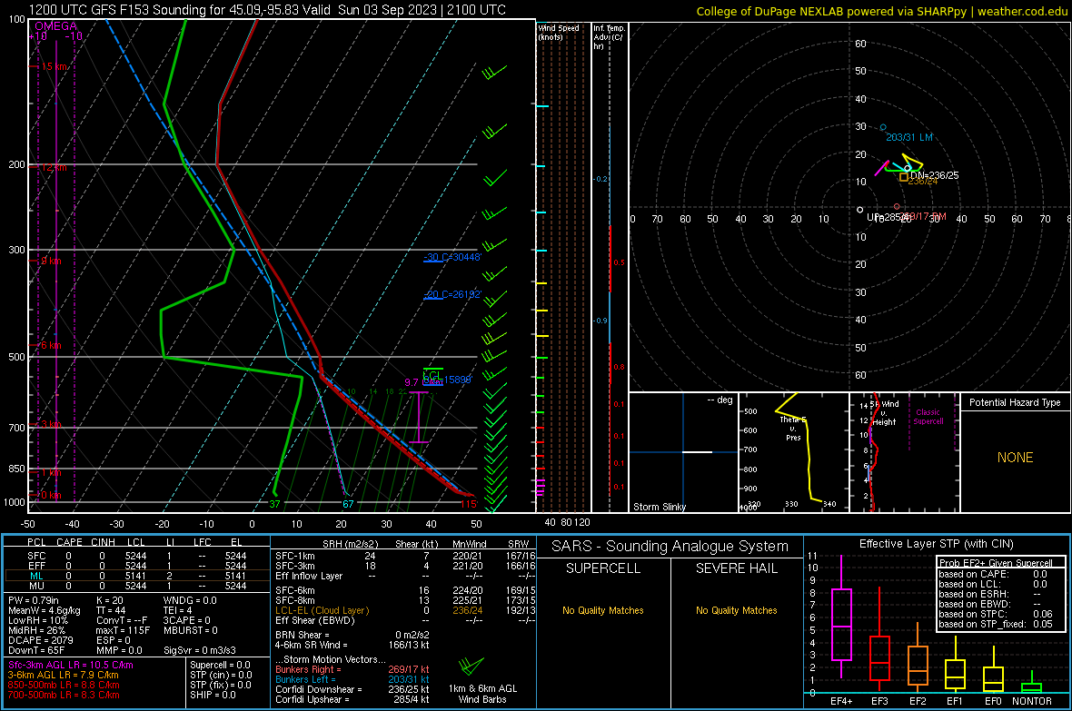
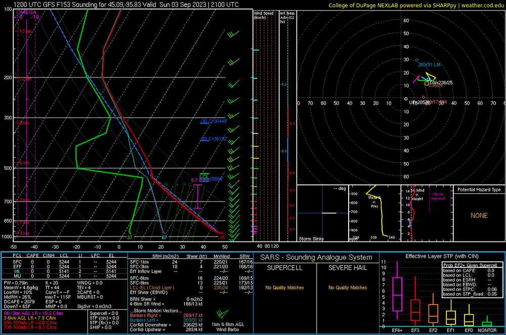
Yeah I'm not buying 115/37 at 45N in Minny on 9/3 with 32C 850s
-
And it was spitting out 30C+ at H85 there. It's been 3-5C too high with the plume where it's mixing up to H5. I'll stick with the euro numbers that are plenty warm enough.
-
Tone that down due to the overmixing
-
Thanks for the heads up
-
Congrats Cedar Key. They’re due for a biggie.
-
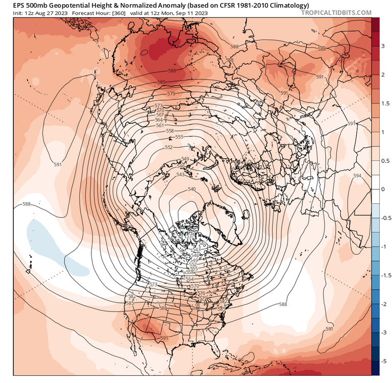
Yeah I get it...there will be more blue come verification since it's getting washed out in the means, but it's still a sign of the times that heights are biased warmer across the entire NHEM
-
Only 1 80+ here and no 90s yet. The 80s this year were Apr 2, May 2, Jun 5, Jul 19, Aug 1 19.36" so far for JJA
-
Look at all of that blue
-
Fine by me. It'll give my pawpaws more time to harden off.
-
We get more snow than Hobart. ITH normal is about 63" and Meredith COOP is about 80". Plymouth may be a hair less in the shadow zone. In winters with numerous overrunning events (SWFEs) we can really rack up the 6-10 inchers.
-
Looks more like a pig ridge centered over the TN/MS valley in much of the extended ens. Expect an occasional cold front with that.
-
Works OK with long wavelengths. Voodoo this time of year.
-
Long, cold, and dark. CAD reigns supreme. Don't expect any blockbuster events unless a deformation band somehow makes it up there and rots.
-
Looks good. Heart of the ridge where it has been with an up and down pattern averaging AN here. Perfect for September.
-
95-100 vs 110-115 is a big deal. It always looked hot up there. The problem is the overmixing. It’s been trying to paint a desert-like 115/45 out there when reality is dews verify 75-80 with near 100 temps. That’s what it’s doing again in the Great Lakes and OH Valley. So take that 110/45 and make it 98/78. Both are miserable.