dendrite
-
Posts
70,373 -
Joined
Content Type
Profiles
Blogs
Forums
American Weather
Media Demo
Store
Gallery
Everything posted by dendrite
-
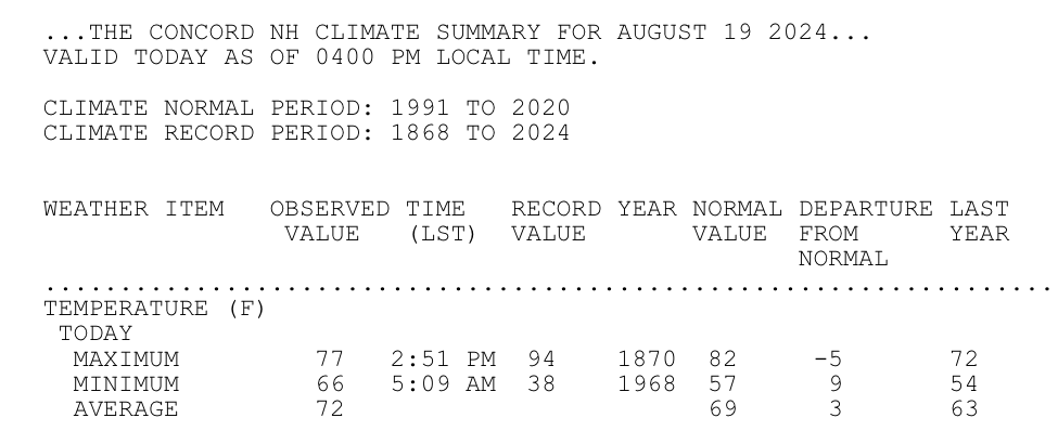
Preaching to the choir But you’re right. 47 should be about as easy to achieve at CON as 67 right now…and that’s with relatively new 30yr normals too.
-
Haven’t you had a bajillion inches of rain this warm season?
-
“Grandpa freak…tell us again about the times it used to radiate in August”
-
Low 60s for highs here the next two days. We’ve had trouble getting that cold at night.
-
Do we have any official reports yet over the state 24hr record?
-
Yeah this batch looks more stabilized…not that any rain is good right now.
-
We kid around, but man…I wouldn’t wish that on anyone. Thankfully he has cradled us all summer.
-
Weak convection is firing along the SW coast again.
-
12z yeah. 00z swiss had an inclination as well.
-
I’ve heard you have a knack for doing that.
-
Outside shot for a 20 burger?
-
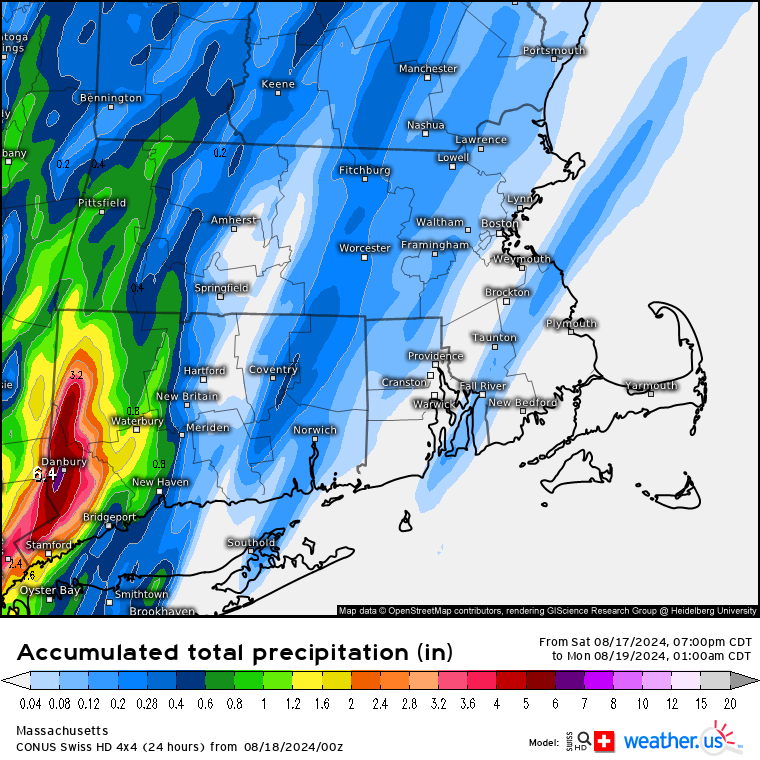
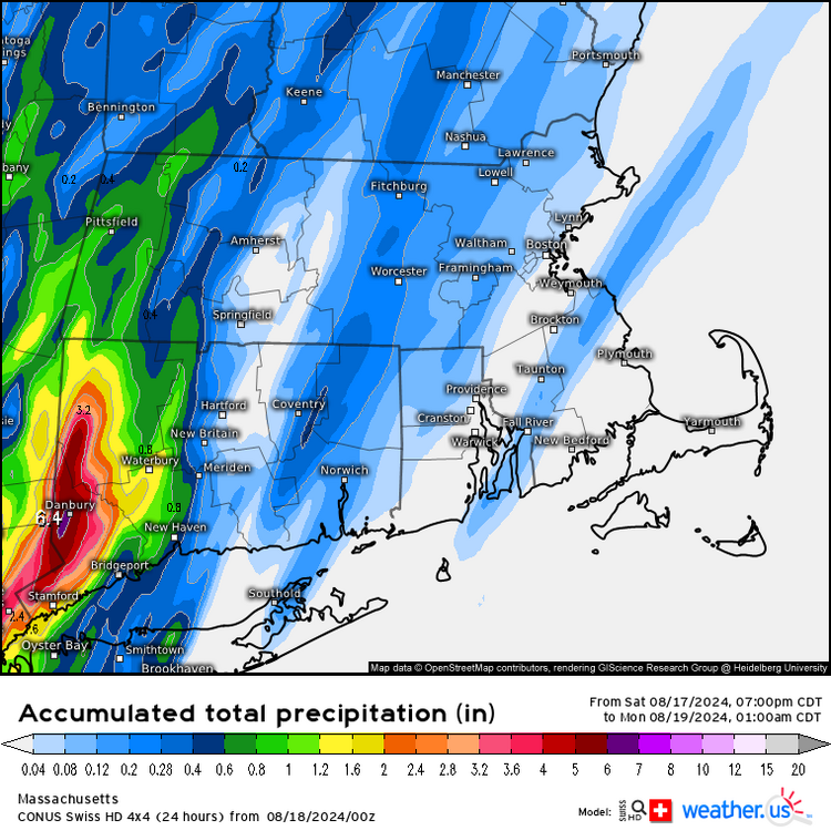
If only we had looked a little more in depth on Friday we would’ve seen a dozen towns breaking the CT 24hr precip record.
-
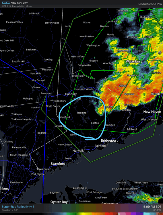
I wonder if this area will reignite soon
-
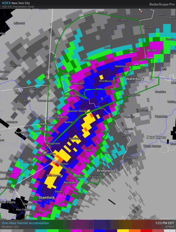
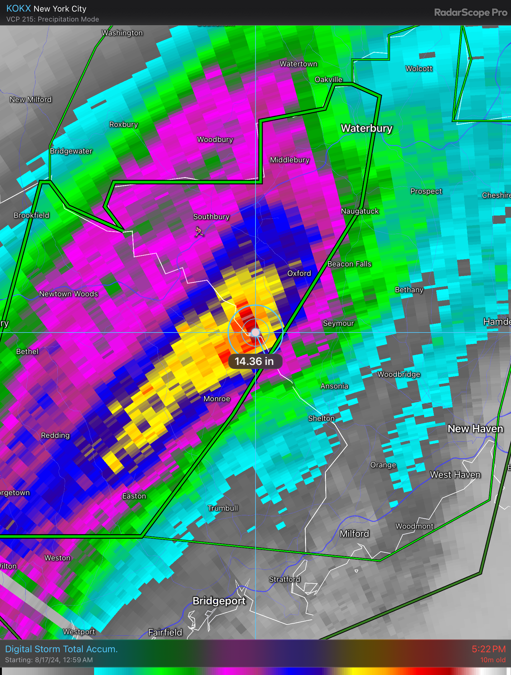
That whole yellow area is an estimated 10”+
-
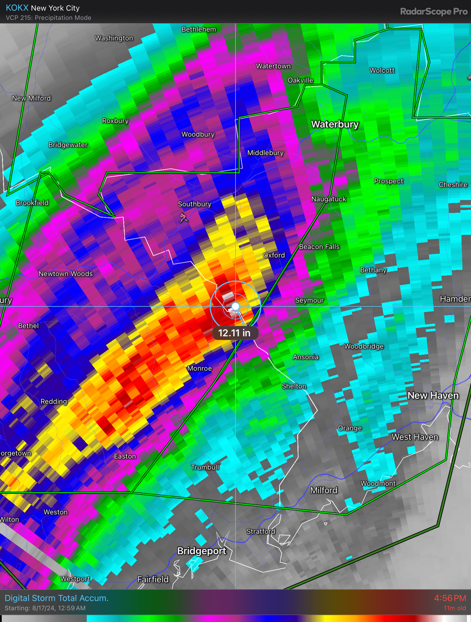
14 burger
-
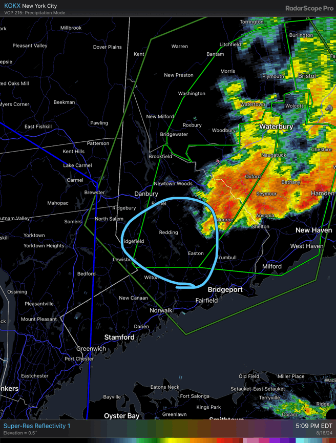
Backbuilding again. I wonder if the convection to the west can catch up.
-
Comment there says a report of a Home Depot washed out via scanner.
-
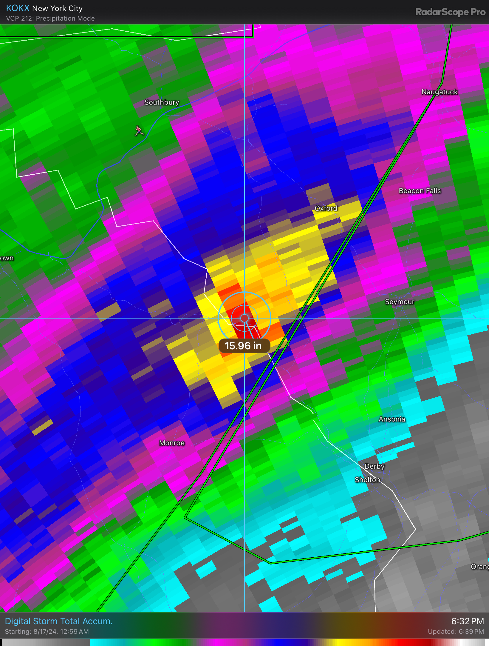
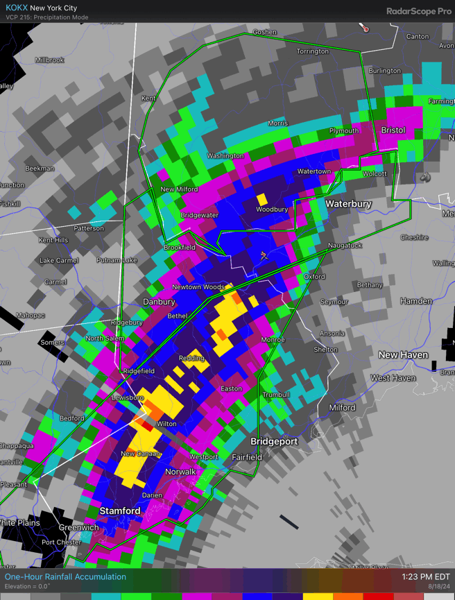
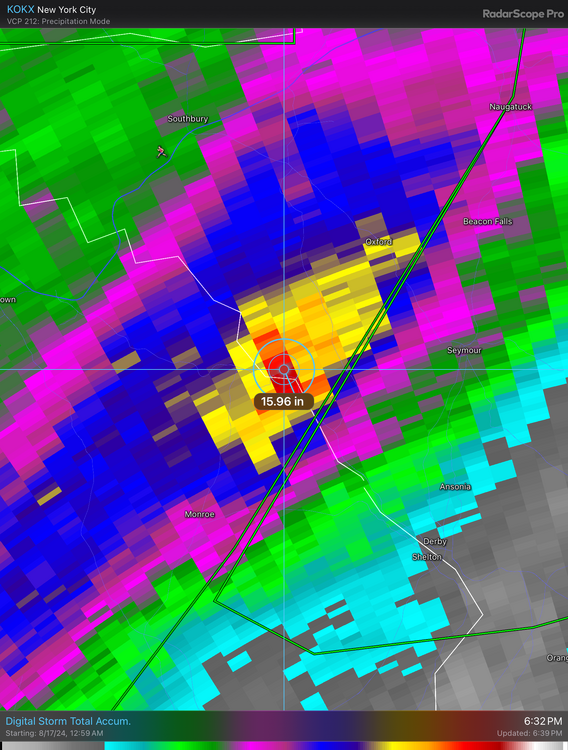
First foot pixel

-
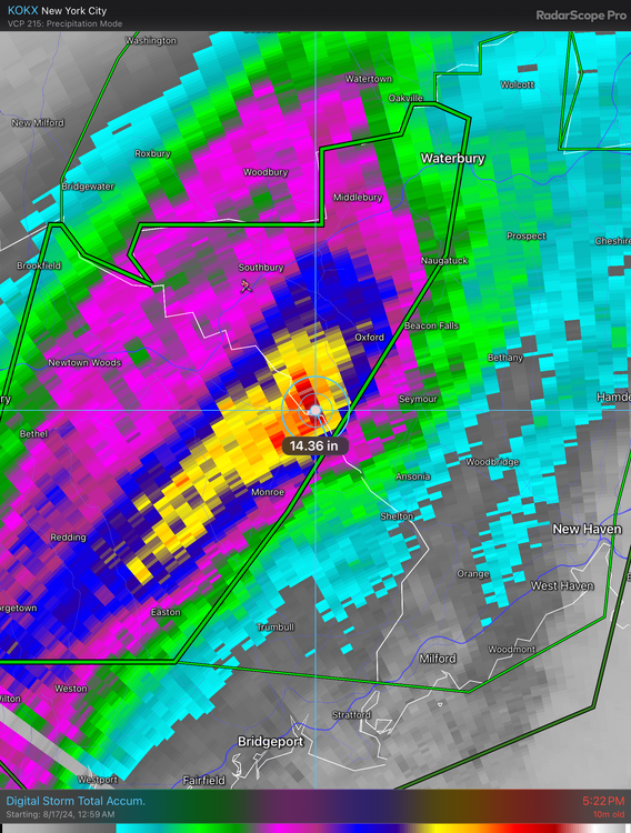
Some backbuilding again. That area from Monroe to Oxford is cooked.
-
Backbuilding again
-
Maybe more cloud condensation nuclei in the air due to the smoke too?
-
PDS for flooding in parts of CT now edit. I see it was posted
-
Parts of CT got more today than I’ve had May, June, July, and August combined.
-
The Islip event was almost exactly a decade ago. A quick foot of rain is always fun.
-
3”/hr in the red