dendrite
-
Posts
75,076 -
Joined
Content Type
Profiles
Blogs
Forums
American Weather
Media Demo
Store
Gallery
Everything posted by dendrite
-

November 2025 general discussions and probable topic derailings ...
dendrite replied to Typhoon Tip's topic in New England
Mins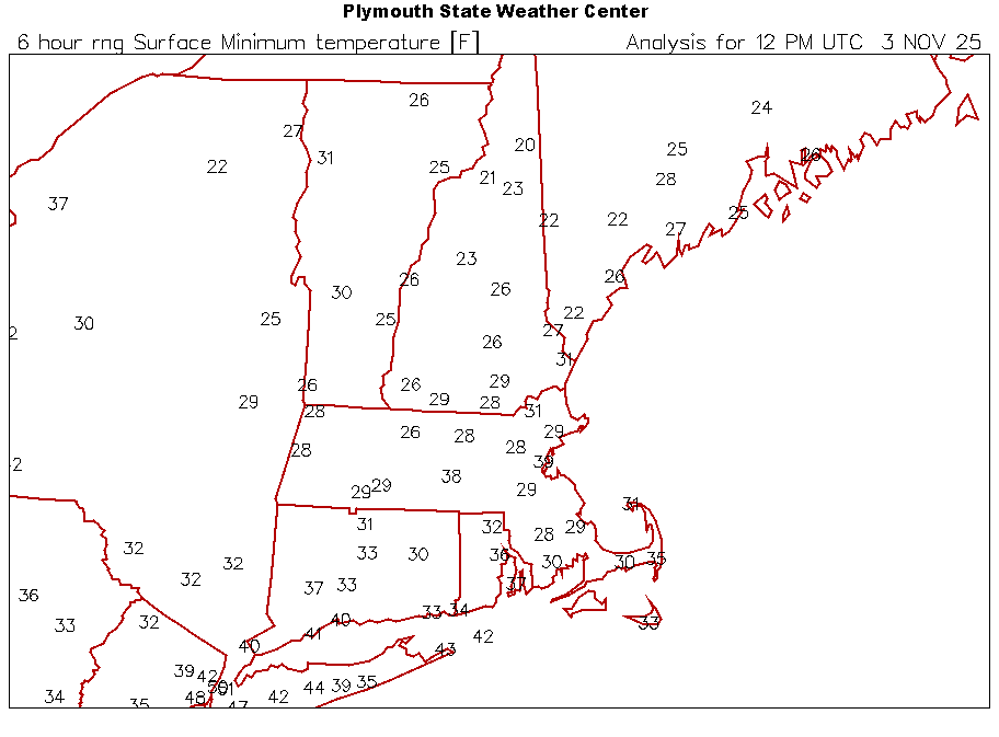
-
November 2025 general discussions and probable topic derailings ...
dendrite replied to Typhoon Tip's topic in New England
Bring the rain -
November 2025 general discussions and probable topic derailings ...
dendrite replied to Typhoon Tip's topic in New England
25.9° Coldest so far -
November 2025 general discussions and probable topic derailings ...
dendrite replied to Typhoon Tip's topic in New England
26.8° so far -
November 2025 general discussions and probable topic derailings ...
dendrite replied to Typhoon Tip's topic in New England
31.6° -
November 2025 general discussions and probable topic derailings ...
dendrite replied to Typhoon Tip's topic in New England
Jan? -
November 2025 general discussions and probable topic derailings ...
dendrite replied to Typhoon Tip's topic in New England
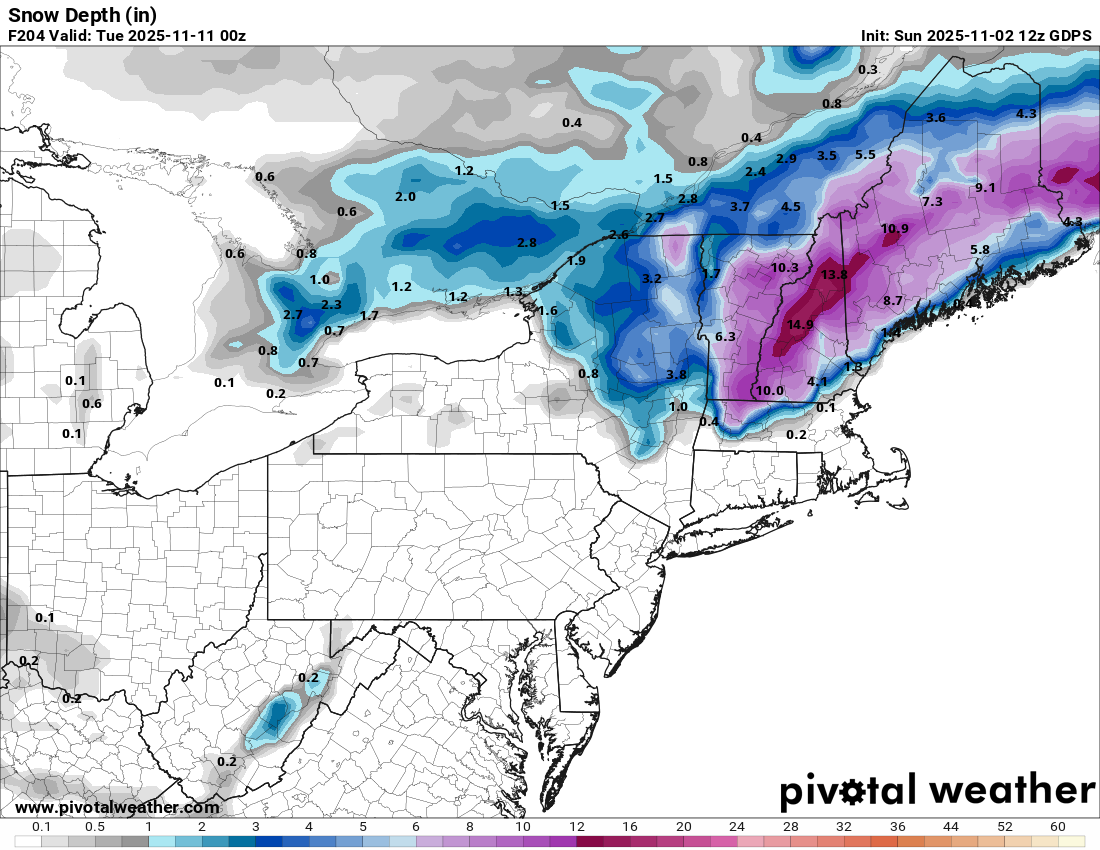
Even the modeled snow depth was lol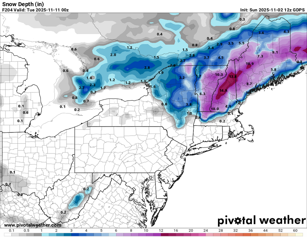
-
November 2025 general discussions and probable topic derailings ...
dendrite replied to Typhoon Tip's topic in New England
We can start cooling the warm ground earlier every night. -
November 2025 general discussions and probable topic derailings ...
dendrite replied to Typhoon Tip's topic in New England
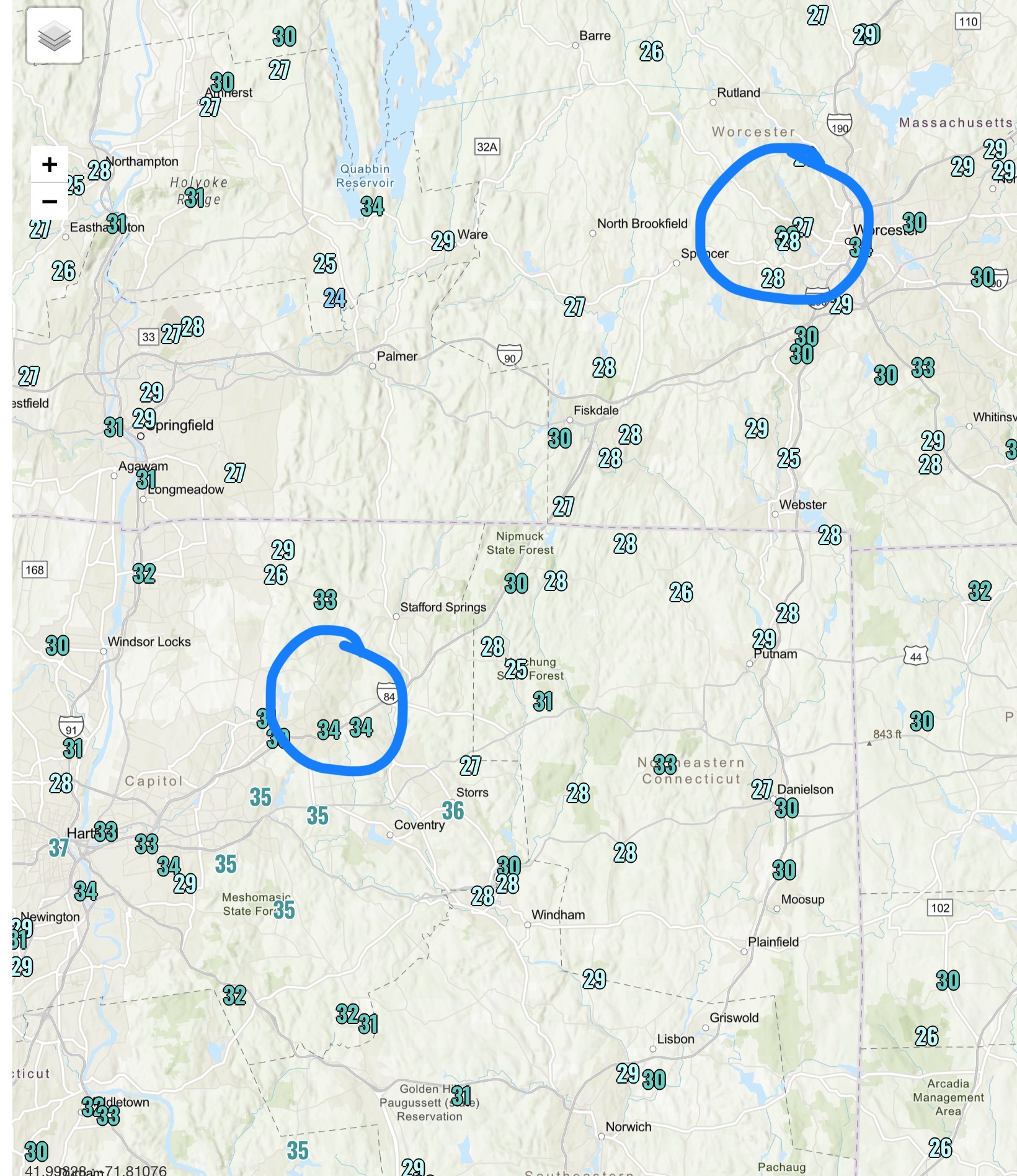
I will say the ORH one initially caught my eye too because they stayed mixed all night through morning…5-10kt. But surrounding min temps do seem to verify ORH and Tol. -
November 2025 general discussions and probable topic derailings ...
dendrite replied to Typhoon Tip's topic in New England
Looks okay to me?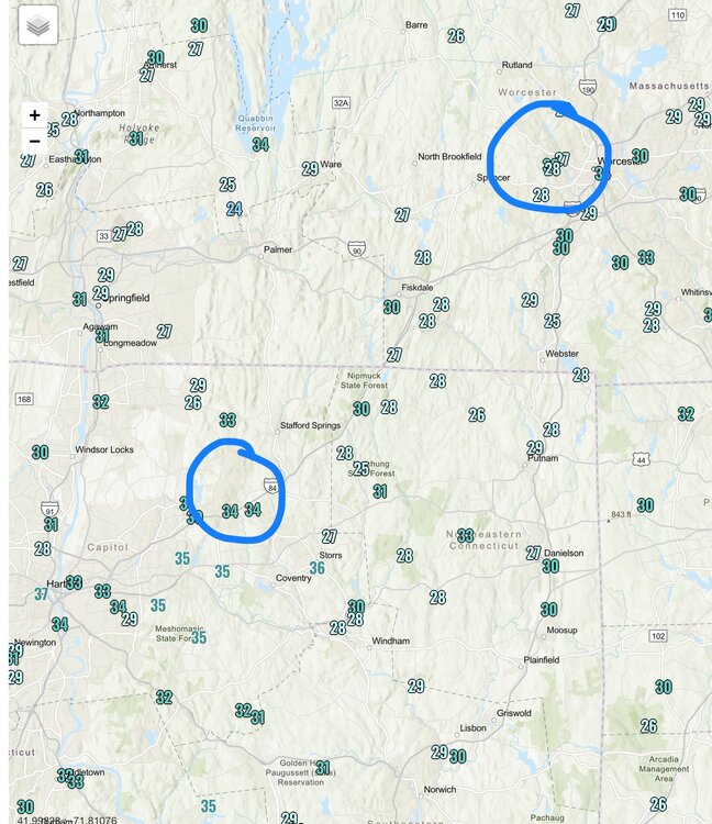
-
November 2025 general discussions and probable topic derailings ...
dendrite replied to Typhoon Tip's topic in New England
Near normal is cold? We’re starting Nov AN up here. -
November 2025 general discussions and probable topic derailings ...
dendrite replied to Typhoon Tip's topic in New England
Mins Interesting variation depending on clouds and mixing.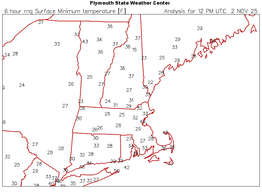
-
November 2025 general discussions and probable topic derailings ...
dendrite replied to Typhoon Tip's topic in New England
Min 31.2° Another “cool” frost on the vehicles. -
November 2025 general discussions and probable topic derailings ...
dendrite replied to Typhoon Tip's topic in New England
My parents had one…works fine. I just mow short and mulch them in though. Glad we don’t live in suburbia. -
November 2025 general discussions and probable topic derailings ...
dendrite replied to Typhoon Tip's topic in New England
Wow I have more leaves than you. -
November 2025 general discussions and probable topic derailings ...
dendrite replied to Typhoon Tip's topic in New England

-
November 2025 general discussions and probable topic derailings ...
dendrite replied to Typhoon Tip's topic in New England
In Hubbardston? We’re talking just flakes…not accums. It’s definitely usually Oct or early Nov. -
November 2025 general discussions and probable topic derailings ...
dendrite replied to Typhoon Tip's topic in New England
1st world problems right there -
November 2025 general discussions and probable topic derailings ...
dendrite replied to Typhoon Tip's topic in New England
No vember. -
Spooky Season (October Disco Thread)
dendrite replied to Prismshine Productions's topic in New England
I saw ORH was still gusting over 40. CON hasn’t hit a 30mph since midnight. -
Spooky Season (October Disco Thread)
dendrite replied to Prismshine Productions's topic in New England
Definitely windier down there. It’s been breezy, but run of the mill up here. -
Spooky Season (October Disco Thread)
dendrite replied to Prismshine Productions's topic in New England
Mitch is down to 33.5° Must be snowing there. -
Spooky Season (October Disco Thread)
dendrite replied to Prismshine Productions's topic in New England
ORH 44…meh Looks like mostly 30s and 40s for gusts except higher SE MA. ACK just hit 61. -
Spooky Season (October Disco Thread)
dendrite replied to Prismshine Productions's topic in New England
I don’t mind being a little hot or a little cool at times. I don’t need to live in a 68-72 window or otherwise feel like I’m suffering. But yeah, if I’m overly uncomfortable and the forecast for the day isn’t going to help raise the temp inside, I’m going to turn the stove on for a bit. -
Spooky Season (October Disco Thread)
dendrite replied to Prismshine Productions's topic in New England
Just let the gusts blow them to the woods.