dendrite
-
Posts
66,758 -
Joined
Content Type
Profiles
Blogs
Forums
American Weather
Media Demo
Store
Gallery
Everything posted by dendrite
-
+++SN
-
Snow squall in progress
-
 We haven’t had the powderfreak jack run yet though
 -
Looks like it’s leaving a little drip over Tolland
-
Every dog has (had) its day. Even the no good model left us some valuable MOS for awhile.
-
Dude, we used to analyze the dgex and srefs here.
-
Yeah kinda meh and warm south of the Pike until that next vort catches up and then it's a nice happy ending into SNE.
-
Listen to Oldies 103 for a couple weeks.
-
2nd verse same as the 1st?
-
Heavy, heavy reverse psychology this morning. We aren’t falling for it.
-
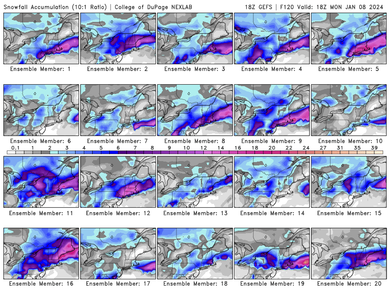
Interesting trends overnight.
-
Still a wide range of results.
-
I have to do the same exact thing later this week. Take care of yourself too. My dad just got out of the hospital today after a battle with covid…finally out of the hospital in 2024.
-
I’m coming over
-
I’m feeling ready to steal this
-
Is that mekster before the face reveal?
-
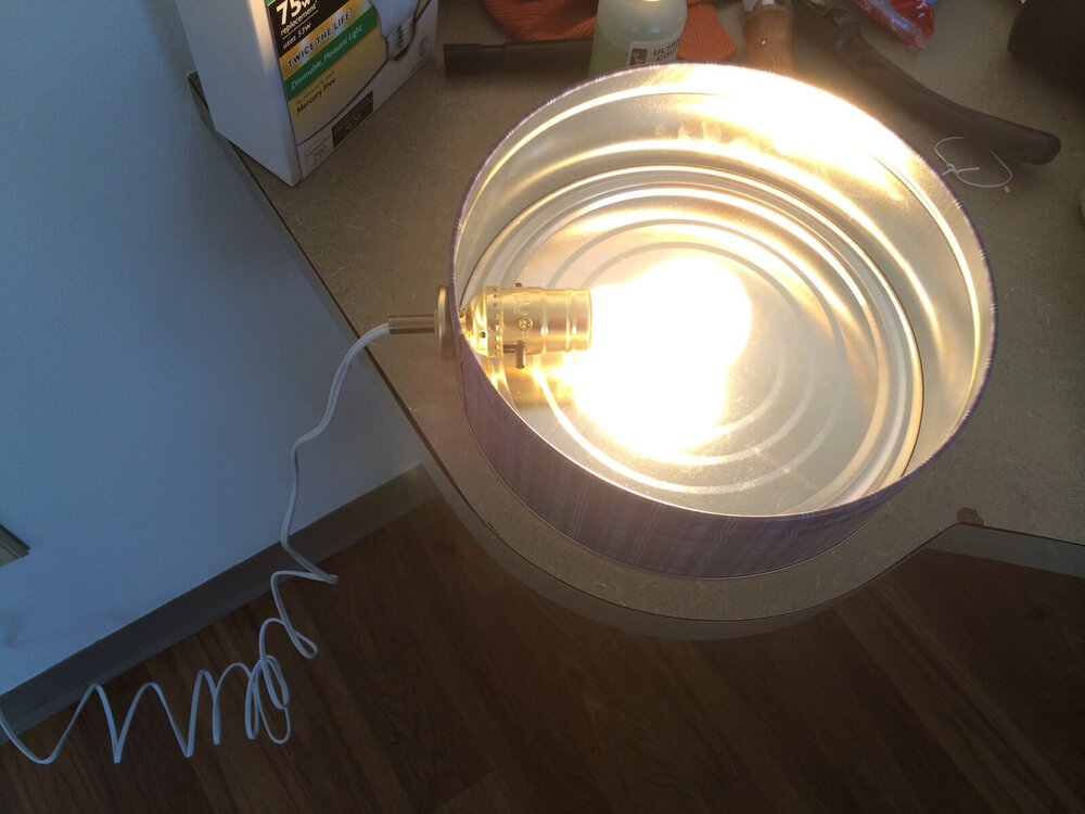
I made my own cheap cookie tin heater. One round cookie tin, a lamp repair kit from the box store, and a lower wattage skinnier bulb (25-40W).
-
who are you?
-
I was going to say...that may be all frozen here until the dryslot aloft.
-
SWFEGW
-
NYC 0.9" 0.9" LGA 1.1" 1.6" JFK 1.0" 0.5"
-
There's the disingenuous NYC 1" stat again
-
And I'm not even sure I'd trust that to survive with the big dog digging in on its heels.