dendrite
-
Posts
66,871 -
Joined
Content Type
Profiles
Blogs
Forums
American Weather
Media Demo
Store
Gallery
Everything posted by dendrite
-
It’s ok. He deserved it for calling me old AF.
-
There were wild differences in elevation last night. Anyone getting a puff of wind stayed mixed. The Peter Sinkses of New England plummeted. 25° on Mt Lafayette right now but a little north at HIE they hit -15°. My hill was 16° at the top on the car thermo and the bottom was single digits. It’s not a good morning to judge thermometer accuracy.
-
Hopefully the euro is more right than the gfs. Frequent brutal cold shots on the goofus knifing in late repeatedly. OJ pattern.
-
Euro pulls the low out early Friday. It’s a DSD.

-
Just looked at my Davis app. You know an airmass is fake when Shabbs is colder than DIT, Gene, and Mitch.
-
00z euro still had them
-
Bouncing around 10F here with the SW return flow. Lots of fake cold in SNE.
-
Yeah thank god we froze our asses off all week for the sake of the pond ice
-

It was a Flop... February 2024 Disco. Thread
dendrite replied to Prismshine Productions's topic in New England
He comin
-
Lots of pretty colors aloft. We’ll see how that looks at the surface come verification time. The GFS looks wet and miserable. Hopefully it’s wrong. GEFS are definitely much warmer.
-
Man that is an ugly, cold wedge up here on Wednesday on the gfs and euro. Ugh.
-
Hudson Bay vibe here
-
Almost every record low min for PVD from the winter solstice through the end of February is below zero. Single digit highs have always been a lot more rare. PVD only has 9 January max temps of below 10°F in their history.
-
At quick glance I count 40 record low maxes and 28 record low mins for PVD in the 2000s.
-
No way. It’s the other way around for the majority of sites.
-
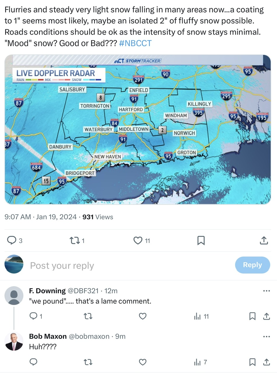
Hopefully everyone is staying safe tonight. Today was climatologically the lowest normal daily max temp for CON annually. It’s all up from here until July. Currently 11° with flurries.
-
That’s a nice cherry picked 354hr image. That map will change anyway after Phil doesn’t see his shadow.
-
12° with flurries Torch
-
4° and breezy. Let’s get that warmup in here.
-
Still no ice-in on Winni https://www.wmur.com/article/lake-winnipesaukee-not-fully-frozen-ice-in/46455533
-
Wtf? Did you reply to him and get your comment deleted?

-
I think the real transition day is Monday. The rad pits will probably be 0° or below Monday morning while the hills are mixed and around +10°. Then we warm up well into the 30s.
-
Thankfully this system went south. I’ve had too much snow lately…need a break.
-
7.8°