

dendrite
-
Posts
66,871 -
Joined
Content Type
Profiles
Blogs
Forums
American Weather
Media Demo
Store
Gallery
Everything posted by dendrite
-
 Yeah…kind of a lackluster run.
 -
33.5 and ripping monster aggregates right now
-
Sun comes out for 5 mins. Temp climbs from 38 to 40. Goes overcast again. Temp drops back to 38. It’s Saturday…I’m not worried about a little diabatic warming. Let’s talk 2m temps tomorrow afternoon when we can actually see what BL wetbulbs advected down to.
-
Has a higher terrain, rt2-north jack look to it. Basically where the euro has the track of the H7 low and just north of it…then adjust for elevation/coastal temp influence.
-
Better on the front end in SNE on the ICON
-
Doesn’t seem too far off from guidance so far. We’re getting some CAA aloft today so that may help dry it out and warm it up into the U30s. Pop a break or 2 and we hit some low 40s. It won’t mean much for the snow Sun night into Mon.
-
The correctional vector points to Hubbardston.
-
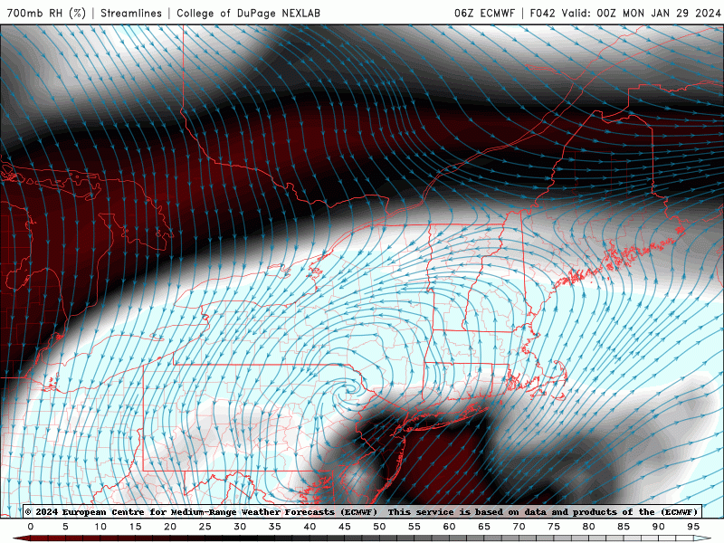
3k delivering the midlevel goods up here. Looks pretty slotty and showery in SNE after the initial weak WAA.
-
HRRR is really marginal down there. Watch out with the ptype intensity maps too because it will simulate very high reflectivities with wet snow/white rain. It’s painting 40dbz snow in spots with 34-36° 2m temps.
-
He was suspended for 4 storms for inflategate
-
If I lived in DC I would never uninstall.
-
And to be fair a forecast of 6” in Hubbardston usually results in 12+.
-
Dude…Franklin closed up here today for ZR and all we got was a few tenths of sleet.
-
Pretty good run for interior MA/S NH there.
-
It was a Flop... February 2024 Disco. Thread
dendrite replied to Prismshine Productions's topic in New England
Let’s not get too cocky yet. Even though the huge positive anomalies will be in the northern plains this could still break in a way where we end up AN. -
We’ve had our share of snow, but I can’t recall this many days of significant winter rain like this before. Sucks.
-
Read the thread
-
It was a Flop... February 2024 Disco. Thread
dendrite replied to Prismshine Productions's topic in New England
Kidding aside…if you want an exotic system an exotic upper level pattern like that helps. -
I’m around 34”. I’ll pretty much be there after Monday.
-
Until now DCA had no 80s in the record period between 11/18 and 2/21.
-
Yup…IAD 78/79 too. So all time monthly records everywhere now.
-
Jfc wxbell has the icon hourly? lol
-
Probably wouldn’t be a record even for the date if they had a longer record history, but it’s impressive nonetheless.
-
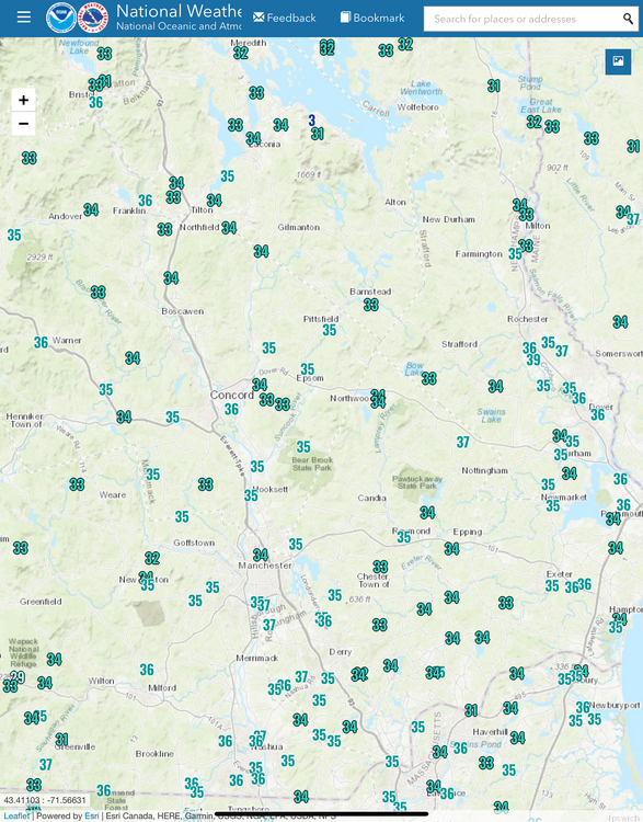
33° -RADZ 0.4” final snow/sleet. It’s a raw mess out there.
-
32.3° Mixing snow in again…50/50 snow/sleet


