dendrite
-
Posts
66,813 -
Joined
Content Type
Profiles
Blogs
Forums
American Weather
Media Demo
Store
Gallery
Everything posted by dendrite
-

Saturday February 16th - Another CT/ Cape special?
dendrite replied to Sey-Mour Snow's topic in New England

-
It was a Flop... February 2024 Disco. Thread
dendrite replied to Prismshine Productions's topic in New England
Lots of moisture in fresh dog excrement. -
Ray had to go and make the thread already.

-
Saturday February 16th - Another CT/ Cape special?
dendrite replied to Sey-Mour Snow's topic in New England
Lousy growth here, but I didn’t expect the steady -SN either. It’s all coated up again much to my chagrin. Maybe a couple tenths? -
It was a Flop... February 2024 Disco. Thread
dendrite replied to Prismshine Productions's topic in New England
What do we need to do to eliminate that damn Labrador current? Dissolve Cape Cod into the Atlantic? Maybe Hatteras too? -
It was a Flop... February 2024 Disco. Thread
dendrite replied to Prismshine Productions's topic in New England
Well, they’ll keep verifying at H5 in April, but not at the surface. It’s almost time for that 3 month period from 3/15-6/15 of 45-60F every day. -
It was a Flop... February 2024 Disco. Thread
dendrite replied to Prismshine Productions's topic in New England
At least the 360hr warm maps verify -
Saturday February 16th - Another CT/ Cape special?
dendrite replied to Sey-Mour Snow's topic in New England
Was he trying to breastfeed? -
Saturday February 16th - Another CT/ Cape special?
dendrite replied to Sey-Mour Snow's topic in New England
This is the way. Have you been up to CH this winter? It’s probably been meh up there the past couple of weeks with mostly old stale snow, but January wasn’t bad. -
Saturday February 16th - Another CT/ Cape special?
dendrite replied to Sey-Mour Snow's topic in New England
I’m glad we were able to suppress the pattern to get people south of us involved. Now we can miss in all directions. But hey, at least it isn’t more rain. -
It was a Flop... February 2024 Disco. Thread
dendrite replied to Prismshine Productions's topic in New England
We did okay here yesterday
-
Saturday February 16th - Another CT/ Cape special?
dendrite replied to Sey-Mour Snow's topic in New England
21.9° with light snizzle. Way more than I expected. -
It was a Flop... February 2024 Disco. Thread
dendrite replied to Prismshine Productions's topic in New England
I slept 2hrs. Failed exhaust fan on the pellet stove ftl. -
It was a Flop... February 2024 Disco. Thread
dendrite replied to Prismshine Productions's topic in New England
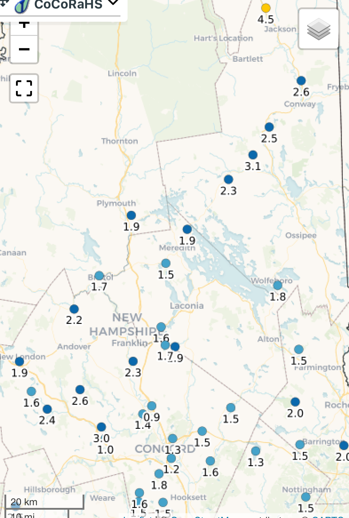
2.1”/0.12” so far. Mostly clear now. -
It was a Flop... February 2024 Disco. Thread
dendrite replied to Prismshine Productions's topic in New England
+SHSN Looks like the meat of a deform band right now. Shouldn’t last long though. -
It was a Flop... February 2024 Disco. Thread
dendrite replied to Prismshine Productions's topic in New England
Dumping pretty good in a squall right now. 26.8° Will measure in a few -
It was a Flop... February 2024 Disco. Thread
dendrite replied to Prismshine Productions's topic in New England
25.6° -SN 1.4” -
The current 798hr CFS ends on the 1st day of spring.
-
It was a Flop... February 2024 Disco. Thread
dendrite replied to Prismshine Productions's topic in New England
8/2/75 -
It was a Flop... February 2024 Disco. Thread
dendrite replied to Prismshine Productions's topic in New England
Pot kettle black. It was loosely CC. Sorry you didn’t like a few posts discussing summer heat events. I’ll remember this when you mention snow in any JJA thread. -
It was a Flop... February 2024 Disco. Thread
dendrite replied to Prismshine Productions's topic in New England
I decided it’s on topic. -
It was a Flop... February 2024 Disco. Thread
dendrite replied to Prismshine Productions's topic in New England
It’s funny how we regularly pull 97-100 no problem, but we’ve really only managed to blow through that once regionally since Jul 95 (Jul 2011). -
It was a Flop... February 2024 Disco. Thread
dendrite replied to Prismshine Productions's topic in New England
Yeah I know Hot Saturday was humid, but some of those sling psychrometers were juiced back then. I know ASOS has its issues, but at least all of the sites are on the same automated playing field today. -
It was a Flop... February 2024 Disco. Thread
dendrite replied to Prismshine Productions's topic in New England
I guess it depends on how you define “extreme” wrt storms. If we’re talking the amount of precipitation, sure. If we’re talking temp gradients, pressure gradients, wind, min slp, etc…I don’t know about that. -
It was a Flop... February 2024 Disco. Thread
dendrite replied to Prismshine Productions's topic in New England
Yeah I think we’re less extreme than we used to be. We have a lot more moisture in our airmasses the past 2 decades and thermodynamically that limits the heating and cooling potential of the airmass. We torch way more on mins than max temps. With the arctic warming faster that should make for shorter wavelengths and less meridional patterns too. It may be different in dry/drought areas, but in the northeast I think temps are less extreme.