dendrite
-
Posts
75,091 -
Joined
Content Type
Profiles
Blogs
Forums
American Weather
Media Demo
Store
Gallery
Everything posted by dendrite
-
 The correctional vector always points away from Tolland in the summer, but toward it in the winter. Funny how that happens.
 -
AWOS is pretty bad…especially when Tds start getting up near 70°. Then it seems like they start going up 2° for every 1° reality as they get oversaturated. It gets easy to pick out the ASOS and AWOS stations in IA when they get one of their big summer corn field dewpoint pooling events. ASOS ends up 25-27C and then AWOS is in that 31-32C area. It’s funny seeing 92/89 obs in the afternoon. I remember that JFK day and that it was a high dew day overall. Lots of 77-79 readings and spotty 80+ in the late afternoon down the coast of NJ/DE. JFK was in line with 77-78 most of the day and then had a couple of hours get into the low 80s…82 and 84 on the hourlies IIRC. The temp went down briefly before a slight rebound before evening. There were some TCu around too with the breezy S flow off the water. Maybe a little evap cooling putting a little extra moisture in the air? Not sure. But I’ve seen spikes like that from manned stations pre-ASOS days too with temp recovery after showers/storms.
-
Enjoy it man. Happy for you.
-
Need to get some of that up here. This will hurt. Congrats Ditty on 5+
-
COC
-
"Only" 105F Sad
-
SREFs?
-
Damn ACY may have tied their all time all time of 106
-
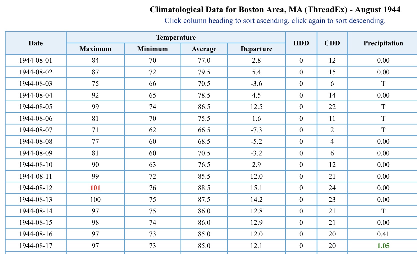
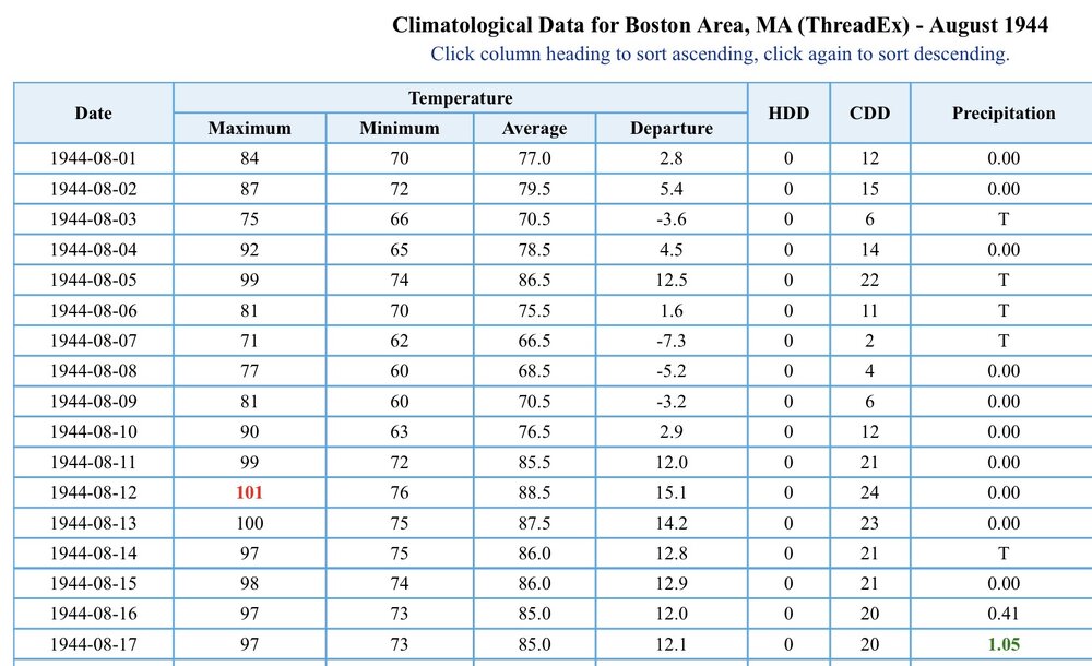
Aug 1944 What a stretch
-
BOS 100 back to back
-
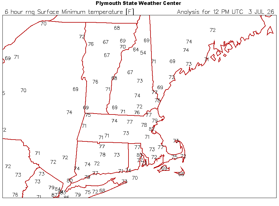
Refreshed…it’s all the sites mesowest has. ASOS includes the 5 min data. https://www.weather.gov/wrh/hazards?&zoom=9&scroll_zoom=false¢er=43.329173667843904,-71.68579101562501&boundaries=false,false,false,false,false,false,false,false,false,false,false,false,false&tab=observation&obs=true&obs_type=air_temp&obs_popup=false&obs_density=10&obs_provider=ALL
-
MHT 92/64 and NW 20G27mph Definitely better mixing today
-
Much stronger WNW flow up here this morning. I feel like S NH will outdo yesterday.
-
Mins. The mornings we dream of.
-
Imagine her gypsy phobia.
-
Celebrating the nation’s birthday like they did in 1911.
-
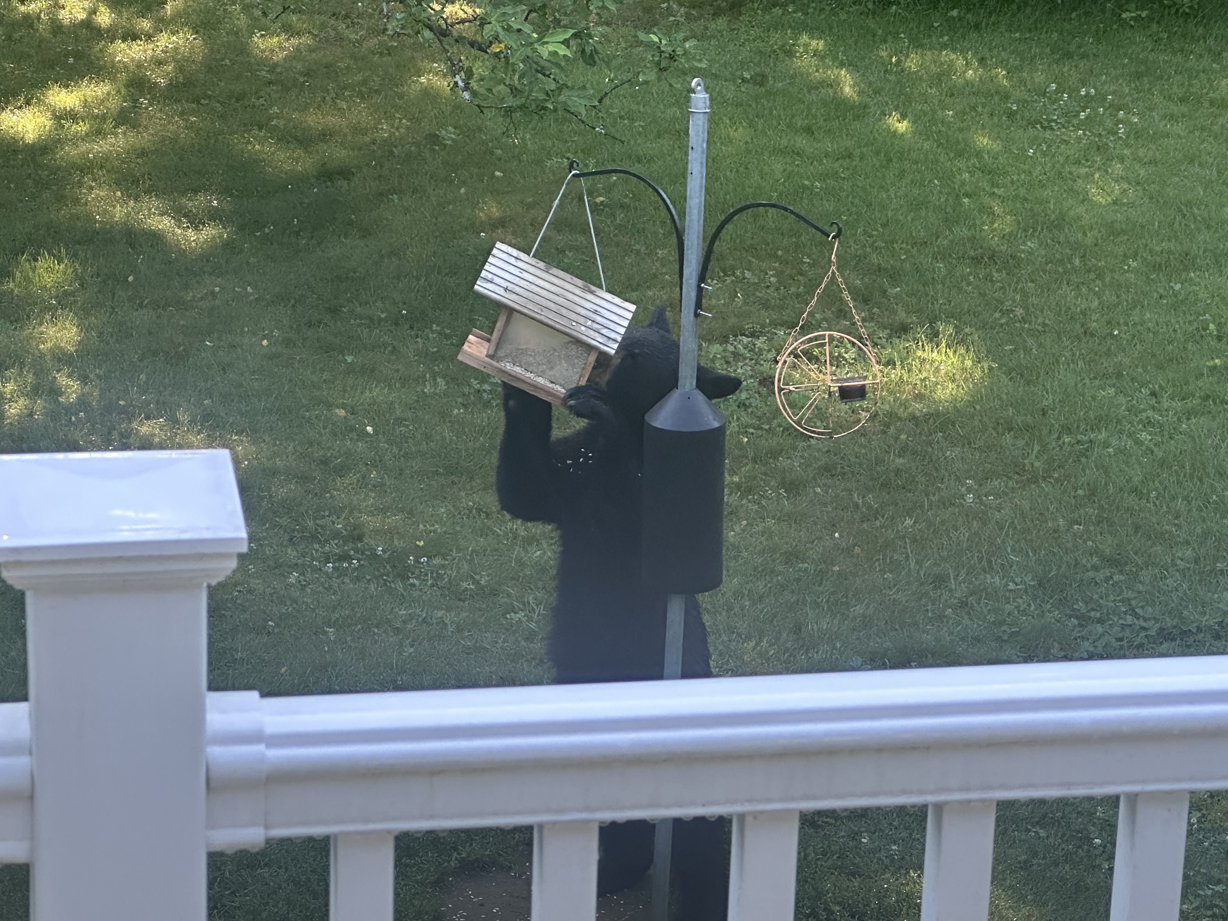
We bear Little one

- 102 replies
-
- 10
-

-
Hopefully one of those concrete pits has a min of 90° in my lifetime. We’re getting closer

-
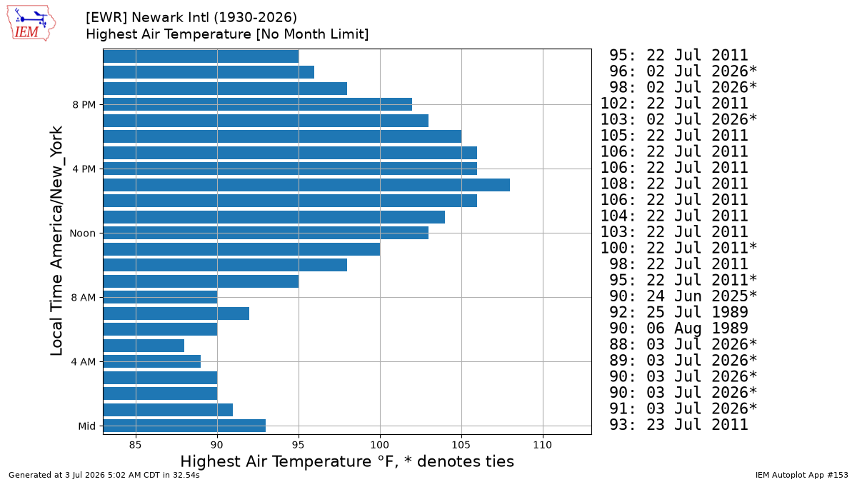
EWR 88
-
69.4°
-
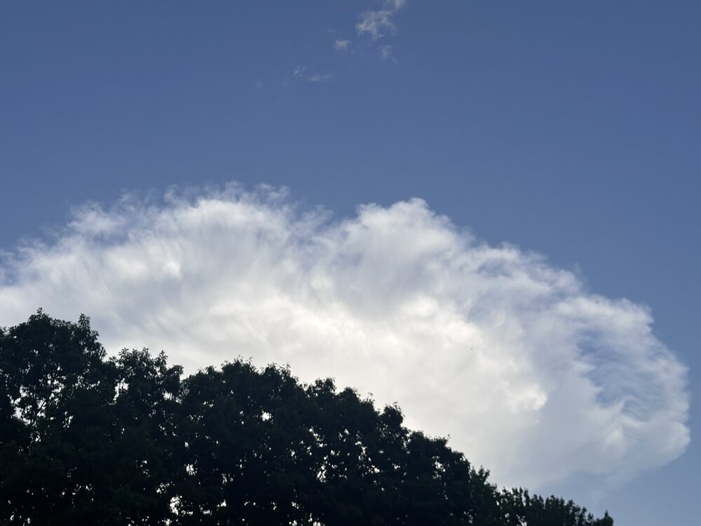
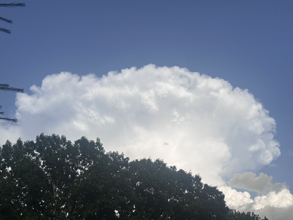
Anvil is collapsing a bit
-
Looking SE
-
I smoke 2 joints at 12z, I smoke 2 joints at night I smoke 2 joints when scooping poop, it makes me feel alright I smoke 2 joints when viewing charts, and 2 when viewing tors I smoke 2 joints before I smoke 2 joints, and then I smoke 2 more
-
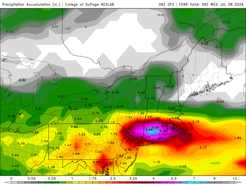
0.12" 77/76 and swampy now
-
Got it...so it can drift either way Didn't we accuse ORH relatively recently of being too cold?