SACRUS
-
Posts
12,325 -
Joined
-
Last visited
Content Type
Profiles
Blogs
Forums
American Weather
Media Demo
Store
Gallery
Everything posted by SACRUS
-
December 2020 General Discussions & Observations Thread
SACRUS replied to bluewave's topic in New York City Metro
Nice view of the snowpack http://synoptic.envsci.rutgers.edu/site/imgs/vis_nj_anim.gif -
December 2020 General Discussions & Observations Thread
SACRUS replied to bluewave's topic in New York City Metro
ECM has 850 temps peaking of >9c on a southerly flow Christmas eve then -10C by Christmas late evening. http://img.meteocentre.com/models/ecmwf_amer_qc_00/TT_UU_VV_168_0850.gif http://img.meteocentre.com/models/ecmwf_amer_qc_00/TT_UU_VV_192_0850.gif -
December 2020 General Discussions & Observations Thread
SACRUS replied to bluewave's topic in New York City Metro
I have been watching the Christmas eve warmth to artctic front rain, temps crash to heavy snow for a period on Christmas early morning threat and believe it is time to track. Could be a wild swing. 60 on the eve and lows in the teens Christmas and boxing day, possible -
Yeah a decade hasnt aged these links well. Was a good place for live loops. Now the site has cache issues too.
-
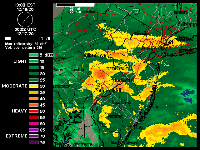
December 16-17, 2020 Storm Observations and Nowcast
SACRUS replied to wdrag's topic in New York City Metro
Pardon if i missed it but does anyone know the final totals from NYC EWR LGA TTN PHL -
December 2020 General Discussions & Observations Thread
SACRUS replied to bluewave's topic in New York City Metro
Just about 7 - 7.5 here and some light snow falling Still could envision a 12/24 in the 50s with front coming through late evening and overnight with rain followed by crashing temps on Christmas early morning and some snow squals or showers and then Christmas very cold. Seems a bit back and forth beyond Christmas to end the year much warmer again by 12/28. -
26/25 mod snow / 4.5 - 5 on the ground.
-
25/24 3.2 inches on the ground
-
28/28 mod to hvy snow 2.3 on the ground
-
27/26 here mod snow 1.5 so far
-
Assume the sleet/mix to near Phil
-
30/25 light /mod snow here coating on grass CNJ
-
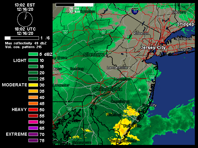
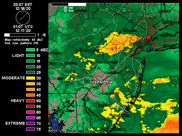
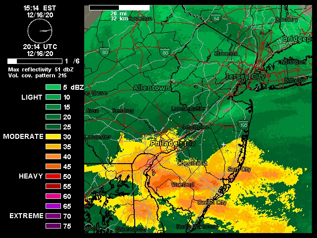
December 16-17, 2020 Storm Observations and Nowcast
SACRUS replied to wdrag's topic in New York City Metro

- 1,011 replies
-
- 1
-

-
- heavy snow
- sleet
- (and 4 more)
-
December 2020 General Discussions & Observations Thread
SACRUS replied to bluewave's topic in New York City Metro
Still would watch strong front Christmas eve into Christmas , kind that can go from 50s and rain to temp crash and heavy snow as front moves through. Looks very cold Christmas - 12/28 before we warm back up. -
Kind of 3 parts looking likely for N/C-NJ and NYC/NE-NJ Snow arrives between 3 and 5 PM - midnight : 3 - 5 inches Mix with sleet between 10PM and 3/4AM : 1 - 3 inches pending on sleet duration and mix 4Am - 11AM : back to snow and perhaps best part of the storm wind whipped powedery snow: 3 - 5 inches (local spots could get more under good banding) 7 - 13 inches (EWR/NYC) 7
- 3,762 replies
-
- 1
-

-
- heavy snow
- heavy rain
- (and 3 more)
-
December 2020 General Discussions & Observations Thread
SACRUS replied to bluewave's topic in New York City Metro
we'll likely go from a very warm 12/22-24 then strong arctic front Christmas timeframe. Wonder if there is some rain - temps crash and some snow at the end. 12/25 - 28 looks cold then warming up to end the year? -
UKIE 40MM / 1.55" looks mostly snow nyc /winds strong too http://img.meteocentre.com/models/ukmet_amer_00/PN_D5_TS_TT_P1_UV_UU_VV_METE_1000_NewYork.png
- 3,762 replies
-
- 2
-
-

-
- heavy snow
- heavy rain
- (and 3 more)
-
Yes still kicking around. Back in town from winter abode.
-
looking like a start time of between 3 and 6pm Wed and ends by noonish on Thursday. Best rates and heaviest bands 10PM - 4Am. QPF : 1.15 - 1.45 = 8 - 14 inches looks like a good bet north of Freehold into Newark / NYC
- 3,762 replies
-
- 1
-
-
- heavy snow
- heavy rain
- (and 3 more)
-
December 2020 General Discussions & Observations Thread
SACRUS replied to bluewave's topic in New York City Metro
Nice image