

SACRUS
-
Posts
13,049 -
Joined
-
Last visited
Content Type
Profiles
Blogs
Forums
American Weather
Media Demo
Store
Gallery
Posts posted by SACRUS
-
-
7/23
EWR: 93
TEB: 89
LGA: 88
New Brnswck: 88
ACY: 88
NYC: 88
PHL: 88
BLM: 87
ISP: 87
TTN: 87
JFK: 86 -
On 4/26/2011 at 9:17 AM, SACRUS said:
2023:
PHL: 11 (Apr: ; May: ; Jun: 1 ; Jul: 10 ; Aug: ; Sep: )
EWR: 14 (Apr: 2 ; May: 1 ; Jun: 1 ; Jul: 10; Aug: ; Sep: )
TTN: 6 (Apr: ; May: ; Jun: 1 ; Jul: 5 ; Aug: ; Sep: )
LGA: 8 (Apr: 0 ; May: ; Jun: 1; Jul : 7 ; Aug: ; Sep: )
ACY: 2 (Apr: ; May: ; Jun: ; Jul: 2; Aug: ; Sep: )
TEB: 12 (Apr: 2 ; May: ; Jun : 1 ; Jul: 9 ; Aug: ; Sep: )
NYC: 6 (Apr: 2 ; May: ; Jun: 1 ; Jul: 3 ; Aug: ; Sep: )
JFK: 1 (Apr: ; May: ; Jun: ; Jul: 1 ; Aug: ; Sep: )
ISP: 1 (Apr: ; May: ; Jun: ; Jul: 1 ; Aug: ; Sep: )New Brunswick: 7 (Apr: ; May: ; Jun: 1; Jul: 5; Aug: ; Sep: )
BLM: 8 (Apr: 2 ; May: ; Jun: ; Jul: 6 ; Aug: )
89 Degree Days:NYC: 2
LGA: 4
TEB: 4
PHL: 4
ACY: 4
TEB: 1
BLM: 2
TTN: 1
New Brnswck: 3------------------------------------------------------------------------------------------------------------------------------------------------------------------------------------------------
EWR gets one
7/23
EWR: 93
TEB: 89
LGA: 88
New Brnswck: 88
ACY: 88
NYC: 88
PHL: 88
BLM: 87
ISP: 87
TTN: 87
JFK: 86 -
Up to 88 but more clouds now and spotty showers into NE PA / NWNJ
-
Records:Highs:
EWR: 102 (2011) - and that day was mainly cloudy if i recall right
NYC: 100 (2011)
LGA: 100 (1955)
Lows:EWR: 55 (1939)
NYC: 58 (1890) 6th record low in July for that year 1890 - would love to see the monthly total averages
LGA: 59 (1992)Historical:
1788 - A weather diary kept by George Washington recorded that the center of a hurricane passed directly over his Mount Vernon home. The hurricane crossed eastern North Carolina and Virginia before moving into the Central Appalachians. Norfolk, VA, reported houses destroyed, trees uprooted, and crops leveled to the ground. (David Ludlum)
1788: Called the George Washington's Hurricane, this storm originated near Bermuda on the 19th before making landfall in Virginia. It passed directly over the Lower Chesapeake Bay and Mount Vernon, the home of George Washington. This track is very similar to the path of the Chesapeake-Potomac hurricane of 1933. At Norfolk, winds increased at 5 p.m. on the 23rd with the wind originating from the northeast. At 12:30 a.m., the wind suddenly shifted to the south and "blew a perfect hurricane, tearing down chimneys, fences"...some corn was also leveled. Also, large trees were uprooted, and houses were moved from their foundations.
Port Royal and Hobb's Hole experienced a violent northeast gale which drove several vessels ashore. In Fredricksburg, vast quantities of corn, tobacco, and fruit were destroyed. Houses and trees fell in significant numbers across Northumberland, Lancaster, Richmond, and Westmoreland counties. Crops were destroyed, and many livestock perished in Lower Mathews County. Many plantations saw their houses leveled. Homes were flooded with water six feet deep, and several inhabitants drowned.
Historical figures of the time logged the storm's antics. George Washington noted the sinking of the small ship Federalist and uprooted trees. Colonel James Madison, the father of the future president, experienced the passing of great winds and rains near Orange. In Alexandria, damage to wheat, tobacco, and corn was "beyond description." The information above is from the Weather Prediction Center and noted American historian David Ludlum.
1898 - A two hour thunderstorm deluged Atlanta, GA, with 4.32 inches of rain. More than a foot of water flooded Union Depot. Many street car motors burned out while trying to run through flooded streets. It grew so dark before the afternoon storm that gas lights were needed. (The Weather Channel)
1923 - Sheridan, WY, was drenched with 4.41 inches of rain, an all-time 24 hour record for that location. Associated flooding washed out 20 miles of railroad track. (22nd-23rd) (The Weather Channel)
1987 - Thunderstorms produced a record ten inches of rain in six and a half hours at Minneapolis, MN, including 5.26 inches in two hours. Flash flooding claimed two lives and caused 21.3 million dollars damage. Streets in Minneapolis became rushing rivers, parking lots became lakes, and storm sewers spouted like geysers. A tornado hit Maple Grove, MN, causing five million dollars damage. Baseball size hail was reported at Olivia, MN. (The National Weather Summary) (Storm Data)
1988 - Thunderstorms produced severe weather in Lower Michigan and northern Ohio, over eastern sections of the Dakotas, and over the Central High Plains Region. Showers and thunderstorms soaked Wilmington, NC, with another two inches of rain, following six and a half inches the previous day. (The National Weather Summary)
1989 - Morning thunderstorms in the central U.S. drenched central Oklahoma with up to six inches of rain. Afternoon thunderstorms produced wind gusts to 85 mph at Fort Smith, AR. Evening thunderstorms over Florida spawned a tornado which touched down three times in south Fort Myers causing nearly three quarters of a million dollars damage. (The National Weather Summary) (Storm Data)
-
81 / 60 with another gorgeous summer day on tap. Party to mostly sunny warm upper 80s and a ew stray 90 readings. Next 48 hours are less humid, warm near normal through Tue (7/25) mid and upper 80s some hot spots could get to 90 to jump start heat legnth.
Wed (7/26) the Western Atlantic ridge retros back and pumps heights, splits the trough and brings a more steamy sw flow and start of the seasons hottest period so far with widespread 90s, could be some storms and clouds with transition. By Thu (7/27) strong heat from the western ridge is pushing east 850 MB temps >16c approaching >18c Fri (7/28) and near 20c Sat (7/29). The Western Atl Ridge contracts a bit by next Sat / Sun (7/30) with storms but still overall hot with storm chances to close the month and open next.
Beyond into next month looks ovrall warm to start, more humid and similar to earlier in July, storm chances with strong ridge into the west and trough into the GL/NE. The Western Atlantic ridge pulsing back west later in the period. Tropics to be watched SE.

-
 1
1
-
-
-
7/22
EWR: 87
TeB: 86
JFK: 86
BLM: 85
PHL: 85
NYC: 85
New Brnswck; 84
LGA: 84
ISP: 84
ACY: 84
TTN: 82
-
Records:
Highs:
EWR: 108 ( 2011) the infamous torch rom 12 yrs ago
NYC: 104 (2011)
LGA: 104 (2011)
Lows:EWR: 56 (1944)
NYC: 58 (1890)
LGA: 62 (1956)Historical:
1918 - A single bolt of lightning struck 504 sheep dead in their tracks at the Wasatch National Forest in Utah. Sheep often herd together in storms, and as a result the shock from the lightning bolt was passed from one animal to another. (David Ludlum)
1986 - Hurricane Estelle passed 120 miles south of the Hawaiian Islands creating a ten to twenty foot surf. The large swells resulted from a combination of high tides, a full moon, and 50 mph winds. The hurricane also deluged Oahu Island with as much as 6.86 inches of rain on the 24th and 25th of the month. (Storm Data)
1987 - Barrow, AK, receives 1.38 inches in 24 hours on the 21st and 22nd, an all-time record for that location. The average annual precipitation for Barrow is just 4.75 inches. Thunderstorms in Montana produced 4 to 6 inches of rain in Glacier County causing extensive flooding along Divide Creek. Missoula, MT, received 1.71 inches of rain in 24 hours, a record for the month of July. (The National Weather Summary) (The Weather Channel)
1988 - Six cities in the south central U.S. reported record low temperatures for the date, including Pueblo, CO, with a reading of 48 degrees. Thunderstorms over the Atlantic Coast Region drenched Wilmington, NC, with 6.49 inches of rain in about eight hours. (The National Weather Summary)
1988: Dust devils are not a unique phenomenon, but usually they stay minimal. This was not the case in Dickinson County, Iowa where a powerful dust devil developed on the edge of Lake Okoboji. It picked up whole sections of several docks and swept away all of the loose dirt in the area. Estimated winds exceeded 60 mph.
1989 - Showers and thunderstorms prevailed across the southeastern third of the country. Afternoon thunderstorms in Florida produced wind gusts to 86 mph at Zephyrhills, and gusts to 92 mph at Carrollwood and Lutz. Thunderstorm winds gusting to 69 mph at Crystal Lake damaged nineteen mobile homes. (Storm Data) (The National Weather Summary)
1993: The levee, holding back the flooding Mississippi River at Kaskaskia, Illinois, ruptures, forcing the town's people to flee on barges. The incident at Kaskaskia was the most dramatic event of the flood. At 9:48 a.m., the levee broke, leaving the people of Kaskaskia with no escape route other than two Army Corp of Engineers barges. By 2 p.m., the entire town was underwater.
-
79 / 60 and very nice out. Partly to mostly sunny with clouds pressing south. Great stretch of weather and reprieve from the sauna. Near normal the next few days and rain free with lower humidity. Mid / upper 80s could see stray 90 in the hot spots through Tue (7/24).
Wed (7/25) the western atlantic ridge is building west and a more humid flow develops along with height rises forcing the trough to lift out and split out so some storms then. By Thu heat is pushing east from the western ridge and a 4 - 5 days, peaking with strong heat by next fri (7/28) into next weekend Sun (7/30). Models have 850 mb temperatures >18c , pushing 20c at times. So hot, humid with a couple days of strong heat.
The W/ Atl Ridge contracts towards the 31st/1st with storms and open the next month likely humid and stormy again with the western ridge pumping trough into the GL/NE and the western atlantic ridge expanding back west and retrograding towards the end of the first week o next month.
-
 1
1
-
-
-
Milan (not sure how to link or paste a twiiter post)
https://twitter.com/rainmaker1973/status/1682473249538560000?s=46&t=Qf9RyQ9OmWnn2YixI_I7hQ
-
2
-
-
7/21
BLM: 89
EWR: 88
TEB: 88
LGA: 87
PHL: 86
New Brnswck: 85
ACY: 85
NYC: 84
JFK: 83
TTN: 83
ISP: 81 -
Records:
Highs:
EWR: 103 (2011) intense heat in 2011 was peaking
NYC: 104 (1977)
LGA: 100 (2019)
Lows:
EWR: 58 (1951)
NYC: 55 (1890)
LGA: 62 (1974)Historical:
1911 - The temperature at Painter, WY, dipped to 10 degrees to equal the record low for July for the continental U.S. (The Weather Channel)
1934 - The temperature reached 109 degrees at Cincinnati, OH, to cap their hottest summer of record. The state record for Ohio was established that day with a reading of 113 degrees near the town of Gallipolis. (David Ludlum)
1975 - Six inches of rain fell across Mercer County, NJ, in just ten hours causing the worst flooding in twenty years. Assunpink Creek crested eleven feet above flood stage at Hamilton and Trenton, the highest level of record. Traffic was brought to a standstill, and railway service between New York City and Washington D.C. was cut off for two days. Flooding left 1000 persons homeless, and caused an estimated 25 million dollars damage. (David Ludlum)
1987 - Thunderstorms produced severe weather from Utah to North Dakota, spawning a dozen tornadoes in North Dakota. Thunderstorms in North Dakota also produced baseball size hail at Clifford which caused four million dollars damage, and high winds which toppled a couple of eighty foot towers cutting off power to the town of Blanchard. (The National Weather Summary) (Storm Data)
1987: An F4 tornado ravages the Teton Wilderness and Yellowstone National Park in Wyoming. The tornado's violent winds destroy millions of trees on a 24.3-mile track that traverses the Continental Divide at an elevation of 10,170 feet.
1988 - While cool air invaded the central U.S., unseasonably hot weather continued over the western states. The temperature at Spring Valley, NV, soared from a morning low of 35 degrees to an afternoon high of 95 degrees. Fallon, NV, reported an all-time record high of 108 degrees, and Death Valley, CA, reported their sixth straight day of 120 degree heat. (The Weather Channel) (The National Weather Summary)
1989 - Afternoon thunderstorms over Florida produced wind gusts to 92 mph at Jacksonville, damaging thirteen light planes at Herlong Field. Five cities in Texas reported record low temperatures for the date. Corpus Christi, TX, equalled their record low for the date with a reading of 71 degrees, and then tied their record high for the date that afternoon with a reading of 97 degrees. (The National Weather Summary) (Storm Data)
-
71 / 69 rain moved through and clouds starting to break. Could shape up to be a fairly pleasant day but chances of storms continue as front moves through and trough settles in. Brief reprieve before the humid / furnace returns and enters to end the month. Sat (7/22) - Tue (7/25) looks very nice near normal (mid - upper 80s) and mainly dry / rain free through Tue (7/25 AM).
Western ridge continues to flex pieces of heat east and as the trough over the northeast lifts out and splits due to the backing Western Atlantic Ridge the warm southwest flow will heat the region up Wed (7/26) to close the month. As the transition occurs return of storms and humidity. Strong heat from the west >18c peaking >20c in the period will bring the hottest weather of the summer so far. We'll see with recent heavy rains if the century mark is feasible or out of the question.
Beyond there overall warm and humid a strong heat is nearby and trough is back into the GL/NE. Western Atlantic Ridge will be watched building west into early August.
-
2
-
1
-
-
-
Records
Highs:
EWR: 102 (1980)
NYC: 101 (1980)
LGA: 101 (1991)
Lows:EWR: 59 (1997)
NYC: 55 (1890)
LGA: 61 (1997)Historical:
1915: A record high temperature of 115 degrees occurred in Yosemite Valley at the National Park Headquarters, California (around 4,000 feet elevation). This reading was the warmest day in a streak of 7 consecutive days of 110 degrees or higher at Yosemite Valley from the 19th through the 25th.
1930 - The temperature at Washington D.C. soared to an all-time record of 106 degrees. The next day Millsboro reached 110 degrees to set a record for the state of Delaware. July 1930 was one of the hottest and driest summers in the U.S., particularly in the Missouri Valley where severe drought conditions developed. Toward the end of the month state records were set for Kentucky with 114 degrees, and Mississippi with 115 degrees. (David Ludlum)
1934 - The temperature at Keokuk, IA, soared to 118 degrees to establish a state record. (The Weather Channel)
1953 - Twenty-two inches of hail reportedly fell northeast of Dickinson, ND. (The Weather Channel)
1986 - The temperature at Charleston, SC, hit 104 degrees for the second day in a row to tie their all-time record high. (The Weather Channel)
1977: A flash flood hits Johnstown, Pennsylvania, on this day in 1977, killing 84 people and causing millions of dollars in damages. This flood came 88 years after the infamous Great Flood of 1889 that killed more than 2,000 people in Johnstown.
1987 - Thunderstorms produced severe weather across Minnesota, Wisconsin and Michigan. Thunderstorms produced wind gusts to 87 mph at Mosinee, WI, and strong thunderstorm winds capsized twenty-six boats on Grand Traverse Bay drowning two women. Thunderstorms produced nine inches of rain at Shakopee, MN, with 7.83 inches reported in six hours at Chaska, MN. Thunderstorms in north central Nebraska produced hail as large as golf balls in southwestern Cherry County, which accumulated to a depth of 12 inches. (The National Weather Summary) (Storm Data)
1988 - The temperature at Redding, CA, soared to an all-time record high of 118 degrees. Showers and thunderstorms produced much needed rains from New England to southern Texas. Salem, IN, was deluged with 7.2 inches of rain resulting in flash flooding. (The National Weather Summary)
1989 - Showers and thunderstorms in the Middle Atlantic Coast Region soaked Wilmington, DE, with 2.28 inches of rain, pushing their total for the period May through July past the previous record of 22.43 inches. Heavy rain over that three month period virtually wiped out a 16.82 inch deficit which had been building since drought conditions began in 1985. Thunderstorms in central Indiana deluged Lebanon with 6.50 inches of rain in twelve hours, and thunderstorms over Florida produced wind gusts to 84 mph at Flagler Beach. (The National Weather Summary) (Storm Data)
2005: Hurricane Emily made landfall in northern Mexico. When the central pressure fell to 29.43 inches of mercury, and its sustained winds reached 160 mph on the 16th, Emily became the strongest hurricane ever to form before August, breaking a record set by Hurricane Dennis just six days before. It was also the earliest Category 5 hurricane ever recorded in the Atlantic basin, beating Hurricane Allen's old record by nearly three weeks.
-
7/20
TEB: 92
EWR: 88
PHL: 88
NYC: 88
New Brnswck: 87
TTN: 86
LGA: 85
ISP: 85
JFK: 84
BLM: 83
ACY: 83 -
73 / 72 and partly sunny. Outside of some widely scattered showers, today looks mainly warm and humid. Mid / upper 80s. Fri (7/21) trough forces front through and next round of more widespread storms during the day. Some strong storms potentially.
Sat (7/22) - Tue (7/25) overall drier and near normal before trough lifts or splits with strong heat coming east from the west and the expanding Western Atlantic ridge.
Wed (7/26) strong heat into the region to end the month hot to potentially very hot. Storms may still be around with position of edge o the ridge and very humid conditions and trough in and out with more storms at times.
-
4
-
-
7/19 pc never connected this post
Records
Highs:
EWR: 100 (2013) the massive ridge hooked with the extreme west based WAR to start the blazing heat.
NYC: 102 (1977)
LGA: 100 (2013)
Lows:EWR: 60 (1962)
NYC: 57 (1924)
LGA: 62 (2000)
Historical:
1886 - A hurricane from the Gulf of Mexico crossed Florida causing great damage from Cedar Keys to Jacksonville. (David Ludlum)
1886: The 1886 Atlanta Hurricane season was a very active year with ten hurricanes, seven of which struck the United States. During the evening hours of July 18th, a category 1 storm made landfall near Homosassa Springs, Florida. Damage was slight as the area was thinly inhabited. The hurricane weakened to tropical storm status south of Gainsville and emerged on the eastern side of Florida, south of Jacksonville during the morning hours of the 19th. This was the fourth hurricane to make landfall in the United States.
1960 - Cow Creek and Greenland Ranch in Death Valley, CA, reported morning lows of 102 degrees. The afternoon high at Greenland Ranch was 124 degrees, and the high at Cow Creek that afternoon was 126 degrees. The coolest low for the entire month for both locations was 82 degrees. (The Weather Channel)
1974 - A severe thunderstorm with winds to 80 mph and up to two inches of rain washed out four to five foot deep sections of roadway in Lake Havasu City, AZ. Three persons in a station wagon died as it was carried 3000 feet down a wash by a ten foot wall of water. (The Weather Channel)
1977 - Thunderstorms produced torrential rains over parts of southwestern Pennsylvania. Some places receive more than twelve inches in a seven hour period. The heavy rains cause flash flooding along streams resulting in widespread severe damage. The cloudburst floods Johnstown with up to ten feet of water resulting in 76 deaths, countless injuries, and 424 million dollars damage. (David Ludlum) (The Weather Channel)
1987 - Fifteen cities in the western and the southeastern U.S. reported record low temperatures for the date, including Winnemucca, NV, with a reading of 33 degrees. Flagstaff AZ reported a record low of 34 degrees. Afternoon and evening thunderstorms produced severe weather in New York State and New Jersey. High winds and hail two inches in diameter injured two persons and caused considerable damage to crops in the Pine Island area of central New York State. (The National Weather Summary) (Storm Data)
1988 - Thunderstorms in Nebraska produced more than five inches of rain at Red Cloud, including two inches in fifteen minutes. Torrid temperatures continued over California, with record highs of 115 degrees at Red Bluff and 116 degrees at Redding. (The National Weather Summary) (Storm Data)
1989 - Early morning thunderstorms in the Lower Mississippi Valley produced 5.50 inches of rain south of Alexander, AR, in just ninety minutes, and flash flooding which resulted claimed the life of one woman. Thunderstorms in Indiana produced 4.95 inches of rain in twelve hours east of Muncie. Eight cities in the southwestern U.S. reported record high temperatures for the date, including Las Vegas, NV, with a reading of 115 degrees, and Phoenix, AZ, with a high of 116 degrees. The low that night at Phoenix of 93 degrees was the warmest of record for that location. (The National Weather Summary) (Storm Data)
2005 - A severe heat wave gripped the region during early to mid-July. Las Vegas, NV tied their all-time record high temperature of 117 degrees, equalling the old record set on July 24, 1942.
2006 - The first of two severe thunderstorms hits the St. Louis area, causing the largest power outage in the city's history with over 570,000 people losing electricity.
2006: A derecho impacted a sellout crowd of almost 44,000 St. Louis Cardinals fans, packed into the new Busch Stadium. Winds of about 80 mph whirled around the St. Louis area, sending the fans running for shelter. The winds knocked out power and broke windows out of the press box. Nearly two minutes after the winds began at 100 mph, they stopped, and it started to rain. In all, about 30 people were injured at the stadium.
-
2
-
-
7/19
EWR: 84
PHL: 84
TEB: 83
LGA: 82
ACY: 82
New Brnswck: 81
ISP: 81
BLM: 80
NYC: 80
TTN: 80
JFK: 78 -
75 / 73 storms and more heavy rain passed through this morning. Mostly cloudy but should see more breaks by noon. Warm , humid mid - upper 80s, perhaps 90 in the hot spots. Thu (7/20) a drier day warm and still humid with scattered storms mid 80s. Fri (7/21) front will bring more widespread storms. Cloudy, and ome more soakers.
Sat (7/22) - Tue (7/25) drier times and cool back near normal with less humidity. Wouldnt rule out some showers or storms on Sun or Tue (7/26).
7/25 and beyond the Western ridge is building into the central US and the trough over the northeast is lifting or splitting as the expanding Western Atlantic Ridge builds heights along the east. The sw flow will bring in hot weather with stronger pieces of the heat into the area to end the month on a very hot note.

-
1
-
1
-
-
Records:
Highs:EWR: 104 (2012)
NYC: 101 (1953)
LGA: 101 (2012)
Lows:EWR: 58 (1946) - record lows from 46 for Jul -4, 8 from the 1940s
NYC: 57 (1925)
LGA: 62 (1962)Historical:
1889 - A cloudburst in West Virginia along the small creeks in Wirt County, Jackson County and Wood County claimed twenty lives. Rockport, WV, reported nineteen inches of rain in two hours and ten minutes that Thursday evening. Tygart Creek rose 22 feet in one hour, and villages were swept away on Tygart, Slate, Tucker, and Sandy Creeks. (The Weather Channel)
1936 - The all time record high temperature for the state of Kansas was set when a 121-degree high temperature fried Fredonia. (US National Weather Service Wichita)
1942 - A record deluge occurred at Smethport in northern Pennsylvania, with 30.7 inches in just six hours. The downpours and resultant flooding in Pennsylvania were devastating. (David Ludlum)
1986 - One of the most photo-genic tornadoes touched down in the northern suburbs of Minneapolis, MN, during the late afternoon. The very slow moving tornado actually appeared live on the evening news by way of an aerial video taken by the KARE-TV helicopter crew. The tornado, unlike most, was quite the prima donna, staying visible to tens of thousands of persons for thirty minutes. It was moderate in intensity, with winds of 113-157 mph, and caused 650 thousand dollars damage. (Storm Data)
1987 - Cool weather prevailed in the western U.S. Seven cities reported record low temperatures for the date, including Alamosa, CO, with a reading of 38 degrees. The low of 52 degrees at Bakersfield, CA, was a record for July. Up to eight inches of snow covered the Northern Sierra Nevada Range of California from a storm the previous day. During that storm, winds gusting to 52 mph at Slide Mountain, NV, produced a wind chill reading of 20 degrees below zero. Susanville, CA, reached 17 degrees that previous day, Blue Canyon, CA, dipped to a July record of 36 degrees, and the high of 44 degrees at Klamath Falls, OR, smashed their previous record for July by ten degrees. (The National Weather Summary)
1988 - Sweltering heat continued in California, with record highs of 111 degrees at Redding and 112 degrees at Sacramento. Death Valley, CA, hit 127 degrees. Late afternoon and evening thunderstorms in the Central Plains Region produced baseball size hail at Kimball, NE, wind gusts to 79 mph at Colby, KS, and six inches of rain near Lexington, NE. (The National Weather Summary) (Storm Data)
1989 - Thunderstorms produced severe weather in Oklahoma, northern Texas and Arkansas during the afternoon, and into the night. Thunderstorms produced baseball size hail at Stamford, TX, and wind gusts to 92 mph near Throckmorton, TX. Record heat continued in the southwestern U.S. Phoenix AZ reported a record high of 115 degrees, and a 111 degree reading at Midland, TX, was second only to their all-time record high of 112 degrees established sixteen days earlier. (The National Weather Summary)
-
25 minutes ago, winterwarlock said:
Why the heck is rain now in the forecast for Wednesday
Models truly blow
Euro 18z has scattered stuff Tue / Wed but more widespread storms Fri as trough pushes front comes through.
-
1
-
-
7/18
PHL: 91
TTN: 88
ACY: 87
EWR: 86
LGA: 86
TEB: 85
New Brnswck: 84
NYC: 84
JFK: 83
ISP: 83
BLM: 80

July 2023
in New York City Metro
Posted
75 / 66 and mostly cloudy with some showers into P and SNJ. Scattered showers into the region. Low - mid 80s (if enough sun). Tue (7/25) transition back to a very humid and hot is commpleting as the W. Atlantic Ridge expands west and splits the trough. Some potential widespread showers and storms Tue PM.
Wed (7/26) - Sun (7/30) the heat is on as sw flow pulls the western heat east 850 mb tmps >18c and near or peaking >20c Fri (7/28) / Sat (7/29). W. Atl Ridge in the classic Bermuda position. Some storms ride the periphery of the ridge to our north but wouldn't rule out some storms in northern sections Fri pm. Peak heat mid - upper 90, we'll see if perhaps enough sunshine and day heating gets the hot spots in NE-NJ or LGA to 100. Will be close.
Ridge contracts and trough and front push south Sun (7/30) with like some storms. Cool back near normal to open next month before warming into the first week. Western Atlantic ridge expands west again, Western ridge anchored with trough into the NE backing into the GL, looks to go humid and warm towards the end of the first week of the month.
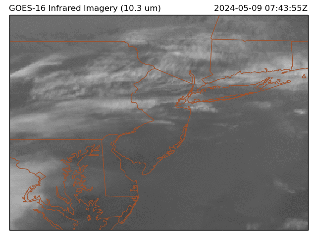
https://cdn.star.nesdis.noaa.gov/GOES16/ABI/GIFS/GOES16-NE-GEOCOLOR-600x600.gif