gsp
.NEAR TERM /THROUGH TONIGHT/...
***A HISTORIC RAINFALL EVENT IS UNDERWAY FOR THE SOUTHERN
APPALACHIANS AND VICINITY WITH WIDESPREAD/LOCALLY CATASTROPHIC FLASH
FLOODING EXPECTED***
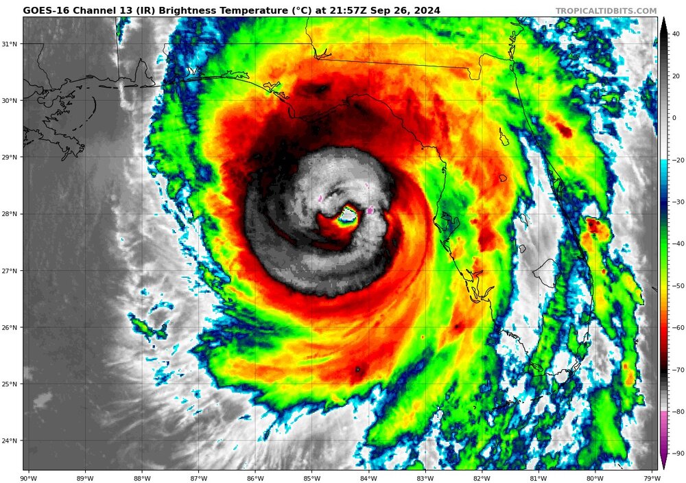
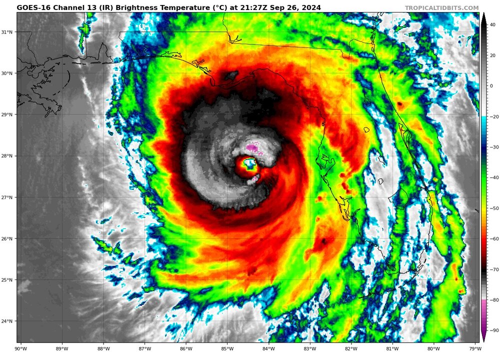
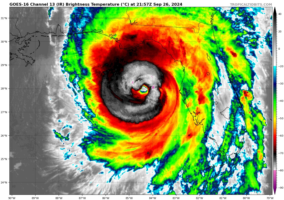
As of 315 am: Moderate to heavy rain continues across the forecast
area early this morning. Rainfall rates associated with the ongoing
activity are relatively tame...generally .25-.5" per hour (albeit
locally heavier). Nevertheless, flash flooding continues to steadily
worsen...especially across portions of the NC Blue Ridge. The center
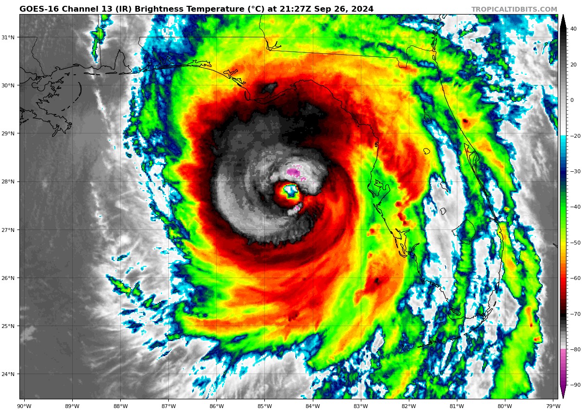
of Hurricane Helene is currently near Vidalia, GA...and is already
accelerating (current speed ~40 mph) toward the north. Tropical
rainbands...possibly producing rainfall rates of 1-2" per hour...
will begin to rotate across the CWA during the 08-12Z time frame.
This is when the flash flood situation...which is already severe in
some areas...will become potentially catastrophic... especially in
locations that received the brunt of the predecessor event over the
past 36 hours (i.e., counties encompassing the Blue Ridge
escarpment...note that this also includes the city of Asheville and
vicinity). It`s very possible that ongoing warnings will be upgraded
to EMERGENCY designation in these areas. Reservoirs along the
Catawba River chain are also running high and these could be
breached as enuf water may not be able to be released beforehand.
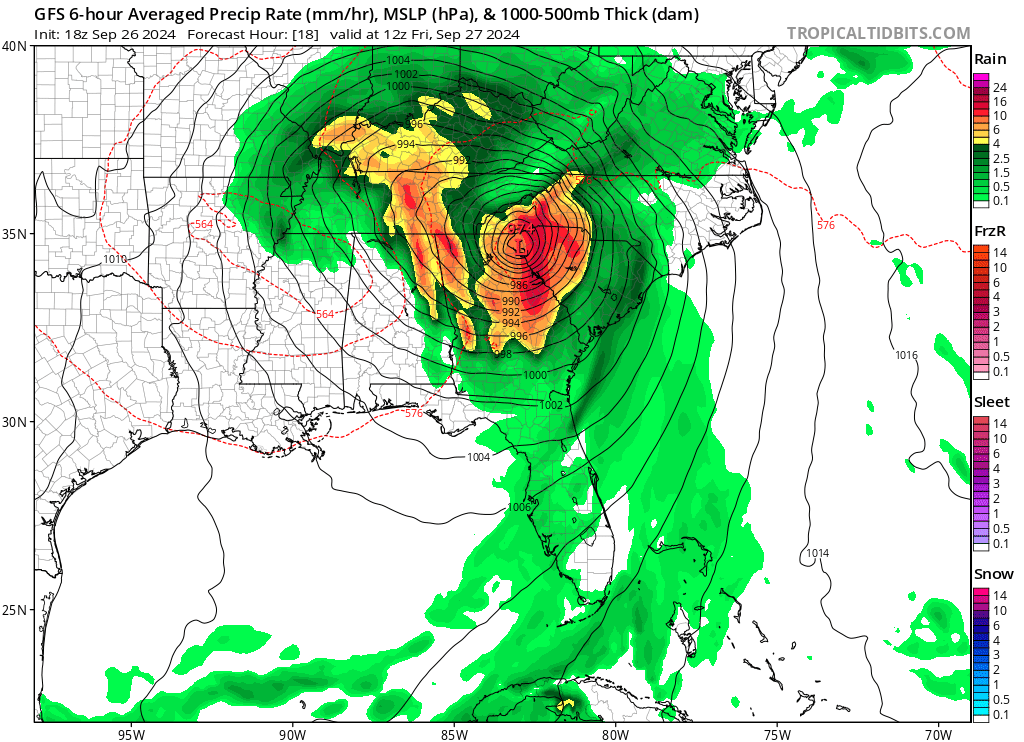
Additional rainfall amounts of 3-6 inches are expected across all
but the southern and eastern fringe of the CWA (where 1.5-3" are
expected). This additional rainfall will result in...at the very
least..."run-of-the-mill" flash flooding across much of the
remainder of the CWA.
Winds remain a secondary concern...but nonetheless quite concerning,
as Helene made landfall as a Cat 4 last evening, and the fast-moving
nature of the cyclone isn`t giving it a lot of time to weaken as the
expanding wind field advances toward the forecast area. Gusts of 35
to 45 kts are being reported as far north as Augusta...about 90
miles north of the cyclone center...and confidence is increasing
that damaging winds (gusts 55-65 mph) are going to be realized
across at least the western part of our area, especially as the
tropical bands around the center begin pushing in around daybreak.
Gusts across the higher elevations could reach 80 mph. The
combination of these wind gusts with saturated soil is likely to
result in widespread power outages across the western half of the
area.
Helene will continue to advance quickly W=>NW of the forecast area
late this morning into the afternoon, with quickly improving weather
conditions as the column dries quickly. However, flooding on some
larger tributaries will linger into at least Saturday, while main
stem river flooding will linger into early next week.